
Balu Pass Trail
View Photos
Balu Pass Trail
Difficulty Rating:
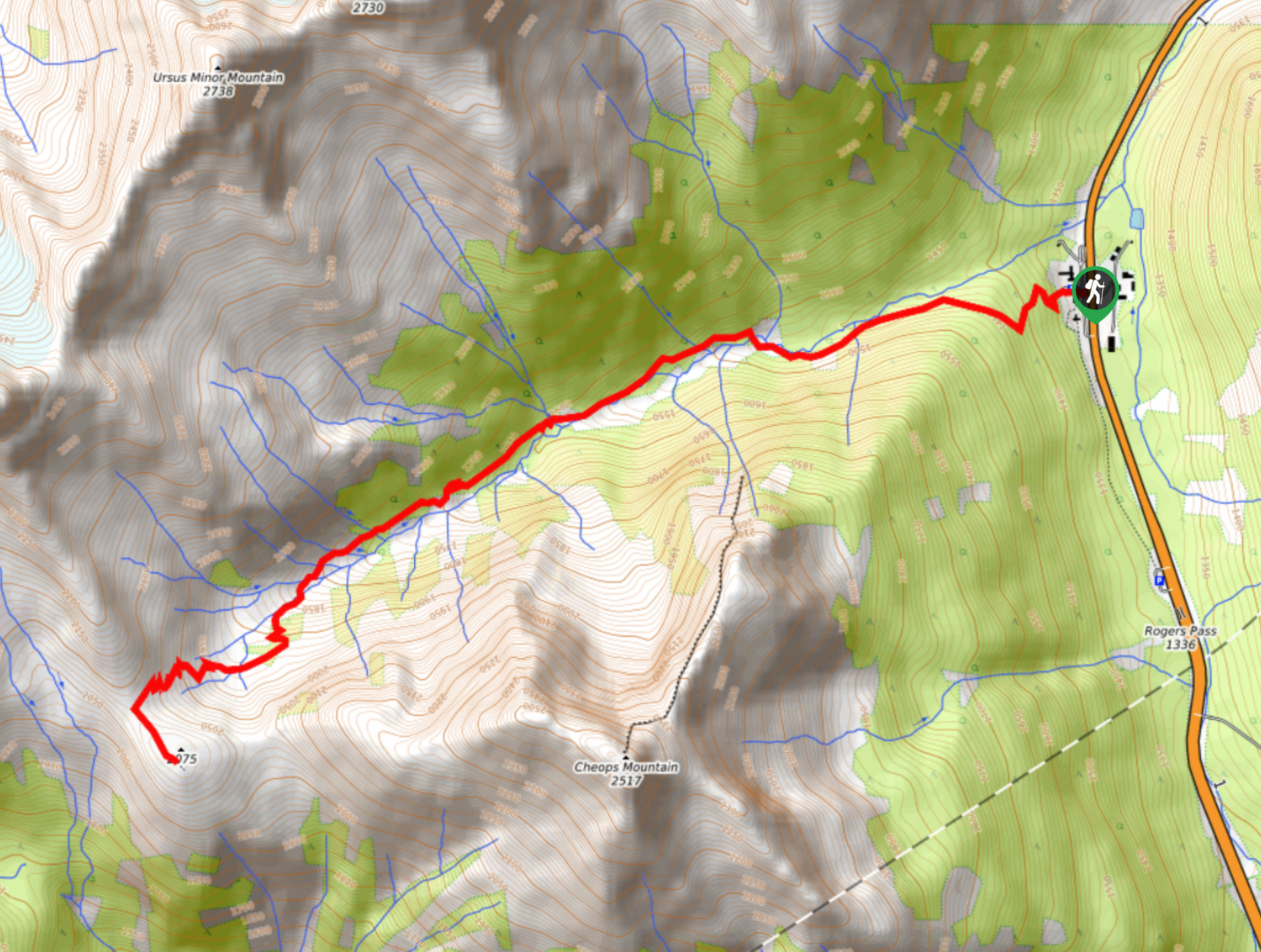
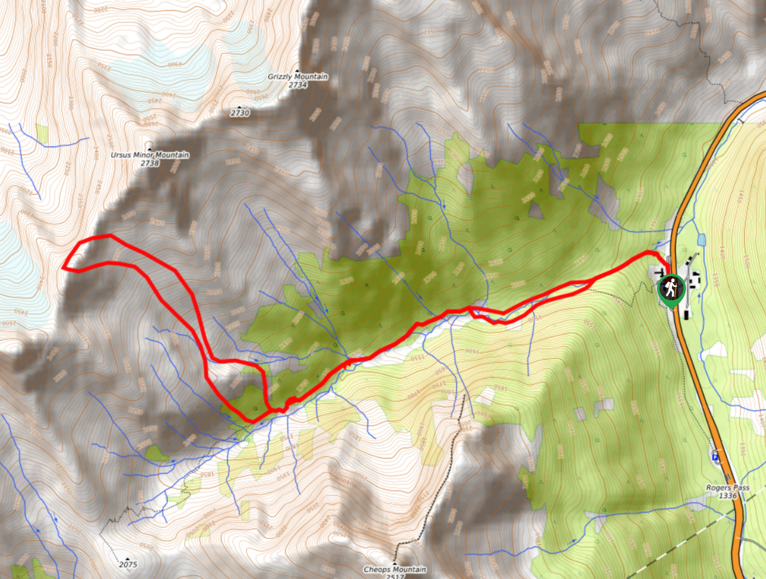
The Balu Pass Trail is a lightly trafficked 7.1mi out-and-back hiking route that passes through grizzly bear territory on the way to some truly amazing alpine views. This awesome hike in Glacier National Park will have you climbing uphill through the forest before breaking out into a scenic meadow. From there, you will have sweeping views of the rugged mountains that characterize this beautiful landscape.
Getting there
To reach the parking area next to the Balu Pass Trail from Revelstoke, head east on BC-1 E for 40.3mi and make a left turn at the Rogers Pass Compound. After 131ft, make a right onto Roger Pass Summit Road, where you will immediately find the parking lot on your left.

About
| When to do | June-October |
| Backcountry Campsites | No |
| Pets allowed | No |
| Family friendly | No |
| Route Signage | Average |
| Crowd Levels | Low |
| Route Type | Out and back |
Balu Pass Trail
Elevation Graph
Weather
Balu Pass Trail Description
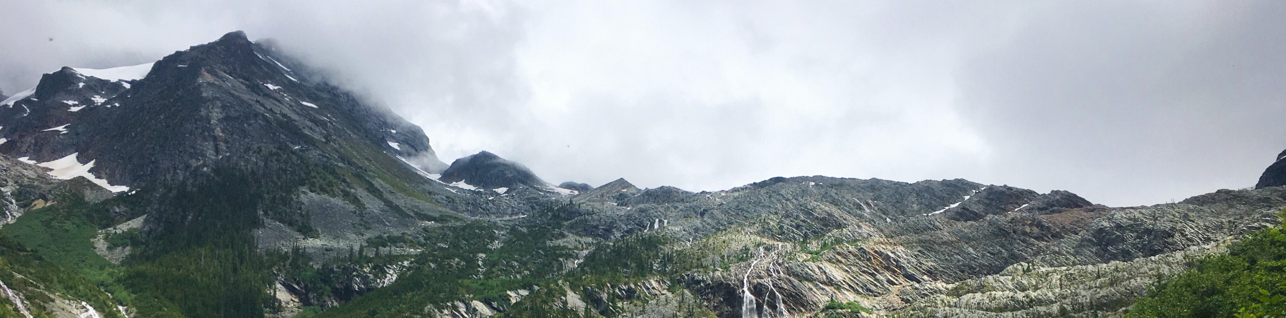
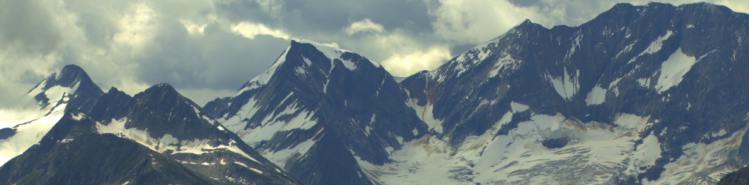
The Balu Pass Trail is an amazing out-and-back hiking route in Glacier National Park that climbs uphill alongside Connaught Creek as it meanders in between the Cheops and Grizzly Mountains. This trail has spectacular views over the alpine meadows and rugged mountains that characterize the landscape. Its moderately difficult terrain makes for a hike that both casual and experienced hikers will enjoy. It should be noted that this route passes through grizzly bear territory, and they are often spotted on or around the trail. Hikers utilizing this route will need to travel in groups of four or more and follow best practices, such as making noise along the trail and carrying bear spray. The information centre near the trailhead has an informational video on bear behaviour and encounters that can be extremely useful in de-escalating any potentially dangerous situations when out on the trail.
Setting out on the trail at the end of the parking area, follow it west as you begin an uphill climb through the dense forest. The trail will steadily climb alongside the creek until you eventually break through the tree cover and enter into a scenic alpine meadow. This upper portion of the trail is packed with picturesque views of the rugged mountains and gently rolling terrain that make this landscape such a beautiful place. Reaching the end of the trail, you will have views of Cheops Mountain to the east, Grizzly Mountain to the north, and the Cougar and Bagheera mountains to the west. After taking in the breathtaking views, head back down along the Balu Pass Trail to return to the parking lot below.
Similar hikes to the Balu Pass Trail hike
Great Glacier Trail
The Great Glacier Trail is an 4.9mi out-and back hiking route in Glacier National Park that features waterfalls,…
Hermit Trail
Hike along the Hermit Trail for a physically demanding but ultimately rewarding journey up to an alpine campsite in Glacier…
Video Peak Trail
The Video Peak Trail is a scenic 8.4mi hiking route in Glacier National Park that takes you through…
Comments