Darwin Falls Trail via Old Toll Road
View Photos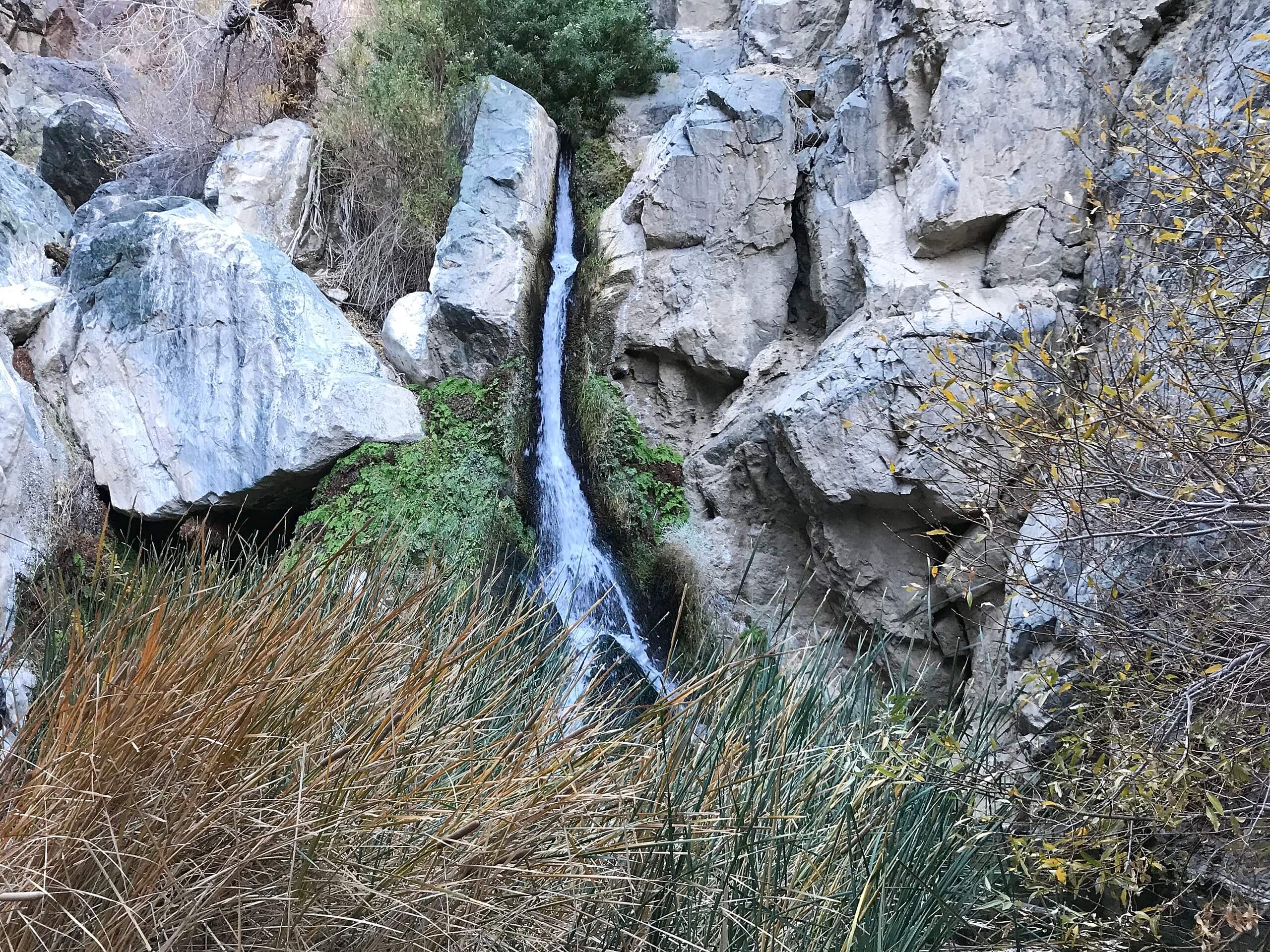
Darwin Falls Trail via Old Toll Road
Difficulty Rating:
Death Valley National Park is among the hottest and driest places on the planet - making the Darwin Falls Trail via Old Toll Road route that much more impressive. Ending at a stunning oasis deep within the park, the route is spectacular simply because of how contrasting its scenery is in comparison to the arid desert environment characteristic of the majority of Death Valley National Park.
Getting there
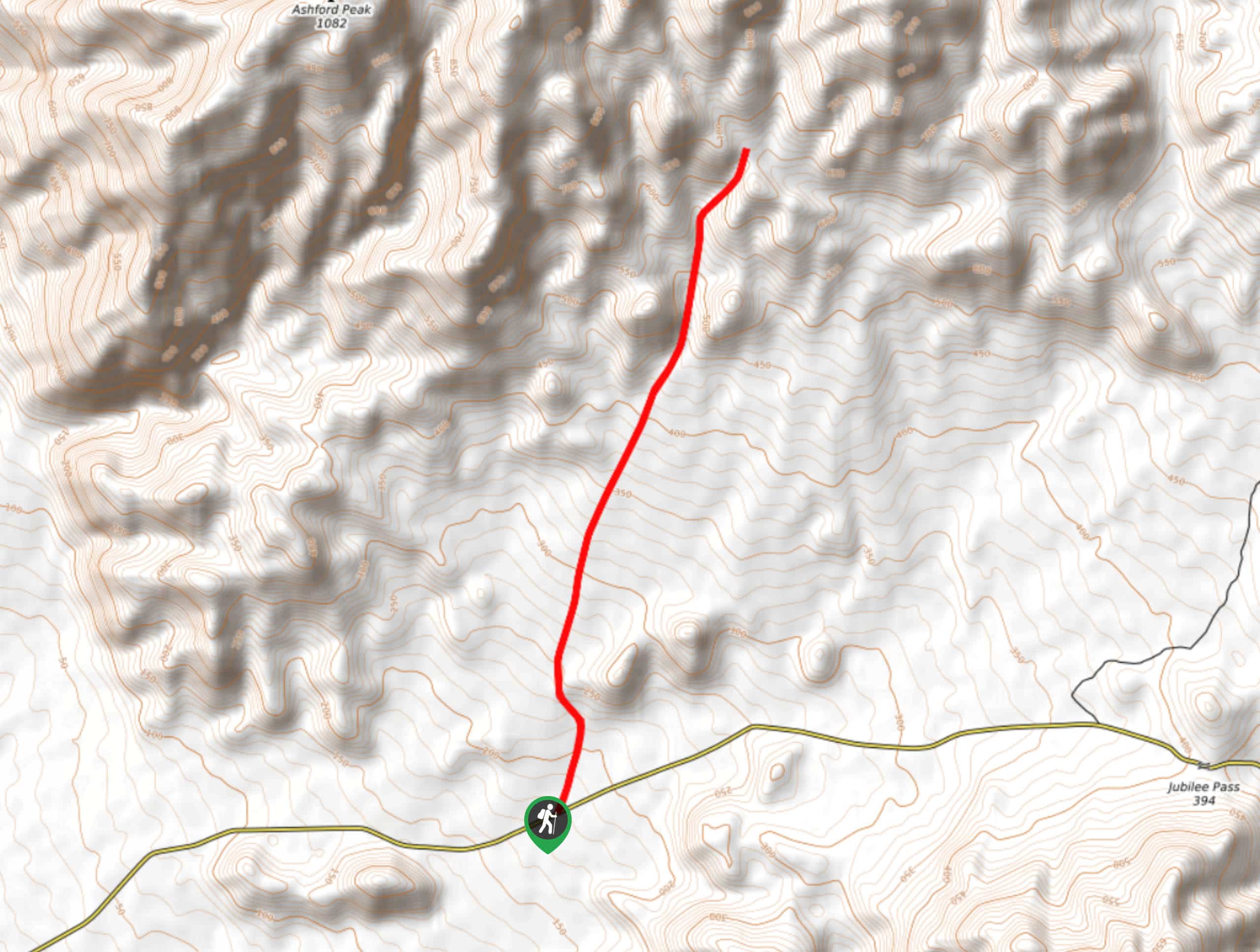
The trailhead for the Darwin Falls Trail via Old Toll Road can be found at a parking lot off of Old Toll Road in Death Valley National Park.

About
| Backcountry Campground | No |
| When to do | Year Round |
| Pets allowed | No |
| Family friendly | Older Children only |
| Route Signage | Poor |
| Crowd Levels | High |
| Route Type | Out and back |
Darwin Falls Trail via Old Toll Road
Elevation Graph
Weather
Darwin Falls Trail via Old Toll Road Description
When planning on doing the Darwin Falls Trail via Old Toll Road route, it is important to remember that the access road is largely unpaved. It is important to ensure your vehicle is up to the task. Likewise, sections of the Darwin Falls Trail via Old Toll Road require slight scrambling over rocks, and so the route is likely not appropriate for young children.
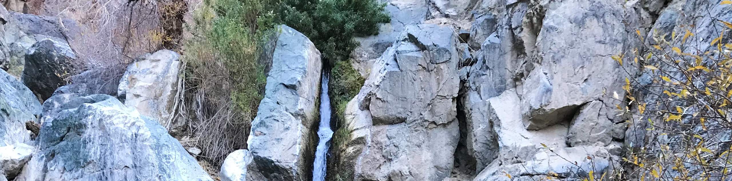
The appeal of the Darwin Falls Trail via Old Toll Road is undoubtedly the uniqueness of its jungle like environment when viewed in contrast to the largely desolate vistas found within Death Valley National Park. Ending at Darwin Falls, the route is charming and regarded as an excellent place to see wildlife such as birds, lizards and frogs.
Having arrived at the trailhead, follow the Old Toll Road south. Beginning on relatively flat terrain, the trail will continue south before entering a canyon. At the canyon, the trail will veer steadily to the east as the path becomes less flat. The canyon walls will grow steeper and more imposing as the desert vegetation becomes more prolific.
Soon – with large canyon walls surrounding you – you will arrive at an isolated oasis, with Darwin Falls visible in the foreground. Take your time and enjoy the sights, sounds and smells of the gorgeous oasis. Once you have had a chance to explore, simply backtrack your steps towards the trailhead and your waiting vehicle on Old Toll Road.
Frequently Asked Questions
How did Darwin Falls get its name?
Darwin Falls is named after American army physician Erasmus Darwin French, who came to prospect for silver in the region in 1846.
Can you swim in Darwin Falls?
As the stream is a source of drinking water, swimming is not permitted at Darwin Falls.
How high is Darwin Falls?
Having been measured at 80ft, Darwin falls is the highest waterfall in Death Valley National Park!
Insider Hints
The winter months are the best time to see Darwin Falls, as there is usually more water flowing through.
Bring lots of water! Even though the Darwin Falls Trail via Old Toll Road has lots of shade, it is still hot!
Consider bringing lunch, as Darwin Falls is a great place for a picnic!
A great route to have a desert vegetation identification guide as there is no shortage of greenery throughout its duration.
Similar hikes to the Darwin Falls Trail via Old Toll Road hike
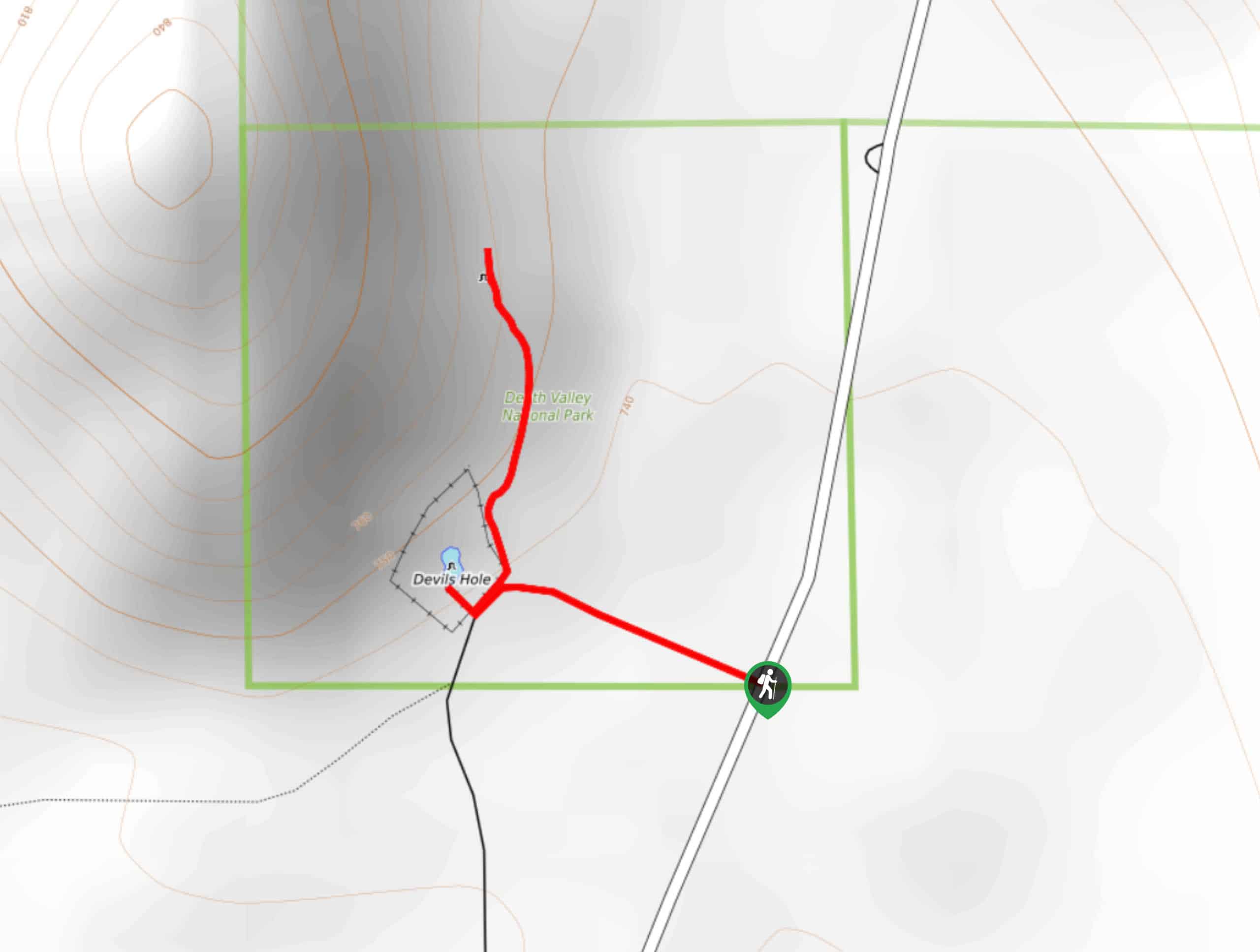
Devil’s Hole Overlook
An excellent route for families with young children and those looking for a more casual hiking experience, the Devil’s Hole…
Lower Telephone Canyon Trail
A difficult route that leads to an incredible vista where panoramic views of the surrounding area can be enjoyed, the…
Kaleidoscope Canyon Trail
A beautiful route within Death Valley National Park, the Kaleidoscope Canyon Trail is a must do for those who love…
Comments