Siffleur Falls Trail
View Photos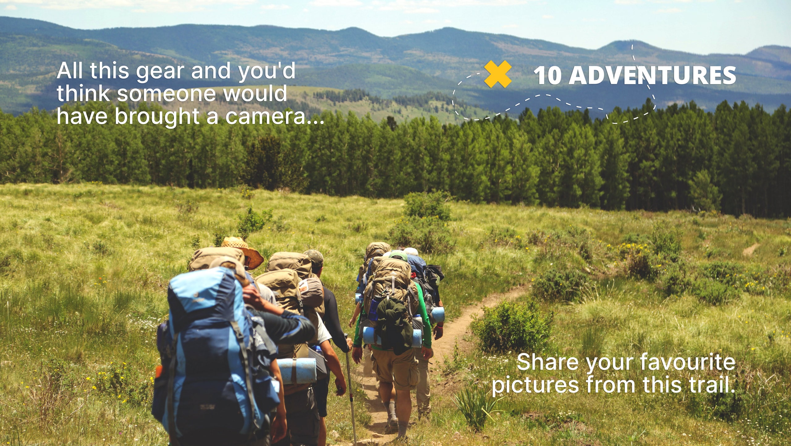
Siffleur Falls Trail
Difficulty Rating:
The out-and-back Siffleur Falls Trail is an excellent half- to full-day adventure (and possibly overnight). The first set of falls appear quickly, and you can choose your own adventure from here. One waterfall might be satisfactory for your trip, but the whole trail features three sets of falls and crosses two rivers. This is a low-traffic trail that seems to be a hidden gem of the David Thompson Highway region.
Getting there
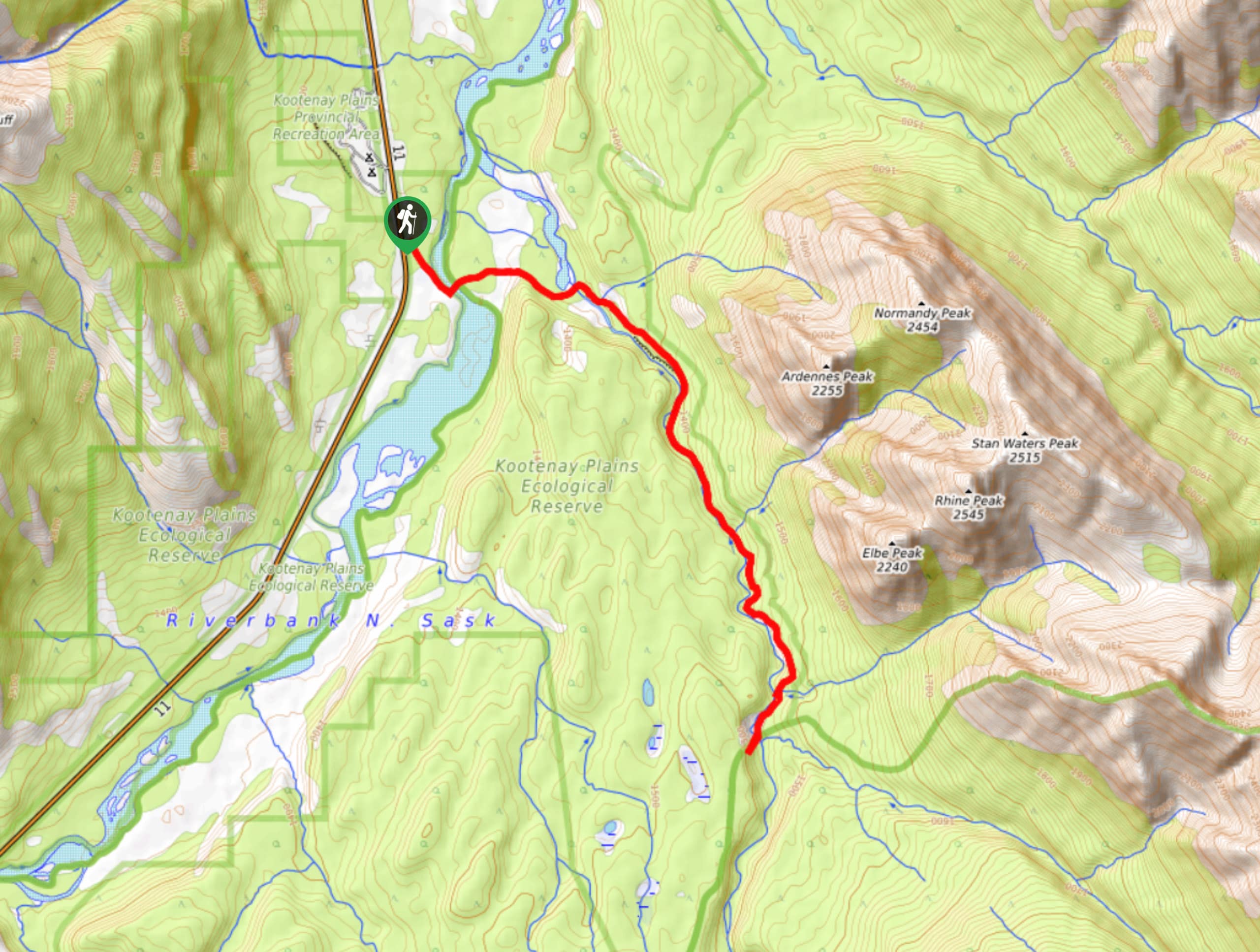
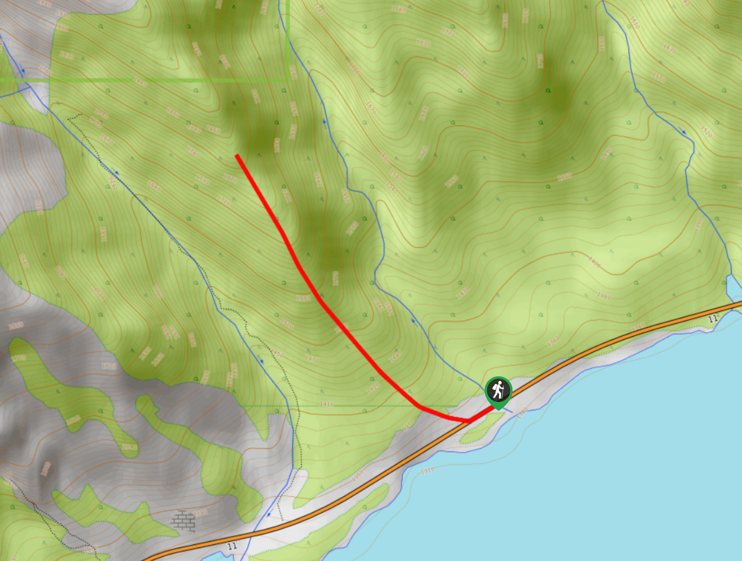
From the Saskatchewan River Crossing, turn onto Highway 11 from Highway 93N and travel 16.7mi before reaching the turnoff for Siffleur Falls on your right. Pull into the parking area for the trailhead.

About
| When to do | June–September |
| Backcountry Campsites | Siffleur Falls Primitive Campsite |
| Pets allowed | Yes - On Leash |
| Family friendly | Older Children only |
| Route Signage | Average |
| Crowd Levels | Moderate |
| Route Type | Out and back |
Siffleur Falls Trail
Elevation Graph
Weather
Siffleur Falls Trail Description
The Siffleur Falls hike is closer to the west side of the David Thompson Highway than others. This trail is a great option when travelling from the westside or taking a detour from the Icefields Parkway. If the 8.8mi distance seems too strenuous for you, you can choose to visit only the first falls, making an easier 4.3mi round trip hike.
Hiking the entire Siffleur Falls Trail is a must-do adventure, in our opinion. The trail sees far fewer visitors than other hikes in the region, yet it features world-class views and outstanding natural features. This trail is graded as moderate and makes for an exciting family adventure. 10Adventures considers this a bucket list hike.
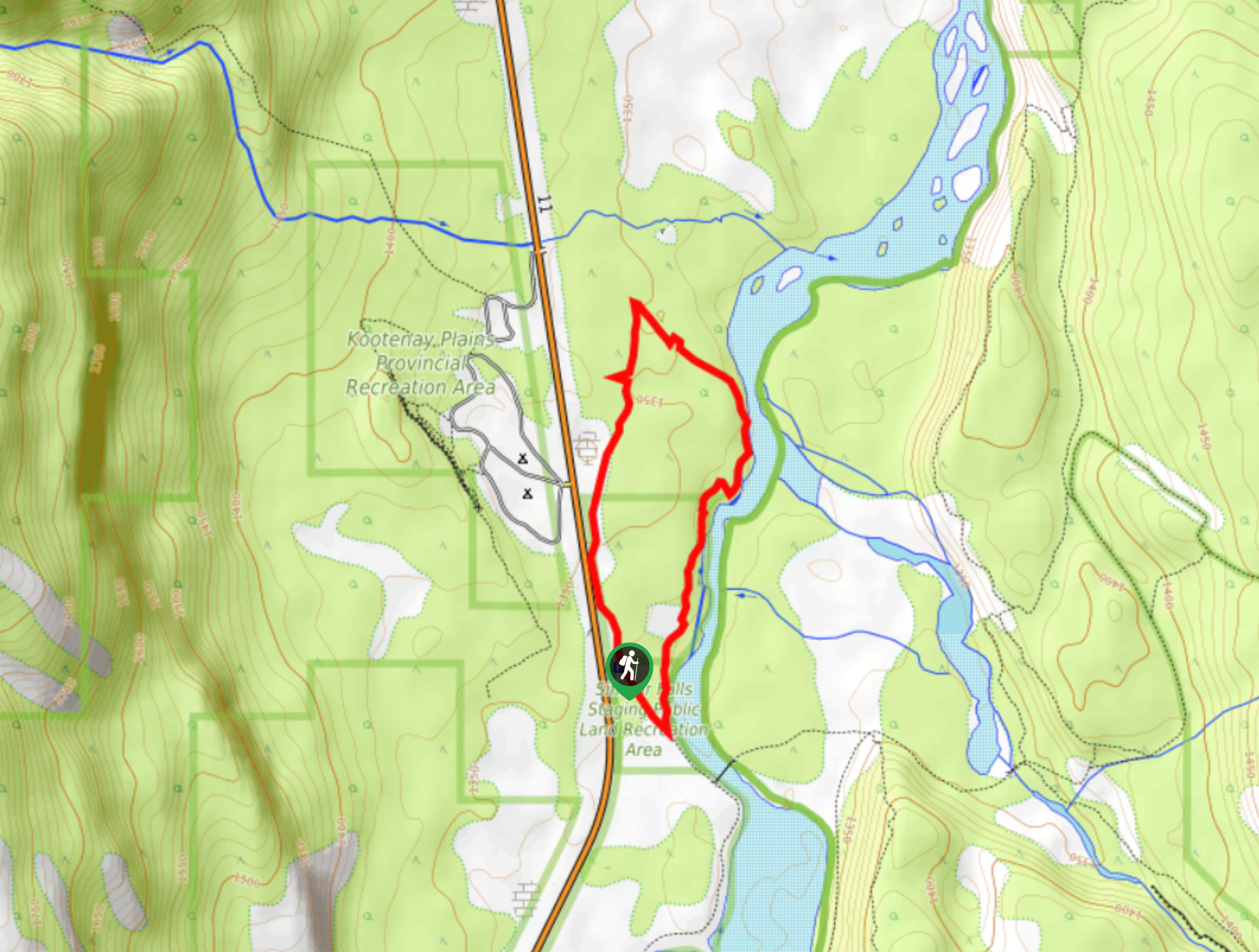
The trail begins in the parking area, where the signs mark the clear path. Descend briefly towards the Kootenay Plains Ecological Reserve on a wide trail that quickly opens up with views of the North Saskatchewan River. Interpretive exhibits line the trail as you make your way through the preserve. Use this as an educational opportunity for your group before continuing to the falls. You’ll learn about the characteristics of the ecological region you’re travelling through, as well as the plants and animals that thrive here.
After 1640ft, you’ll come to the impressive Topham Suspension Bridge. This bridge crosses the North Saskatchewan River and makes for an exciting moment along the trail. After the bridge, you come to a meadow equipped with a wide boardwalk. The boardwalk exists to protect the vegetation in the area, so make sure you and your group hike along the wooden planks.
0.8mi from the first bridge, you will come to another bridge that crosses the Siffleur River. This bridge is smaller than the first but still impressive. Immediately after the bridge, a trail junction to the left appears, but you will remain on the main trail. After the bridge, the trail begins to gain elevation gradually towards a notable viewpoint. The viewpoint is fenced to safely capture photos of the Siffleur River as it flows through the canyon.
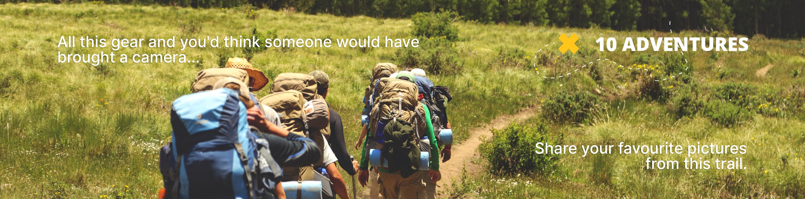
You will begin to hear the roaring echo of the first falls in another kilometer when you come to a viewpoint that looks out towards the falls. The falls appear in another 656ft from this viewpoint. The trail has plenty of spots to view the falls safely, so bring your camera and accommodate extra time for the mighty falls. Be sure to abide by signage for the dangerous cliffside and use the fenced viewpoints respectfully. Getting too close to the edge can be very dangerous.
The first falls is a common turnaround point for many as it meets the needs of beginner to intermediate hikers on a time limit. We recommend continuing to the other sets of falls if you have the time and ability. The second set of falls is only about 0.9mi from the first falls. Continue another 1.9mi to the third falls, where a primitive campsite marked with cairns exists. Be aware this site has no amenities and requires good knowledge of backcountry camping etiquette. You’ll need to cross a creek between the second and third falls, so if this is out of your comfort level, turn back after the second falls.
If you decide to hike the extent of the trail and visit all three falls, enjoy a lunch break on the riverbank near the third falls before hiking back. Enjoy the rolling descent on your return as you pass by all three falls one more time.
Trail Highlights
Siffleur Falls
Siffleur Falls are a series of waterfalls along the Siffleur River before it joins the North Saskatchewan River. The falls are extraordinary natural features that can’t be missed. We recommend putting this trail on your bucket list immediately.
Insider Hints
Pack up your overnight gear and spend a night at the third set of falls you encounter. This is a primitive campsite that requires proper food storage and bathroom use as there are no amenities here.
Accommodate plenty of extra time for photos and viewpoints. The trail is packed with remarkable photo opportunities and natural features.
If your group can’t complete a 8.7mi round trip, cut this distance in half by hiking to the first falls, which still makes for an incredible adventure.
Similar hikes to the Siffleur Falls Trail hike
Marble Mountain Hike
Getting to the Marble Mountain trailhead can be tricky and out of the way, but this remote trail is sure…
Paula’s Ridge Hike
Paula’s Ridge Hike is just east of Mount Abraham and offers incredible views of Abraham Lake. If you are looking…
Kootenay Plains Heritage Trail
Take in some history on the Kootenay Plains Heritage Trail. The trail travels through the ecological preserve and passes by…
Comments