Kinglet Lake Trail
View Photos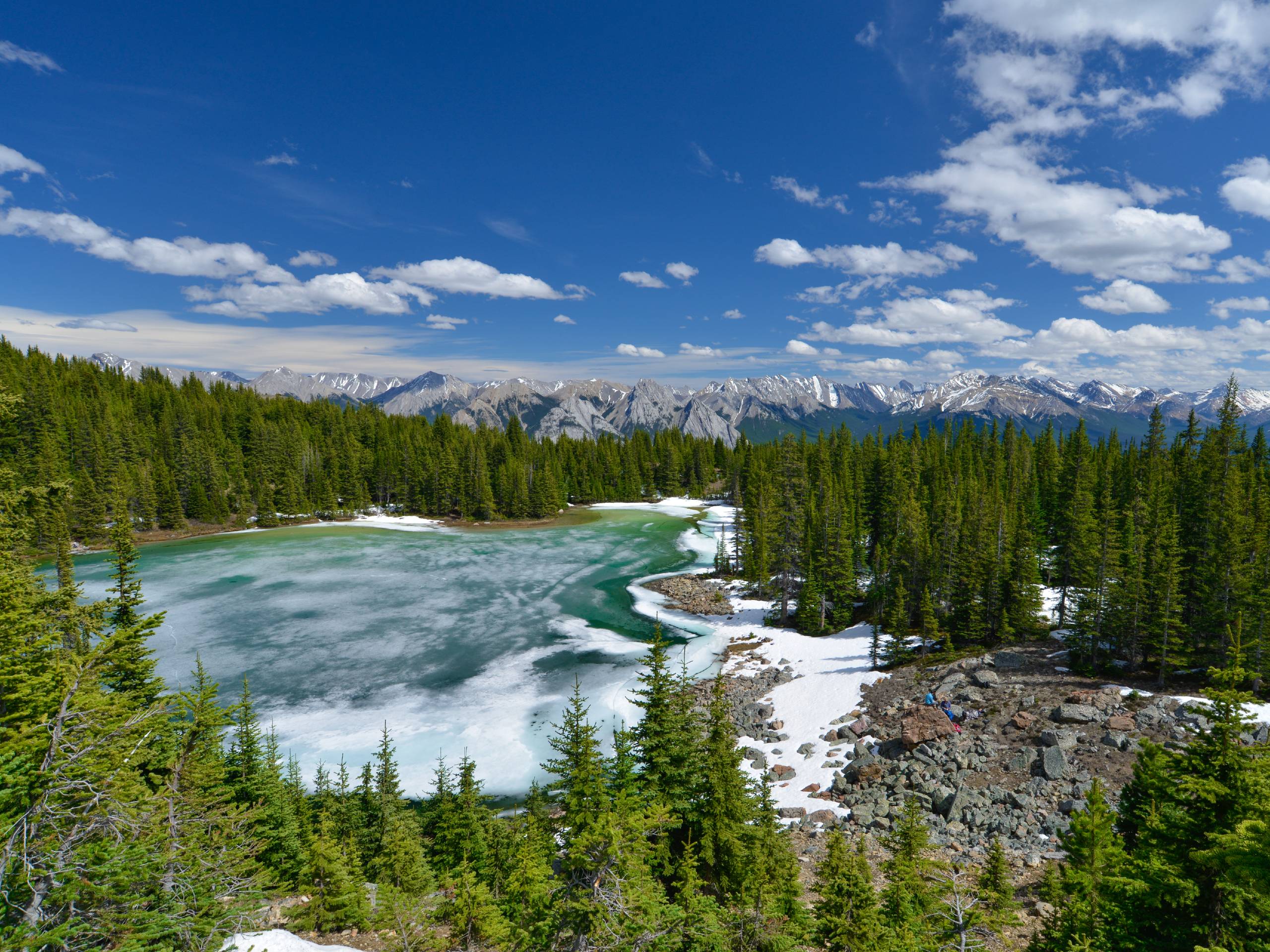
Kinglet Lake Trail
Difficulty Rating:
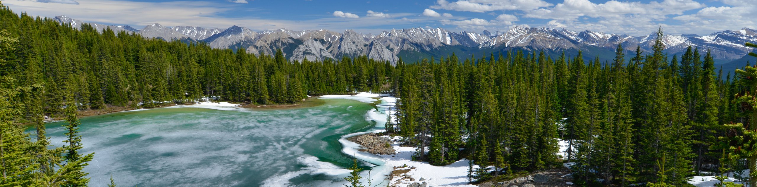
Kinglet Lake is a beautiful destination in the heart of David Thompson Country. It’s an intermediate hike that requires some route-finding and ends with a steep section. This is an excellent hike for anglers looking to fish in the lake and also makes a great overnight trip. The trail has fantastic views of the North Saskatchewan River and sees moderate amounts of traffic.
Getting there
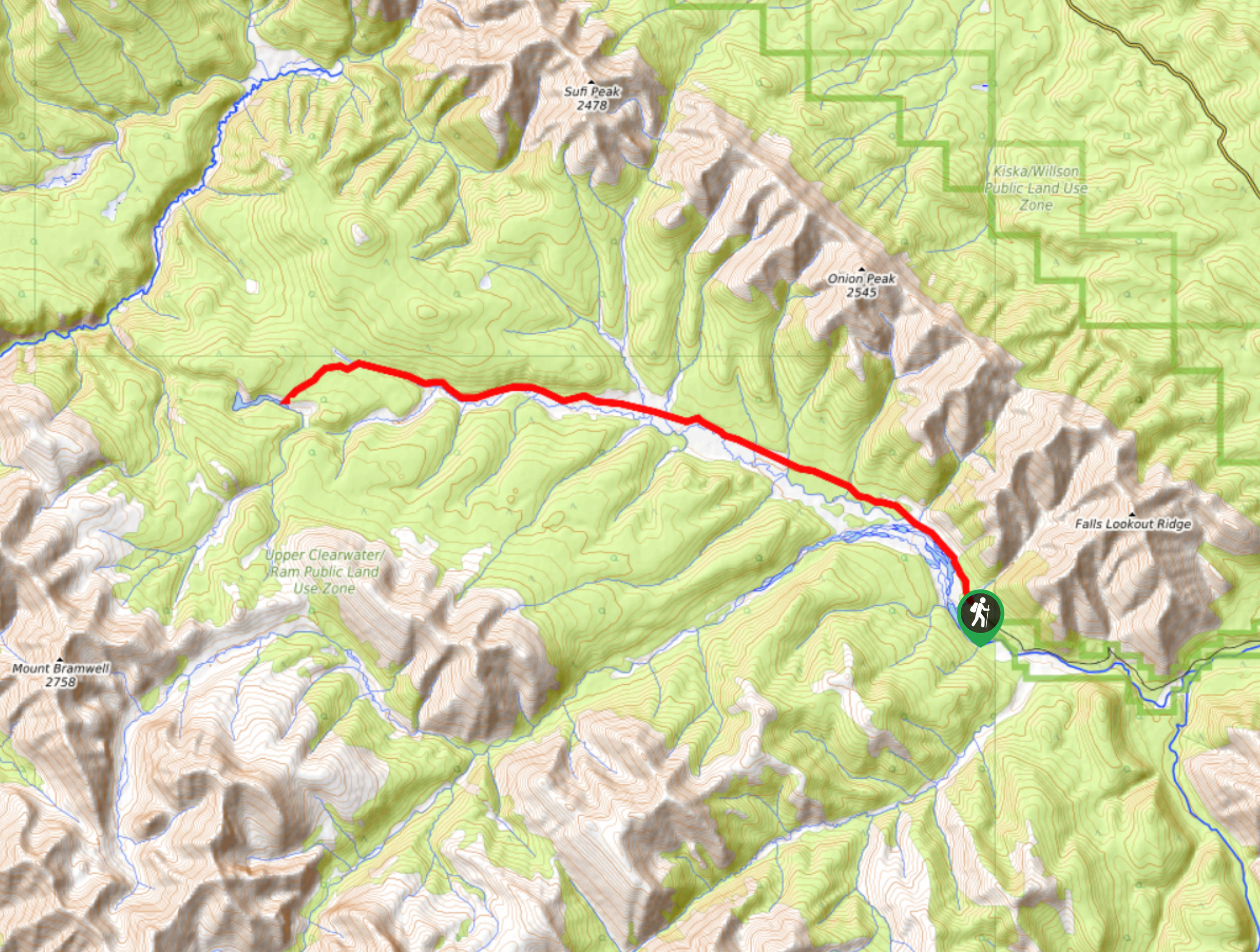
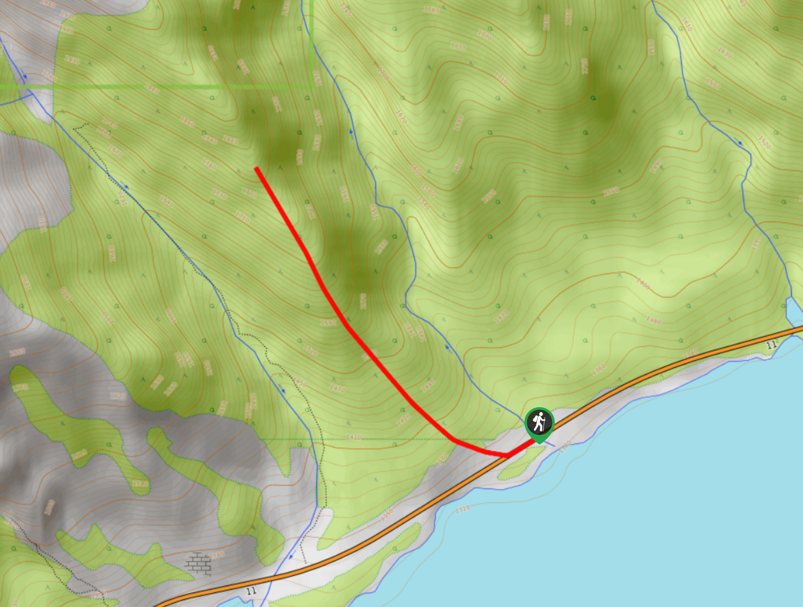
To get to the Kinglet Lake trailhead, join Highway 11 eastbound from Saskatchewan River Crossing. Travel 15.2mi to a pullout on the highway and park there.

About
| When to do | June–September |
| Backcountry Campsites | Kinglet Lake |
| Pets allowed | Yes |
| Family friendly | No |
| Route Signage | Poor |
| Crowd Levels | Moderate |
| Route Type | Out and back |
Kinglet Lake Trail
Elevation Graph
Weather
Kinglet Lake Hike Trail Description:
Kinglet Lake is a stunning destination equipped with a primitive campsite for those interested in an overnight adventure. From the pullout on the road, you’ll see a wooden sign for Kinglet Lake. Begin your hike on an old road, hiking north from Abraham Lake. There will be some small trails leading off on the right side that you should ignore. Keep hiking up the ridge until you see some markers for both Kinglet Lake and Tuff Puff Ridge. There should be markers spelled out in rocks on the ground; however, this can change with heavy traffic. The Kinglet Lake trail takes a left towards a creek and suddenly becomes extremely steep for about 1.2mi. You will reach the lake after a forested section. The lake is crystal clear and a great spot for fishing cutthroat and brook trout.
Similar hikes to the Kinglet Lake Trail hike
Onion Lake Trail
Onion Lake is a secluded subalpine lake that makes for a long day hike. The 17.4mi trail is…
Marble Mountain Hike
Getting to the Marble Mountain trailhead can be tricky and out of the way, but this remote trail is sure…
Paula’s Ridge Hike
Paula’s Ridge Hike is just east of Mount Abraham and offers incredible views of Abraham Lake. If you are looking…
Comments