
Black Canyon Creek Trail
View Photos
Black Canyon Creek Trail
Difficulty Rating:
The Black Canyon Creek Trail is a beautiful multi-use trail that begins along the Fish Lake Trail, a popular location for many activities like fishing, swimming, hiking, and biking. This is a great trail to take if you stay at the Fish Lake Campground and want to explore the area and discover all the stunning scenery it offers.
Getting there
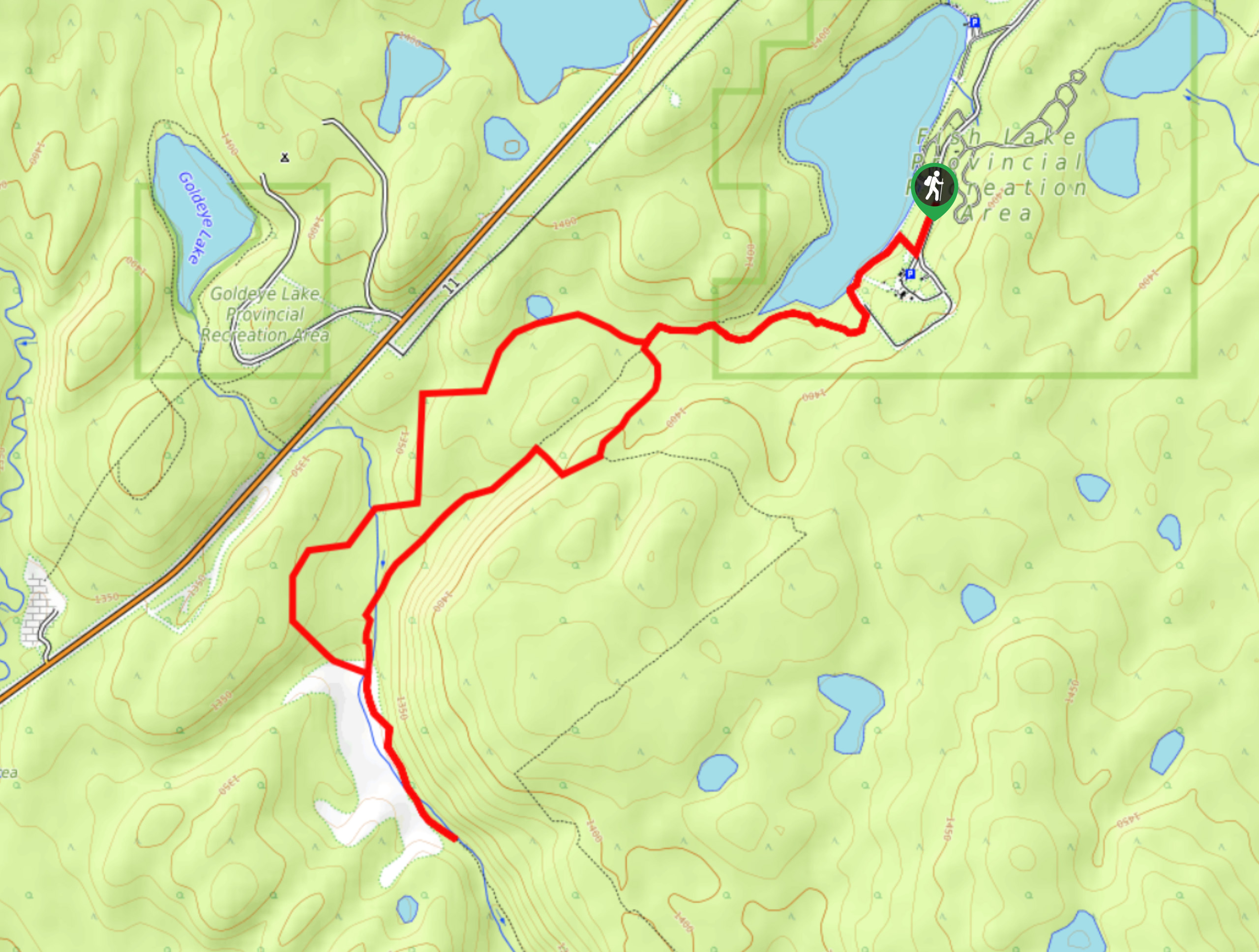
From Nordegg, travel eastbound along Highway 11 for 2.8mi before turning left onto Range Road 155 for Fish Lake Campground. Travel 1.1mi along this road before reaching the campground, where you will park at the far end, at the Fish Lake/Shunda Lake day-use area.

About
| When to do | May–October |
| Backcountry Campsites | No |
| Pets allowed | Yes |
| Family friendly | Yes |
| Route Signage | Average |
| Crowd Levels | High |
| Route Type | Lollipop |
Black Canyon Creek Trail
Elevation Graph
Weather
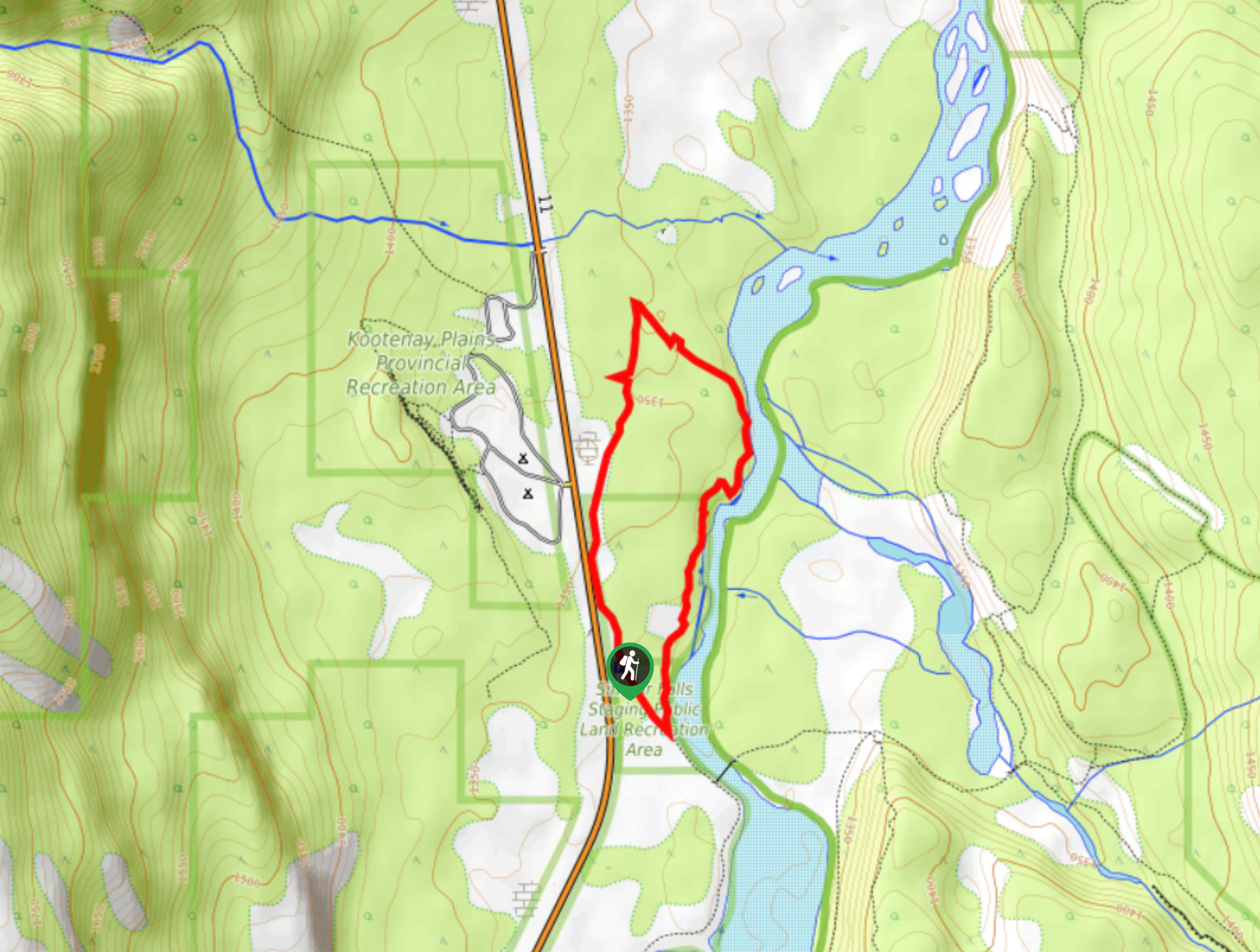
Black Canyon Creek Trail Description
From the Fish Lake Campground day-use area, join the Fish Lake Trail along the shores of the lake. You’ll want to hike towards Frontier Lodge in a clockwise direction. After 1.0mi, you’ll reach a junction that continues around the lake or joins the Black Canyon Creek Trail to the left. Stay left here for 1312ft, where you will come to another junction with the Black Canyon Creek Loop. Take the trail to the left to start the loop, hiking in a clockwise direction. The two left trails will take you to the same place—one simply takes longer, and the other is more direct.
In roughly 1.2mi, you’ll find a trail leading off to the left at a creek. This is Black Canyon Creek, and the trail leads up the creek from here. You can take this short out-and-back detour to explore the beautiful creek before rejoining the main loop. Complete the rest of the loop and head back to the parking area along the Fish Lake Trail. If you would like to extend your trip, you can complete the rest of the Fish Lake Trail instead of simply returning the way you came.
Similar hikes to the Black Canyon Creek Trail hike
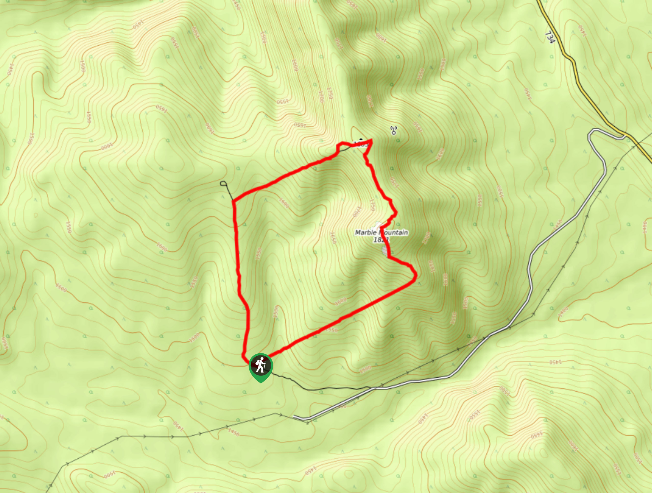
Marble Mountain Hike
Getting to the Marble Mountain trailhead can be tricky and out of the way, but this remote trail is sure…
Paula’s Ridge Hike
Paula’s Ridge Hike is just east of Mount Abraham and offers incredible views of Abraham Lake. If you are looking…
Kootenay Plains Heritage Trail
Take in some history on the Kootenay Plains Heritage Trail. The trail travels through the ecological preserve and passes by…
Comments