
Allstones Ridge and Lake Hike
View Photos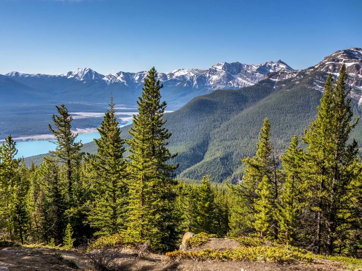
Allstones Ridge and Lake Hike
Difficulty Rating:
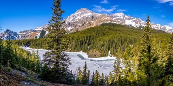
Allstones Ridge and Lake hike near David Thompson Highway is a bucket-list trail that leads to the calm Allstones Lake with lots of space for camping and a possibility to hike to the Allstones Peak just nearby. The trail is relatively short, but most of the scramble is quite steep hiking. At around half of the climb to the lake, you’ll be greeted by stunning views of the surrounding valleys and mountains and this view will lead you all the way to the top.
Getting there
There is unmarked parking right next to the David Thompson Hwy on the southeast side of the road near the Allstones Creek.

About
| When to do | May - October |
| Backcountry Campsites | Near Allstone Lake |
| Pets allowed | Yes - On Leash |
| Family friendly | No |
| Route Signage | Poor |
| Crowd Levels | Low |
| Route Type | Out and back |
Allstones Ridge and Lake Hike
Elevation Graph
Weather
Route Description for Allstones Ridge and Lake Hike
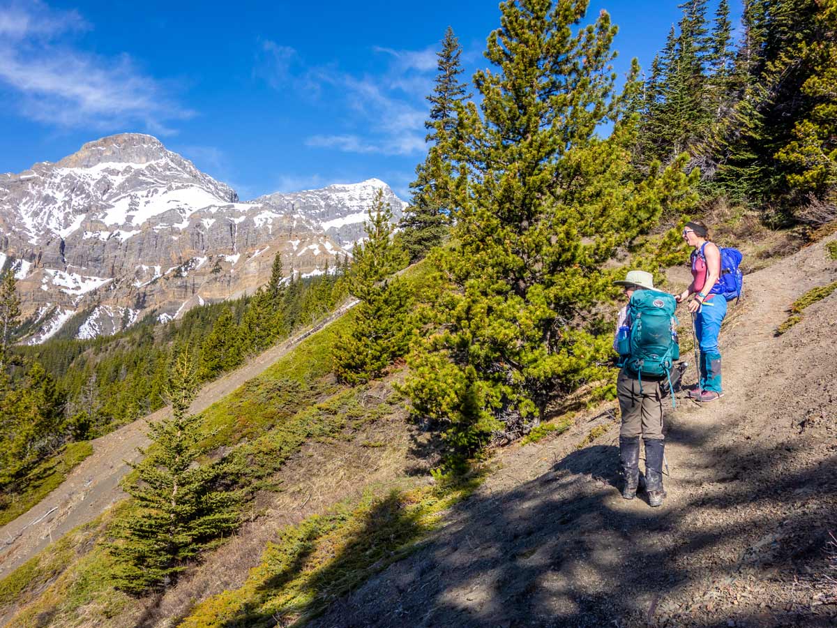
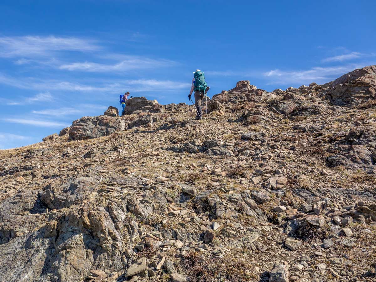
Although quite steep, the Allstones Ridge and Lake hiking trail to the lake is quite pleasant and of good quality. Be ready to sweat a little more when climbing to the top of the ridge, as this part of the trail involves some off-trail scrambling, but the whole path, in general, is not very technical. You can easily skip the top of the ridge if you don’t feel like climbing. We strongly suggest wearing proper hiking footwear and if you have hiking poles, your knees will thank you later!
After parking your car, you’ll see the trailhead straight away – it’s a path to the woods right across the highway with a signboard. Follow this path.
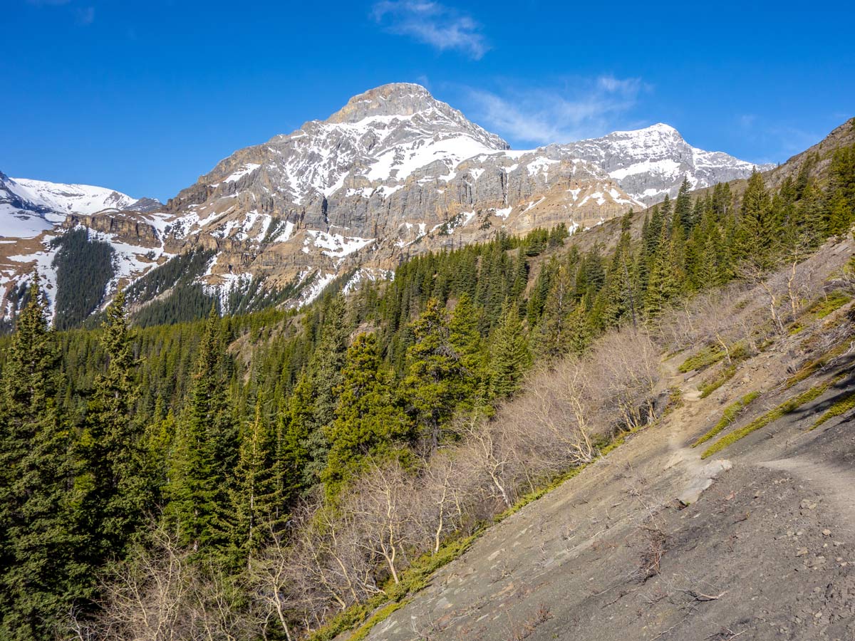
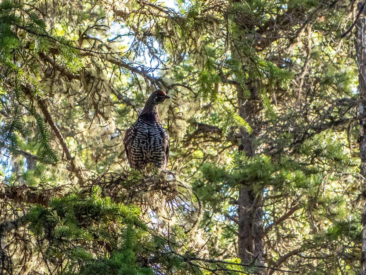
The trail of the Allstones Lake route is quite easy to follow as it’s a well-trodden path through the heavily forested area. It’s quite steep, but of good quality and quite pleasant.
At around 0.8km you will cross the Allstones Creek. Keep pushing forward.
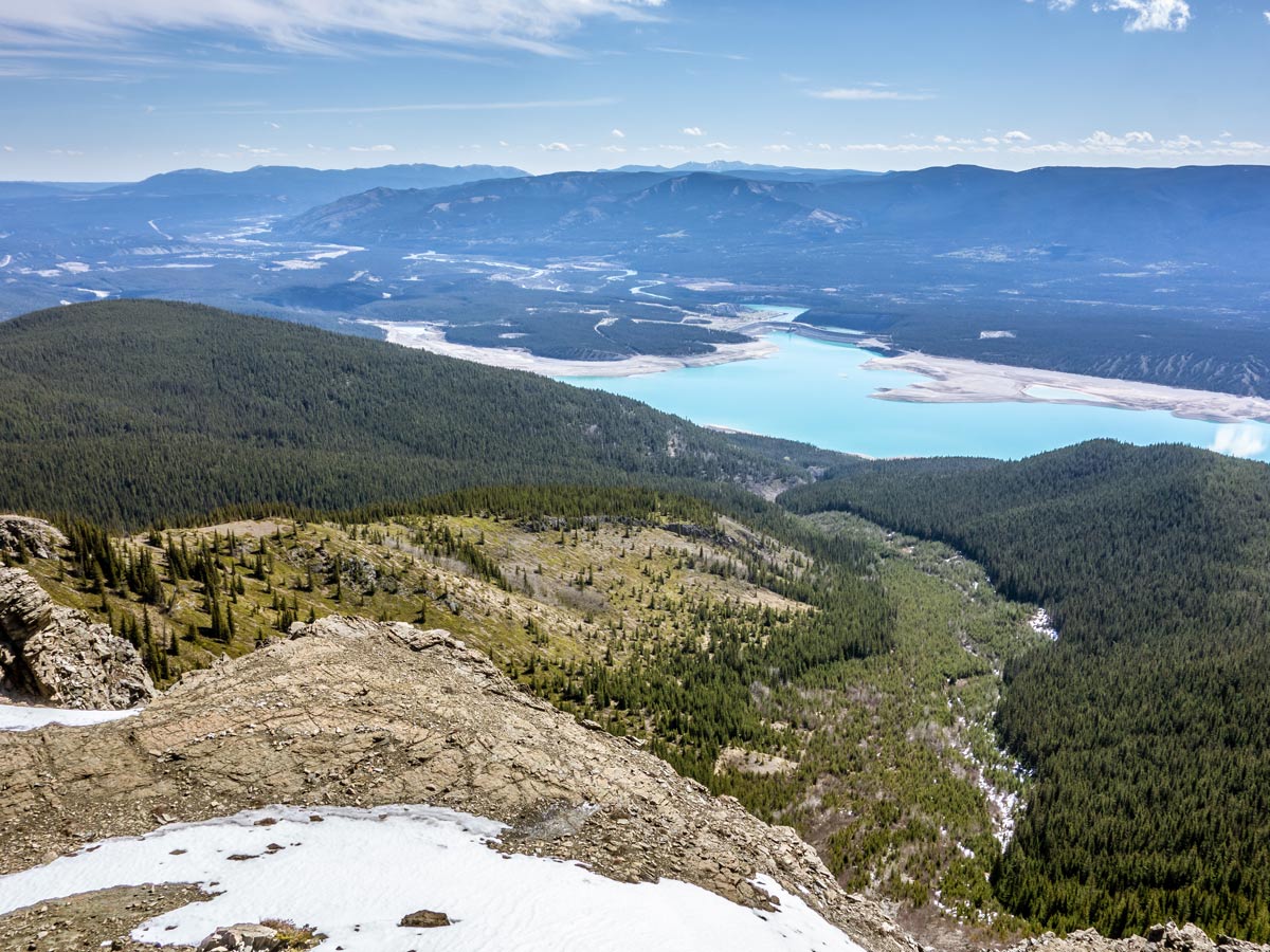
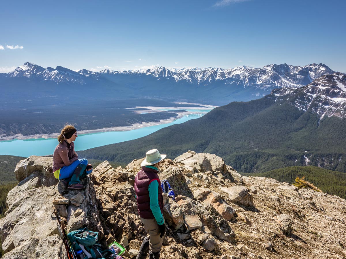
About halfway on the trail to the Allstones Lake, the forest will start clearing out. You will be greeted by magnificent views of the surrounding valleys and ridges. Abraham Lake and Mount Michener look stunning from up here! Keep going, soon it will get easier.
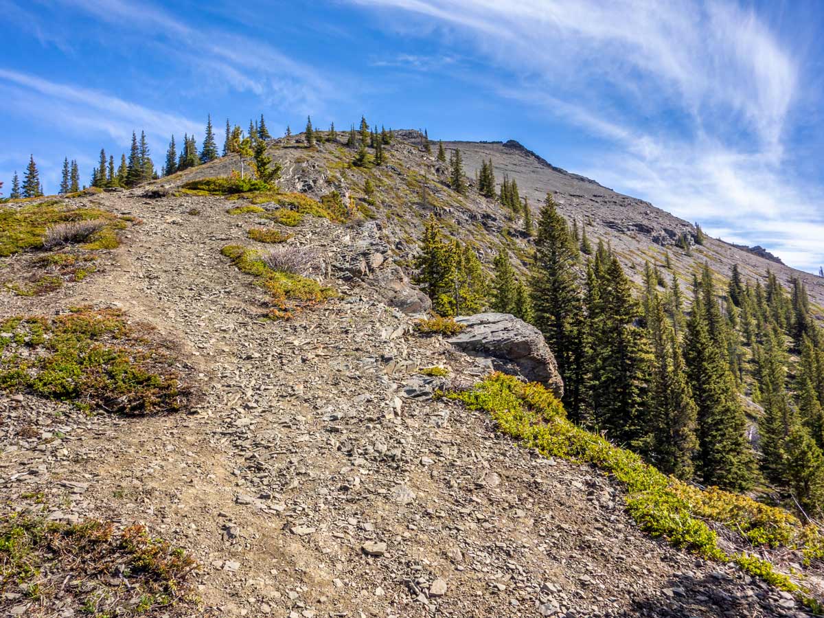
Eventually, the trail will start to even out. Only 1/3 of the trail left to get to the lake! It’s possible to get to the top of the ridge from here, but the terrain is a little annoying with lots of scree. You can either go to the lake now and visit the ridge later or climb to the ridge now. Or even skip it!
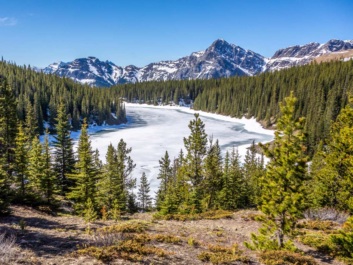
After continuing straight for a bit along the southern side of the Allstones Ridge, you will reach a small fork with its left path leading to the southern side of the Allstones Lake, and its right path – to the northern side. Choose whichever one you want, as they both lead to your final destination.
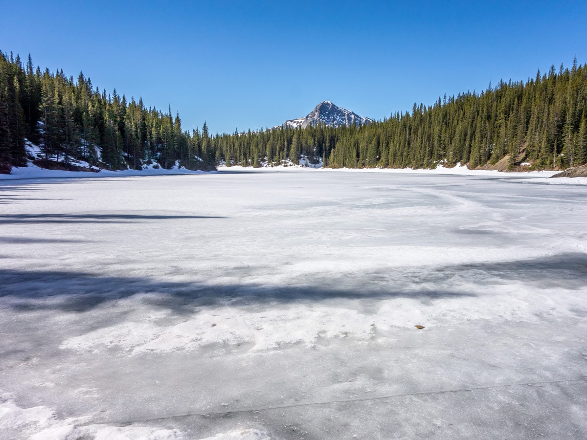
Enjoy the beautiful view of the turquoise Allstones Lake. You can have a picnic here and even camp, but be aware of the restrictions regarding burning fires and you’ll also need a fishing license if you wish to cast out.
After a brief rest, you have two options – either climb to the top of the ridge for a beautiful lookout or return the same way you came. If you choose to ascend to the top from the lake, take the path towards the ridgeline that you passed on your way forward. It’s right next to the fork with paths leading to both sides of the lake.
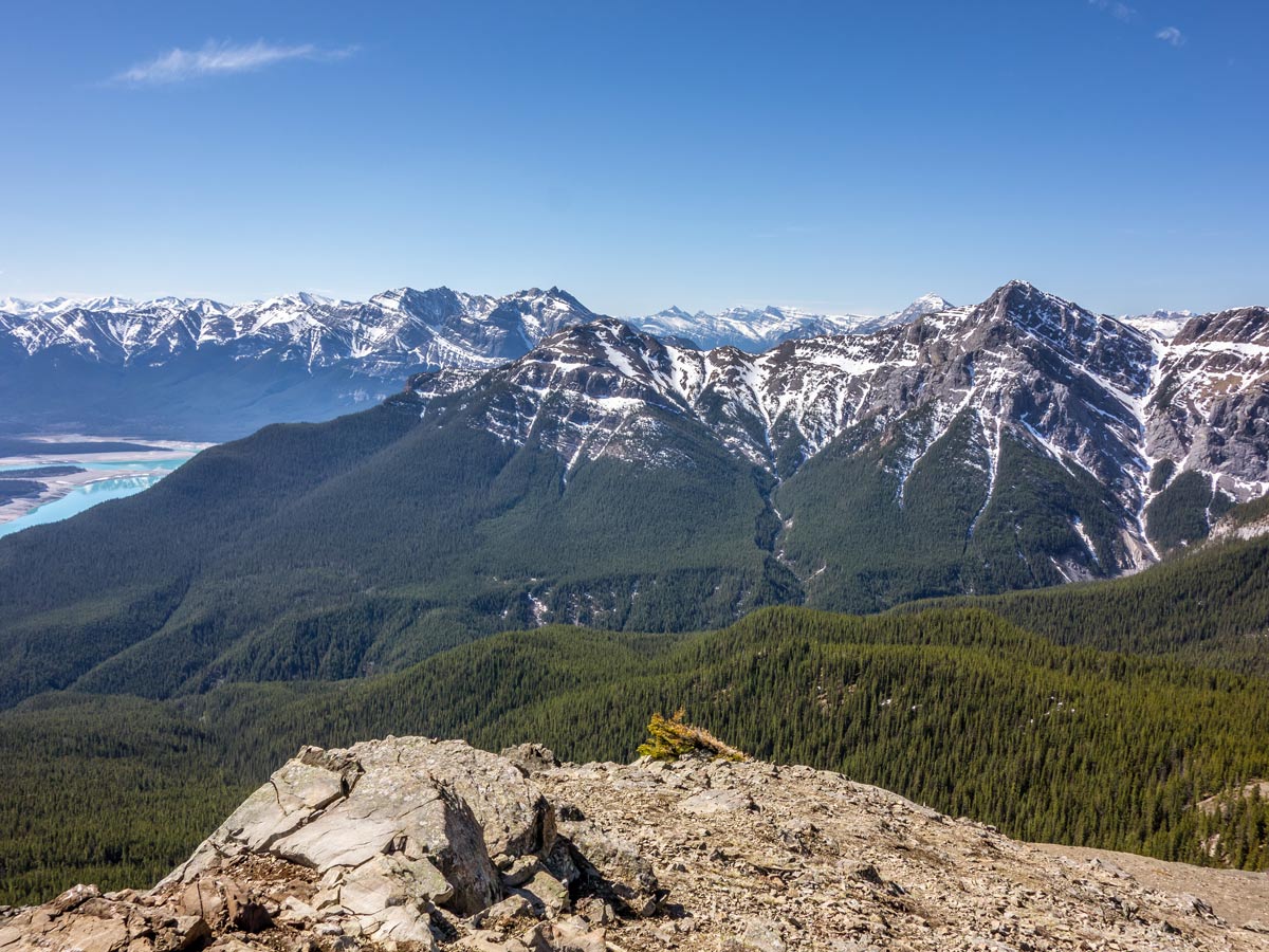
At the top, you will be rewarded with a beautiful lookout to the surrounding Canadian Rockies, the reservoir below, Allstones Lake and Allstones Creekbed, and the surrounding stunning ridgelines. There’s also plenty of space for a lunch break if you didn’t have one on your way up.
From the top, you can either climb down the same way you ascended, or take the path to the southeast, but this trail requires caution, as we found this path to be more annoying and slippery because of the slate rocks and scree.
Retrace your footsteps back to the parking.
Insider Hints
You can camp near the lake, but burning fires is prohibited and fishing is allowed with a license only.
If you are driving from Calgary, take the route through Icefields Parkway. This highway is way more scenic!
Similar hikes to the Allstones Ridge and Lake Hike hike
Marble Mountain Hike
Getting to the Marble Mountain trailhead can be tricky and out of the way, but this remote trail is sure…
Paula’s Ridge Hike
Paula’s Ridge Hike is just east of Mount Abraham and offers incredible views of Abraham Lake. If you are looking…
Kootenay Plains Heritage Trail
Take in some history on the Kootenay Plains Heritage Trail. The trail travels through the ecological preserve and passes by…
Comments