
Warner Route Hike
View Photos
Warner Route Hike
Difficulty Rating:
The Warner Route Hike is a strenuous trail down difficult, unmarked terrain. This excursion is not for the faint of heart and is reserved for experienced hikers only. Although this trail is extreme, we love it! The hike down into the inner canyon will give you more than your daily dose of adrenaline as you navigate the technical terrain.
Getting there
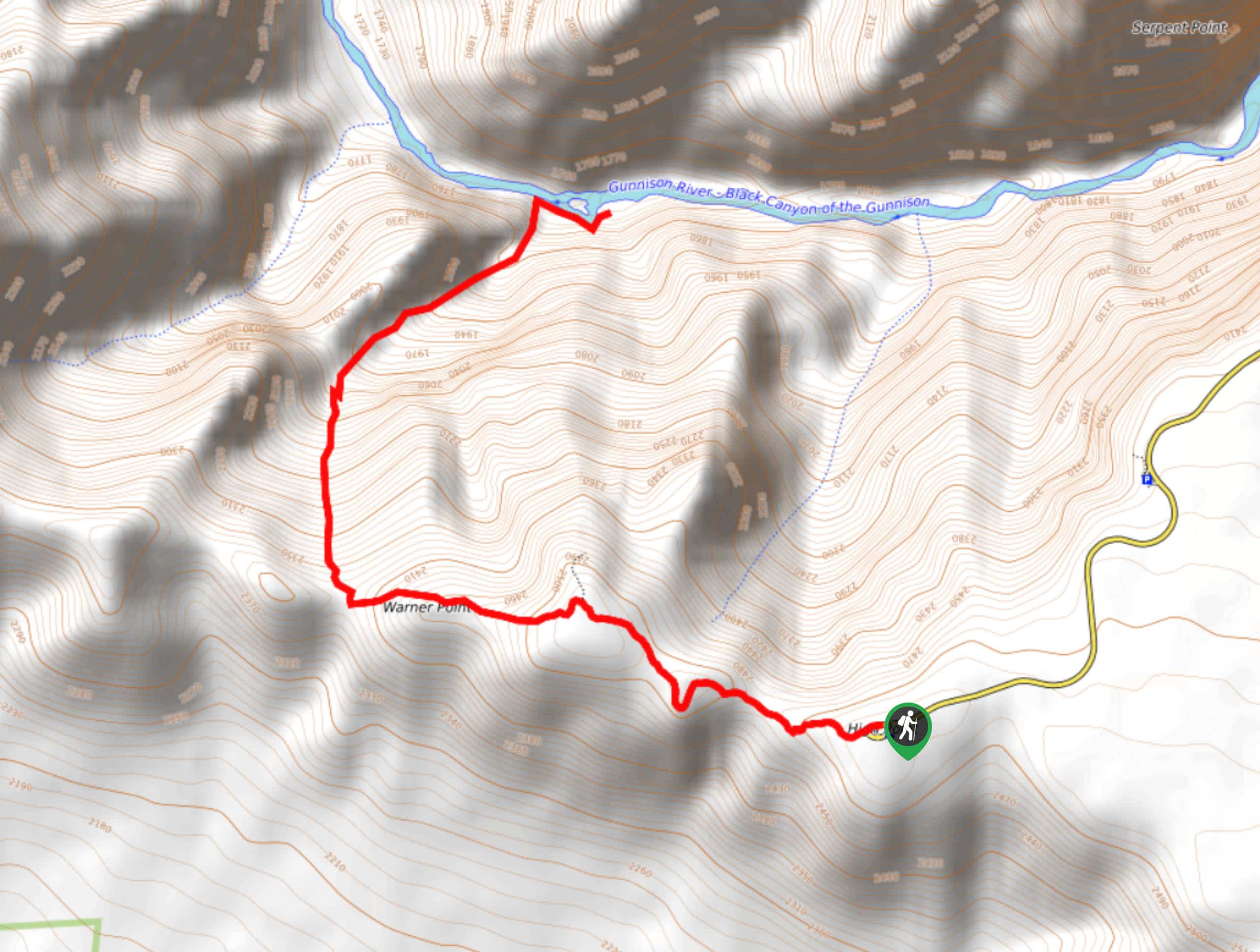
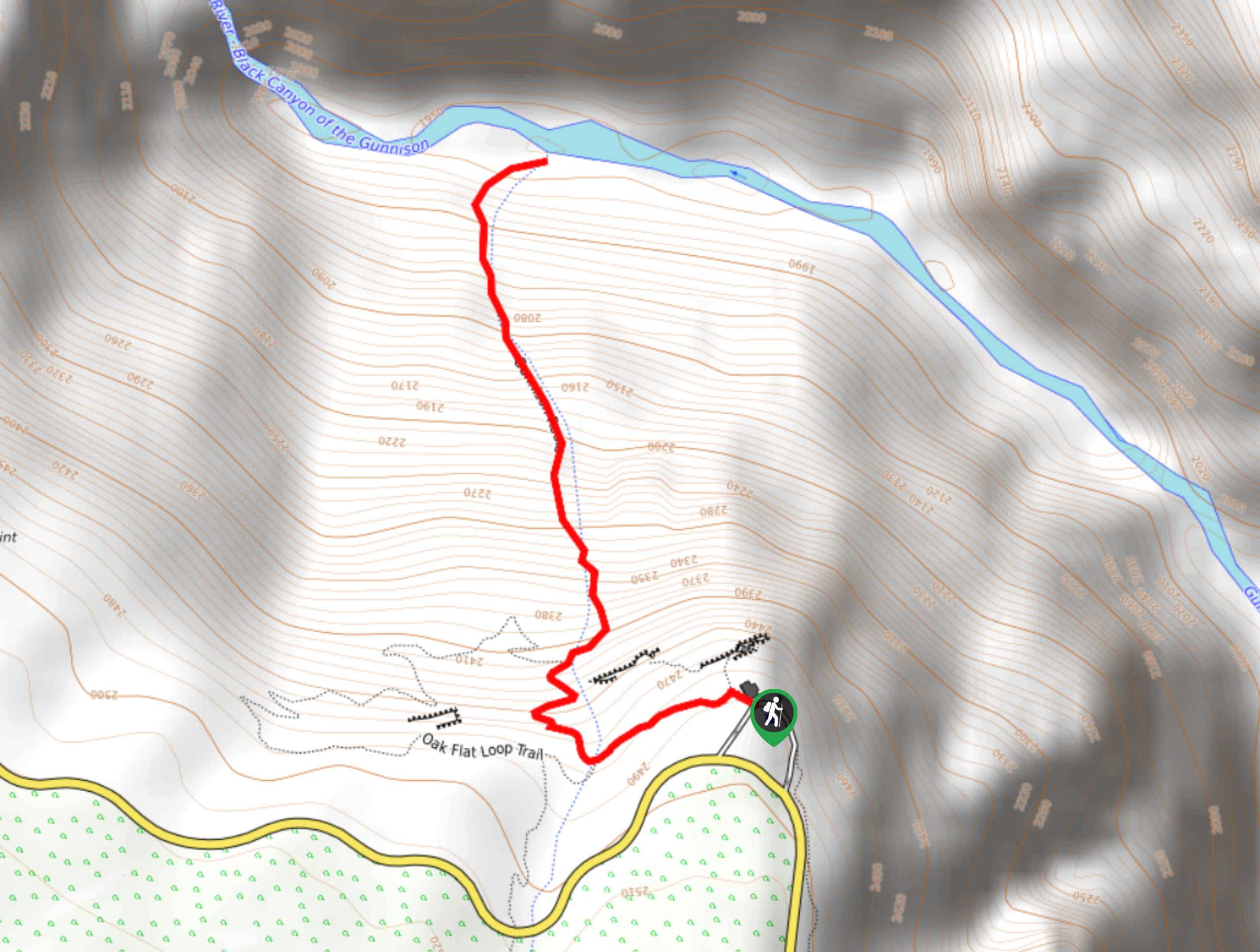
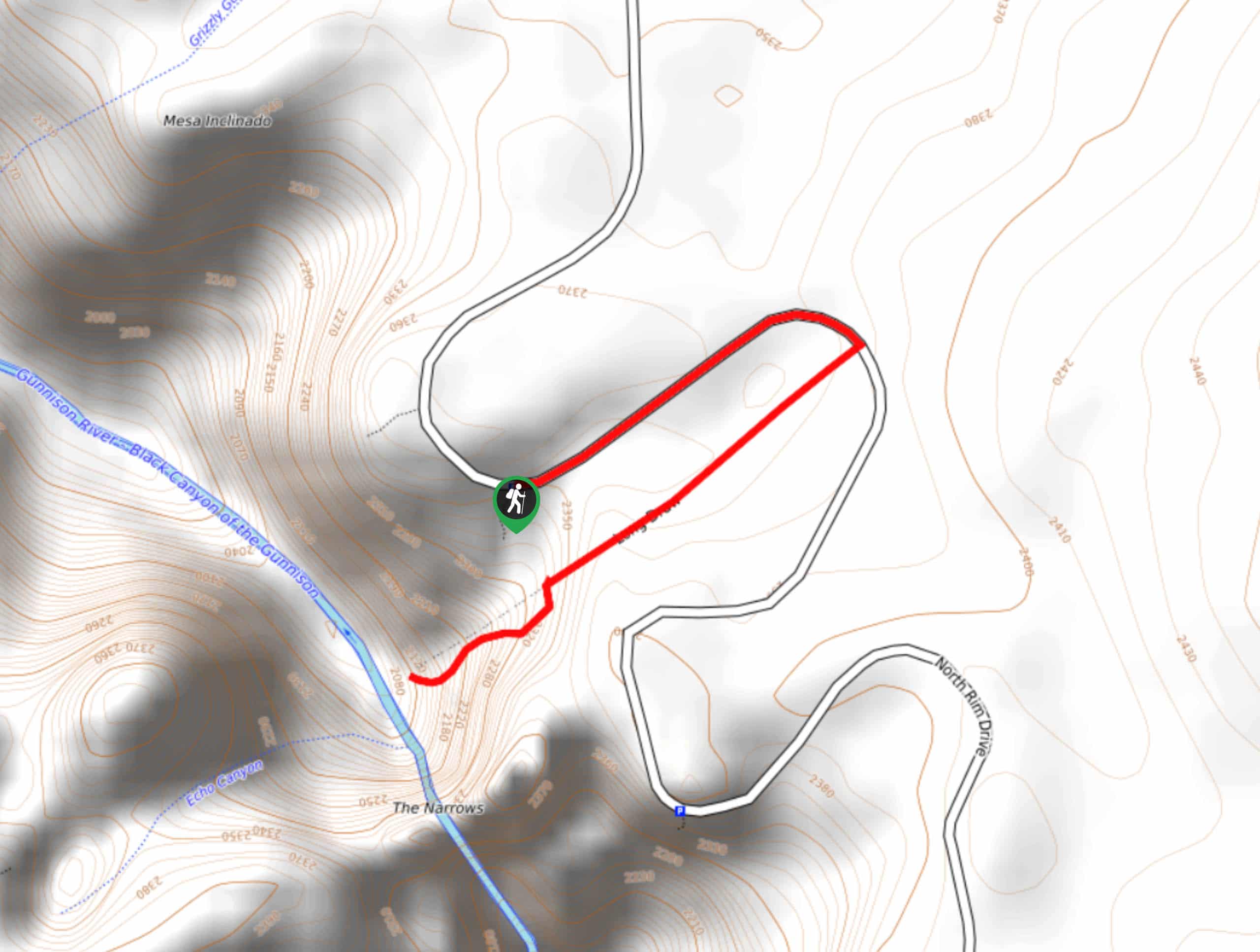
The Warner Route Trailhead is off the High Point Parking Lot at the end of the South Rim Road.

About
| Backcountry Campground | Yes, permits required |
| When to do | April-October |
| Pets allowed | No |
| Family friendly | No |
| Route Signage | None |
| Crowd Levels | Moderate |
| Route Type | Out and back |
Warner Route Hike
Elevation Graph
Weather
Warner Route Hike Description
Craving an adrenaline rush, eh? We don’t blame you; the Warner Route Hike is extremely fun and stimulating assuming you come prepared. For safety reasons, the National Park only allots fifteen hiking permits per day which are required if you wish to adventure this trail. These permits can be reserved the night before or the morning of your hike at the Ranger Station. You and your party will also have to complete a safety briefing before you are ready to roll. These precautions help the park keep tabs on how many people are on these inner canyon trails, and when. Due to the technicality and length of this trail, consider camping overnight at one of the designated campsites along the base of the river.
Before commencing this adventure, make sure you are stocked up on water or have a water filter, and bring plenty of snacks. You’ll need to conserve some energy for the ascent back up! Consider bringing gloves and hiking poles to help you navigate the steep rocky terrain. Additionally, we recommend wearing pants as you will be traversing through brush and the riverbanks are often lined with poison ivy.
Begin the excursion down the Warner Route Trail from the High Point Parking Lot. Track west along the Warner Point Nature Trail. Continue along the trail as you pass the lookout and merge onto the Warner Route Trail. This section of the hike becomes strenuous and unmarked. The primitive trail will curve north and quickly become steep. Take your time as you navigate down the steep rocky terrain. Use tree routes and secure boulders as handholds. Do your best to maintain along the GPS route as you scramble the steep ravine.
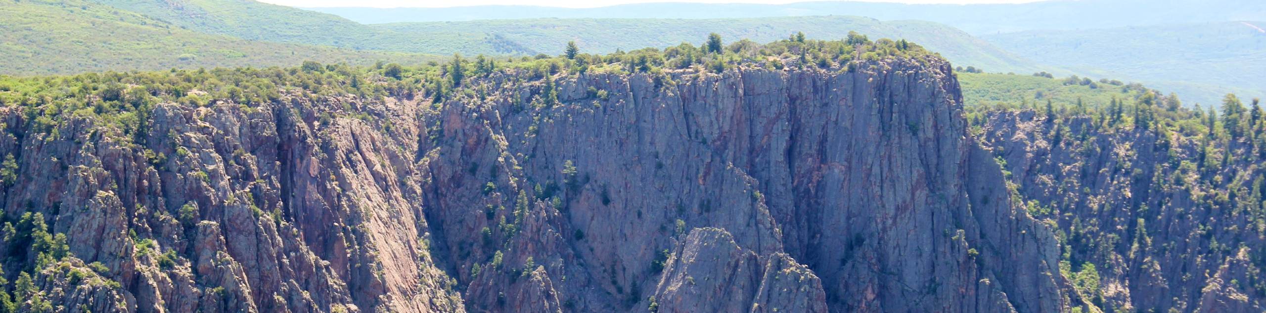
Once you make it down the trail you will be rewarded with stunning sights of the narrow-walled gorge and the Gunnison River. Stay the night at one of the designated campsites or retrace your steps up the trail. The ascent to the trailhead will be hard as you scramble up loose rock screes and dirt paths. Use your poles and wear gloves. Once you make it back to the trailhead make sure you alert a Park Ranger that you are off the trail.
Similar hikes to the Warner Route Hike hike
Tomichi Hike
The Tomichi Hike is the steepest hike on the South Rim of the Black Canyon. This unmarked hike will lead…
Gunnison Route Hike
The Gunnison Route is a stimulating excursion down the ridge of the Black Canyon to the Gunnison River. This hike…
Long Draw Hike
The Long Draw Hike is an extreme excursion into the inner canyon. Reserved for experienced hikers, this trail requires adventurers…
Comments