
Gunnison Route Hike
View Photos
Gunnison Route Hike
Difficulty Rating:
The Gunnison Route is a stimulating excursion down the ridge of the Black Canyon to the Gunnison River. This hike is reserved for experienced hikers who won’t shy away from steep, challenging and rocky terrain. We love this hike! Get your daily dose of adrenaline and then some as you scale the rocky terrain down into the river by navigating tightly wound switchbacks and using a chain rope to guide you down loose terrain. This excursion may be tricky, but man is it fun!
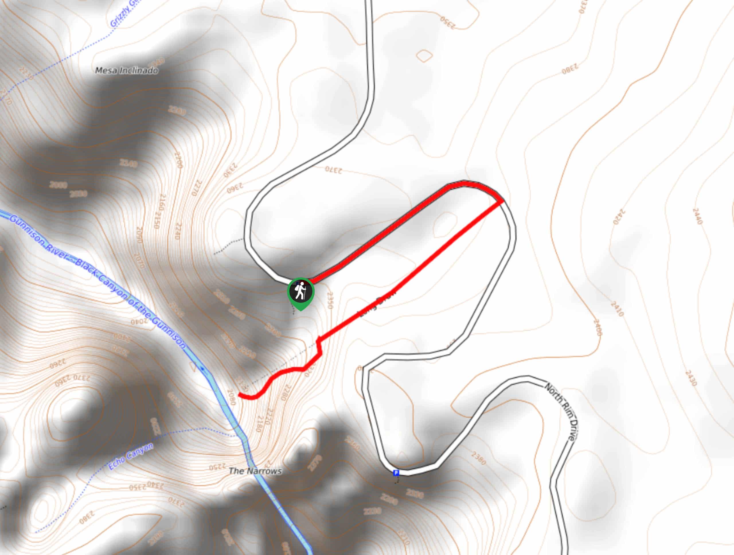
Getting there
Embark on your adventure on the Gunnison Route from the South Rim Visitors Center off the South Rim Road. Seasonal Road Closure November-April. National Park passes required.

About
| Backcountry Campground | One night only, permits required |
| When to do | May-October |
| Pets allowed | No |
| Family friendly | No |
| Route Signage | Poor |
| Crowd Levels | Moderate |
| Route Type | Out and back |
Gunnison Route Hike
Elevation Graph
Weather
Gunnison Route Hike Description
This hike is a sought-after excursion for adventurers visiting the Black Canyon of Gunnison. This exciting hike is so popular that the National Park had to set a daily limit. The Gunnison Trail has a maximum capacity of fifteen hikers per day for traffic and safety reasons. For that reason, permits are needed to hike this route. Permits are free and are first come first serve the day before your hike at the South Rim Visitors Center the last hour they are open, or the morning of your hike. Additionally, you will have to do a quick safety briefing with a park ranger before you embark on your adventure. Once you complete the hike, let a park ranger know you and your party are off the trail.
There are safety measures in place to protect hikers on this trail. This trail is for experienced hikers only. You will have to navigate switchbacks, steep rocky terrain and use a chain rope to maneuver down slick terrain. Wear good hiking boots and bring plenty of water and snacks to refuel. A GPS is also a good idea as a few segments of the trail are overgrown and hard to navigate. Though this hike is demanding, it is so rewarding! We love an excursion that pushes our boundaries and takes us off the beaten path!
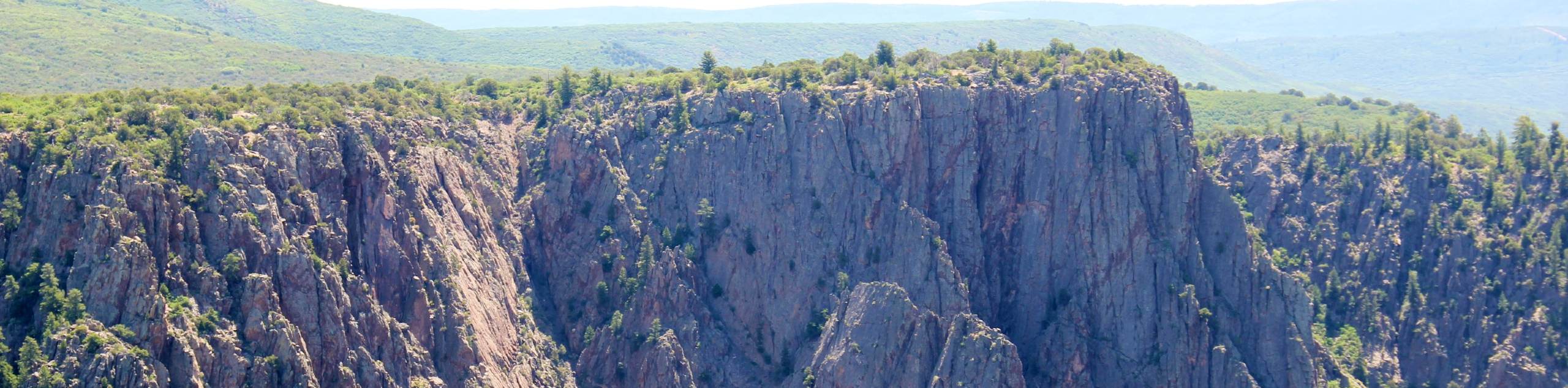
The vistas as you descend into the Black Canyon of Gunnison are like no other! You will get the best of both worlds, views of the canyon from above as you descend, and the perspective from the bottom. Once on the river bank, you will get up close and personal with the Gunnison RIver and sights of overwhelmingly tall cliffs that flank the narrow canyon. You need to add this trail to your adventure list!
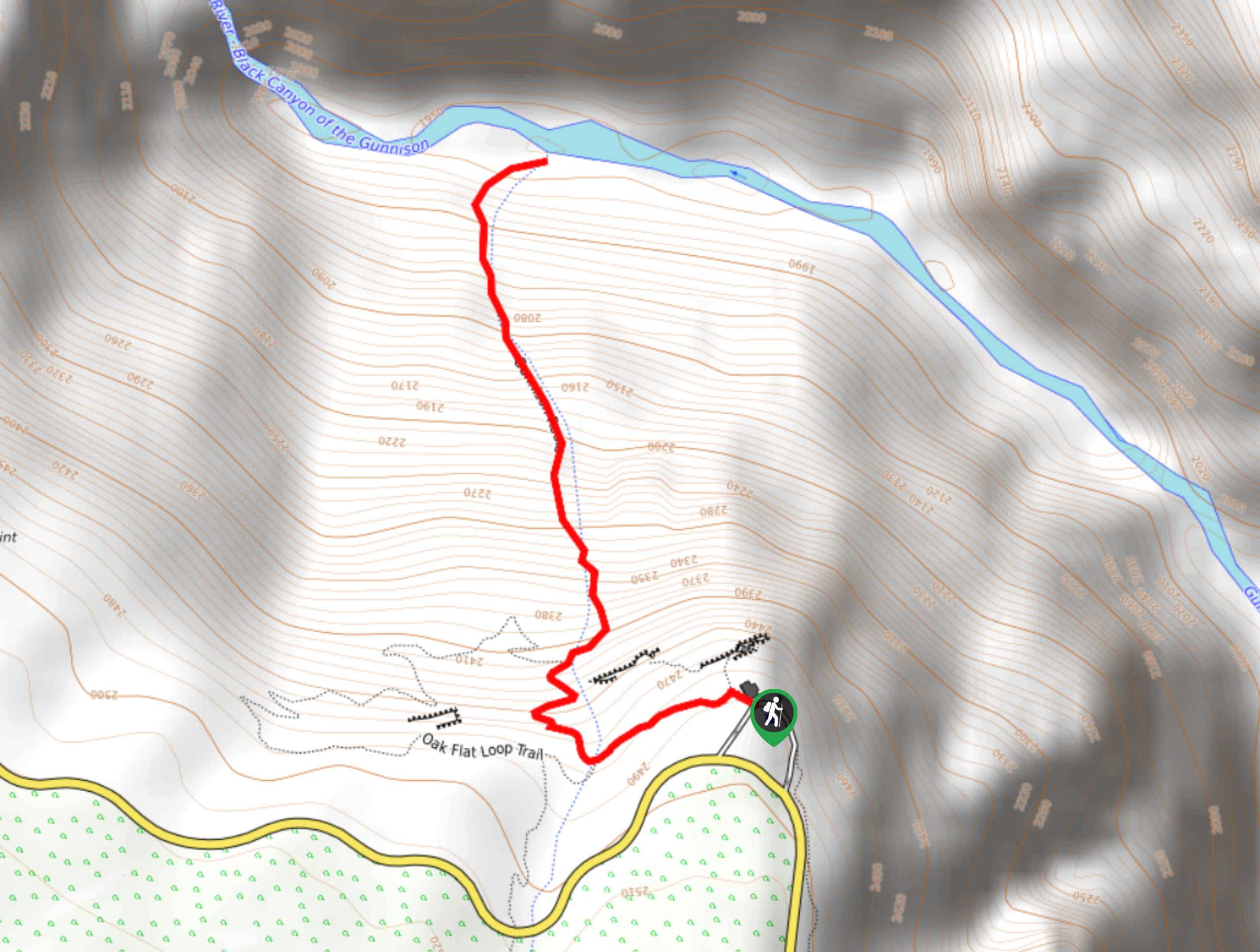
Once you secure your permits and are given the go ahead, begin your adventure on the Gunnison Route Hike. Start on the Oak Flat Loop Trail. This hike will guide you southwest until you encounter an intersection. At the junction, veer right onto Gunnison Route.
Gunnison Route will take you down to the river. As you begin descending you will have to scramble over tree routes and large boulders. Navigate a few switchbacks before you reach the chains. Here is where the trail takes it up a notch; the terrain will be substantially steeper from this point forward. Use the Chain ropes to maneuver down the steep terrain.
Seemingly, wipeouts are inevitable on this steep path down into the canyon, but the chain ropes may lessen the number of falls. Continue down the trail as it intersects with a stream and the ropes end. The last leg of the path down into the canyon is straight down and steep without trail markers. Do your best to navigate tree roots, loose boulders and a rock scree before the trail delivers you to the river.
Admire the views of the Black Canyon from a different perspective. Enjoy the level terrain and dip your tired feet in the river before beginning your ascent. The ascent up the trail will be easier to navigate but your legs will be burning! We love a good leg workout though, right? Retrace your steps and scramble up all the way back up the path to the visitors centre. Ensure to let a park agent know when you finish your adventure.
Trail Highlights
Gunnison River
The Gunnison Route is one of few trails in the National Park that will bring you directly to the Gunnison River. Located among the Precambrian rock gorge, the Gunnison River is one of the tributaries of the Colorado river. The Gunnison River is approximately 180.0mi long and is fed by numerous rivers and streams in the area. Dropping an average of 43ft per mile, the Gunnison River drops more steeply than the Colorado River does through the Grand Canyon (7.5ft per 1.0mi).
Insider Hints
There is poison ivy along the riverbank so wear long pants if you plan to explore at the bottom!
Bring plenty of water or a water filter! This adventure will be exhausting, but in a good way.
Wear hiking boots or hiking shoes, you will need solid soles and good traction as you scramble this trail.
Download the trail GPS to help you navigate unmarked sections of the trail.
Similar hikes to the Gunnison Route Hike hike
Tomichi Hike
The Tomichi Hike is the steepest hike on the South Rim of the Black Canyon. This unmarked hike will lead…
Green Mountain Summit Hike
On your next adventure through the Black Canyon of the Gunnison National Park add the Green Mountain Summit Hike to…
Long Draw Hike
The Long Draw Hike is an extreme excursion into the inner canyon. Reserved for experienced hikers, this trail requires adventurers…
Comments