
Long Draw Hike
View Photos
Long Draw Hike
Difficulty Rating:
The Long Draw Hike is an extreme excursion into the inner canyon. Reserved for experienced hikers, this trail requires adventurers to scramble loose rock screes and technical terrain. You will be anything but bored as you maneuver the Long Draw Hike.
Getting there
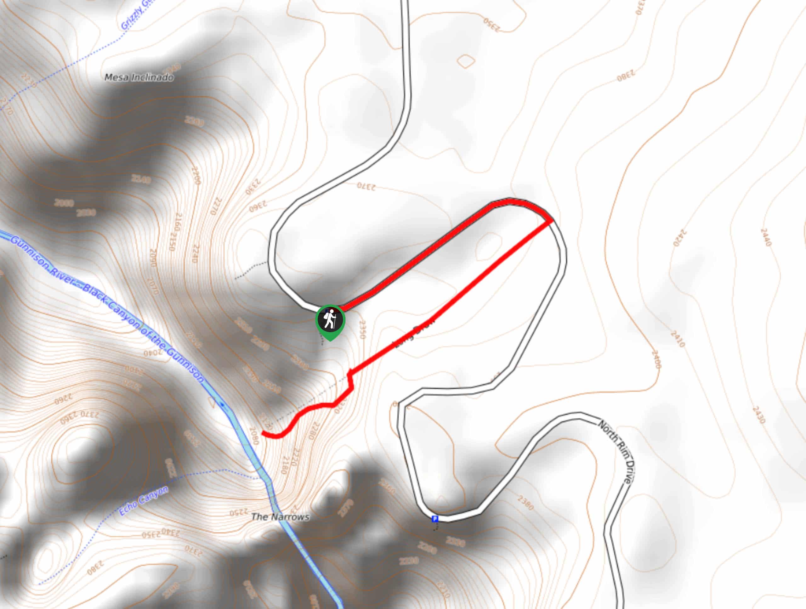
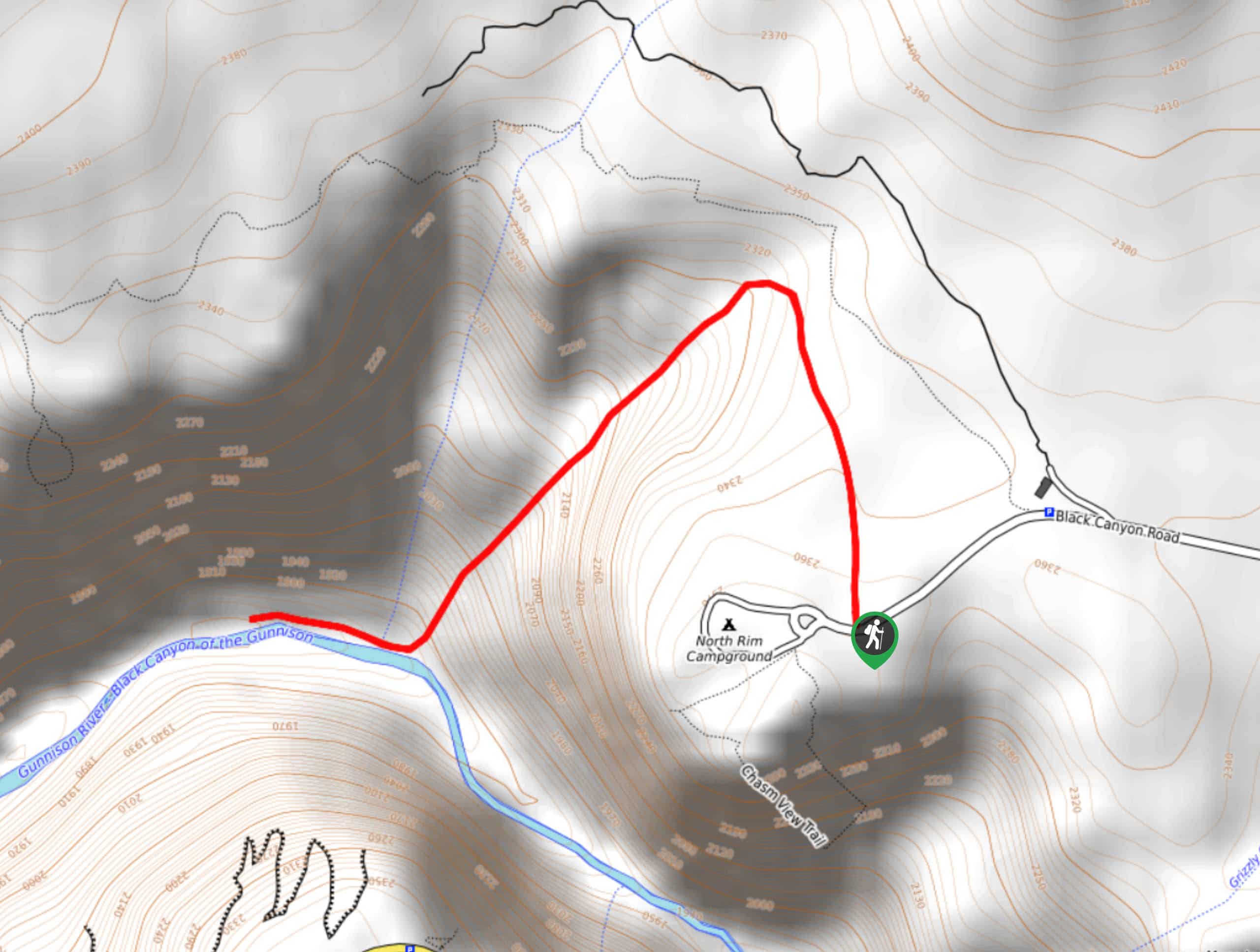
Access the Long Draw Hike from North Rim Drive. Park at the Balanced Rock View Parking Lot and walk northwest along the road until you encounter the Long Draw Trailhead.

About
| Backcountry Campground | Yes, permits required |
| When to do | May-October |
| Pets allowed | No |
| Family friendly | No |
| Route Signage | Poor |
| Crowd Levels | Low |
| Route Type | Out and back |
Long Draw Hike
Elevation Graph
Weather
Long Draw Hike Description
The Long Draw Hike, formerly known as the Devil’s Slide, is a steep hike down into the narrow Black Canyon. This adventure is extremely stimulating and fun if you don’t mind venturing off the beaten path. Permits are required for this hike and can be reserved at the North Rim Ranger Station the evening before, or the morning of your hike. There are a limited number of permits per day allotted, and if you get one, you will have to complete a safety briefing with a park ranger.
Once you get your permits sorted, it’s time to prepare. Wear long pants and long sleeves on this hike as it is notorious for poison ivy. Additionally, we recommend wearing gloves to protect your hands as you navigate steep rocky terrain. Be prepared to maneuver down loose rock screes and rock ledges on this hike. Pack plenty of water and snacks to refuel at the bottom before you tackle the ascent.
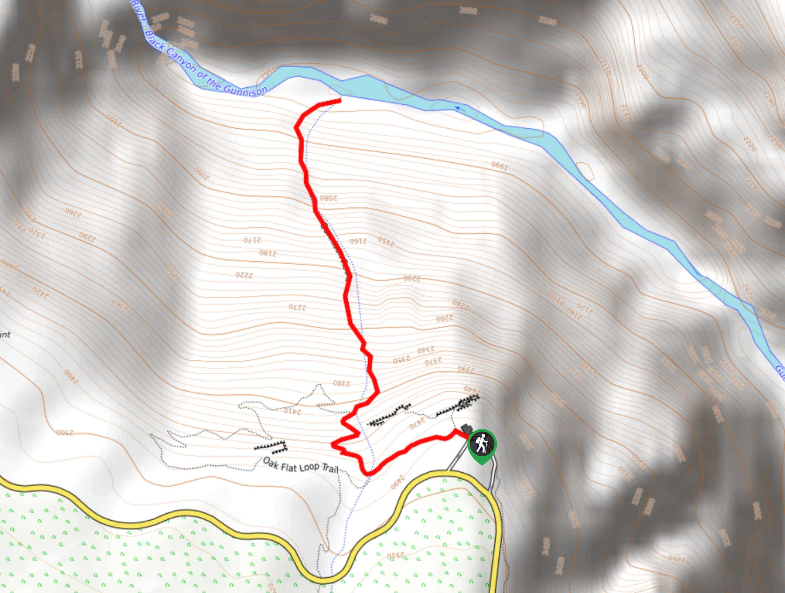
When you are ready, depart the Balanced Rock Carpark and head northwest along the road to the trailhead. When you meet the trailhead, follow the Long Draw Trail down the steep gully. Walk through the dense forest and navigate roots and rocks as you descend into the gorge. Exercise caution when stepping on rocks, make sure they are sturdy before pressing all your weight down. Maneuver the switchbacks and rock ledges all the way down the primitive path.
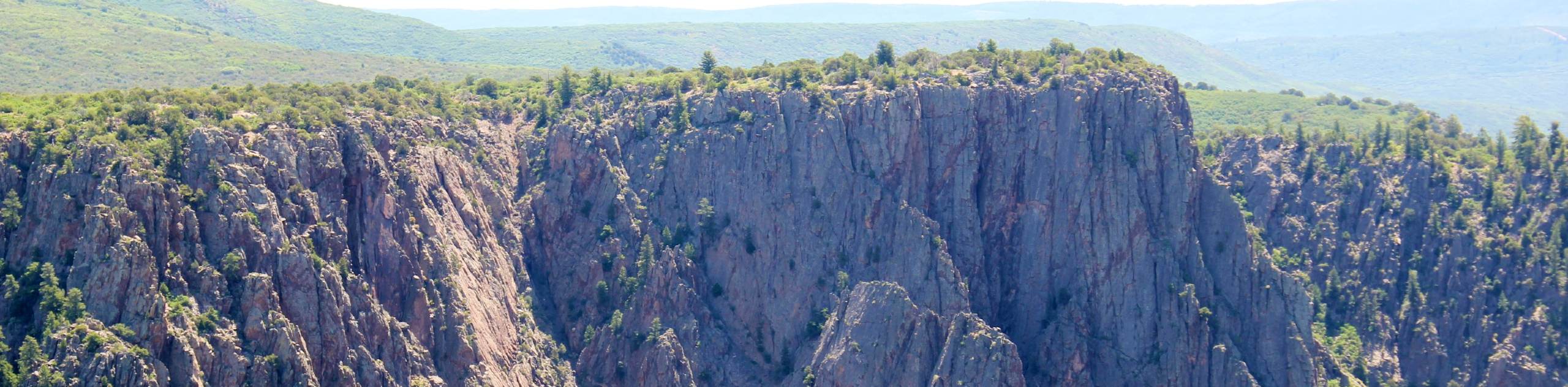
When you get down to the Gunnison River and back on level terrain you will be bewildered by the narrowness of the steep cliffs that encompass you. The perspective from the bottom of the canyon is way grander than those from the viewpoints above. Take a break or camp overnight at one of the designated campsites before commencing your ascent.
Retrace your steps all the way back up the steep gully to the carpark. Be careful of loose rocks falling on hikers behind you. When you have completed the hike, let a park ranger know.
Similar hikes to the Long Draw Hike hike
Tomichi Hike
The Tomichi Hike is the steepest hike on the South Rim of the Black Canyon. This unmarked hike will lead…
Gunnison Route Hike
The Gunnison Route is a stimulating excursion down the ridge of the Black Canyon to the Gunnison River. This hike…
S.O.B Draw Hike
If you are seeking a challenging hike into the inner canyon, then the S.O.B Draw Hike is your match. The…
Comments