Tomichi Hike
View Photos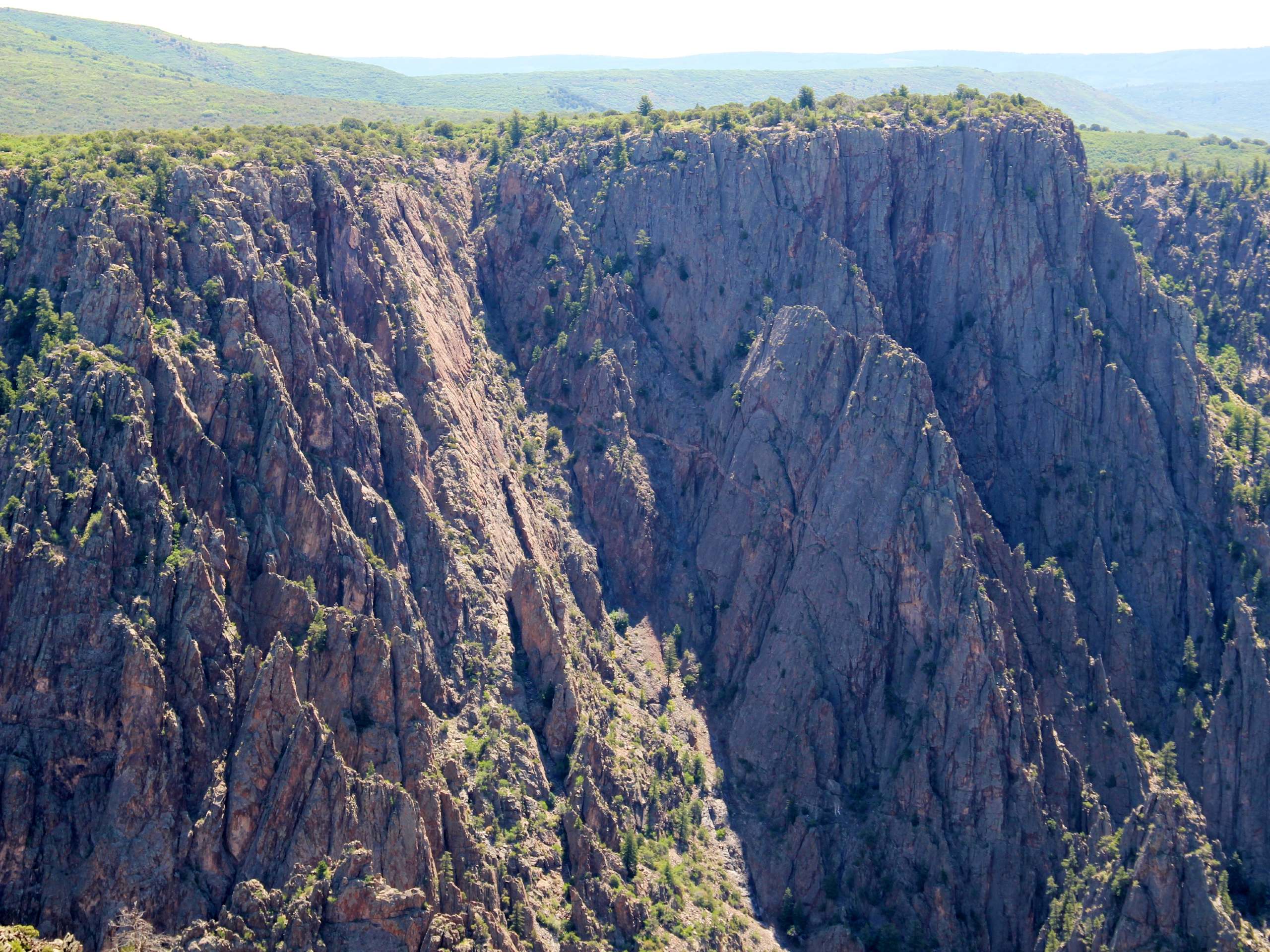
Tomichi Hike
Difficulty Rating:
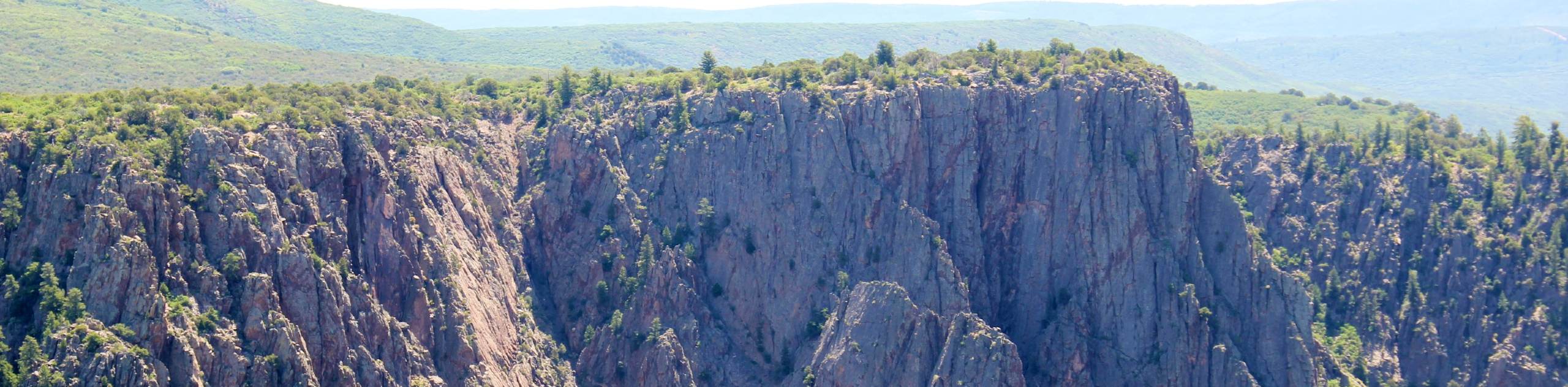
The Tomichi Hike is the steepest hike on the South Rim of the Black Canyon. This unmarked hike will lead you down the side of the canyon's rugged cliffs into the gorge. This hike is not for the faint of heart, and even the most experienced hikers may have difficulty navigating the terrain. Though the Tomichi Trail is extreme, it is tons of fun, and you will be rewarded with a unique perspective of the steep walled canyon from the riverbed.
Getting there
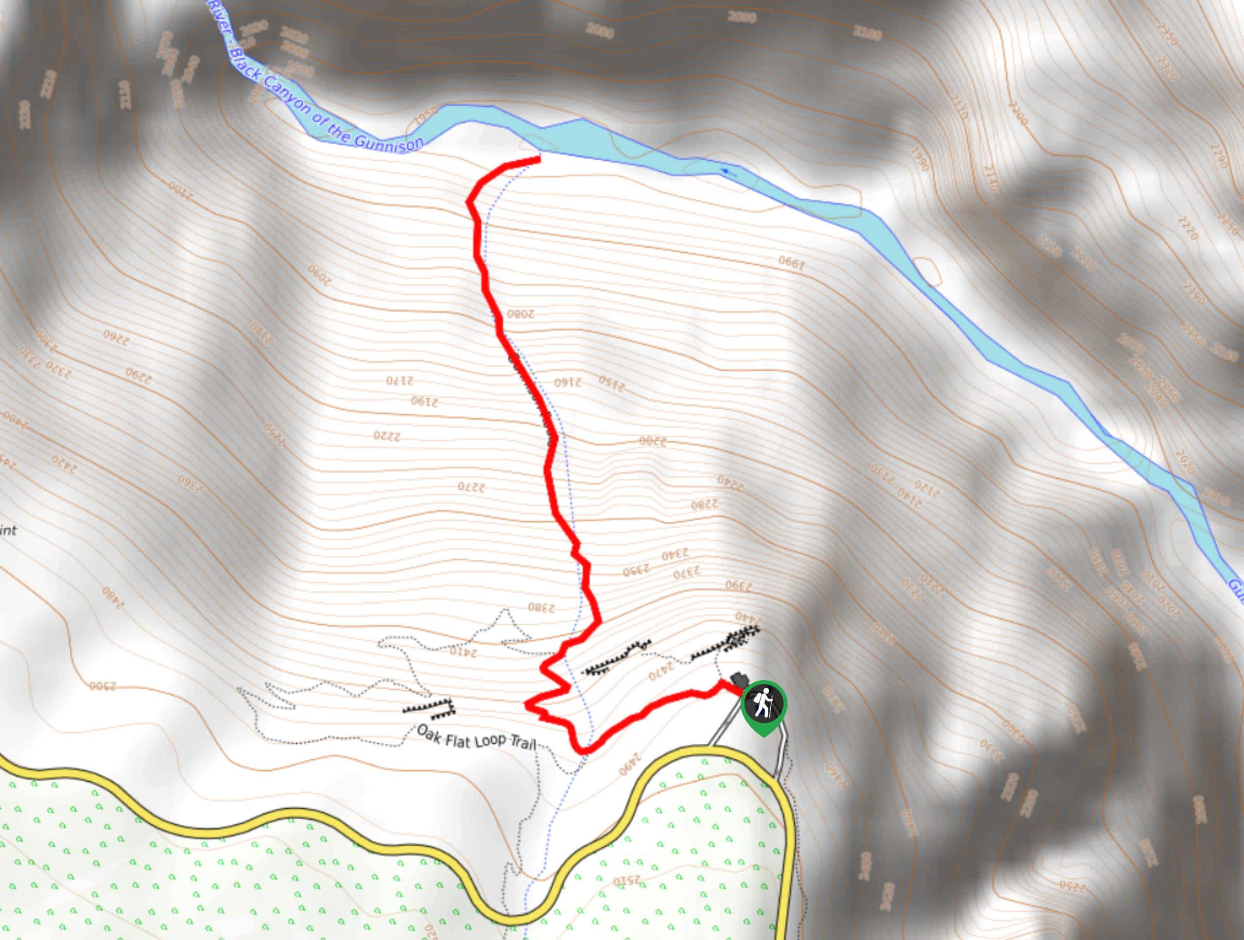
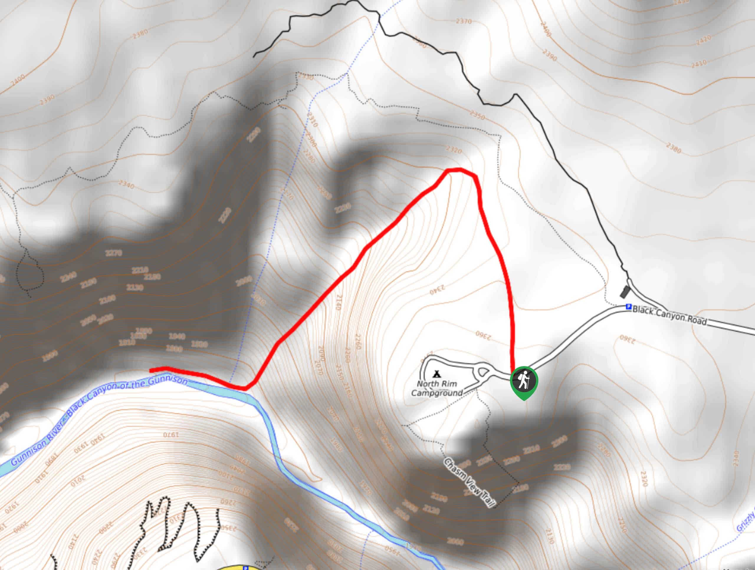
The Tomichi Hike is off of the South Rim Road at the Tomichi Lookout. Note the road closes seasonally from November-April.

About
| Backcountry Campground | One night only, permits required. |
| When to do | May-October |
| Pets allowed | No |
| Family friendly | No |
| Route Signage | None |
| Crowd Levels | Low |
| Route Type | Out and back |
Tomichi Hike
Elevation Graph
Weather
Tomichi Hike Description
If you are an avid adventurer who craves a challenge and an adrenaline rush, then we are sure you’ll love the Tomichi Hike. This hike is reserved for experienced hikers only and requires a hiking permit. Purchase the permits from the South Rim Visitors Centre the evening before your excursion or the morning of. Once you secure your permit you will have to do a safety briefing with the park ranger before taking off down the trail. This safety measure ensures that they know who is on the trail and when. The Tomichi Trail is tough and rocky, and you will likely slide on your bum down a few sections. Come prepared with plenty of water, hiking boots, and consider gloves.
By no means are we trying to scare you away from this trail, we just want to make sure you have all the information! Once you have your permit and have completed your safety briefing it is time to take to the trail! Depart from the Tomichi Point Trailhead and head east down the unmarked path. The trail has some wear, so it is easy to spot from the trailhead and few rock cairns will guide you the rest of the way. Mind your footing as you navigate down the steep rocky scree. Use trees and tree routes as support while you descend.
Continue scrambling and sliding down the trail until you are eventually rewarded with the Gunnison River and level terrain. Enjoy the perspective of the Black Canyon from the bottom and revel In the impressive grandeur of the cliffs. Soak your tired feet in the river and refuel prior to commencing your ascent.
When you are ready, retrace your steps back up the trail. Be careful of hikers behind you as you ascend the extremely steep rocky path. Gloves will come in handy as you scramble your way up the path. Once you arrive back at the parking lot be sure to alert a Park Ranger that you are off the trail.
Similar hikes to the Tomichi Hike hike
Gunnison Route Hike
The Gunnison Route is a stimulating excursion down the ridge of the Black Canyon to the Gunnison River. This hike…
Long Draw Hike
The Long Draw Hike is an extreme excursion into the inner canyon. Reserved for experienced hikers, this trail requires adventurers…
S.O.B Draw Hike
If you are seeking a challenging hike into the inner canyon, then the S.O.B Draw Hike is your match. The…
Comments