Loaf Mountain and Spionkop Ridge Scramble
View Photos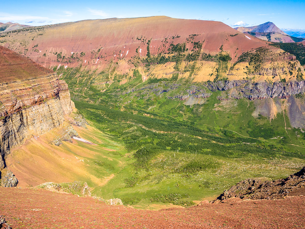
Loaf Mountain and Spionkop Ridge Scramble
Difficulty Rating:
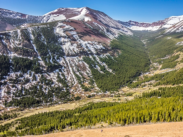
Loaf Mountain is the second highest peak in the Castle area and is bordered by spectacularly colorful valleys. An extension to the summit of Spionkop Ridge provides a spectacular view into Waterton Lakes National Park.
Getting there
From Pincher Creek head south on Highway 6 after about 12.4mi then a turn right onto Township Road 43A, signed for Shell Waterton Complex. Continue on this road, but before reaching the complex take a left on Range Road 303, as it turns to 302A and 302B. Continue past the turn on the left to stay on Range Road 303 and continue along this road until you reach the trailhead at the end.

About
| When to do | June - September |
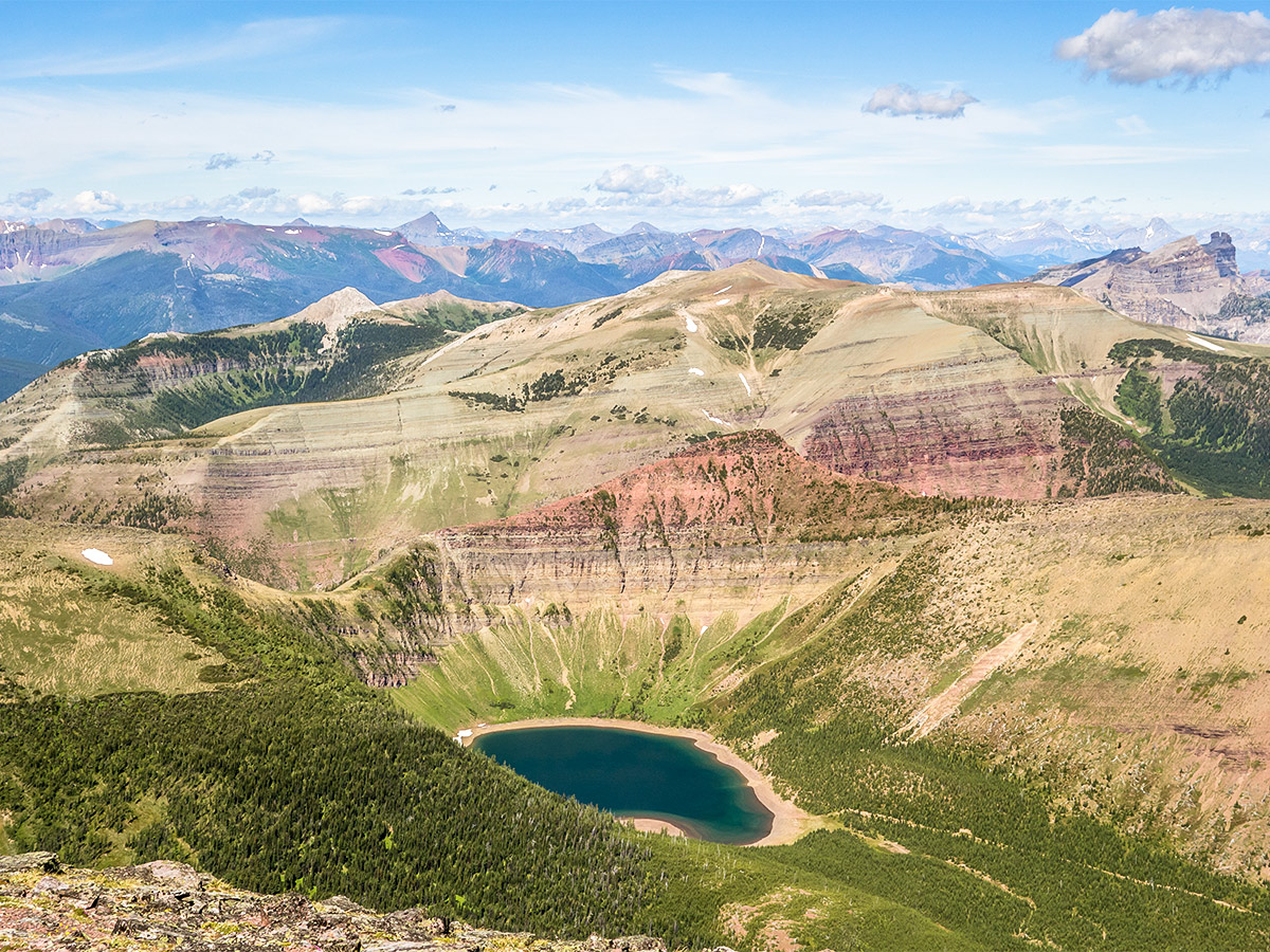
| Backcountry Campsites | Bovin Lake, northwest of Loaf Mountain and passed en-route. |
| Toilets | None |
| Pets allowed | Yes - On Leash |
| Scarmbling Rating | Grade 2 |
| Exposure | Mild |
| Family friendly | No |
| Route Signage | None |
| Crowd Levels | Low |
| Route Type | Out and back |
Loaf Mountain and Spionkop Ridge
Elevation Graph
Weather
Route Description for Loaf Mountain and Spionkop Ridge
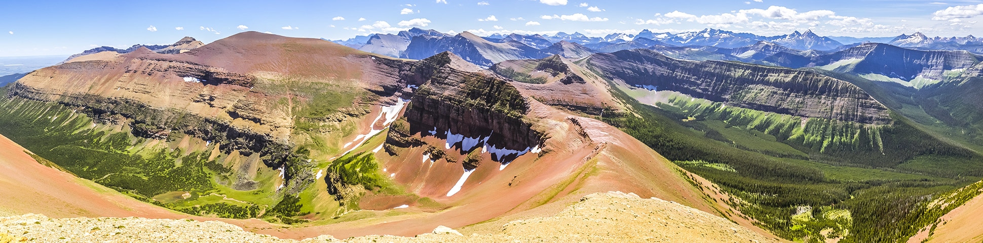
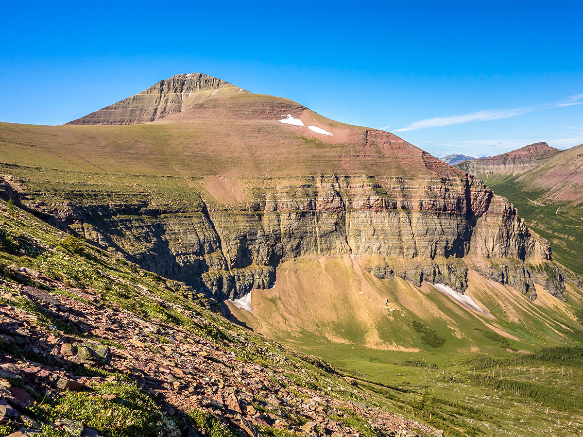
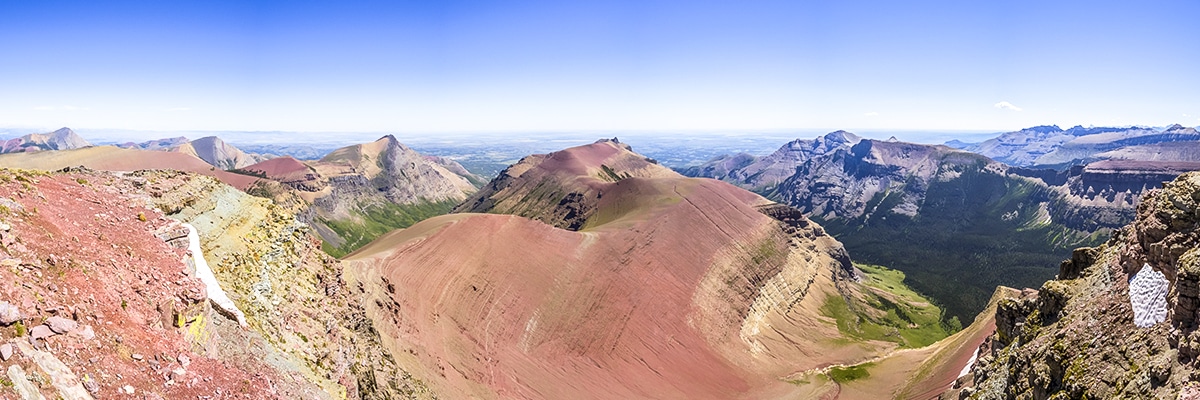
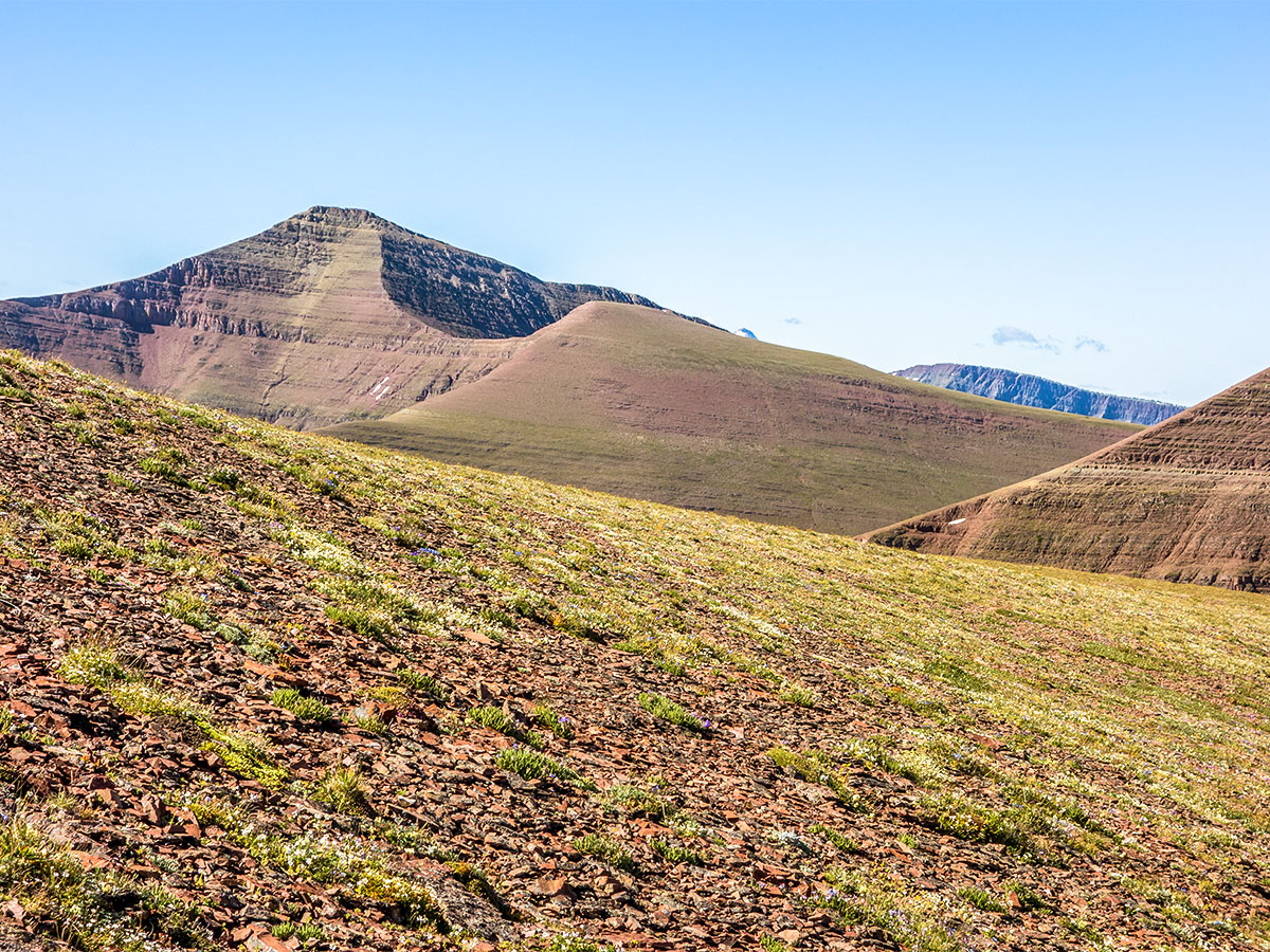
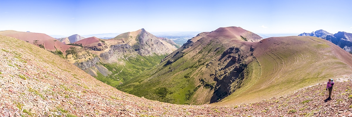
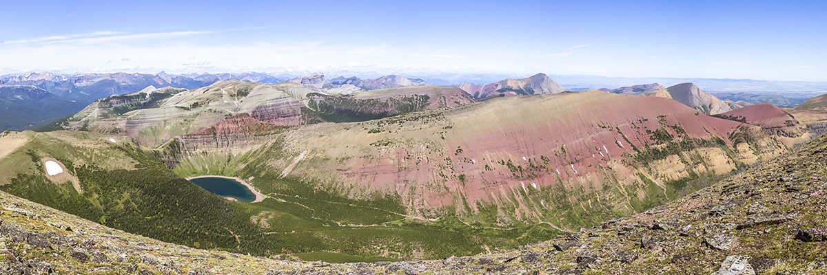
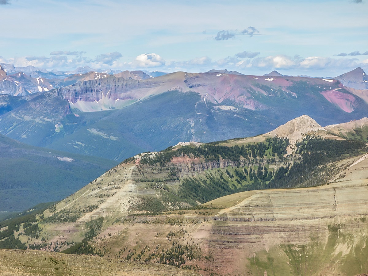
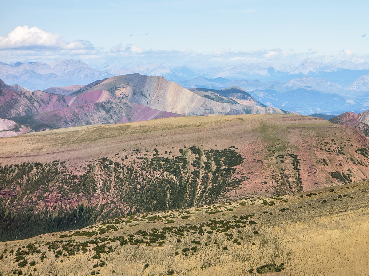
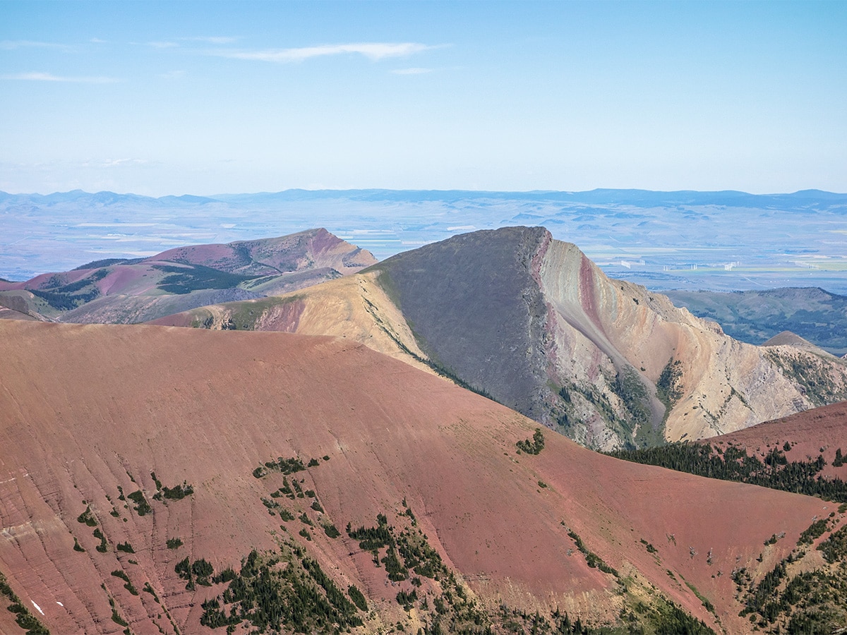
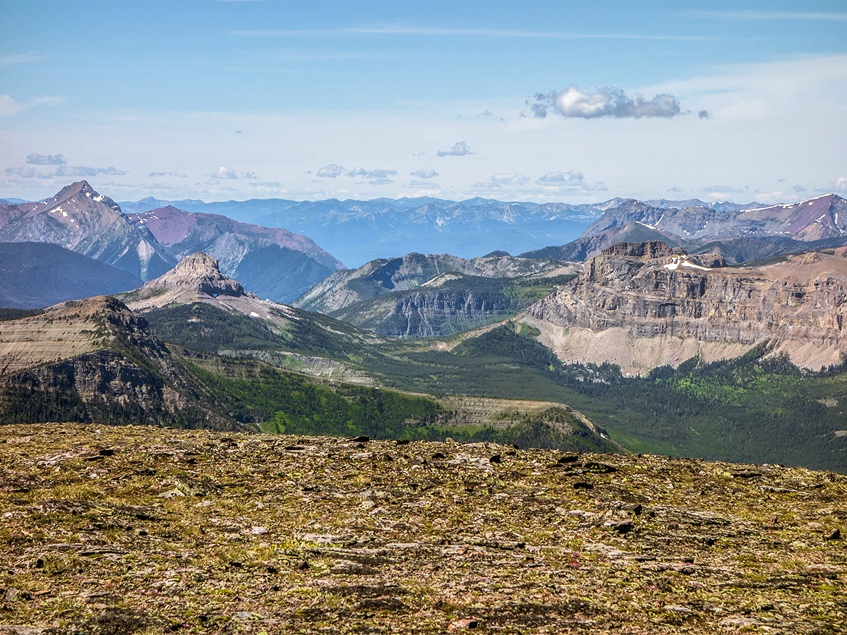
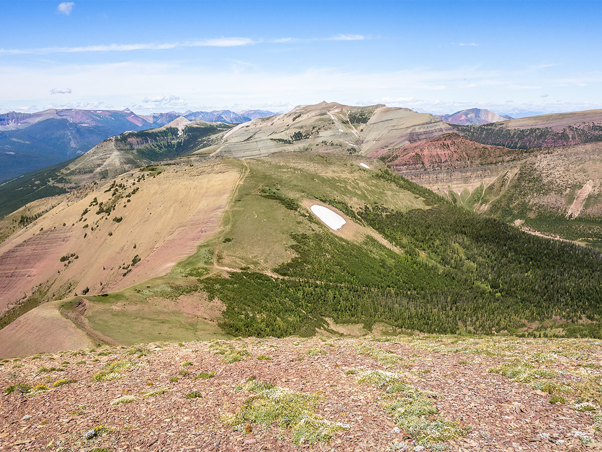
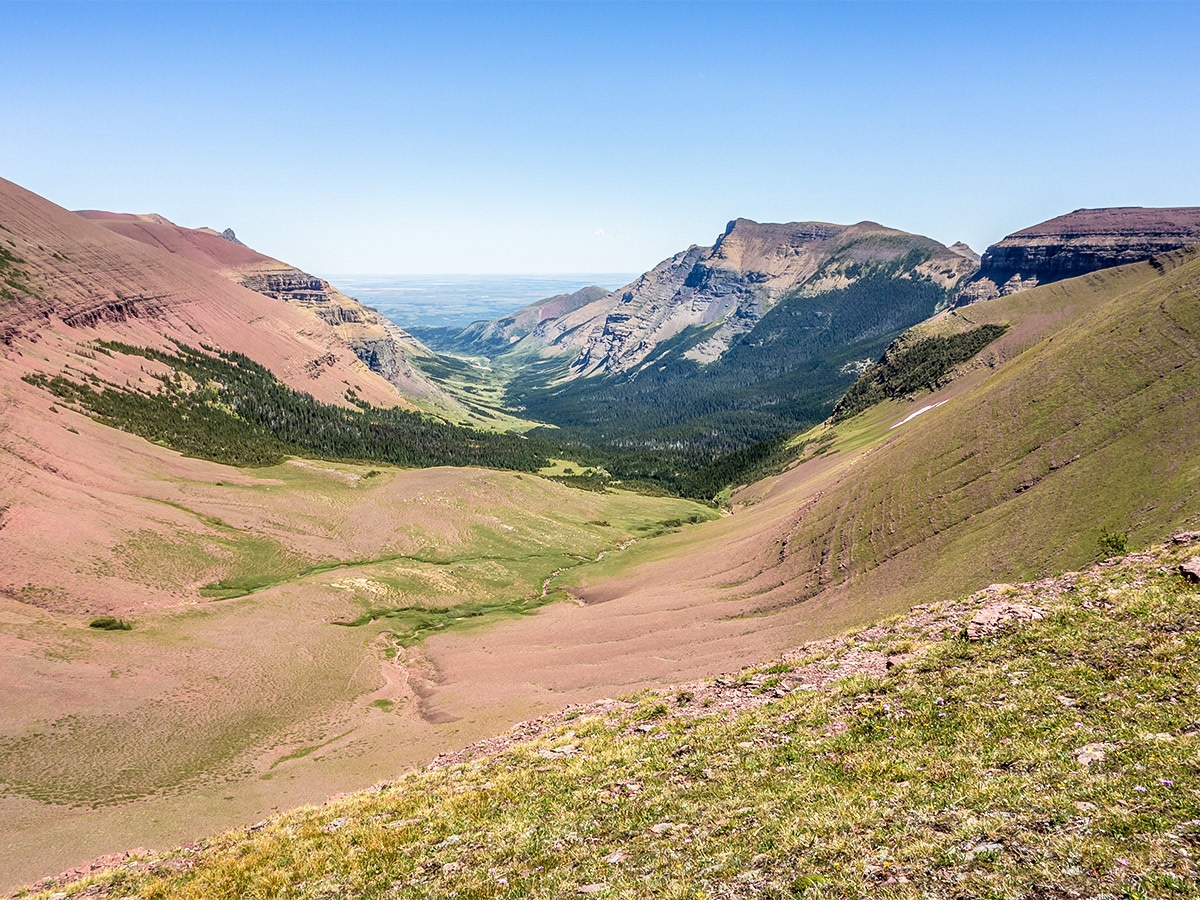
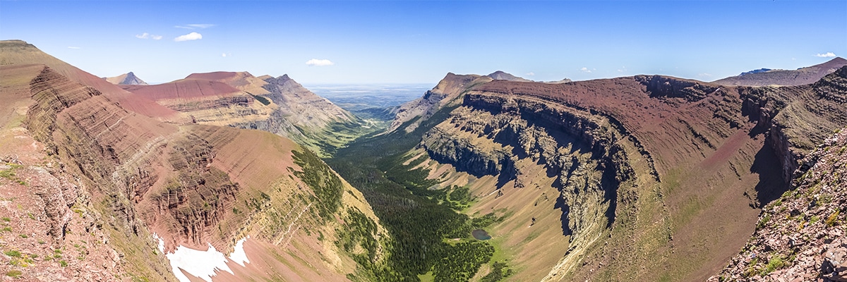
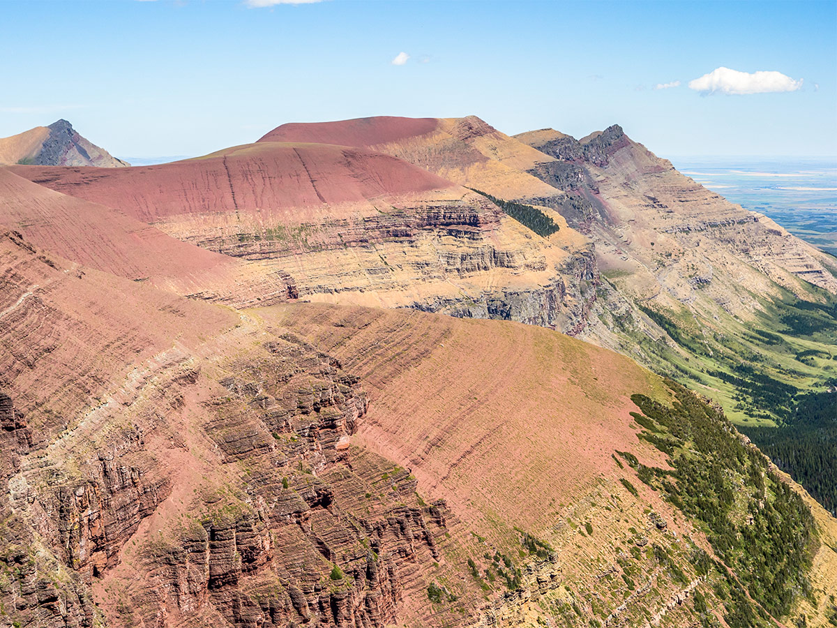
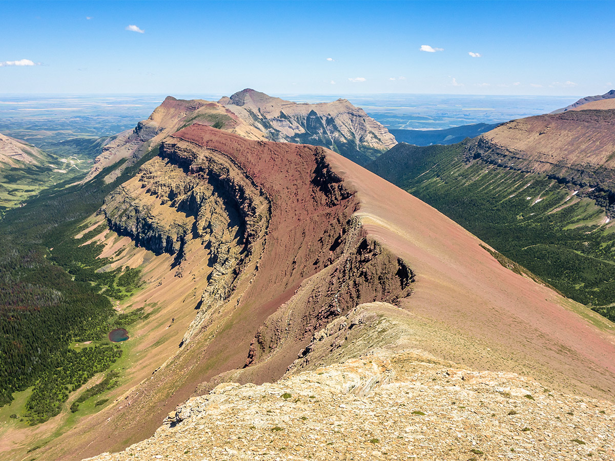
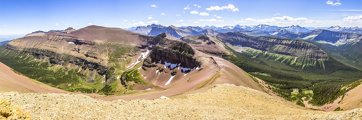
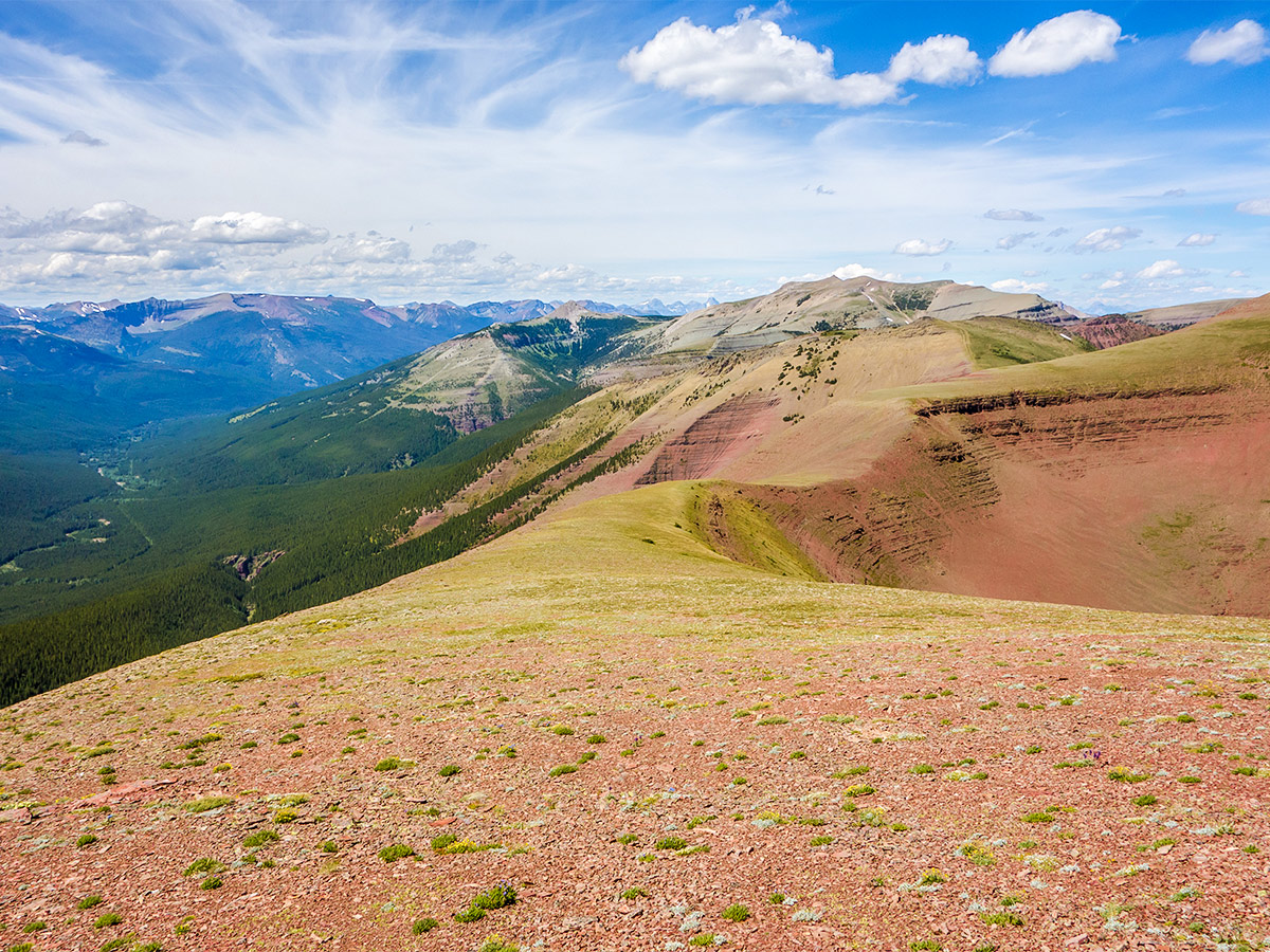
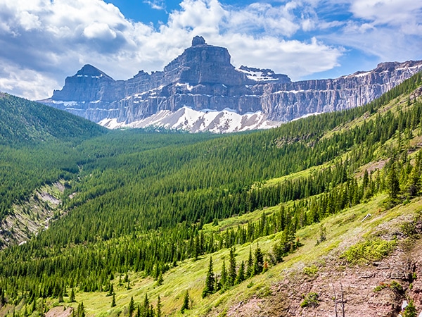
The eastern edge of the Castle Wilderness, just to the north of Waterton Lakes National Park, is reputed to contain some of the best and most colorful scenery in all of the Rockies. In the heart of this region is Loaf Mountain, the name given to the western high point of a long ridge composed largely of red argillite and flanked by two lush green valleys. It is also the highest mountain in the general area and thus provides a good view of other nearby scrambles.
There are several routes to the summit of Loaf Mountain, and we profile the northern route. This is shorter than the southern route, and as this route ends with an ascent of Spionkop Ridge, length was an important factor in this being a great scramble in the Castle.
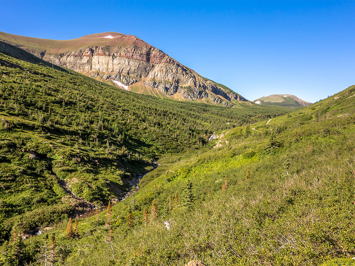
From the trailhead, the trail itself is obvious, being regularly used by ATV’s. The only point of minor confusion is where to leave the trail and begin the ascent. Watch for a drainage ditch and this is where you will begin your ascent line, leaving the trail to cross South Drywood Creek just upstream of a waterfall.
We had to remove our boots to cross the creek, but as it is only a few feet wide, the crossing is not difficult.
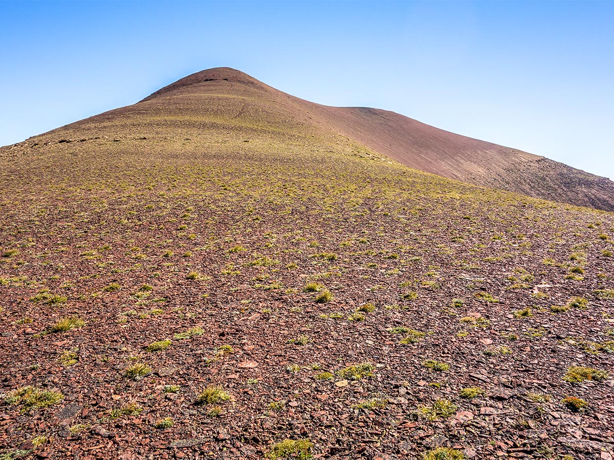
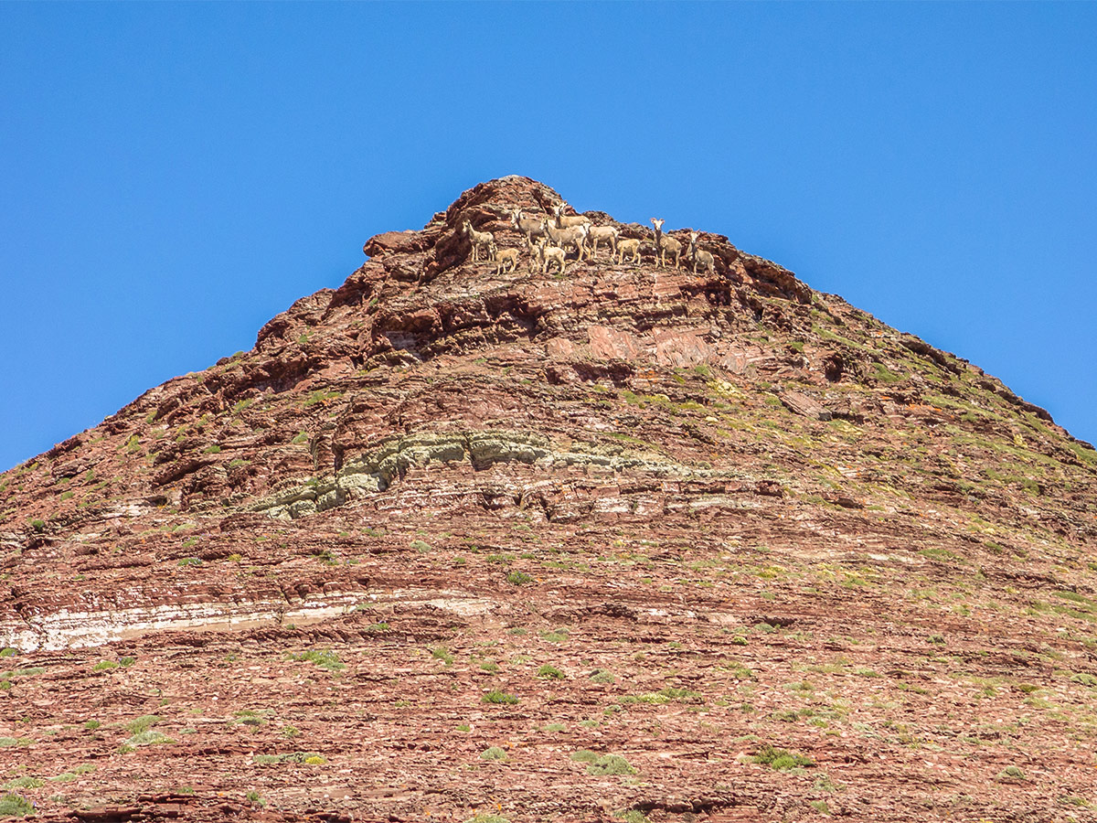
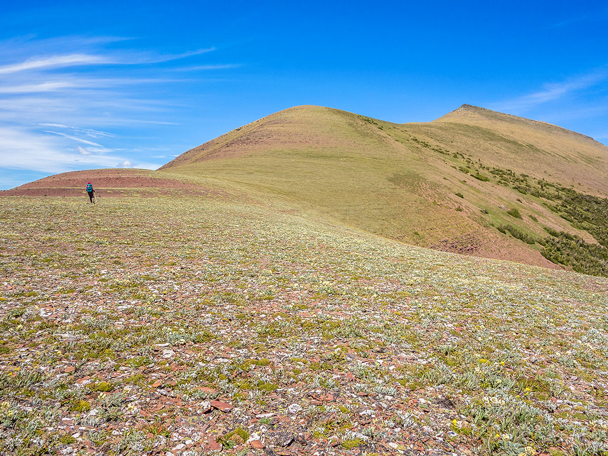
After crossing the creek, the initial ascent is a terrible bushwhack for a hundred meters or so. As the slope steepens the bush disappears, thankfully, and after 1640ft of ascent the sparse vegetation transitions to loose rubble. Within mere meters there is a very good sheep trail heading towards the low point of the ridge. Follow this and you will be on the ridge within minutes.
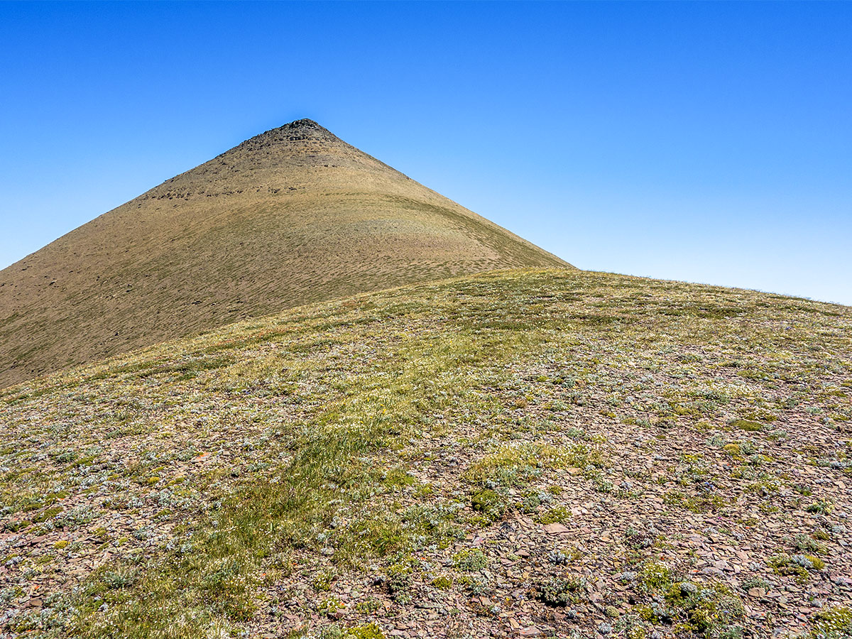
The ascent is both technically and physically easy from this point forward and the views are absolutely fantastic in every direction. From the ridge, the summit is an hour away and has a great ledge for lunch just below! Oddly there are two summit cairns, each containing a register. One is clearly the original (placed by Rick Collier) and well sealed, while another bulky one is soggy and had been placed in 2014.
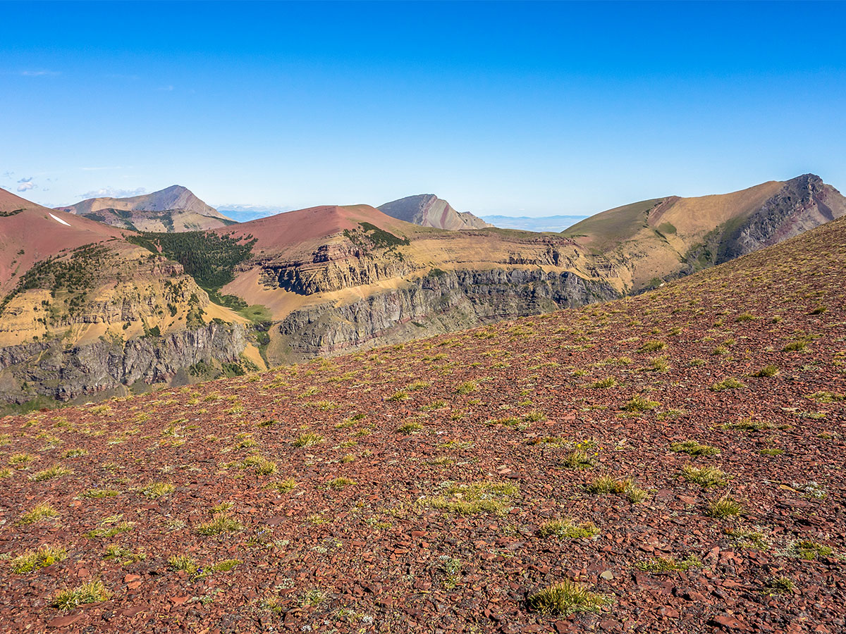
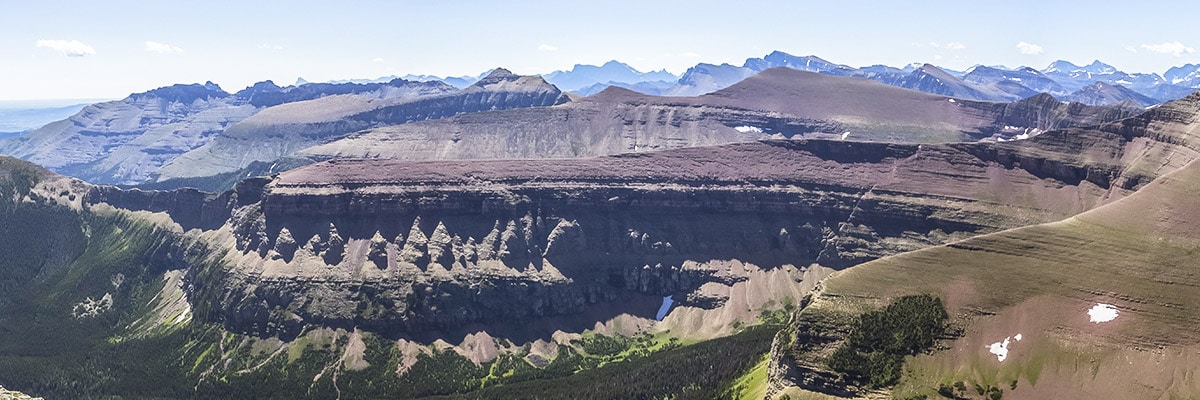
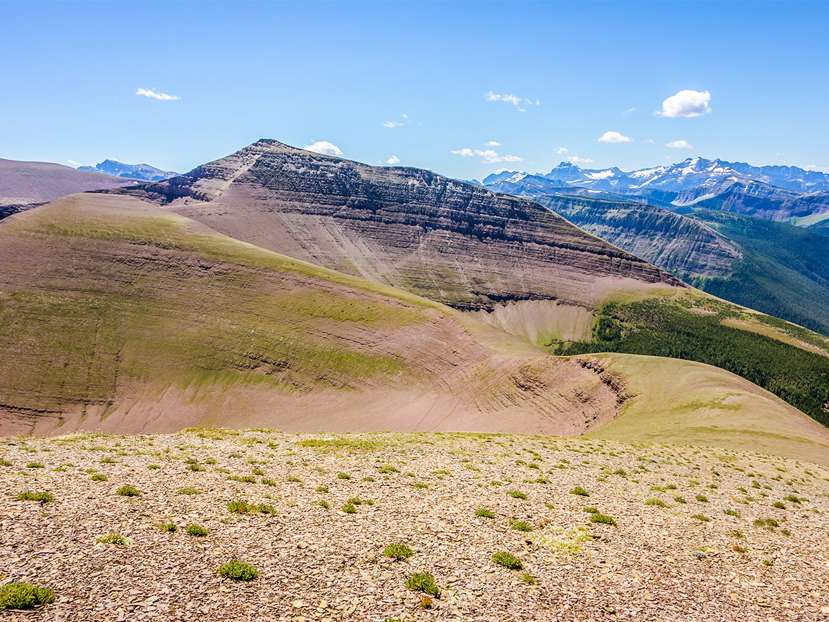
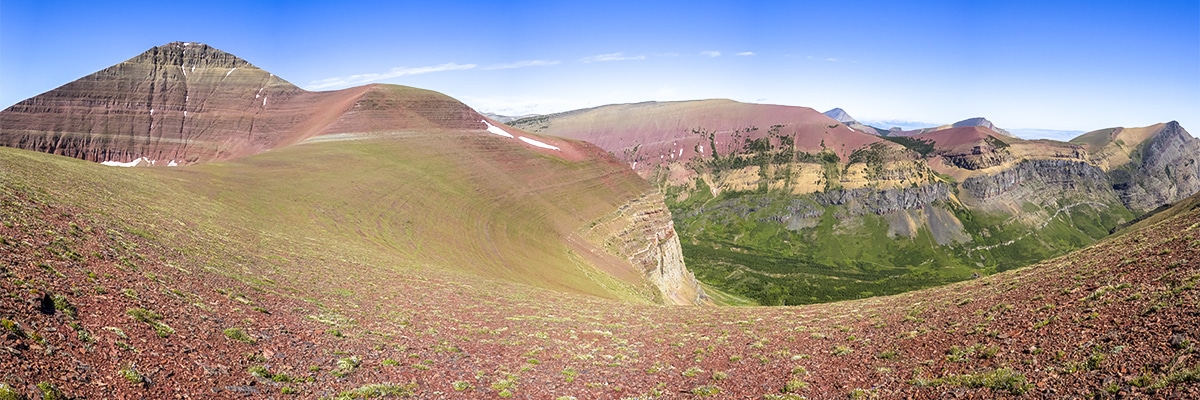
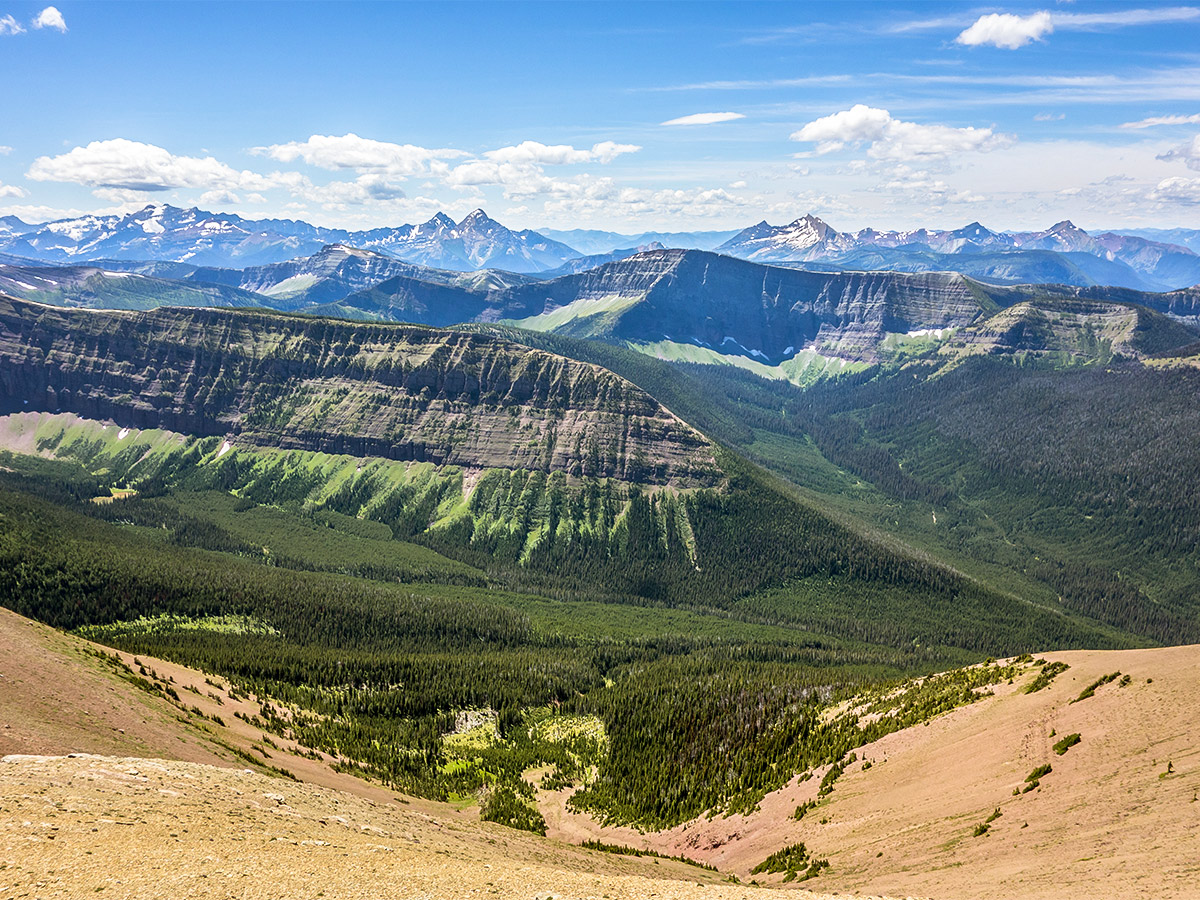
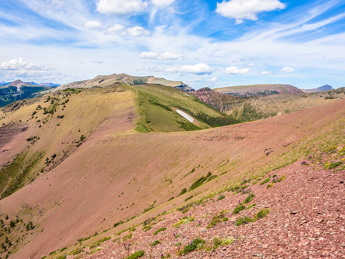
From the summit, continue west along the Loaf Mountain ridge, heading towards the north face of Spionkop Ridge. The final scramble to its summit from this side is considered a moderate scramble by those who have done it, and the interceding 1.9mi of beautiful scenery and ridge-walking certainly make the journey worthwhile!
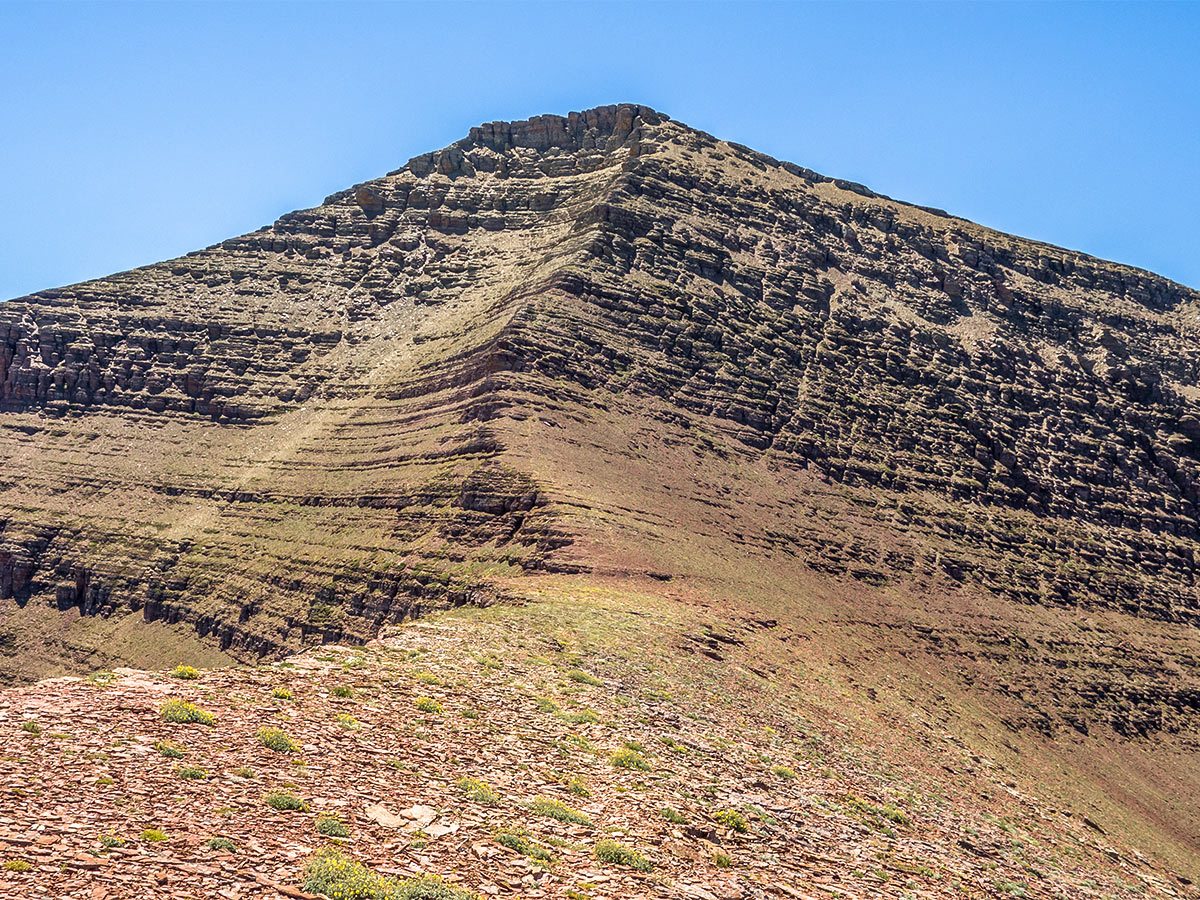
The north face of Spionkop Ridge looks quite intimidating from below, thankfully the lay of the ridge keeps most of the wind at bay. The first 328ft are an easy scramble, but the final 164ft require some route-finding over loose and mildly exposed terrain and as each rocky ledge and scree pile looked identical, you may need to make a few cairns to ensure you can find our route down. If you aren’t an experienced scrambler turn back before you get into trouble.
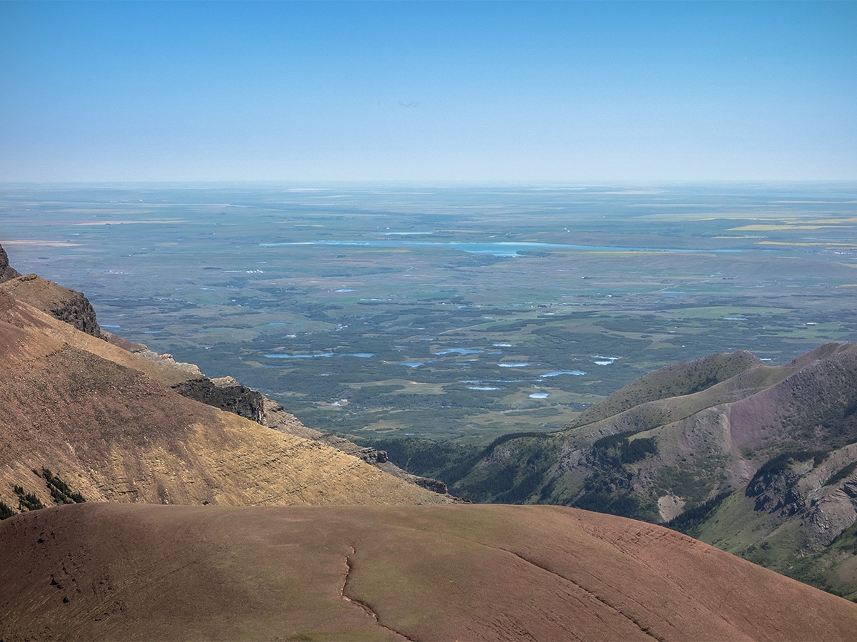
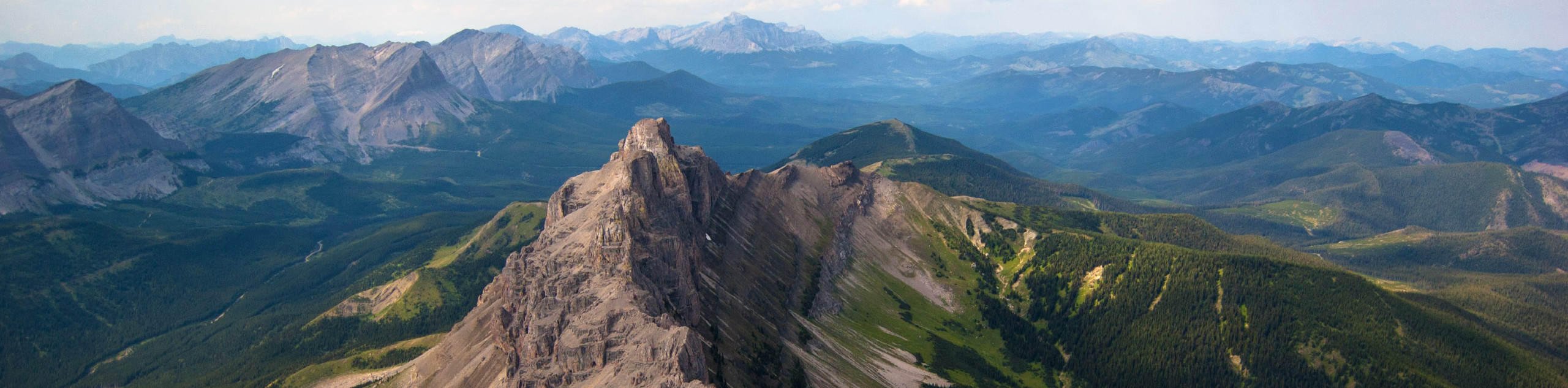
The wind here can make the scramble much more difficult, and in our case made a traverse along the short and mildly exposed summit ridge impossible. Instead we detoured to the west and were able to follow a route where the wind was only blowing into the mountain, not off it. The views from the summit were perhaps the most beautiful we’ve ever seen, with lush green valleys and colorful red ridges stretching out in all directions and a few small glaciers on rockier mountains to the southwest.
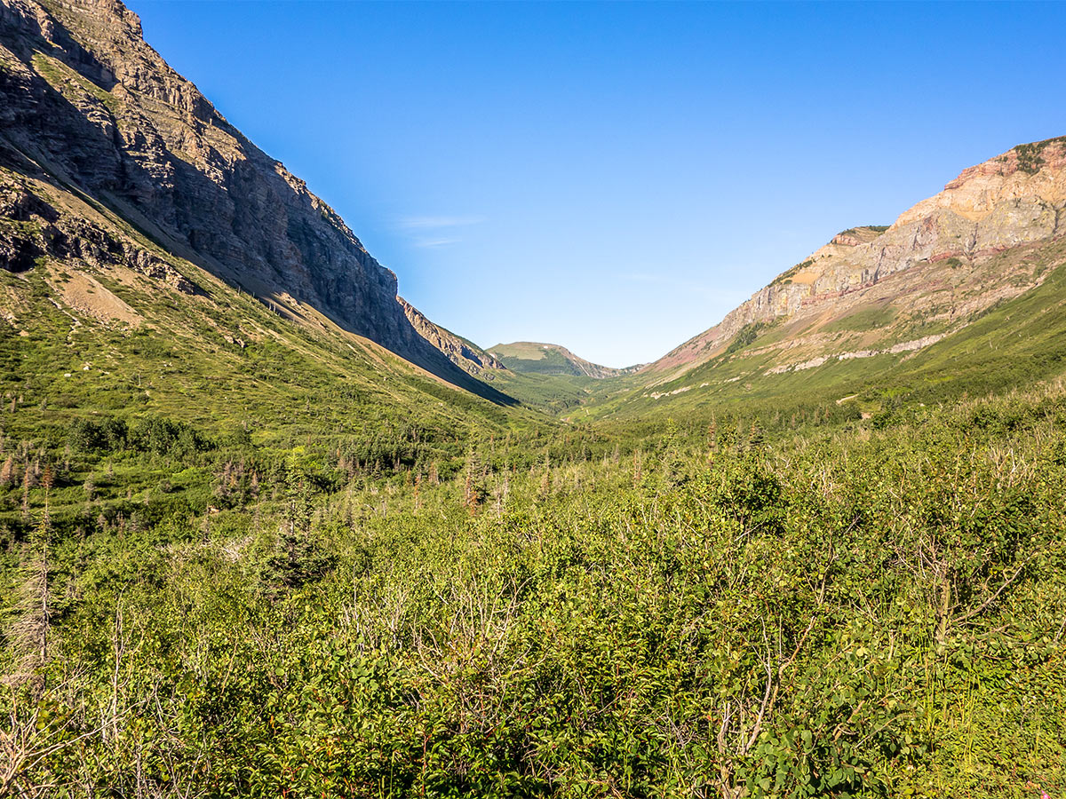
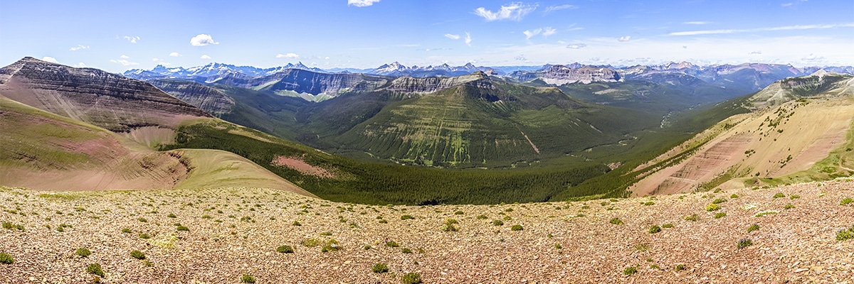
The descent is easier than expected. Our initial plan was to start back towards Loaf Mountain, detouring around its west end and descend towards Bovin Lake (Blue Lake) before heading back via the trail along South Drywood Creek. The wind, however, had greatly intensified and travel along the ridge was nearly impossible by this point. Our route continued back towards Loaf Mountain until reaching the col above Bovin Lake. From there you can head down into the valley on good trail and get out of the wind.
You can follow the road back to the start.
Insider Hints
Bring a bike for the initial part in case the road is closed. You can stash your bike in the bushes for the return journey!
The wind can be brutal, and greatly increase the risk on some of these scrambles. Be aware of wind and turn back if it’s impacting your route.
This route involves some bushwhacking and route finding. It is recommended to have a GPS unit (or app for your phone) that allows you to track your progress.

Similar Scrambles to the Loaf Mountain and Spionkop Ridge Scramble
Crowsnest Mountain
Crowsnest Mountain is a popular scramble that requires a good understanding of the route before departure. This trail is a…
Mount Gladstone
A scramble up Mount Gladstone is a wonderful day out in the Castle! A nice trail alongside a lively creek,…
Pincher Ridge
Pincher Ridge is located near the heart of Castle Wildland Provincial Park, a spectacular part of the Canadian Rockies. The…
CamilaP. 4 years ago
Gonna say that it's a day well spent. The views are very pleasing to the eye.
kelsih_99 4 years ago
definitely harder than victoria, more tiring but definitely worth it. take the extension to see waterton- so pretty!
Rebel M. 5 years ago
Bring a jacket because the wind is strong. Astonishing views await at the summit. Great hiking experience.
Coll A. 5 years ago
The second highest peak in the Castle area. Spectacularly colorful valley views. Spionkop Ridge provides an amazing view of Waterton Lakes National Park.
Linby SK. 5 years ago
The trail changes as you go forward. It was a challenging hike. A kind of hike that lets you explore a lot of places.