Victoria Peak Scramble
View Photos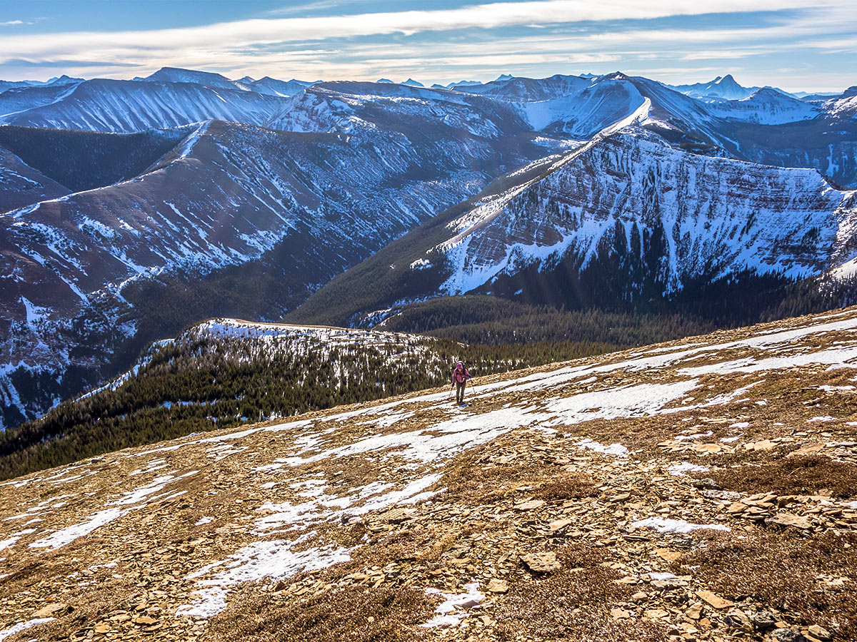
Victoria Peak Scramble
Difficulty Rating:
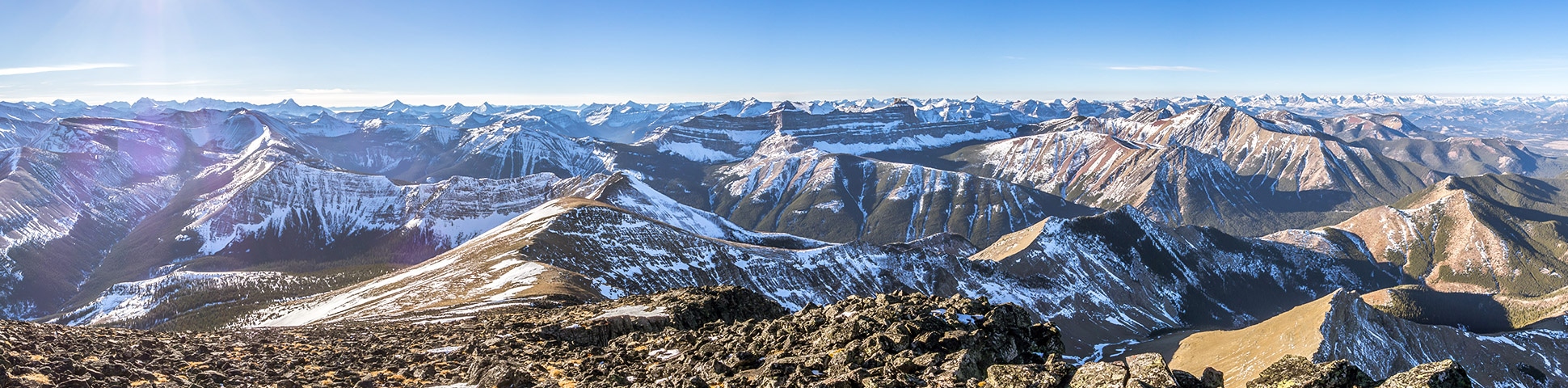
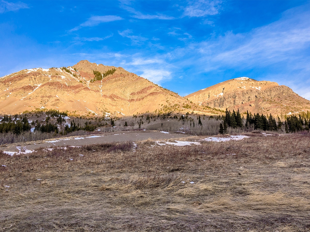
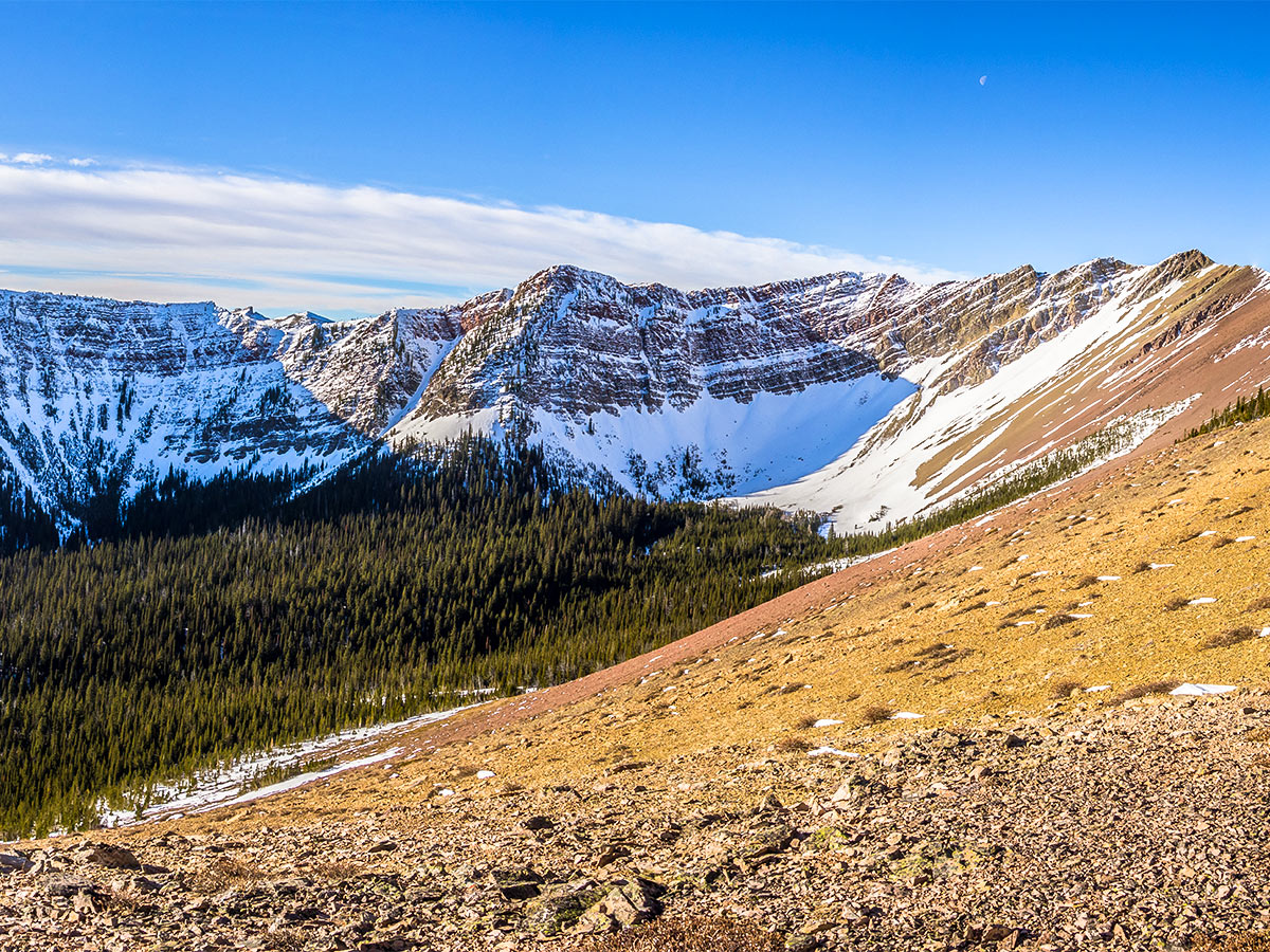
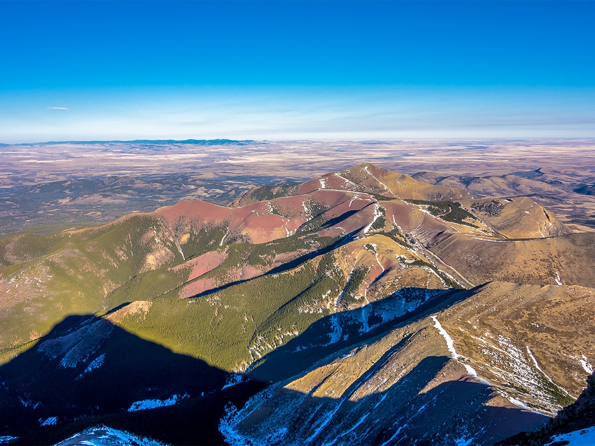
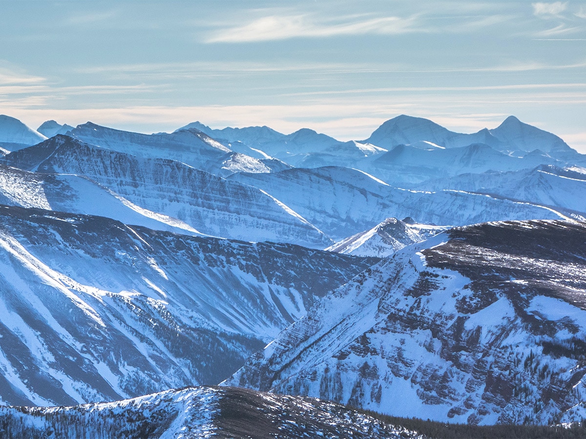
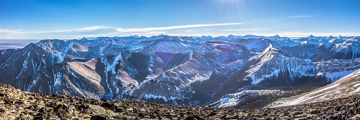
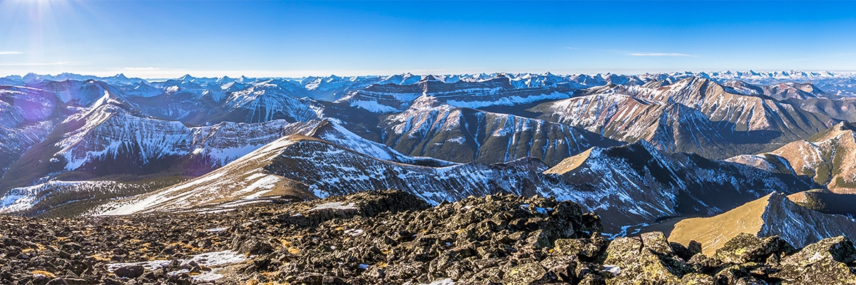
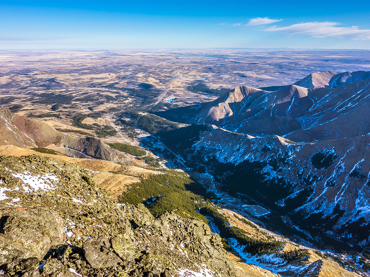
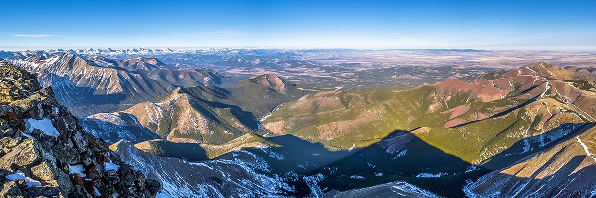
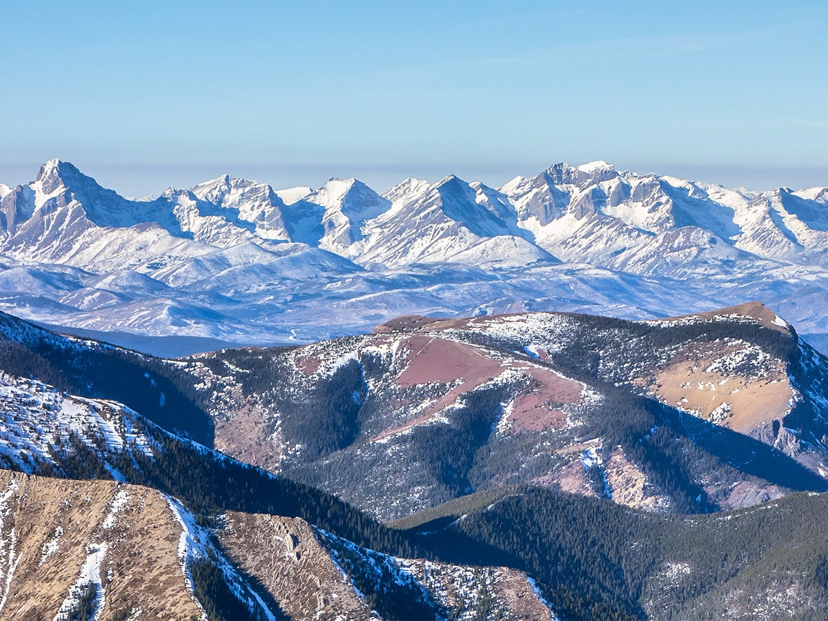
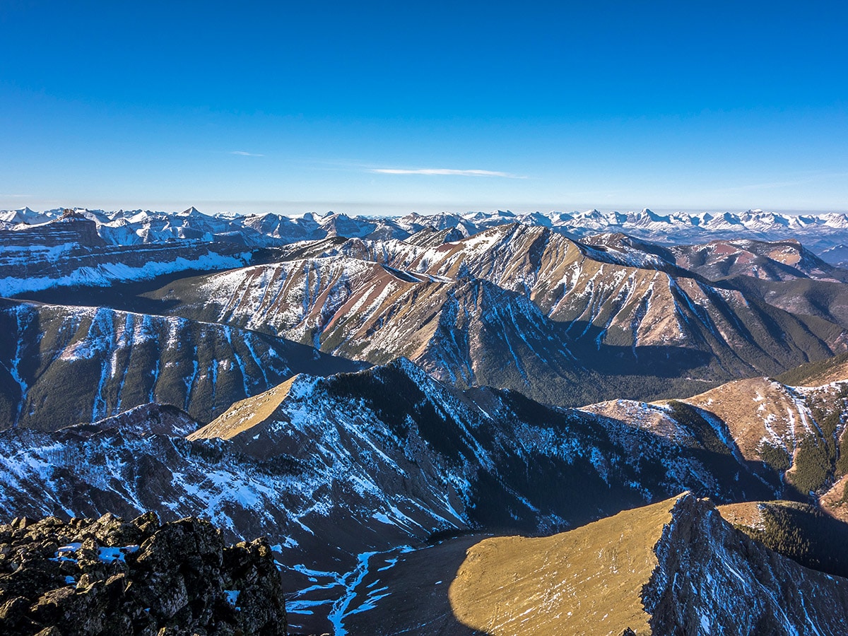
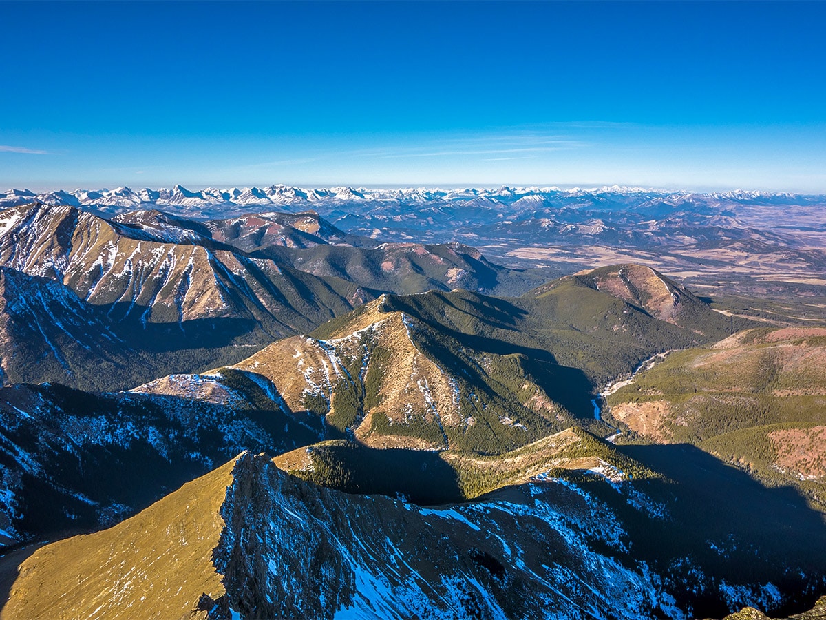
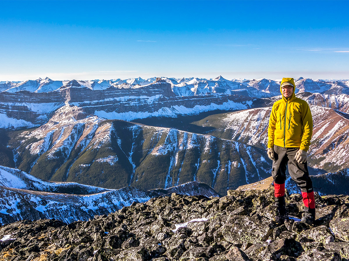
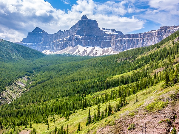
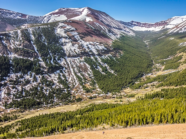
Victoria Peak is the highest peak in the Castle area, scrambling up Victoria Peak provides spectacular views of where the colorful mountains of the Castle meet the prairies.
Getting there
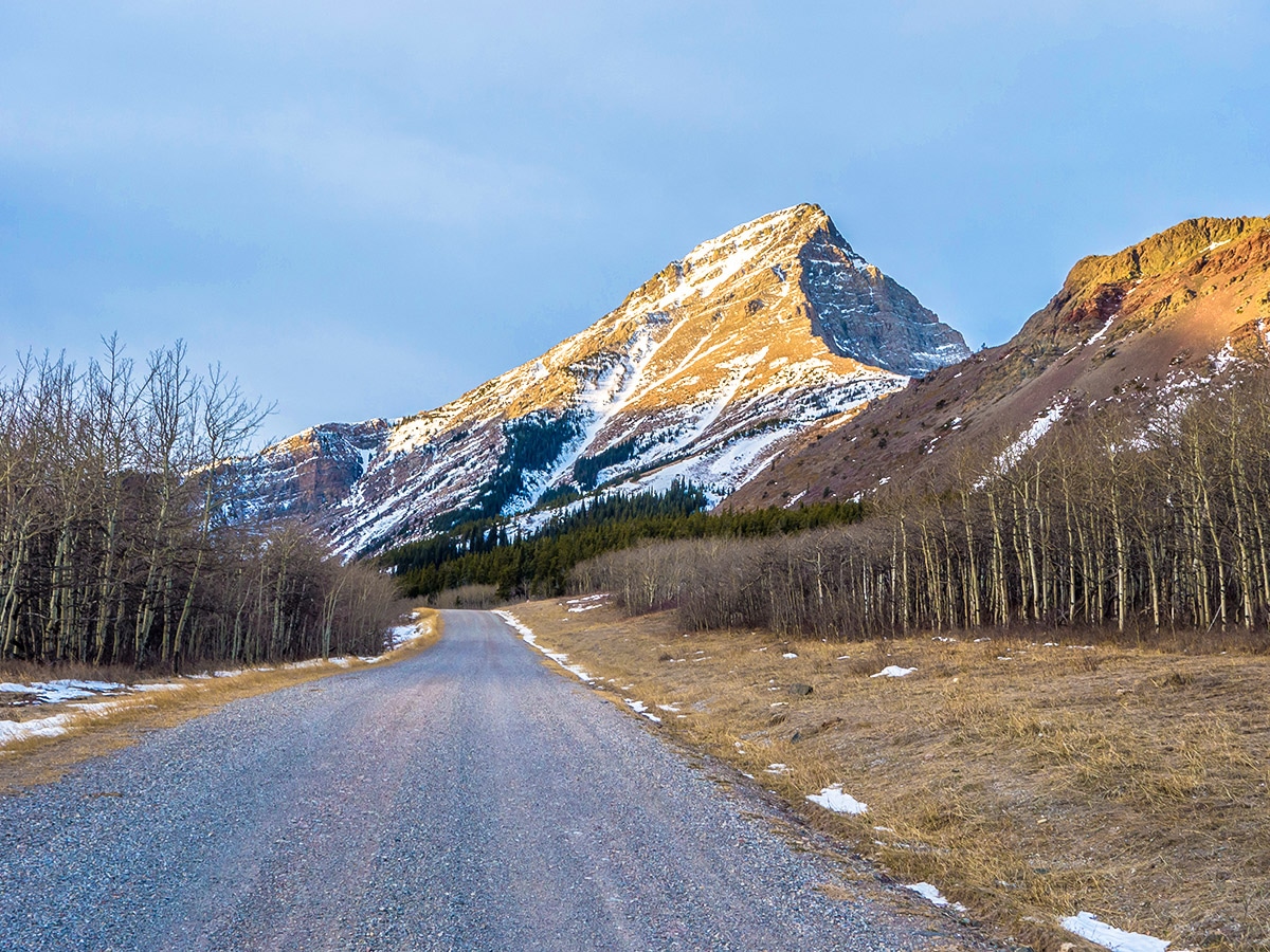
From Pincher Creek head south on Highway 6 after about 12.4mi then a turn right onto Township Road 43A, signed for Shell Waterton Complex. Continue on this road, past the Shell Waterton Complex, until you reach a locked gate. Find parking and begin your trek on the road past the gate.

About
| When to do | June - November |
| Backcountry Campsites | None |
| Toilets | None |
| Pets allowed | Yes - On Leash |
| Scarmbling Rating | Grade 1 |
| Exposure | None |
| Family friendly | Older Children only |
| Route Signage | None |
| Crowd Levels | Low |
| Route Type | Out and back |
Victoria Peak
Elevation Graph
Weather
Route Description for Victoria Peak
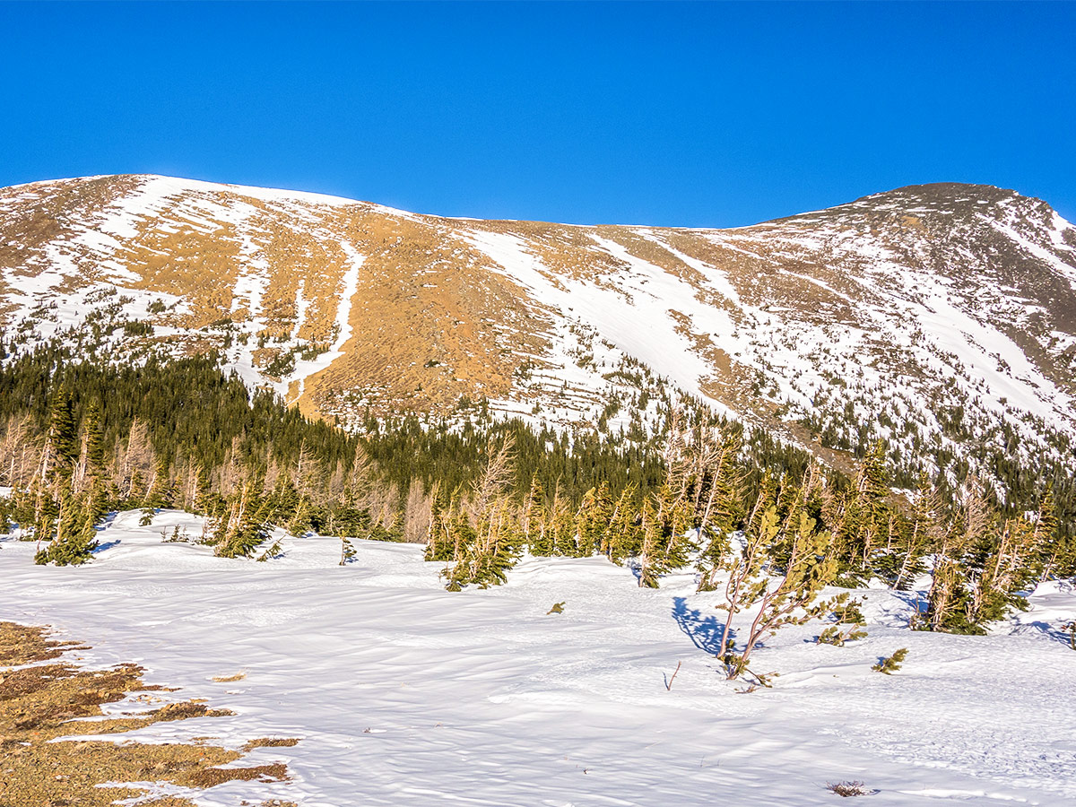
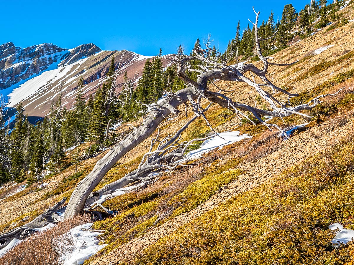
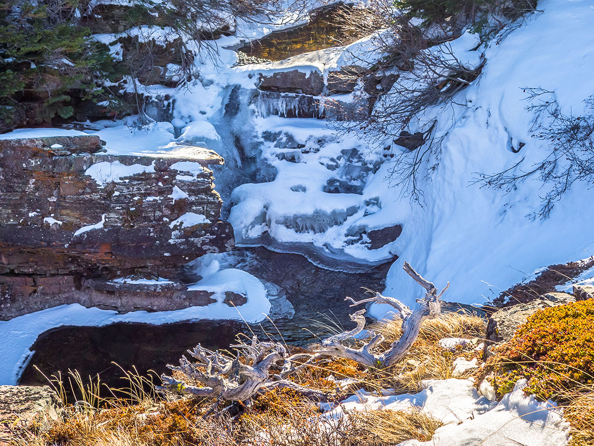
This ascent of Victoria Peak was done via the less popular south slope, but given that there was snow we chose this easier and drier slope. You should also check for wind when scrambling up Victoria Peak, as it can be really windy in Castle Provincial Park.
The scramble up Victoria Peak involves a bit of trail-finding and bushwhacking. We suggest taking a GPS device with the map loaded to assist you on this scramble.
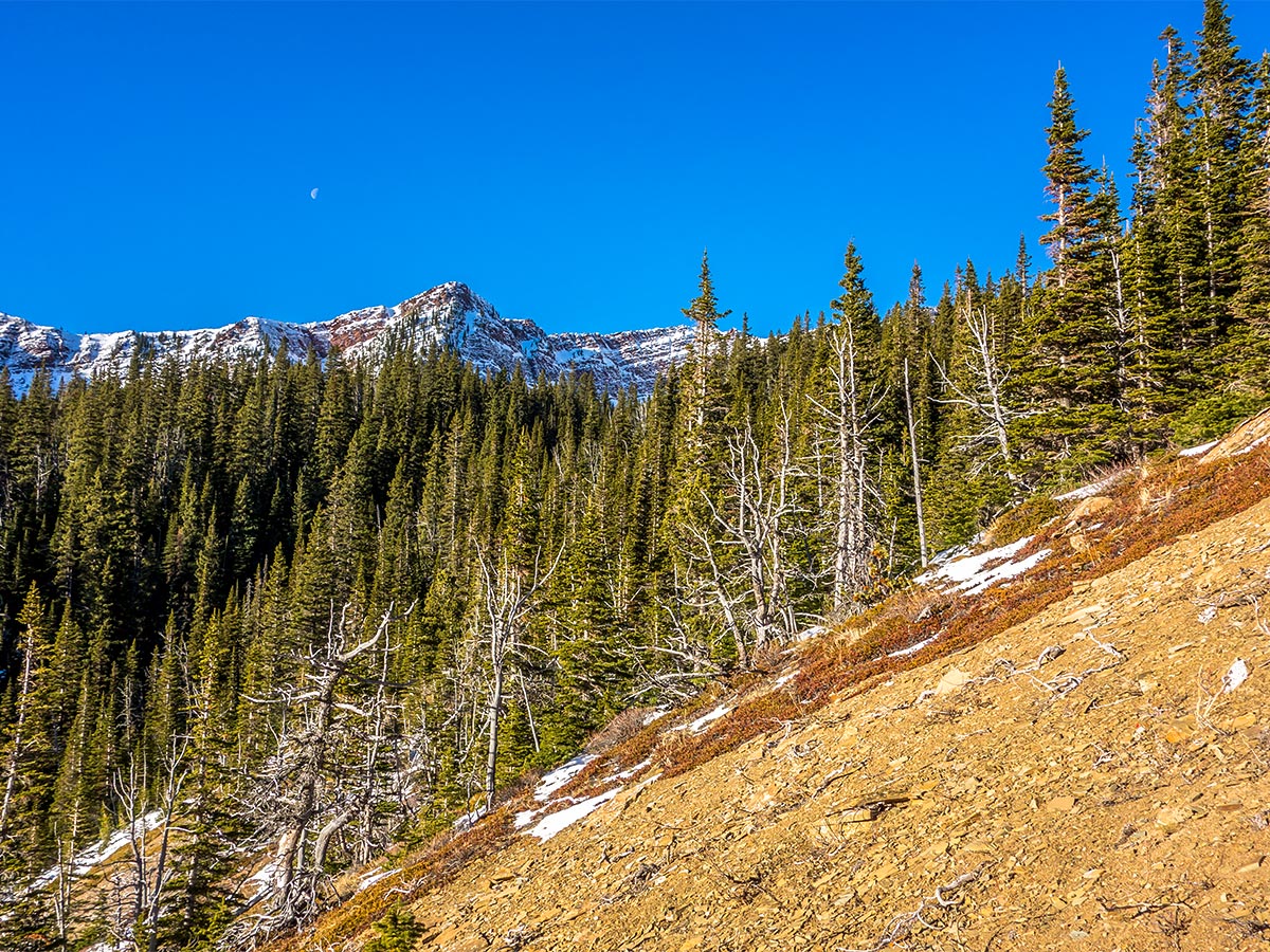
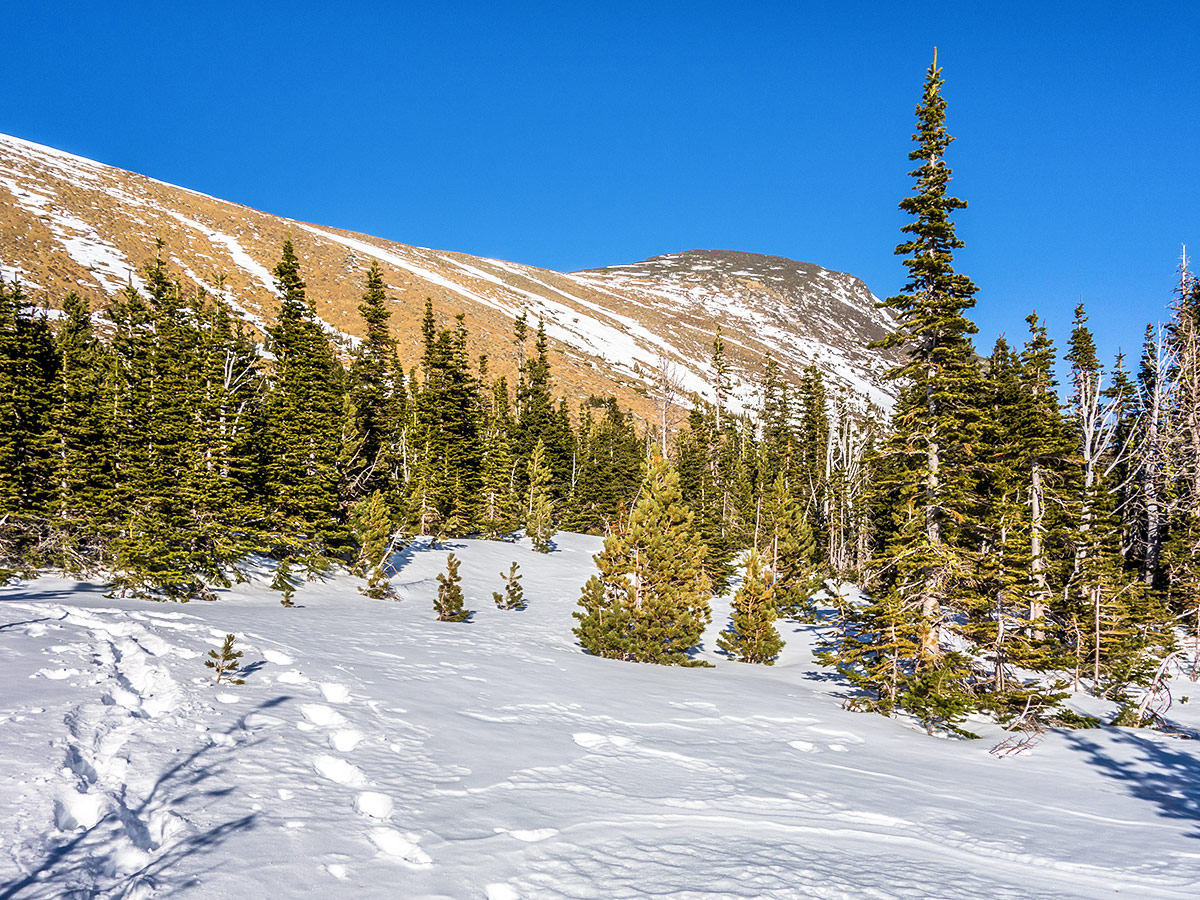
From the gate after the large Shell Waterton industrial complex, begin by walking up the road, heading west, for about 2.2mi. This portion is made easier by bringing a bike and stashing it in the bushes once you reach the trail and enter the forest.
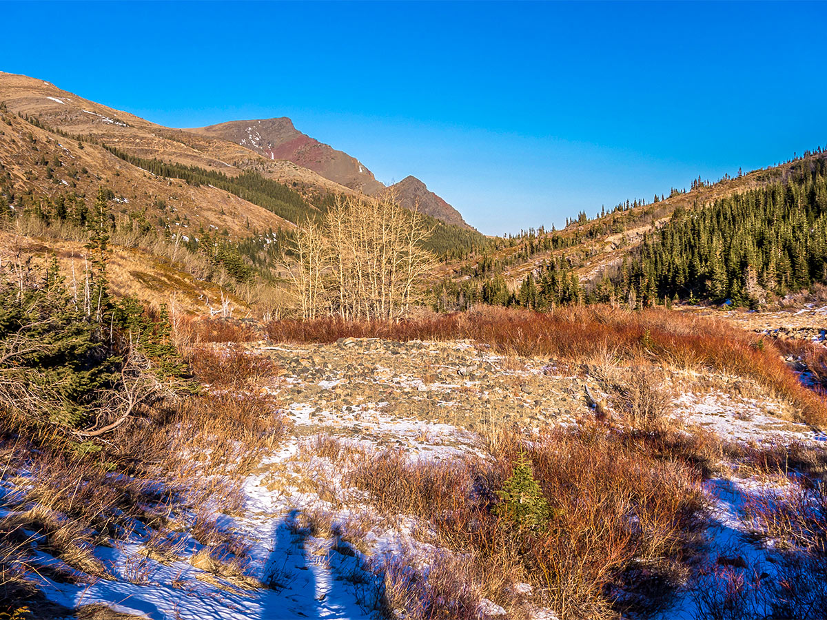
Continue following the path that goes into the trees and then you walk through a mixture of trees and clearings for another 1.6mi.
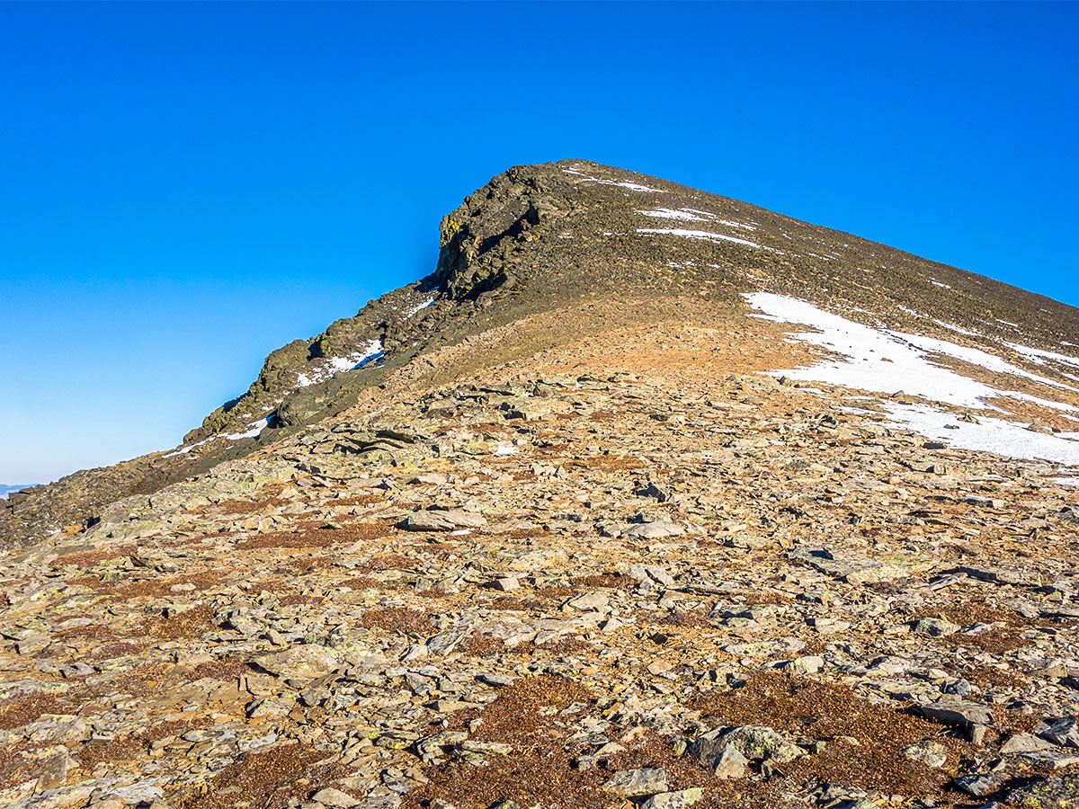
A bit over 3.7mi from where you parked your car you will leave the trail and head up the southwest slope of Victoria Peak. This is just after the trail turns north and enters the forest, after having been in the open for a while.
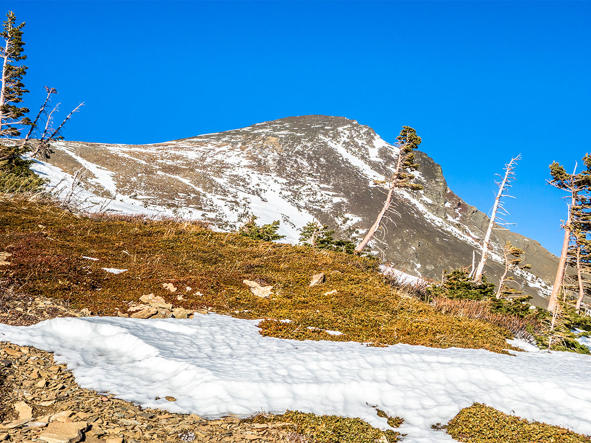
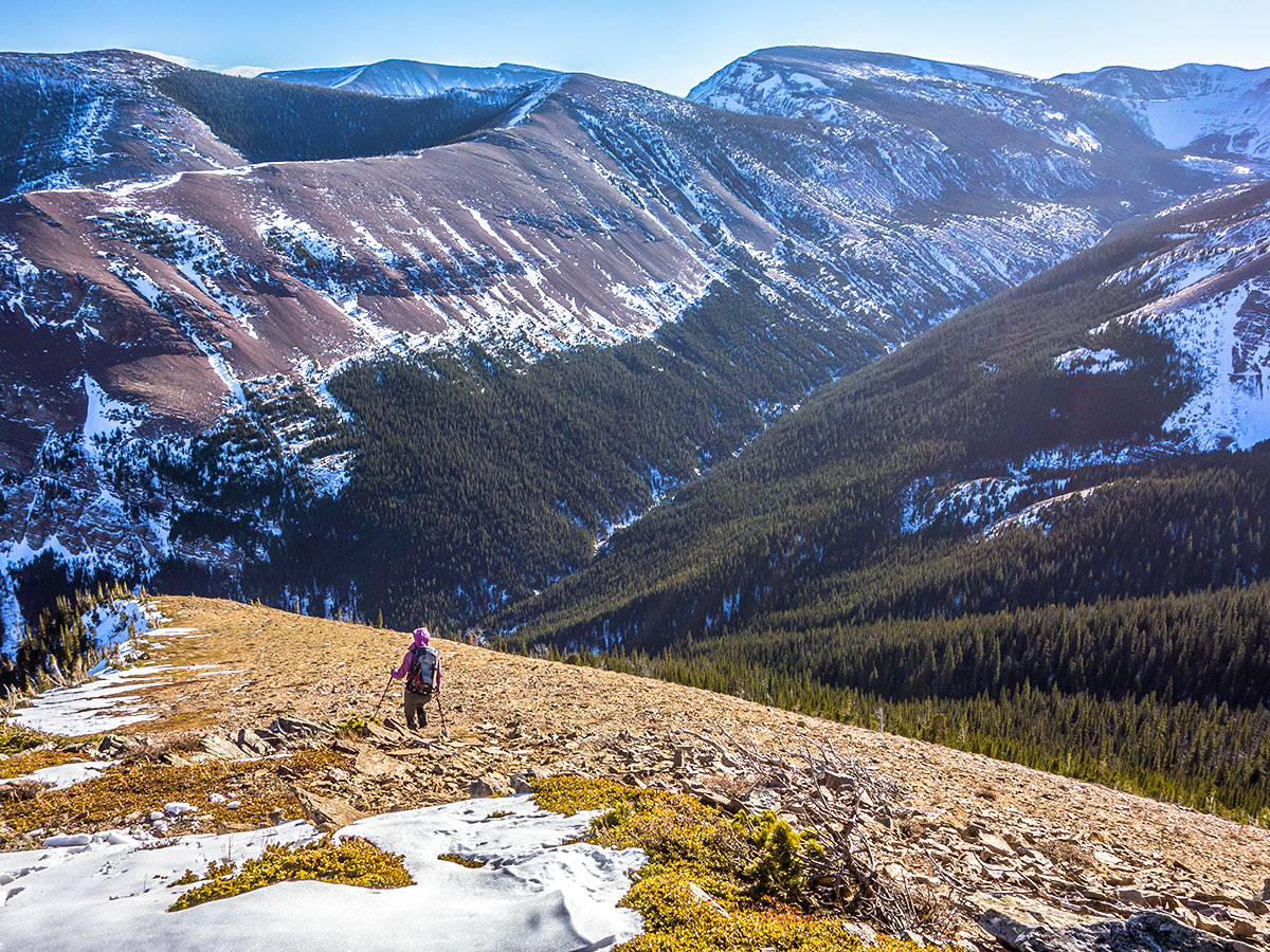
After a short stint of very intense bushwhacking there will be a steep scree slope that you can follow all the way up to a small plateau 1312ft below the summit. Keep in mind, this is prime bear country, hike in a group, as we came across dozens of fresh bear diggings on the slope as well as seeing bear tracks in a patch of snow.
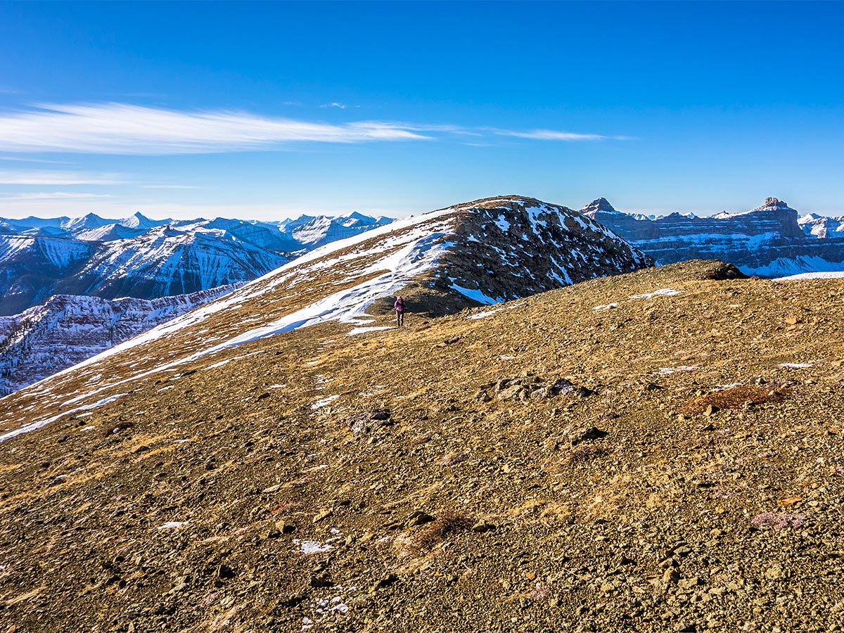
From the plateau a small forest separates you from the scree slope of the summit ridge, The scree leading to the ridge is quite easy to ascend, and the rubble on the final 100 m to the summit is similarly pleasant to hike along. Remarkably, the wind was light (far lighter than on the access road) and with the sun beating down on us, we didn’t even need a jacket or gloves!
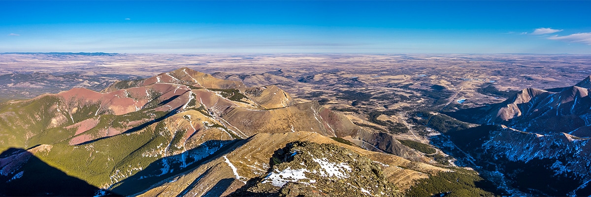
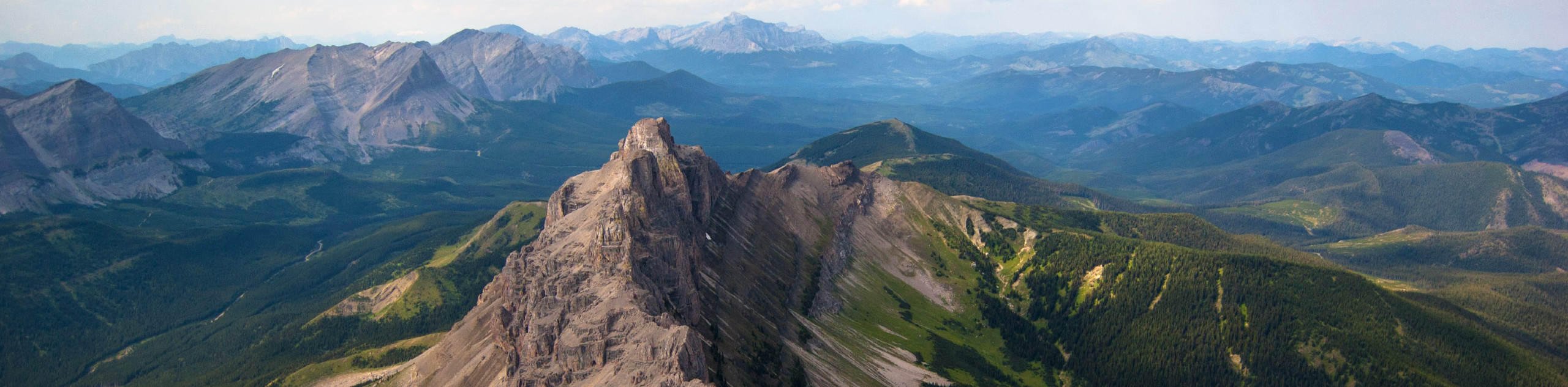
The view from the summit was absolutely fantastic! Return the way you came, and revel in the joy of another great day in the mountains!
Insider Hints
Bring a bike to cut down on journey time while you are on the road.
This trail requires some bushwhacking, so it’s good to have downloaded a map onto your phone or GPS unit to assist you in making your way onto the summit ridge.
The Castle area is notoriously windy, so be prepared for increased winds once you’re in the alpine.

Similar Scrambles to the Victoria Peak Scramble
Crowsnest Mountain
Crowsnest Mountain is a popular scramble that requires a good understanding of the route before departure. This trail is a…
Mount Gladstone
A scramble up Mount Gladstone is a wonderful day out in the Castle! A nice trail alongside a lively creek,…
Pincher Ridge
Pincher Ridge is located near the heart of Castle Wildland Provincial Park, a spectacular part of the Canadian Rockies. The…
Willow F. 4 years ago
The lake has a relaxing vibe on it. Definitely worth the hike. Tag along with your friends to make it more fun.
RobCruz 4 years ago
This Hike is a good family bonding, my kids looking out for me. I'm strong enough I'm not that old yet! I can still hike for another 30 years!
CamilaP. 4 years ago
It's true that this trail includes bushwhacking so better to have GPS device. The summit views are pretty and amazing.
kelsih_99 5 years ago
perfect spot to see how beautiful Castle is. such an underrated hike!
Linby SK. 5 years ago
The highest peak in the Castle area. It provides spectacular views of where the colorful mountains of the Castle meet the prairies. Definitely loved the view.
Fredie L. 5 years ago
I love the relaxing sensation when traversing the trail surrounded by trees. Fantastic view at the summit. The Castle area is windy, so be sure to bring a jacket.