Drywood Mountain Traverse Scramble
View Photos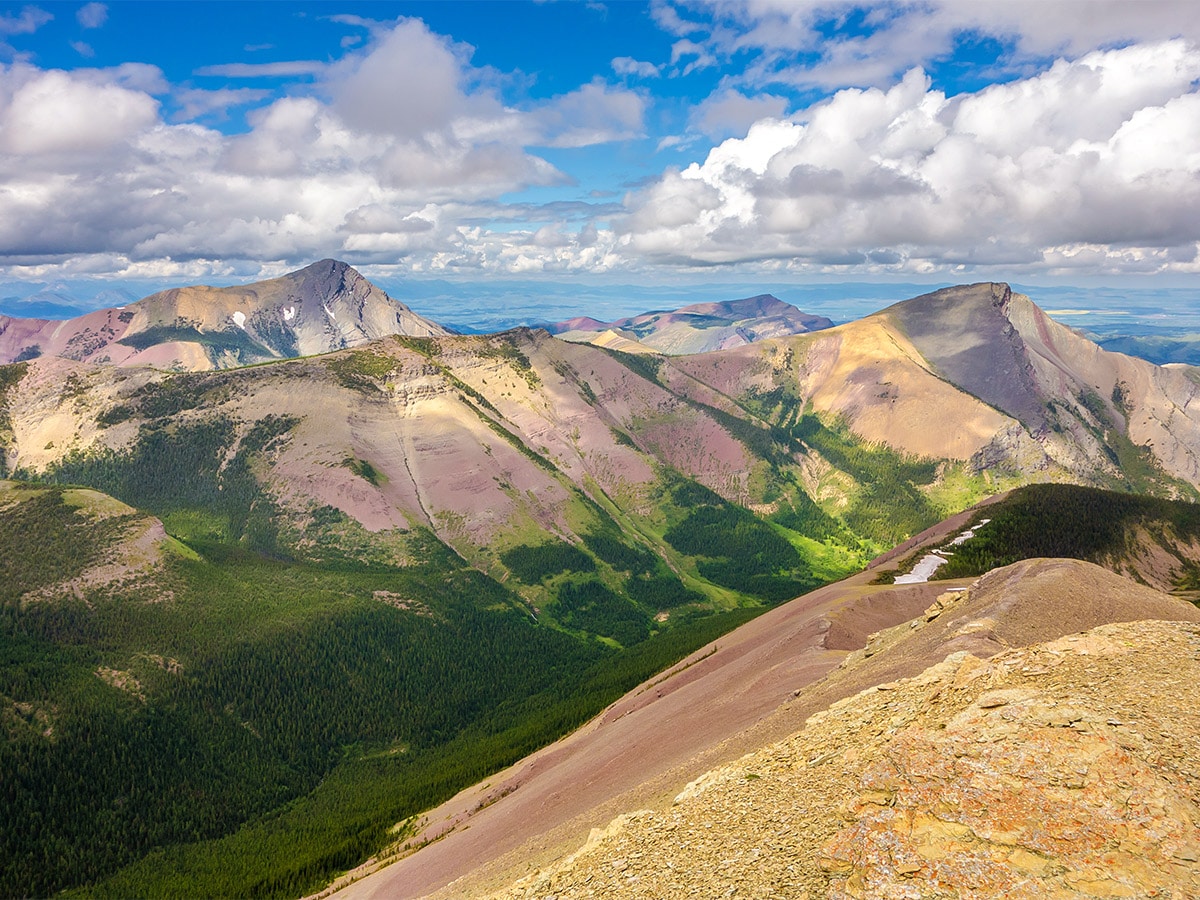
Drywood Mountain Traverse Scramble
Difficulty Rating:
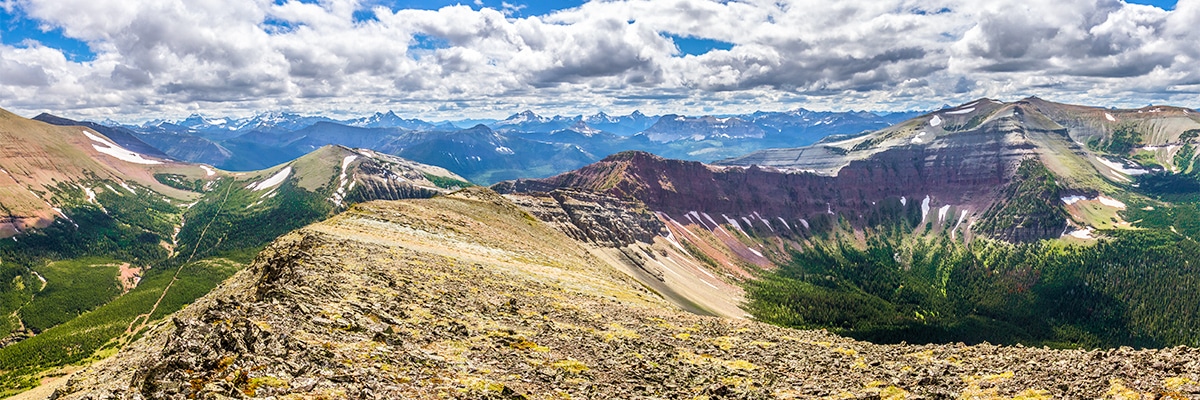
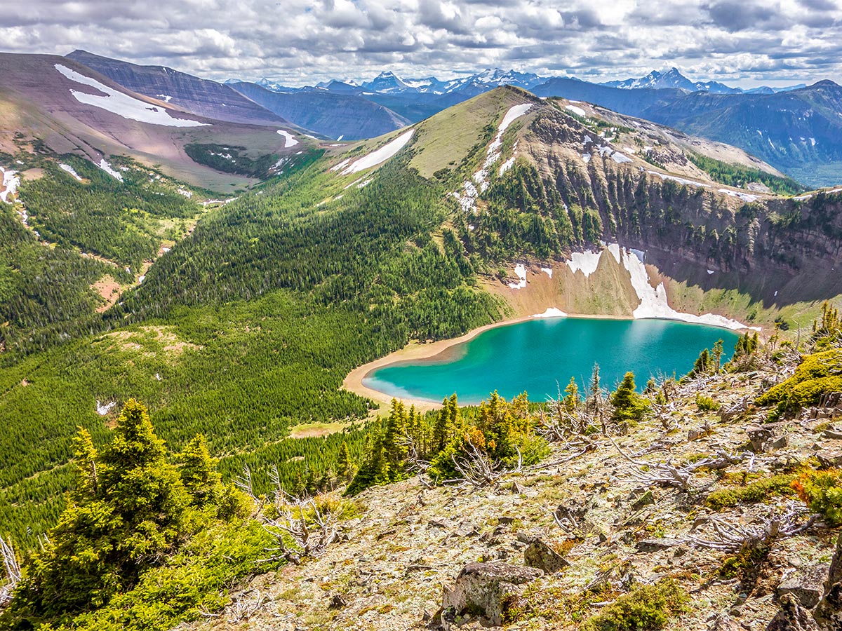
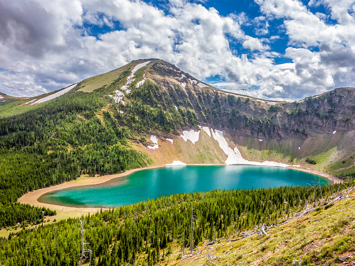
The Drywood Mountain Traverse is a long and easy traverse of a high ridge in the colorful Castle Wildland. The traverse is followed by a descent to a brilliantly-blue lake for a swim and possible camping, making this a spectacular summer outing!
Getting there
From Pincher Creek head south on Highway 6 after about 12.4mi then turn right onto Township Road 43A, signed for Shell Waterton Complex. Continue on this road, but before reaching the complex take a left on Range Road 303, as it turns to 302A and 302B. Continue past the turn on the left to stay on Range Road 303 and continue along this road until you reach a gate.

About
| When to do | June - September |
| Backcountry Campsites | Bovin Lake, below the north end of the ridge on the descent route. |
| Toilets | No |
| Pets allowed | Yes - On Leash |
| Scarmbling Rating | Grade 1 |
| Exposure | None |
| Family friendly | Older Children only |
| Route Signage | None |
| Crowd Levels | Low |
| Route Type | Lollipop |
Drywood Mountain Traverse
Elevation Graph
Weather
Route Description for Drywood Mountain Traverse
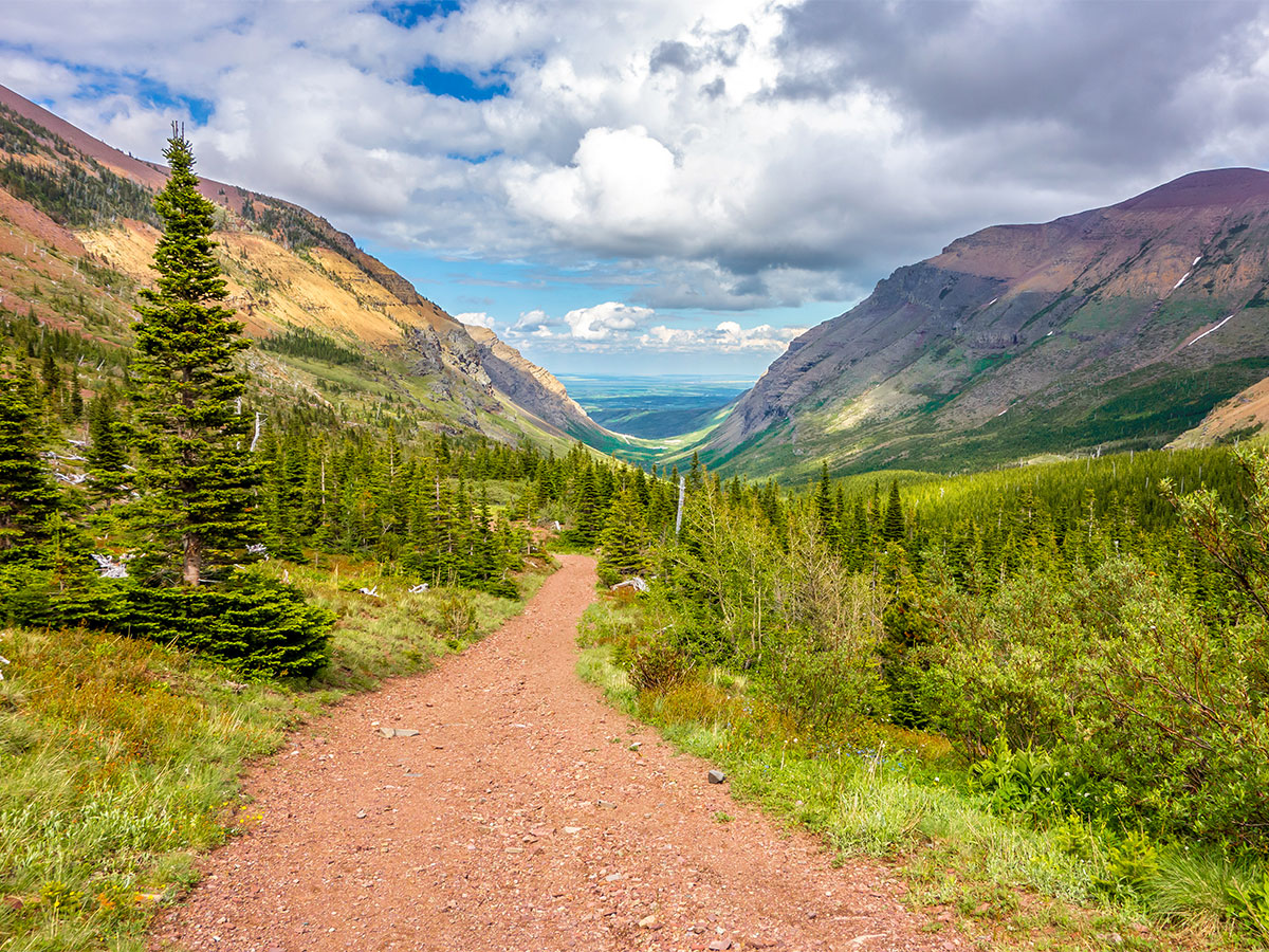
Be aware that the approach road to this scramble can be closed due to “industrial activity”. Unfortunately, this may mean that your trip will begin and end with a 2.5mi hike along a hot and dusty road. If you have a bike this will make quick work of the extra distance, as travel is easy along the road.
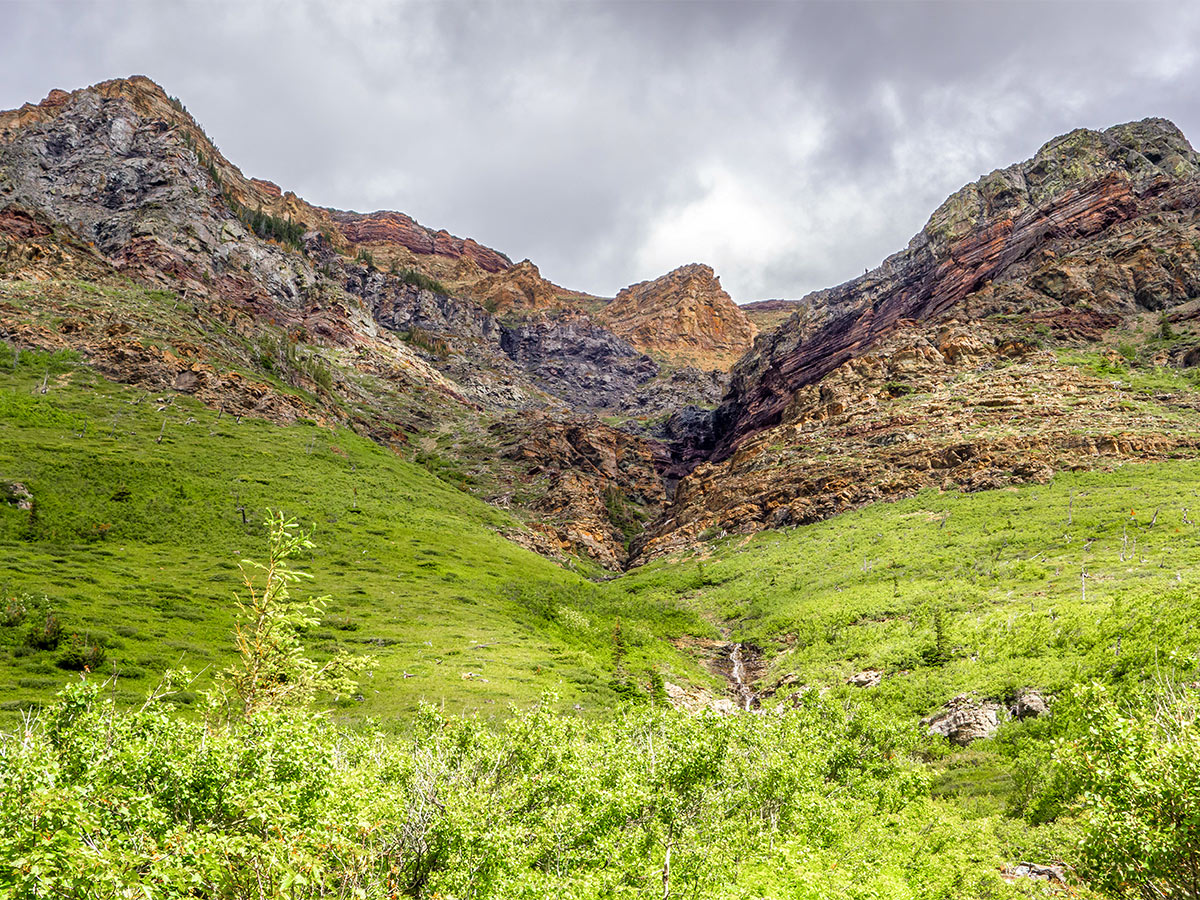
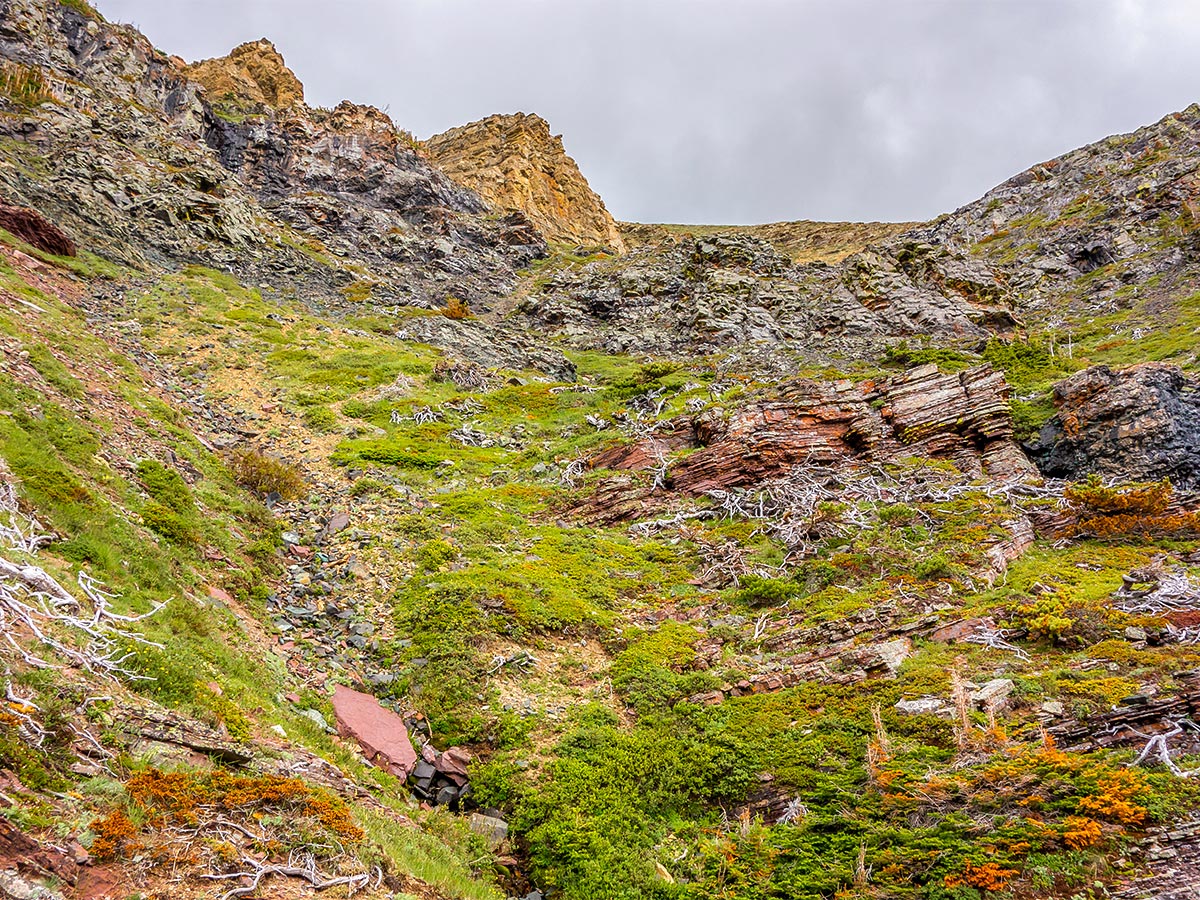
Follow the trail as it goes along the southern flanks of Drywood Mountain. You will pass a building on left (with a turnoff going left right after), and continue ahead, following the road. You’ll soon pass a building on your right and then pass a turnoff for a building on your left. Continue ahead, following the clear path, soon crossing over a large gully and continue on the main trail. Hike for another 2789ft or so until you come to the second gully, and head up on the right. The rocky drainage intersects the trail here and you can start hiking up it, shortly migrating to the grassy and mildly bushy slope to its left. You will soon intersect an intermittent animal trail that leads onto dirt and scree as the gully narrows. Although there is no path, route-finding is very straightforward as you make your way up the gully.
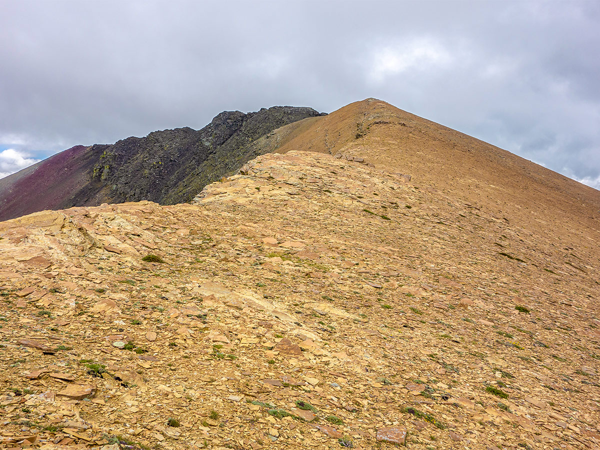
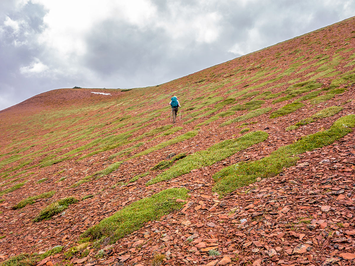
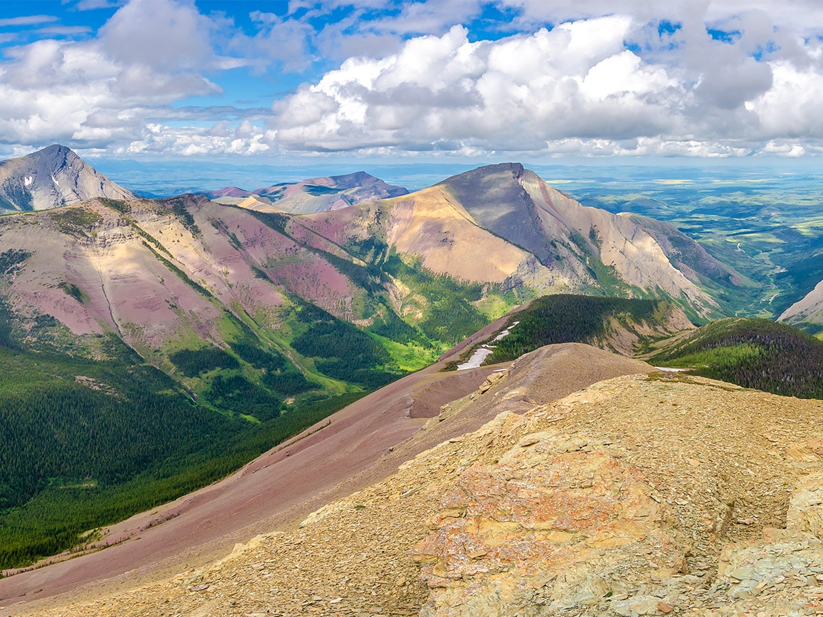
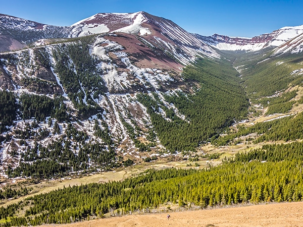
The gully eventually opens onto a scree slope, but sheep trails and areas of stable rock mean there is nearly no tread-milling involved. You can stay on this scree almost all the way to the summit, or you can contour to the north and easily make your way over stable bedrock, vegetation, and rubble to the summit ridge. From trail to ridge it is nothing more than an off-trail hike or easy scramble.
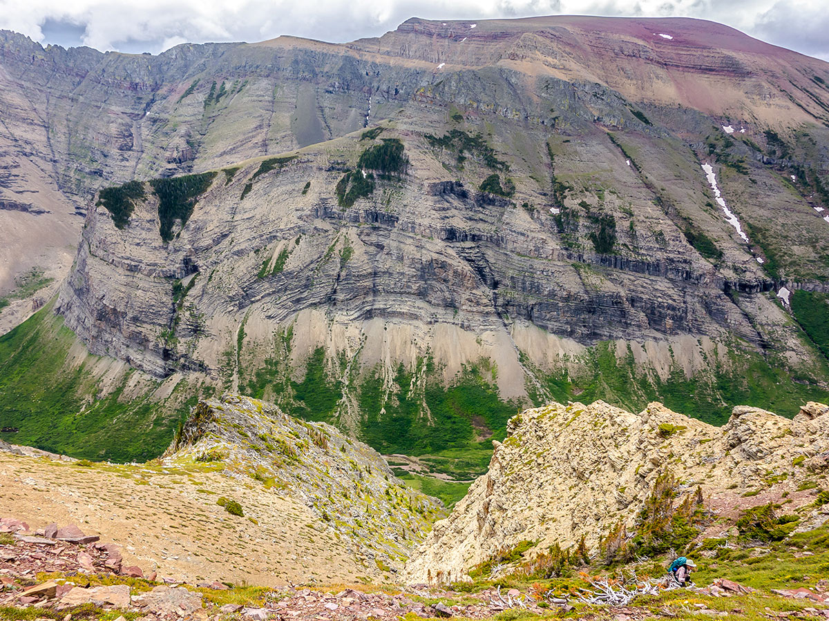
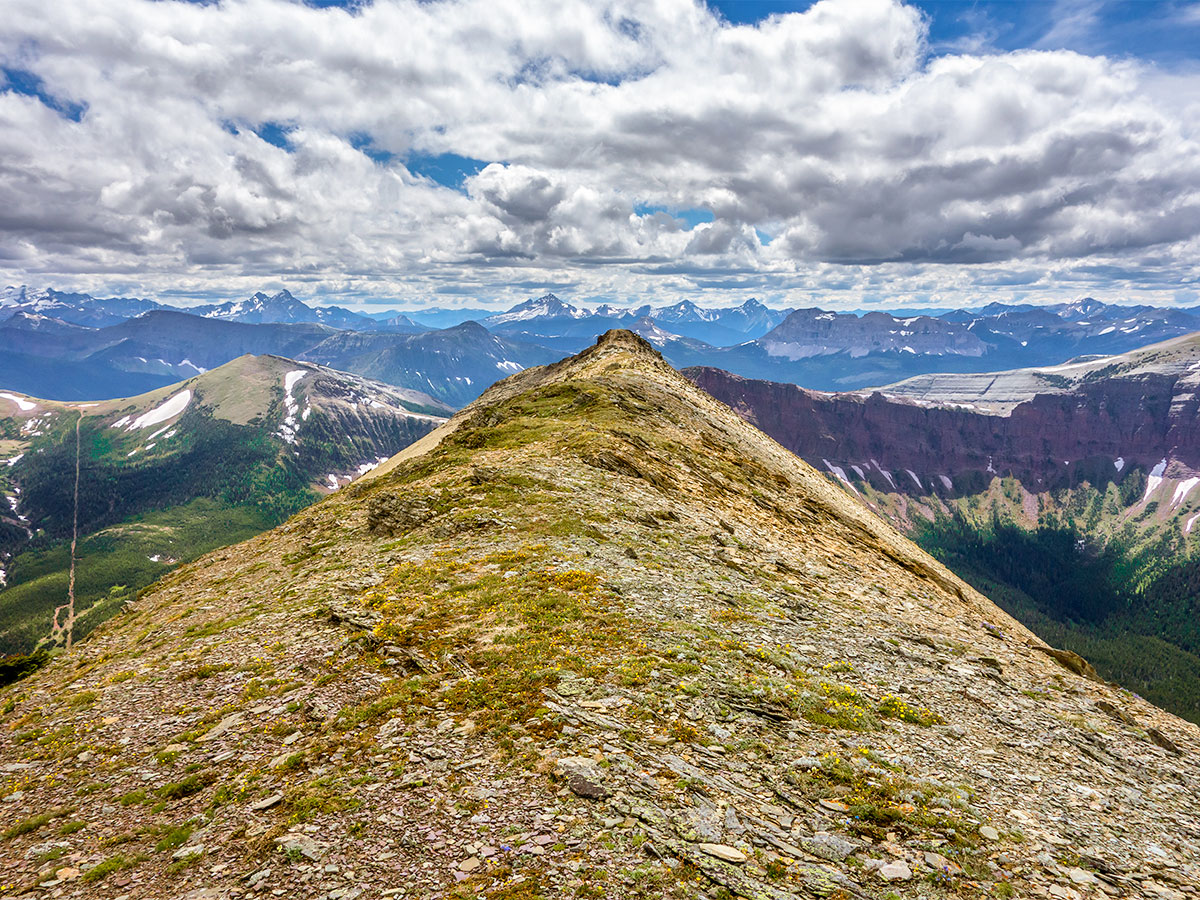
Intersecting the ridge about a 0.6mi from the summit, it is easy going over gently-angled terrain to within 328ft or so of the summit. At this point things get to be a bit more of a scramble, but with careful route selection you can reduce exposure and will only require hands for balance. Bad route selection and this can be a dangerous scramble.
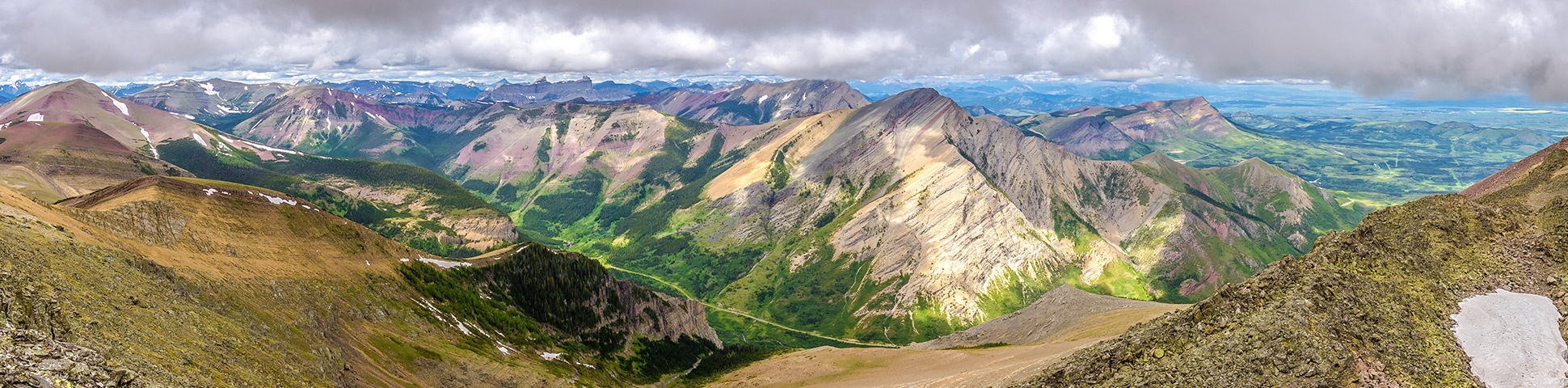
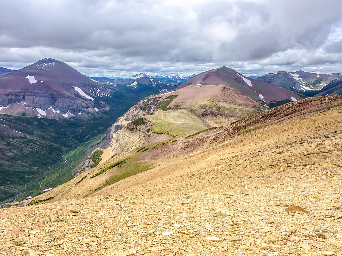
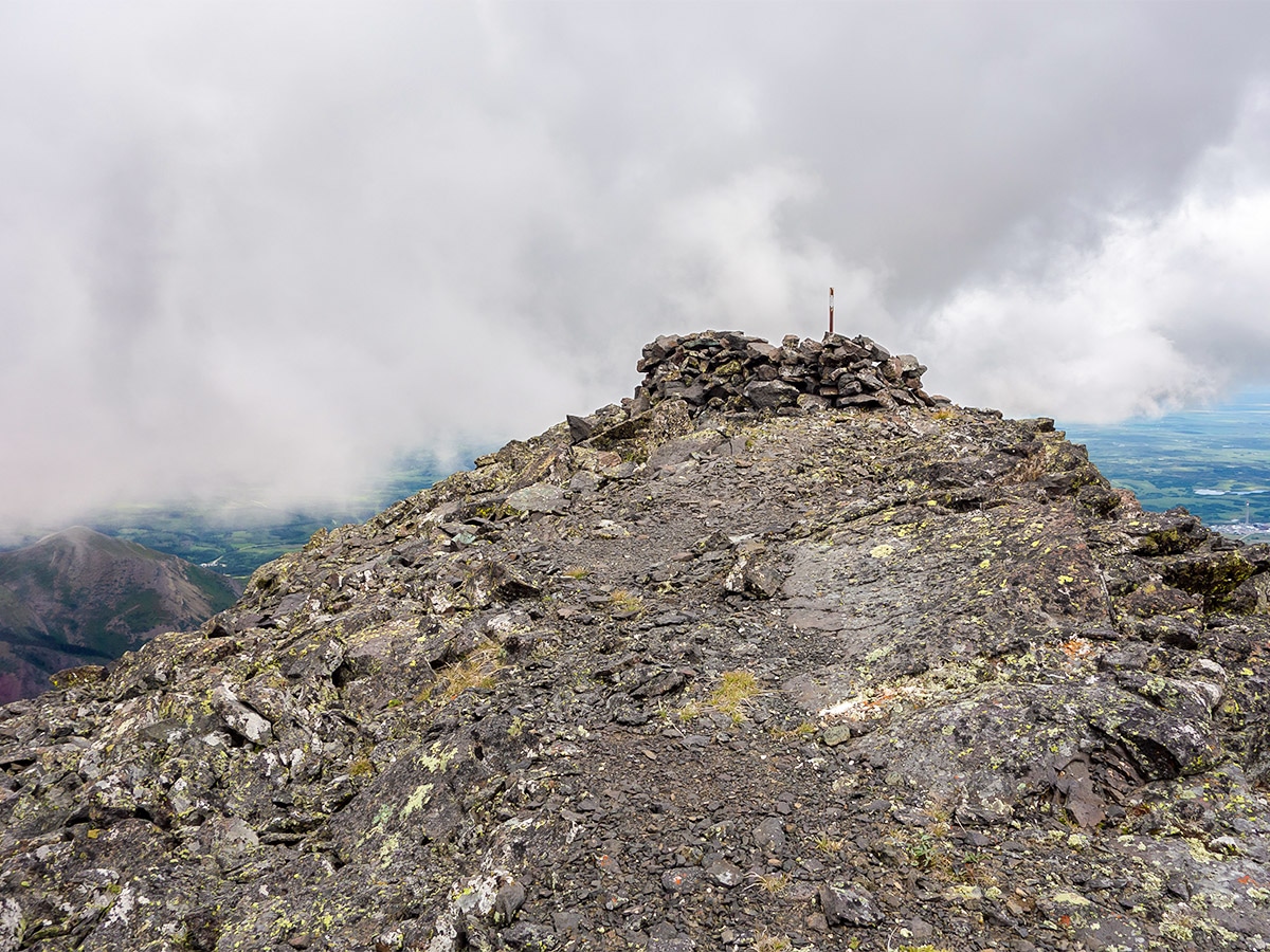
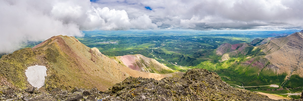
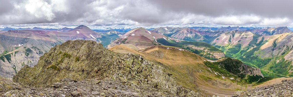
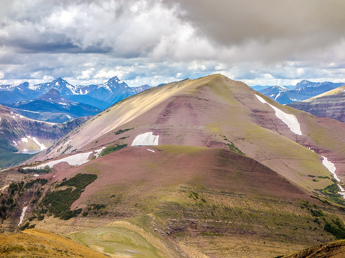
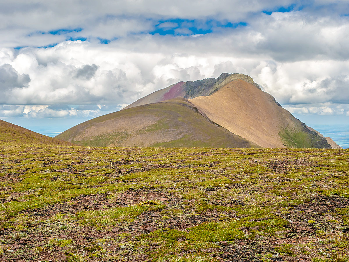
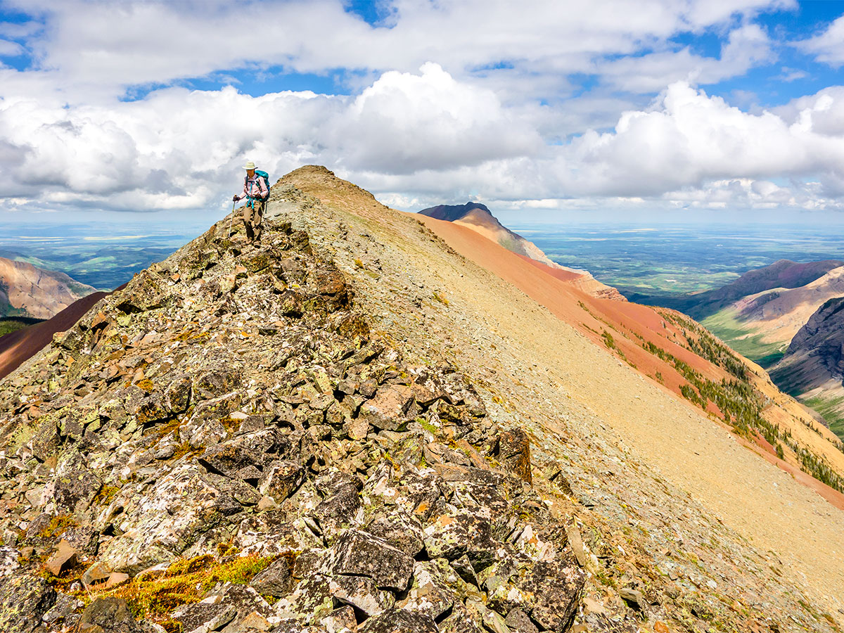
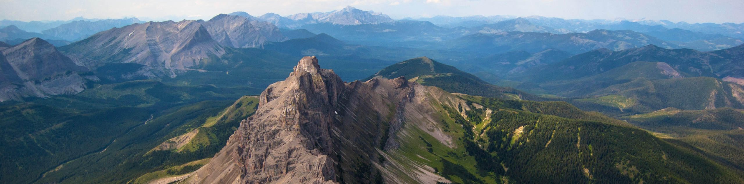
The view from the summit is very nice! Take time for a quick lunch, sign the register, and set out for the western summit, dubbed Loafwood Mountain by others.
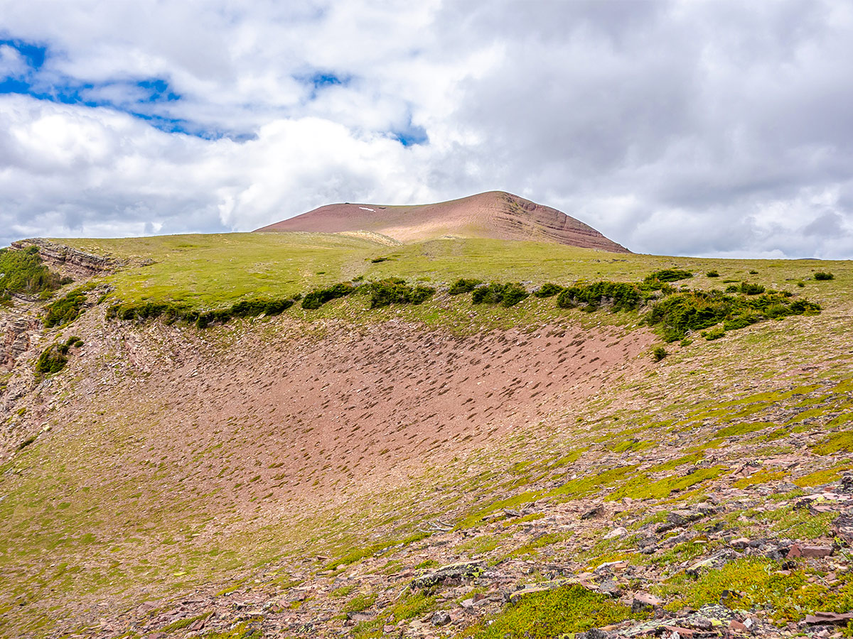
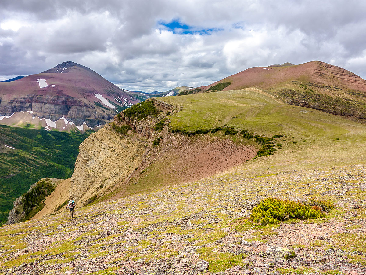
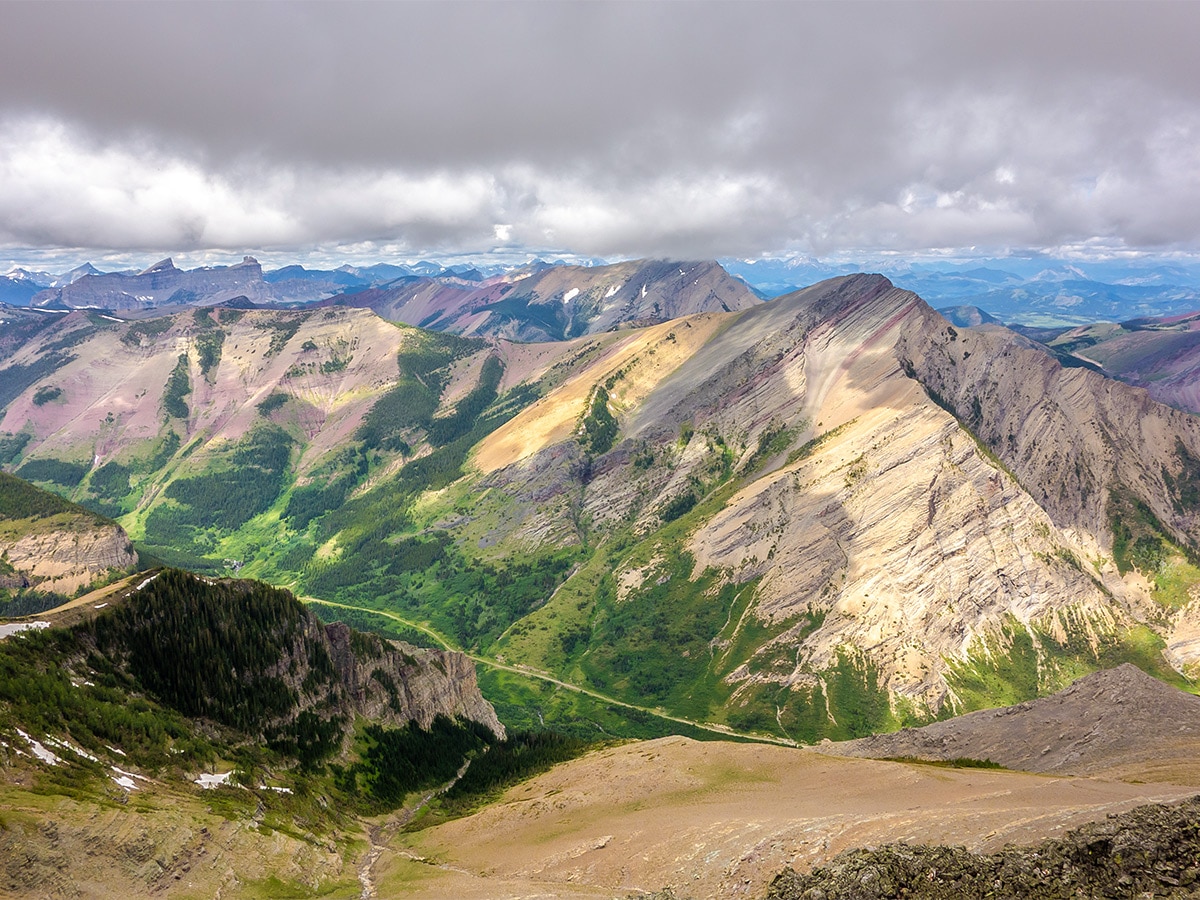
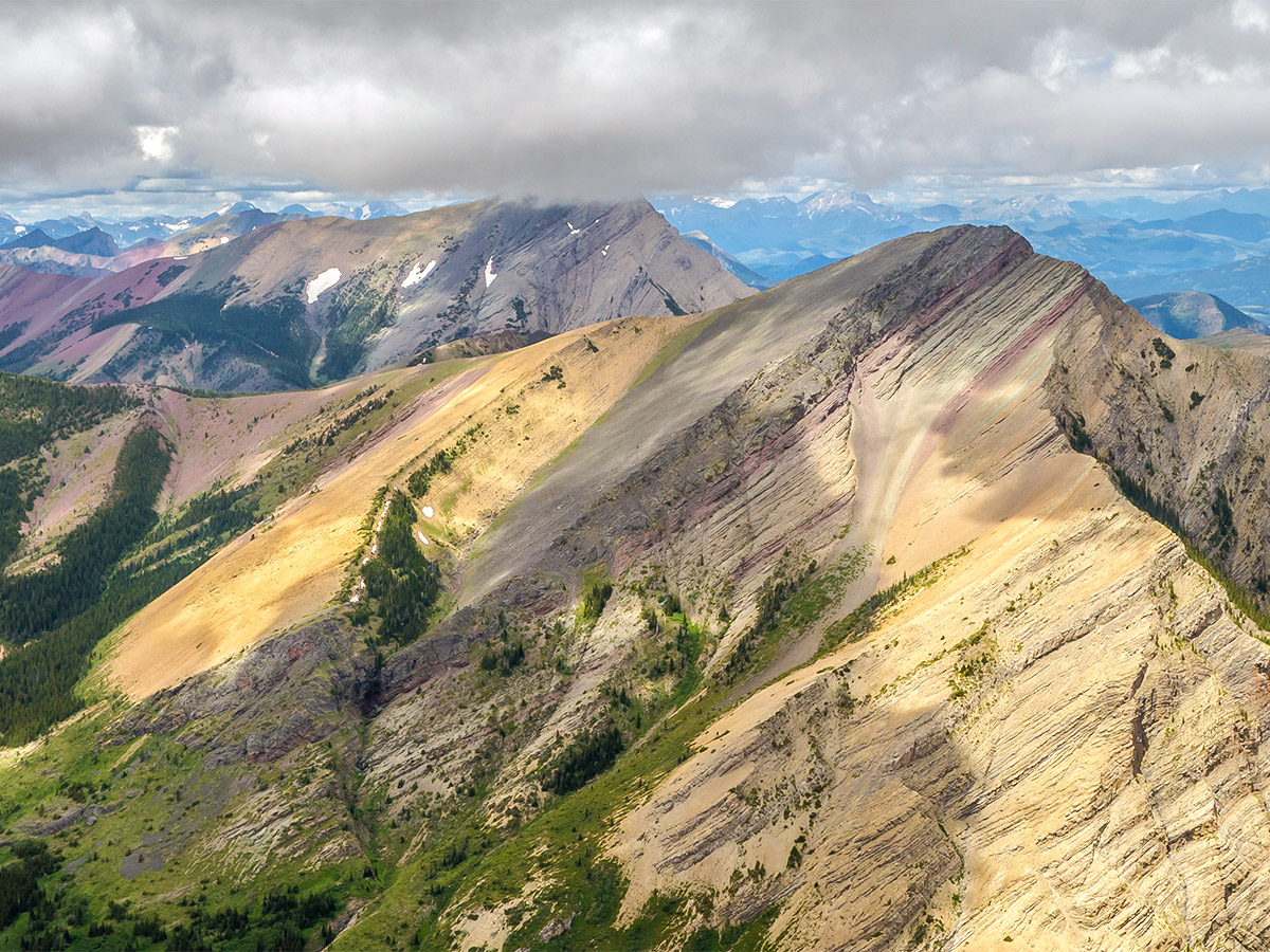
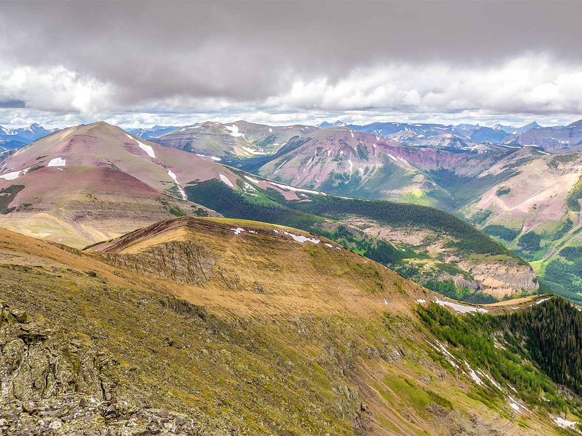
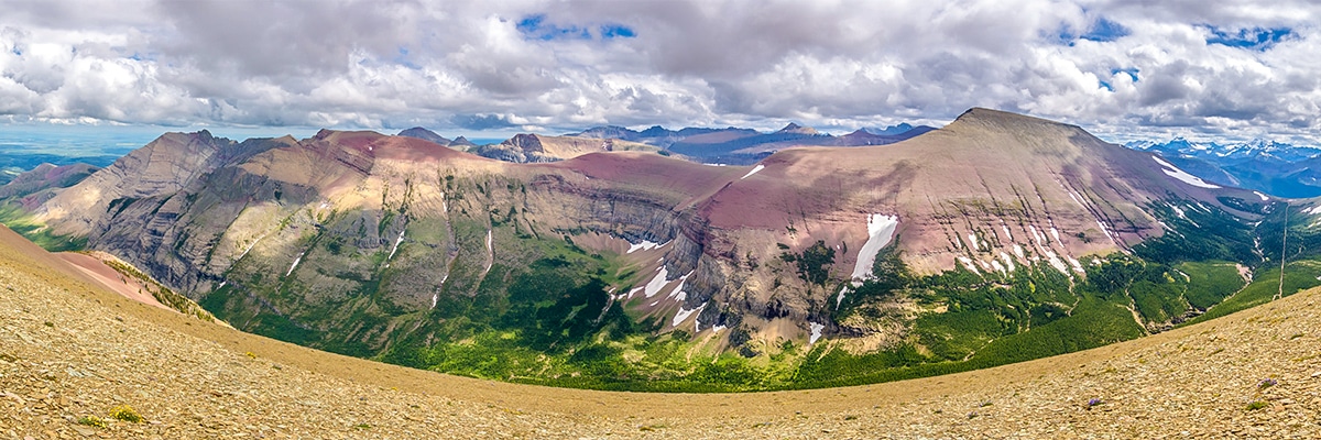
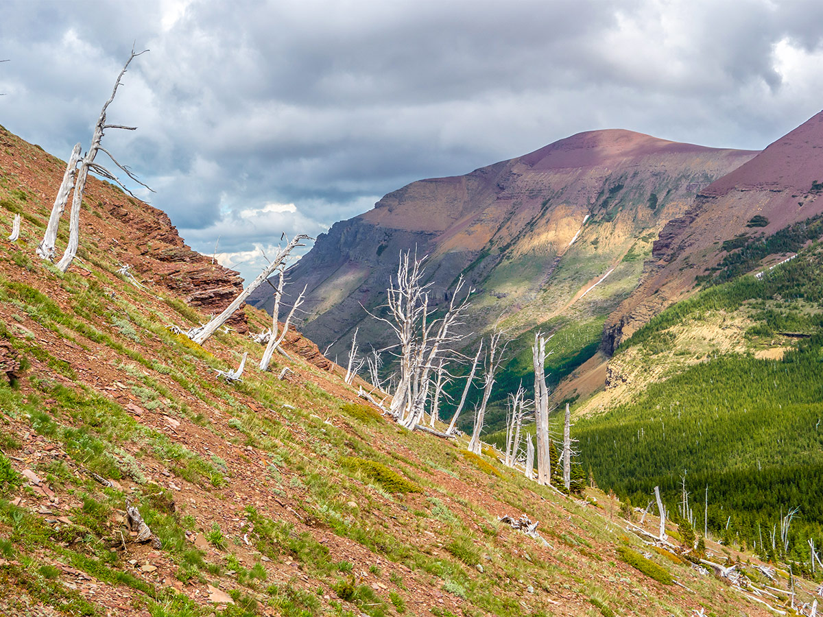
Travel along the ridge is easy and the colorful rock and wildflowers make it an exceedingly pleasant trek. Hiking is generally wonderful in this area and this is no exception. It is long though, requiring 1148ft of elevation gain and loss along the 2.5mi between the east and west summits.
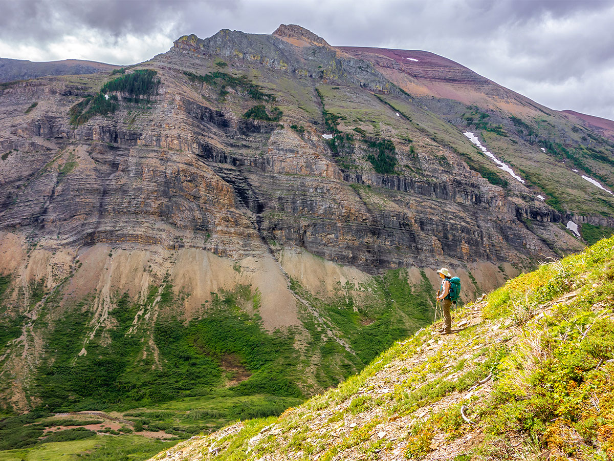
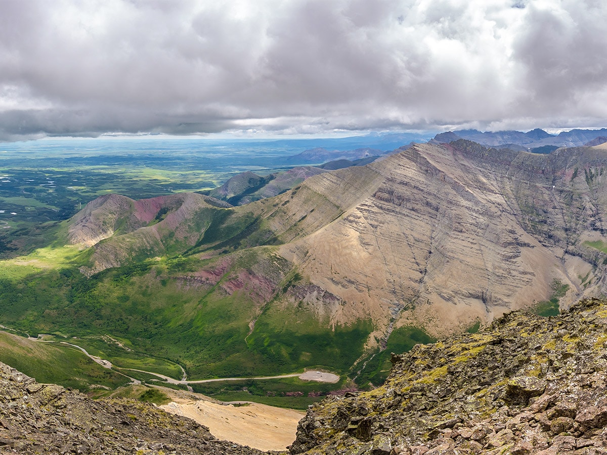
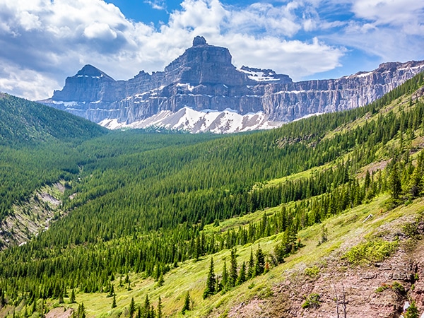
Continue about 0.9mi past the western summit along the ridge, then started your descent to Bovin Lake, SW of you on the ridge.
There are some minor cliff-bands above Bovin Lake, so if you take any detours, be careful. Our route involves nothing more than soft scree and very minor bushwhacking just before the lake. Bovin Lake itself is beautiful, and it is becoming very popular now that the noise of OHV’s is gone. There were already 10 people camping at the lake and we met another two groups totaling about 15 heading in! This was on a Wednesday, too.
The trip back out along the former OHV trail and then the gated road was a bit too long, but a good breeze kept the heat manageable. The entire trip took 9 hours, and that was with several breaks. Our route up the mountain is likely the easiest from any side and allows a hiker to tag both the east and west summits in one trip.
Insider Hints
Bring a bike for the initial part in case the road is closed. You can stash your bike in the bushes for the return journey!
Book a night at Bovin campsite to take some extra time to enjoy the area!

Similar Scrambles to the Drywood Mountain Traverse Scramble
Crowsnest Mountain
Crowsnest Mountain is a popular scramble that requires a good understanding of the route before departure. This trail is a…
Mount Gladstone
A scramble up Mount Gladstone is a wonderful day out in the Castle! A nice trail alongside a lively creek,…
Pincher Ridge
Pincher Ridge is located near the heart of Castle Wildland Provincial Park, a spectacular part of the Canadian Rockies. The…
Clark Hermano 4 years ago
It was a glorious hike! Really long and exasperating. Great for veteran hikers but may be too rough for the beginners.
CamilaP. 4 years ago
Very enjoyable scramble, If finding your route is your thing. I recommend to try this one.
Michael M. 4 years ago
Fantastic hike with arduous and challenging sections. It was so tiring, and we had to stop several times to rest. Overall, it's a great hike.
Joshua Zagreb 4 years ago
Exceptional scenery! However, I can say that this is something I would be happy doing once. I might not do it again. So glad I was able to do it safely.
Perry K. 4 years ago
A long and easy traverse of a high ridge in the colorful Castle Wildland. A spectacular summer outing. Amazing view of the lake.
Coll A. 5 years ago
The path is followed by a descent to a brilliantly-blue lake for a swim and possible camping. A long and easy trail with views of colorful rock and wildflowers.
Linby SK. 5 years ago
The gated road was a bit too long, but a good breeze kept the heat manageable. A route up the mountain is likely the easiest from any side and allows a hiker to tag both the east and west summits in one trip. A hike perfect for veteran hikers.
kelsih_99 5 years ago
big day on this one! pretty long but well worth jumping in the lake at the end.
Jack Pimmles 5 years ago
Drywood mountain hike was amazing. I enjoyed every hour of it.
Stoves_M 5 years ago
It was fantastic! We managed to find a good spot to eat our packed lunch while enjoying the scenery!