O'Shaughnessy Dam to Tuolumne River Hike
View Photos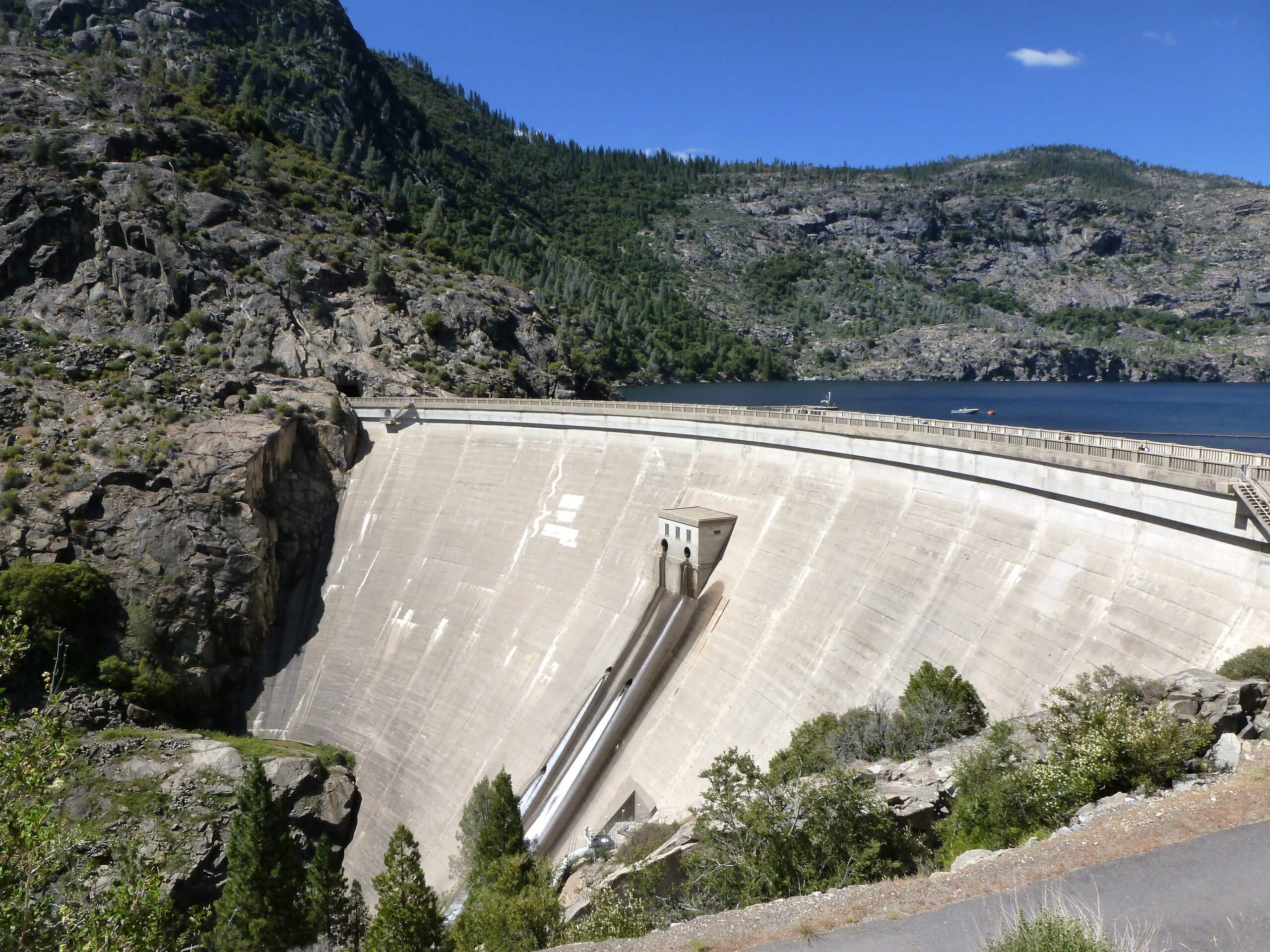
O'Shaughnessy Dam to Tuolumne River Hike
Difficulty Rating:
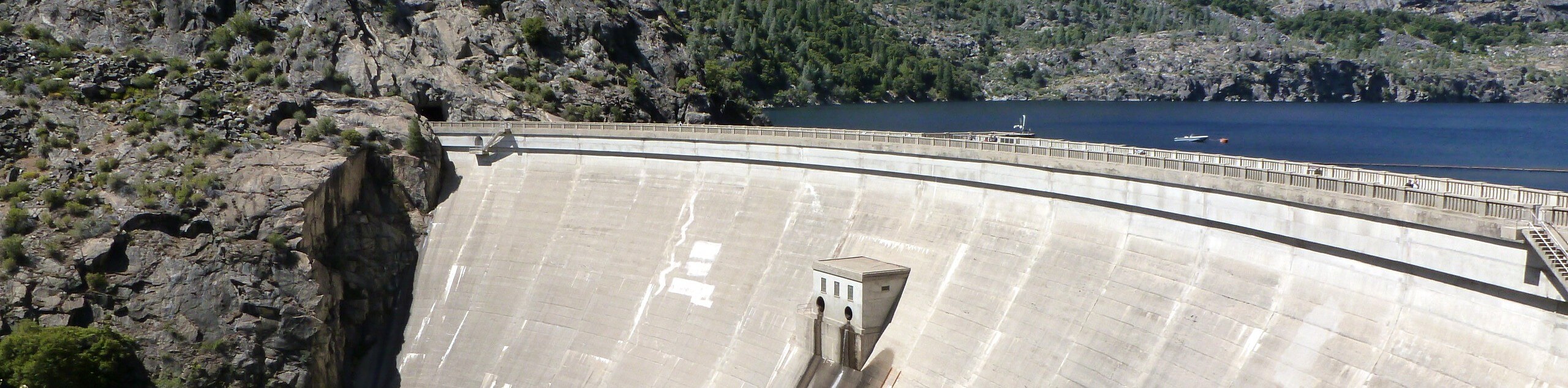
The O'Shaughnessy Dam to Tuolumne River Hike is an amazing adventure in Hetch Hetchy that boasts breathtaking views and a relaxing experience. Wander along the Tuolumne River while reveling in the beauty of the reservoir and the waterfalls that cascade over the granite cliffs.
Getting there
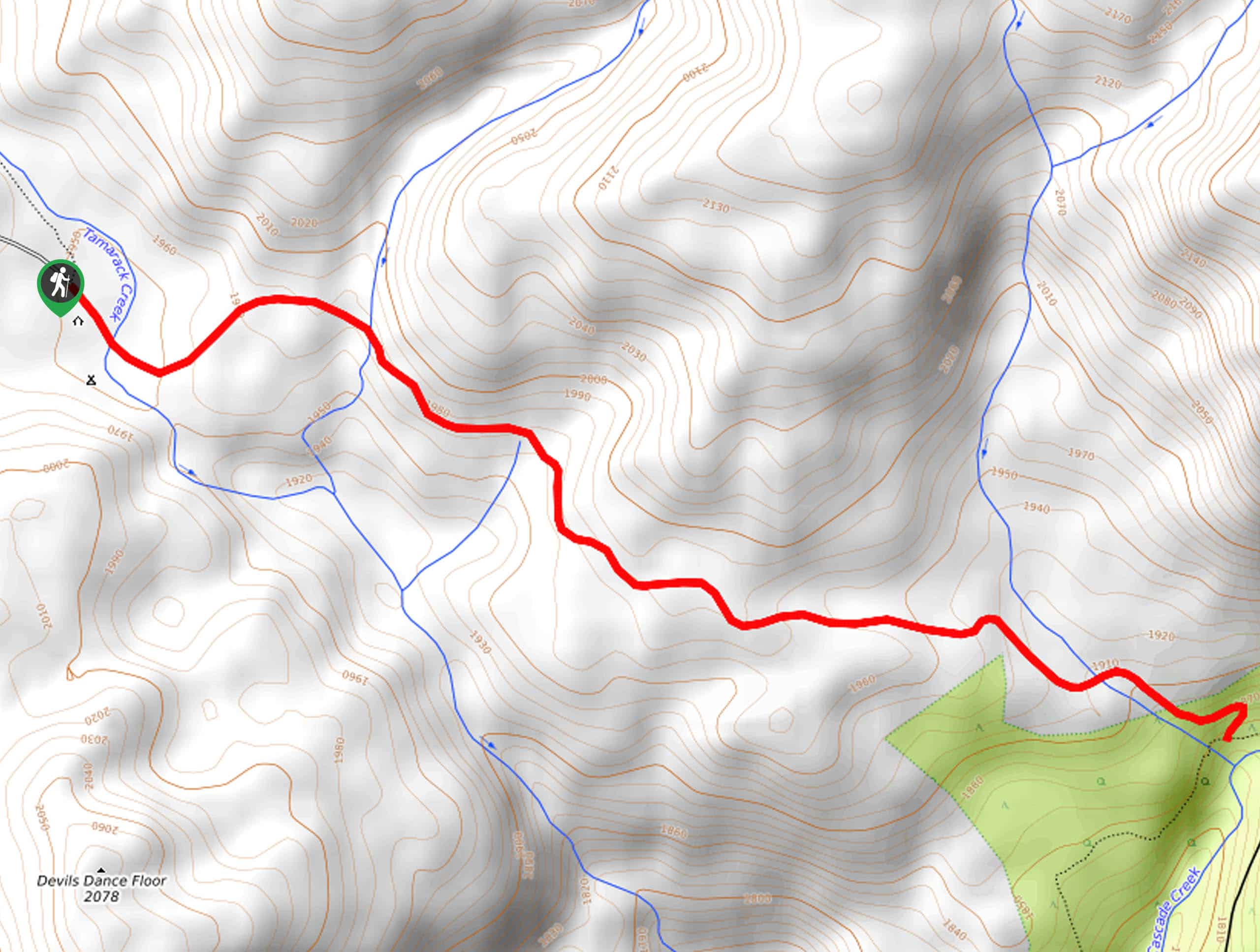
The O'Shaughnessy Dam to Tuolumne River Hike departs from the O'Shaughnessy Dam Trailhead off Hetch Hetchy Road.

About
| Backcountry Campground | No |
| When to do | May-October |
| Pets allowed | No |
| Family friendly | Yes |
| Route Signage | Poor |
| Crowd Levels | High |
| Route Type | Out and back |
O'Shaughnessy Dam to Tuolumne River Hike
Elevation Graph
Weather
O'Shaughnessy Dam to Tuolumne River Hike Description
The O’Shaughnessy Dam to Tuolumne River Hike is a great route for those seeking a quick, easy-going adventure. This path exhibits the grandeur of the dam that bounds the reservoir and serves as a source of drinking water for millions of residents in the Bay Area. Note that much of the path is exposed, so we suggest heading out in the early morning to beat the heat! Though not necessary, the trail GPS may prove useful as the paths are not signposted. The National Park charges an entrance fee; refer to the NPS website for the pricing guide and park updates.
Setting out from the trailhead, take the leftmost path and head southwest down a ridge. Mind your footing on the rocky terrain and you will soon reach an intersection. Take a sharp right here and head north along the Tuolumne River to the base of the O’Shaughnessy Dam that towers above the river. Admire the grandeur of the dam and, when you are ready, retrace your footing back to the intersection, keeping right to continue along the river. Enjoy the sounds of the gurgling waters, before reaching the turnaround point at the footbridge over the Tuolumne River.
Here you will be granted yet another impressive view of the river and the dam. To get back to the trailhead, retrace your footing along the path and stay right at the junction to make your way back to your car.
Similar hikes to the O'Shaughnessy Dam to Tuolumne River Hike hike

Chain Lakes Hike
Explore one of the more secluded trails in Yosemite National Park along the Chain Lakes Hike. This wonderful trail exposes…
Cascade Creek Trail
The Cascade Creek Trail is a great adventure atop Yosemite Valley’s northern rim that boasts breaking views of the lush…
Tamarack Creek Trail
The Tamarack Creek Trail is an easy-going, family-friendly hike in Yosemite that boasts wonderful scenes of vibrant wildflowers in the…
Comments