
Lake Eleanor Hike
View Photos
Lake Eleanor Hike
Difficulty Rating:
The Lake Eleanor Hike is a great excursion in Yosemite National Park that can be enjoyed by hikers of almost all skill levels and ages. Explore the high country and revel in the picture-perfect views of the shimmering alpine waters bounded by granite bluffs and verdant woodlands.
Getting there
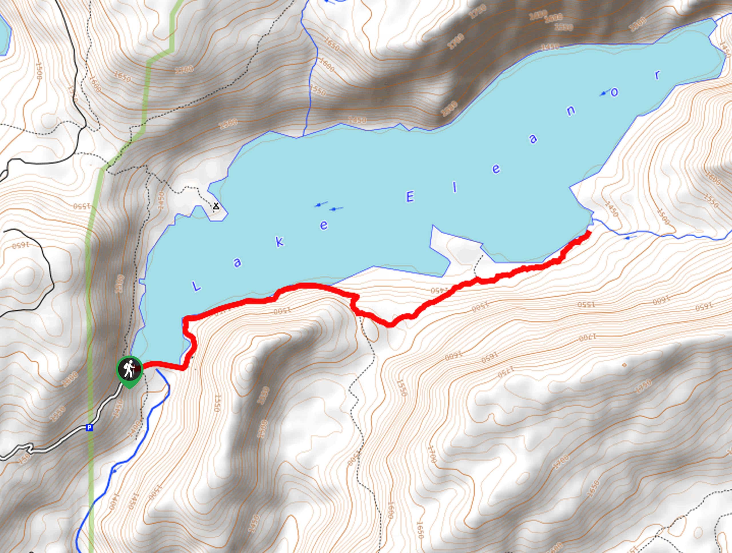
The Lake Eleanor Hike departs from the Parking Lot off Forest Road 1N14.

About
| Backcountry Campground | No |
| When to do | May-October |
| Pets allowed | No |
| Family friendly | Yes |
| Route Signage | Average |
| Crowd Levels | Moderate |
| Route Type | Out and back |
Lake Eleanor Hike
Elevation Graph
Weather
Lake Eleanor Hike Description
Hiking the Lake Eleanor Trail is a relaxing and incredibly scenic adventure. Immerse yourself in Yosemite’s high country as you wander along the shore of a shimmering alpine lake that looks inviting enough to hop in—though the water would likely be extremely chilly! Located in the Hetch Hetchy area, this excursion is much more secluded than most, making it an ideal spot if you are seeking a bit of tranquility. Note: the parking lot for the hike is found off Forest Road 1N14, so adventurers will have to briefly walk along the shoulder of the route to the trailhead. The Yosemite National Park Charges a fee to utilize the trails; refer to the NPS website for additional information.
Embark on your adventure along the Lake Eleanor Hike from the carpark. From here, hike northeast along the southern shoreline of Lake Eleanor via Forest Road 1N14 and past the ranger station. At the road’s end, you will reach the Miguel Meadow Fire Road—this is your hiking route. Head north along the trail and make your way through mixed pine forest and wildflowers. As you wander, be sure to admire the postcard-perfect lake through the tree breaks. Soon the path will climb more intensely and guide you through a meadow before descending to Frog Creek.
Frog Creek marks your turnaround point. From here, you will be granted lovely views of Lake Eleanor and the granite bluffs that hem the glittering waters. When you are ready, retrace your footing along the path back to the trailhead.
Similar hikes to the Lake Eleanor Hike hike

Chain Lakes Hike
Explore one of the more secluded trails in Yosemite National Park along the Chain Lakes Hike. This wonderful trail exposes…
Cascade Creek Trail
The Cascade Creek Trail is a great adventure atop Yosemite Valley’s northern rim that boasts breaking views of the lush…
Tamarack Creek Trail
The Tamarack Creek Trail is an easy-going, family-friendly hike in Yosemite that boasts wonderful scenes of vibrant wildflowers in the…
Comments