Vogelsang Hike
View Photos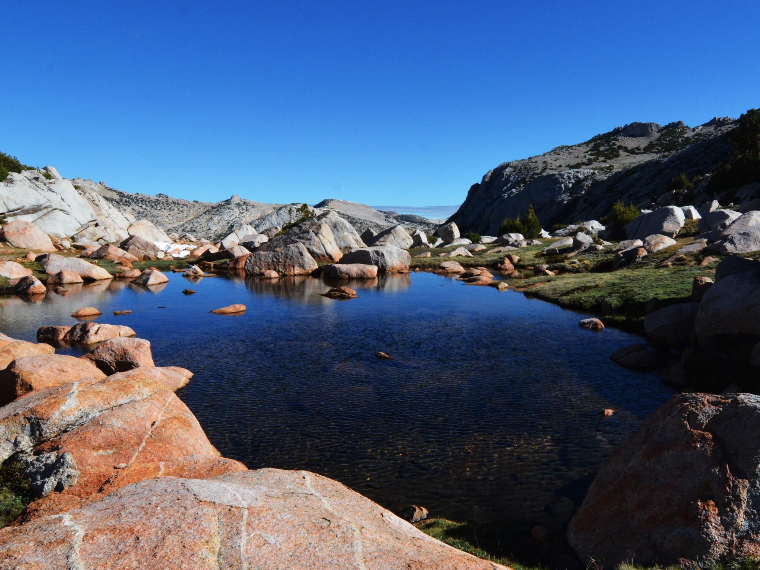
Vogelsang Hike
Difficulty Rating:
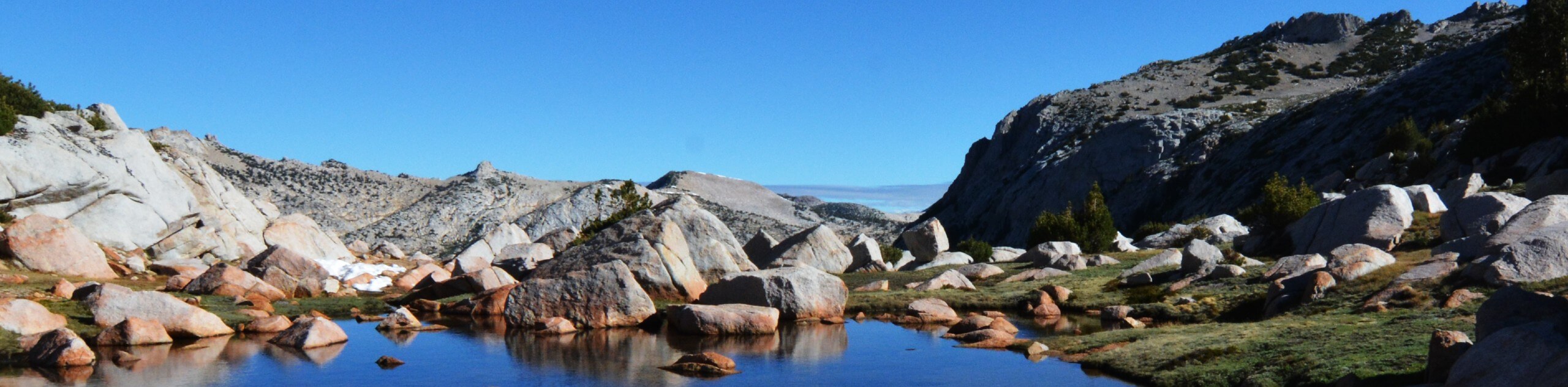
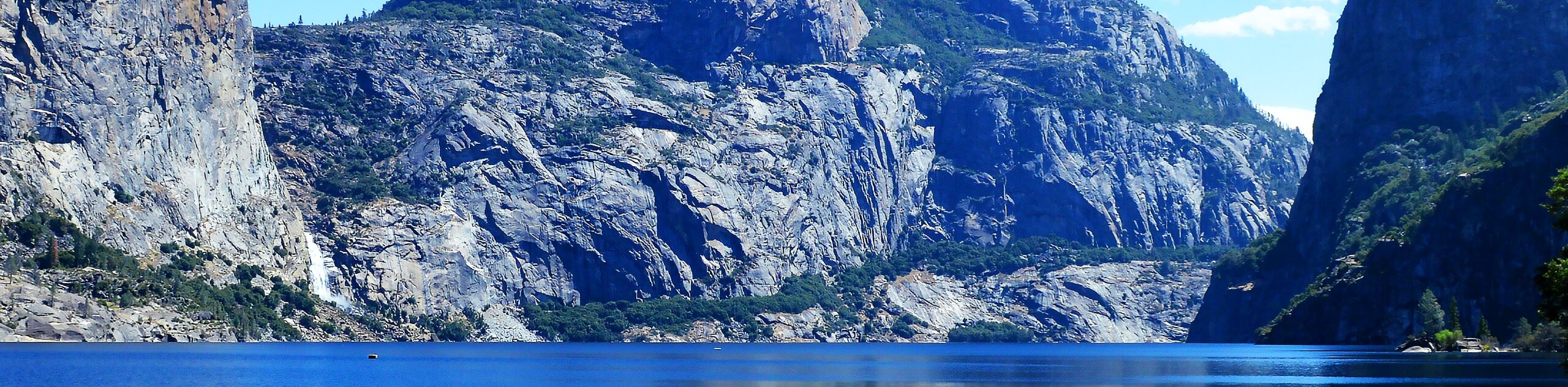
The Vogelsang Hike is an incredible adventure in Yosemite National Park. Boasting views of countless Sierra Nevada summits and shimmering alpine lakes, there is no shortage of scenery to admire. This picturesque trek is one of our favorites, and we think it could be one of yours too!
Getting there
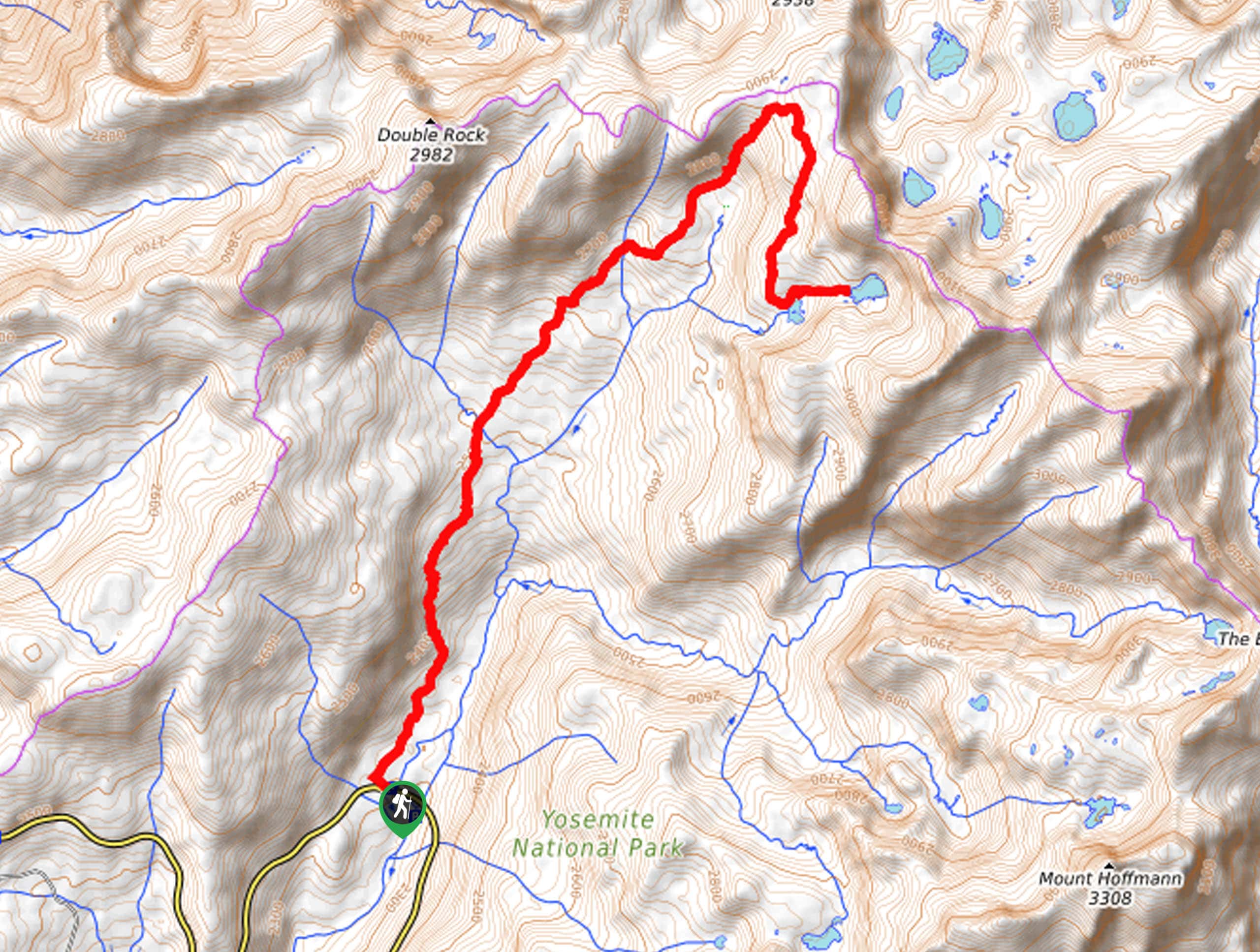
The Vogelsang Hike departs from the Dog Lake Parking Lot off Tuolumne Meadows Lodge Road.

About
| Backcountry Campground | Vogelsang High Sierra Camp, Wilderness Permit Required. |
| When to do | May-October |
| Pets allowed | No |
| Family friendly | Older Children only |
| Route Signage | Average |
| Crowd Levels | Moderate |
| Route Type | Out and back |
Vogelsang Hike
Elevation Graph
Weather
Vogelsang Hike Description
The Vogelsang Hike is a popular backpacking route in Yosemite, but it can also be enjoyed as a long and rewarding day-hike. Explore Yosemite’s high country and revel in the postcard-worthy panoramas of the alpine terrain. Though not necessary, a sturdy pair of footwear and trekking poles will prove useful as you navigate the rocky and, at times steep, trail. Note that much of the path is exposed, so be sure to keep an eye out for afternoon storms, check the forecast, and prepare accordingly! The National Park charges an entrance fee; refer to the NPS website for additional details.
Setting out from the Dog Lake Parking Lot, the Vogelsang Hike tracks south along the Pacific Crest National Scenic Trail #200 (PCT). Follow this path over Dana Fork and across the Twin Bridge over Lyell Fork. After crossing the creek, you will head east along the John Muir Trail/PCT until you reach an intersection with the Rafferty Creek Trail. Turn right here and hike south along the Rafferty Creek Trail, which hugs the curves of the babbling snowmelt stream. As you wander this meadow-cloaked path, you will be granted amazing views of the surrounding granite peaks.
Eventually, you will reach Tuolumne Pass and revel in the views of the granite oasis, before continuing south to the Vogelsang High Sierra Camp. Near Fletcher Lake, you will be granted amazing views of Vogelsang Peak to the south. To get back to the trailhead, simply backtrack along the same route.
Similar hikes to the Vogelsang Hike hike
Beehive Meadow Trail
The Beehive Meadow Trail is an amazing adventure in Hetch Hetchy that travels through diverse terrains. Cross the O’Shaughnessy Dam,…

Chain Lakes Hike
Explore one of the more secluded trails in Yosemite National Park along the Chain Lakes Hike. This wonderful trail exposes…
Grant Lakes Hike
Immerse yourself in Yosemite’s high country along the Grant Lakes Trail. This epic hike exhibits the grandeur and diversity of…
Comments