Pen-y-Ghent Circular Walk
View Photos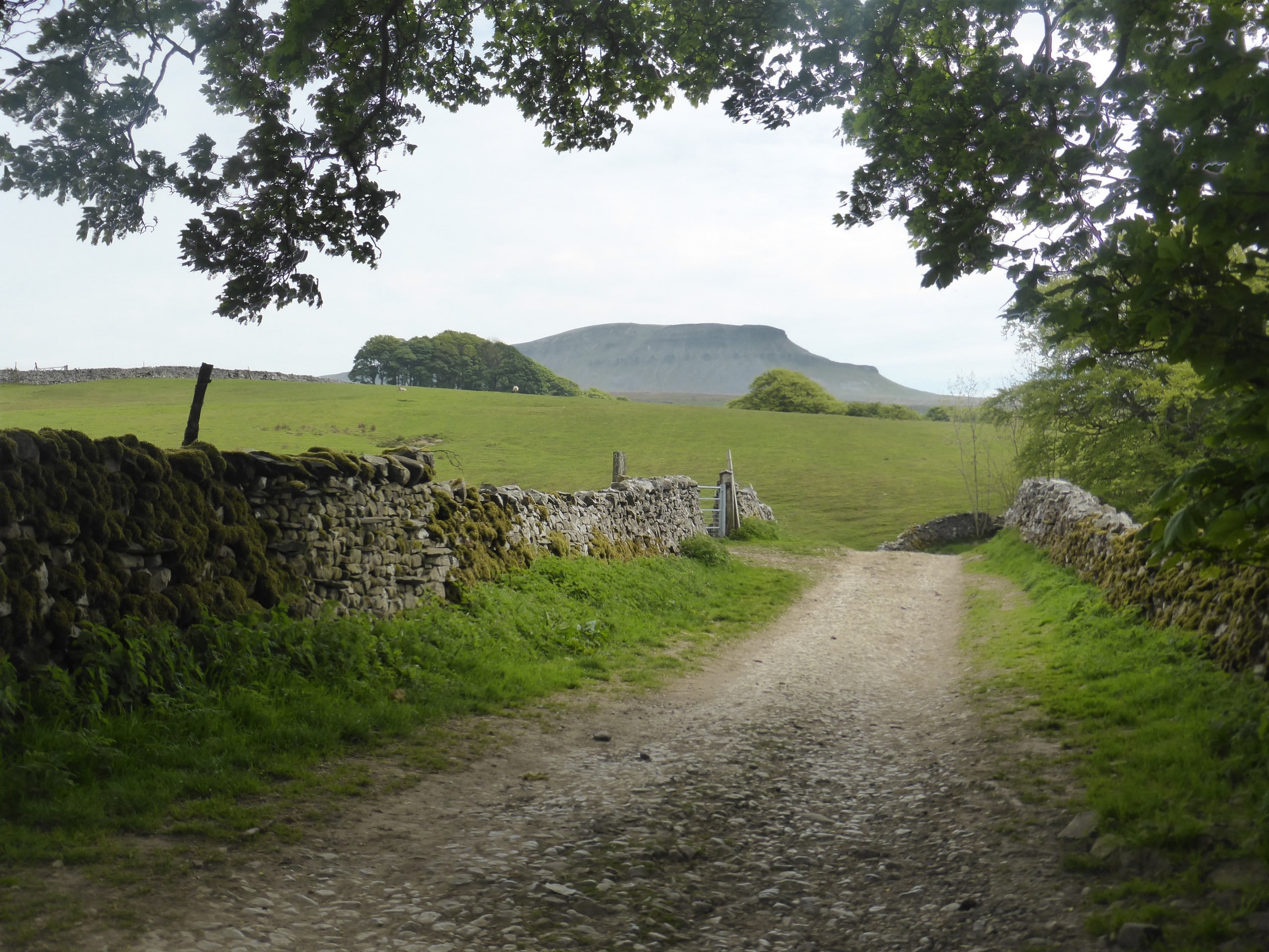
Pen-y-Ghent Circular Walk
Difficulty Rating:
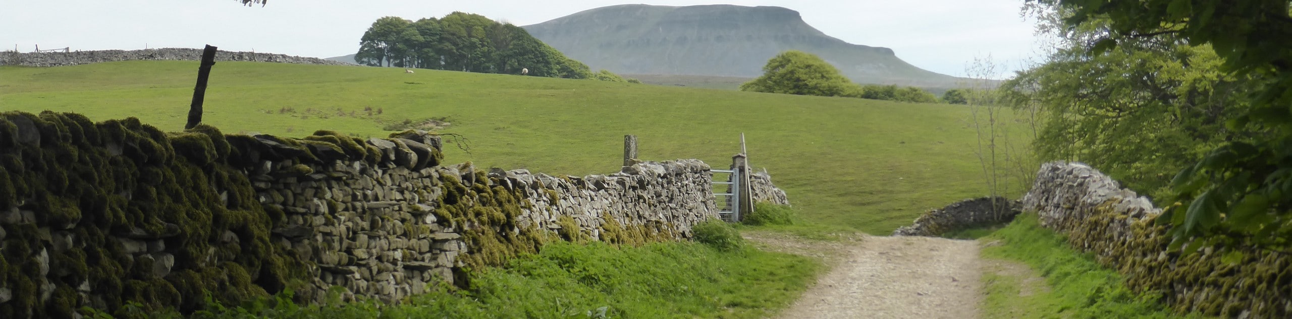
The Pen-y-Ghent Circular Walk is a heart-pumping thrill that has you scrambling through the peaks that make up this path. Explore Hunt Pot and Hull Pot as you summit the Pen-y-Ghent peak and watch as the stream flows down into the 100ft drop of Hunt Pot. You can marvel at two other peaks along this path called Ingleborough and Whernside.
Getting there
To get to the Pen-y-Ghent Circular Walk from Austwick, head southeast toward Clapham Road and follow A65, B6480 and B6479 to Stainforth. In 7.6mi, take Goat Lane and Silverdale Road to Pennine Way. In 3.9mi, arrive at your destination.

About
| When to do | April - September |
| Backcountry Campsites | No |
| Pets allowed | Yes |
| Family friendly | No |
| Route Signage | Average |
| Crowd Levels | Moderate |
| Route Type | Circuit |
Pen-y-Ghent Circular Walk
Elevation Graph
Weather
Pen-y-Ghent Circular Walk Description
The Pen-y-Ghent Circular Walk is an adrenaline-pumping trek that involves rough terrain and scrambling. This path is for experienced walkers and one must be alert when traveling this route. There are steep areas where scrambling will be necessary, so this path is not to be used after heavy rain.
The walk is treacherous, however, the reward of the stunning views of the surrounding area is worth it. There are three main peaks on this walk that you can explore: Pen-y-Ghent, Ingleborough and Whernside. You can also take in the beauty of the Hull and Hunt Pot. Don’t get too close as the drops where the stream falls into are quite deep.
Beginning at the car park, walk to the Tourist Information Centre near the Post Office. Follow the road to the Golden Lion Hotel and turn down the second side road with the school sign. You will come across a junction and can see the beginning of this path. From this point, you can see Pen-y-Ghent in the distance, and you will continue on, walking towards the peaks and past Brackenbottom Farm. There will be a wooden sign that says “Pen-y-Ghent Summit 1 ¾ miles ahead” and you will go through the wooden gate.
Begin climbing upwards and pass through the stile. In the early months of the year, you will see an abundance of lambs here. Continue your climb, keeping an eye out for the other two peaks to come into view (Ingleborough and Whernside). You will see two stiles; climb over both and continue on your way towards Pen-y-Ghent. A wooden stile will appear, navigate this, and continue following the path. You will then come to a flight of stairs, which you will climb and maneuver another stile and join Pennine Way.
At this point, the climb will become much steeper and the path less visible. You will have to focus at this point as the path is faint and some scrambling may be necessary. The route will flatten momentarily before becoming rocky and steep once again. When you reach the top, the path will flatten out and you will clearly see the marked route.
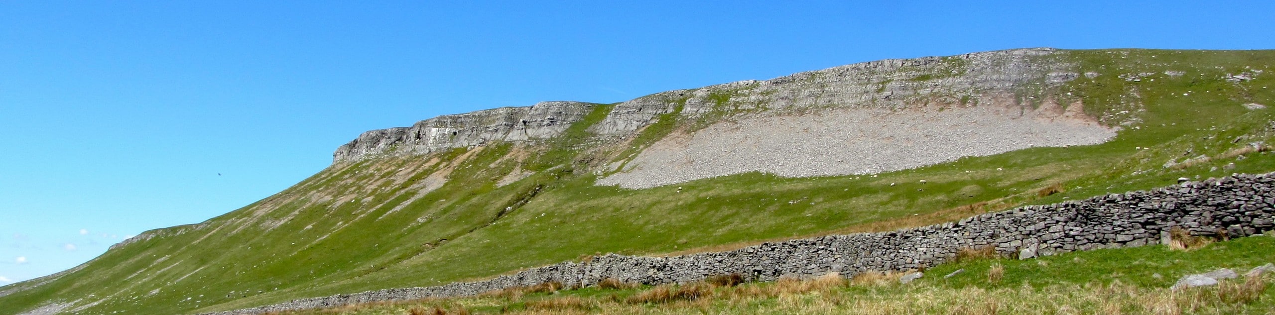
Maneuver a wooden stile and follow the Horton path, which descends and turns right at the edge of a steep cliff. You will be able to see Hunt and Hull Pots from here and you will continue to follow the route and take a sharp left. Another stile will come about, pass this and you will find Hunt Pot along with a stream. There is a detour right after Hunt Pot along the path, where you can walk for 1640ft in the opposite direction from the path toward the Foxup sign. As you walk along this area, you will be able to get close to Hull Pot (stay close to the wall on the right, especially if it is not a clear day), which has a very steep crater that stretches 328ft long and runs 49ft deep. It is a very beautiful crater to witness and sometimes after it rains, small waterfalls will appear, running over the side of the crater.
After exploring the Hunt and Hill Pot, return to the path and navigate two stiles and arrive at Horton Scar Lane. Continue following the path and go through the gate that is marked “BW Horton in R 1 ¼,” and you will begin to see houses in Horton. You will turn left and arrive back at the car park where you began, as this is a circuit walk.
Trail Highlights
Hunt Pot
The Hunt Pot is an interesting and dangerous-looking geological formation that is located in the Yorkshire Dales National Park and sits between the peaks of Pen-y-Ghent, Ingleborough and Whernside. A stream flows along the path and flows into the mouth of the Hunt Pot, dropping 200ft inside a cave-like area.
Pen-y-Ghent Peak
Pen-y-Ghent Peak sits in the Yorkshire Dales National Park and is the lowest of the three peaks. It sits at 2227ft, with Ingleborough and Whernside Peaks towering over. This magnificent peak is made out of millstone grit top and lays on top of a carboniferous limestone. The water that flows through this peak ends up in the Irish sea.
Frequently Asked Questions
Is Pen-y-Ghent Circular Walk family-friendly?
Due to the rough terrain, the Pen-y-Ghent Circular Walk is not suitable for children.
Other Great Walks in Yorkshire Dales National Park
Check out our trail guides to Malham Tarn, Malham Cove, Kisdon Force, Grimwith Reservoir, and the Whernside Walk. Or see all of our Yorkshire Dales walks.
Insider Hints
Wear appropriate footwear as this walk has rough terrain and scrambling may be necessary.
Book a night at the Old Hill Inn to extend your stay.
Enjoy a meal at the Helwith Bridge Inn before or after your walk.
Head to the Norber Erratics to see some incredible countryside views.

Similar hikes to the Pen-y-Ghent Circular Walk hike
Old Gang Smelt Mill and Reeth High Moor Walk
The Old Gang Smelt Mill and Reeth High Moor Walk is a rough and rugged adventure that will take you…
Hawes and Sedbusk Walk
The Hawes and Sedbusk Walk is a great family-friendly adventure in Yorkshire Dales National Park that will take you through…
Malham Tarn Upland Farm Walk
The Malham Tarn Upland Farm Walk is a fantastic route in Yorkshire Dales National Park that will take you around…
RossDoughty 2 years ago
Lovely walk for my first hike.