Malham Cove Circular Walk
View Photos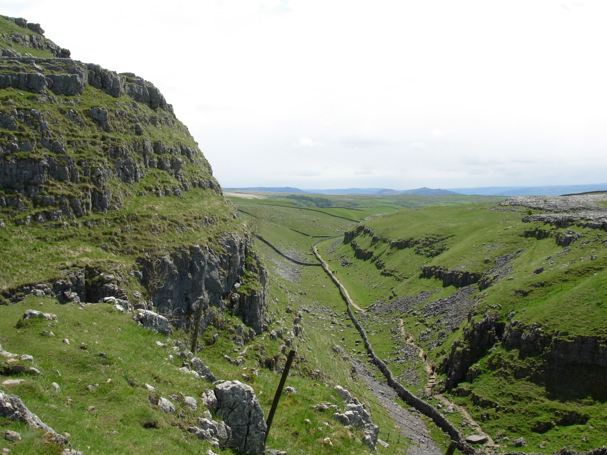
Malham Cove Circular Walk
Difficulty Rating:
The Malham Cove Circular Walk is an amazing place to explore. The Gordale Scar was created by melting glaciers and houses beautiful waterfalls full of lime that pour onto the rocks below, creating a brown tufa. In the warmer months, you can also explore the vibrant wildflowers that fill this path.
Getting there
To get to the Malham Cove Walk from Malham, head east on Pennine Way toward Finkle Street—Pennine Way turns slightly right and becomes Finkle Street. Continue straight onto Gordale Lane, and in 0.7mi, you will arrive at your destination.

About
| When to do | April - September |
| Backcountry Campsites | No |
| Pets allowed | Yes |
| Family friendly | No |
| Route Signage | Average |
| Crowd Levels | Moderate |
| Route Type | Circuit |
Malham Cove Circular Walk
Elevation Graph
Weather
Malham Cove Walk Description
The Malham Cove Circular Walk is a stunning journey that takes you deep into nature’s beauty; however, it is suggested that experienced walkers use this path as there are areas that can be difficult to maneuver and some scrambling may be necessary, especially when walking the Gordale Scar.
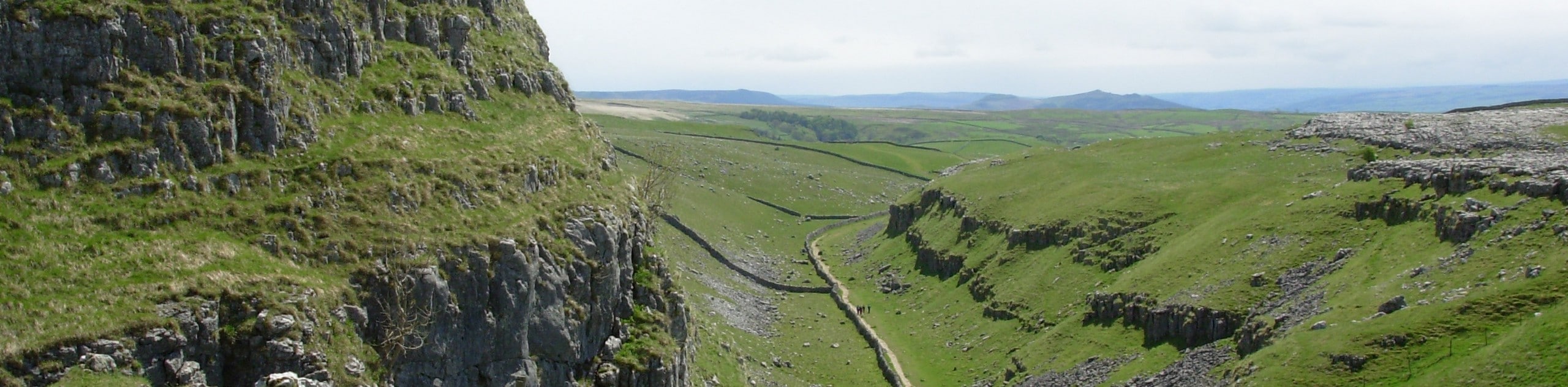
This path holds incredible beauty and is a great place to explore the cascading waterfalls. The Malham Cove was created over 12,000 years ago from melted glacier water flowing through it. You will also see Janet’s Foss waterfall along this path, which is a gorgeous sight and has a very deep pool for swimming that sits below. The main highlight of this walk is the Gordale Scar. These large, jagged rock cliffs showcase the beautiful waterfalls that rush along them and many people scramble along these to reach the top.
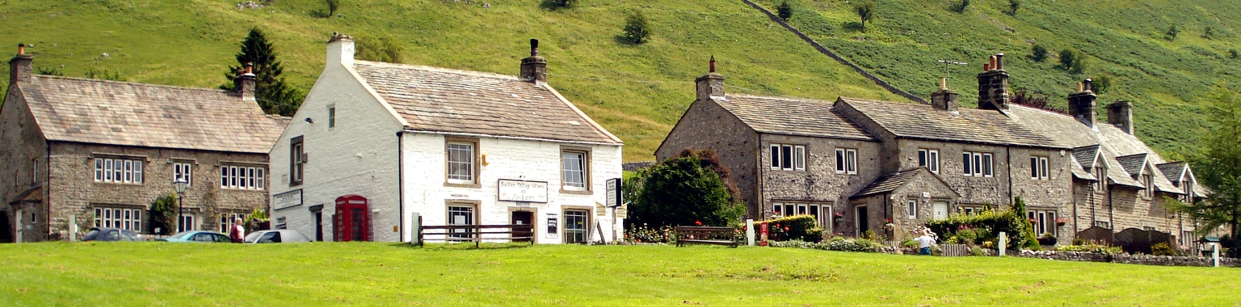
Beginning at the car park, follow the path and turn left along the road past the Wesleyan Chapel. At Buck Inn, turn right and follow the footbridge. You will come to a wooden gate, which you will pass through as well as a kissing gate. After this, you will head through another kissing gate, reaching a sign marking Janet’s Foss; follow this and maneuver three more kissing gates.
You will then enter the National Trust in a wooded ravine, which will lead you to Janet’s Foss Waterfall. Take your time exploring this area of the path as it is quite a beautiful sight. This area in the summer months will be filled with vibrant wildflowers, such as bluebells.
When you have finished taking in the beautiful scenery, follow the path that takes you to the left of the waterfall and go through a kissing gate. Follow the lane and the road to the right, and follow the Gordale Scar sign, which will lead you through the private campground for the Gordale Scar. You will round a corner and come face to face with the captivating beauty of the Gordale Scar.
This path walks up the waterfall, where scrambling will be necessary; however, if you do not want to partake in this, there is a small path that will lead you to the same spot on top. If you choose to continue up the waterfall, the path will begin to ease as you get higher and you will come across another waterfall. When you reach the top, you will follow the path to the left, and you will find yourself in grassy and flatter terrain. Continue along passing a stone stile and follow the sign labelled “Malham Tarn 2 miles”.
As you continue along the grassy path, go left across the field and follow along the wall. You will come to a stone stile, pass through this and turn right along the track. At the T-junction, follow the wall to a plantation where you can see Malham Tarn. Turn left on the track before the cattle grid and follow along the side of the plantation called Great Close Plantation.
You will come across another track, where you will turn right. Pass through the gate and enter Malham Tarn. Continue along the track through the Tarn and explore this area, heading back to the gate when you are finished. Find the “Pennine Way Watersinks ¾ mile” marker sign and follow the road. Turn right through the gate, pass over Malham Beck, and then head right along the “Footpath Malham Cove 1 ½ miles” sign. Follow this path and continue along it, past the stile, and into the valley. You will then head right and see a wooden stile and a sign “Malham Cove ½ mile, Malham Village 1 mile”. Pass through the kissing gate and continue along the path.
Pass over two more stone stiles and pass through the gap in the wall on the left and go through the stile. Turn right and cross the road above Malham Cove, where you must be very careful about your footing as the cove sits 230ft high. Continue following the path through a kissing gate and down the steps, through 2 more gates and then take the right-hand fork that leads towards Malham.
Continuing to follow this path, you will pass a gate, follow the gravel path through a kissing gate and then back onto the road where you will find the car park where you began as this is a circuit walk.
Trail Highlights
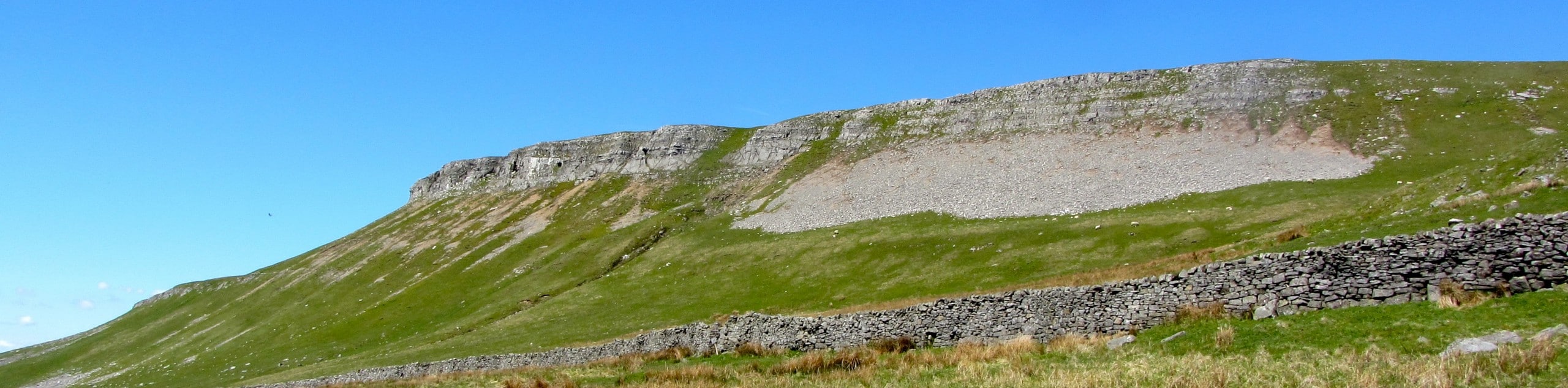
Malham Cove
Malham Cove is located within the Yorkshire Dales National Park and is a very popular attraction. It was created through the last ice age, which was over 12,000 years ago by glacier ice melting and rushing down through this area of rock.
This cove towers at 260ft high and looks out over the beautiful village of Malham. This area is open all year long; however, weather conditions may make it difficult to access the top of the cove and it may be dangerous to attempt.
Janet’s Foss
Janet’s Foss is a small but mighty waterfall that is located in the Yorkshire Dales National Park and is nestled amongst the woodlands and Gordale Scar. It starred in the 2006 independent British Film called Waterfall and was given the fictional name Molkham Falls, which increased its popularity.
Frequently Asked Questions
Is the Malham Circular Walk family-friendly?
No, the Malham Circular Walk is not family-friendly due to some rough terrain.
Is the Malham Circular Walk pet-friendly?
Yes, the Malham Circular Walk is pet-friendly.
Other Great Walks in Yorkshire Dales National Park
Check out our trail guides to Malham Tarn, Pen-y-Ghent, Kisdon Force, Grimwith Reservoir, and the Whernside Walk. Or see all of our Yorkshire Dales walks.
Insider Hints
Wear appropriate footwear for rough terrain
Extend your stay and book a night at the Buck Inn
Stop and have a meal at The Lister Arms
Explore the small town of Yorkshire
Similar hikes to the Malham Cove Circular Walk hike
Old Gang Smelt Mill and Reeth High Moor Walk
The Old Gang Smelt Mill and Reeth High Moor Walk is a rough and rugged adventure that will take you…
Hawes and Sedbusk Walk
The Hawes and Sedbusk Walk is a great family-friendly adventure in Yorkshire Dales National Park that will take you through…
Buckden Circular Walk
The Buckden Circular Walk is a lovely adventure in Yorkshire Dales National Park that will provide scenic views overlooking Wharfedale…
Comments