Lake McArthur hike
View Photos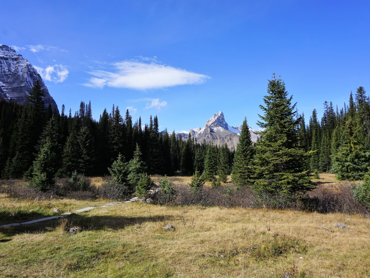
Lake McArthur hike
Difficulty Rating:
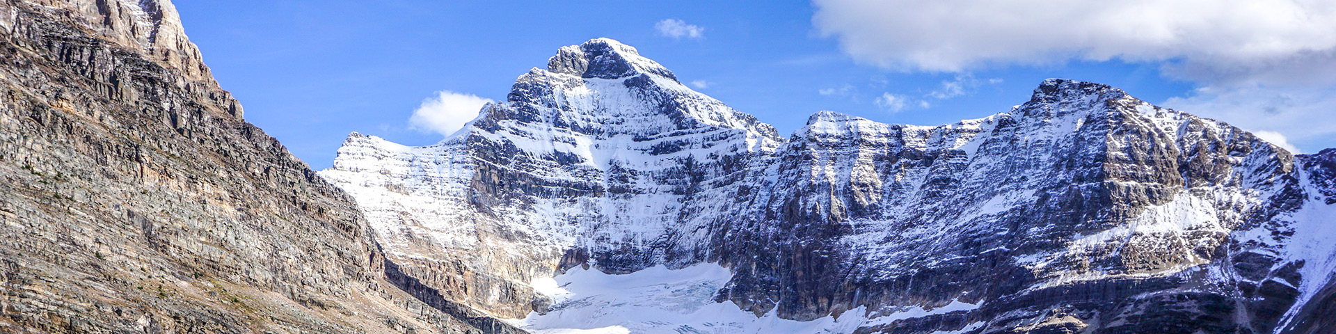
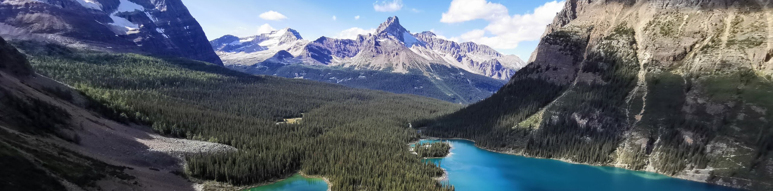
The hike to Lake McArthur is a gem. This is another walk in the Lake O’Hara region, so access is limited by Parks Canada. Lake McArthur is an awe-inspiring hike that you should absolutely put on your hiking bucket list.
Getting there
To access this hike, you must either hike in on an 6.8mi access road or else make reservations on the Lake O’Hara bus through Parks Canada. These reservations fill up early, but cancellations happen.

About
| When to do | June through October |
| Backcountry Campsites | Yes |
| Toilets | Trailhead |
| Family friendly | No |
| Route Signage | Average |
| Crowd Levels | Low |
| Route Type | Out and back |
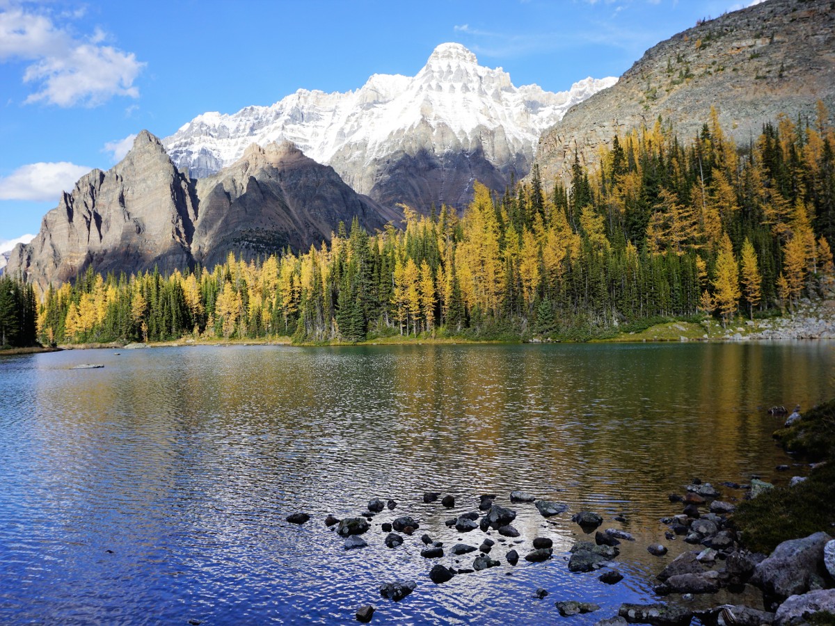
Lake McArthur
Elevation Graph
Weather
Route Description for Lake McArthur
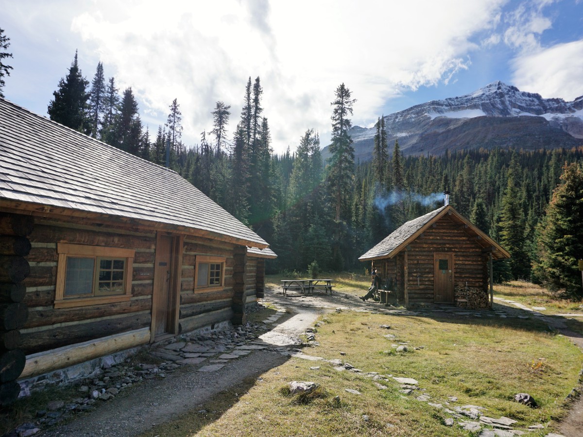
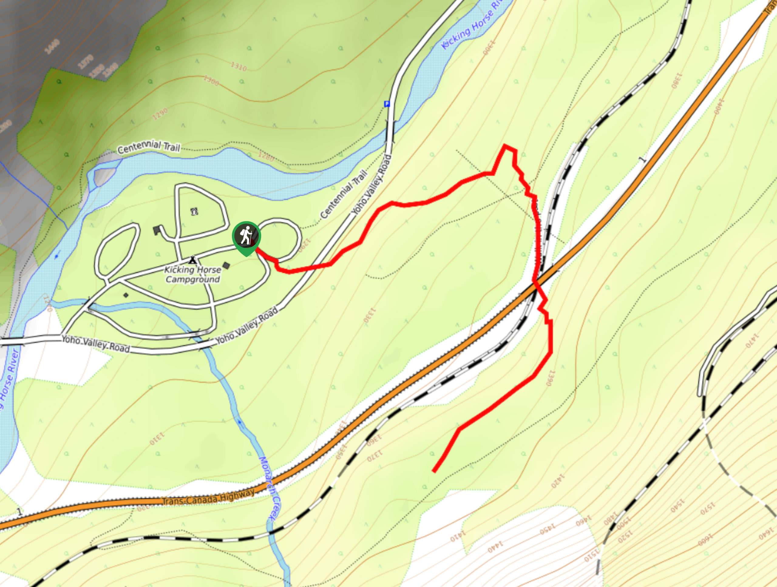
Starting at the Le Relais Day Shelter, head into the forest uphill coming to a junction where you can choose to go straight and pass the ACC Elizabeth Parker Hut or go left into the Big Larch Trail. We prefer to head past the ACC Hut, which sits in a beautiful meadow. The hut is wonderful, but access inside is only granted to ACC members with reservations.
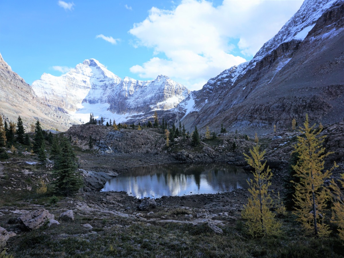
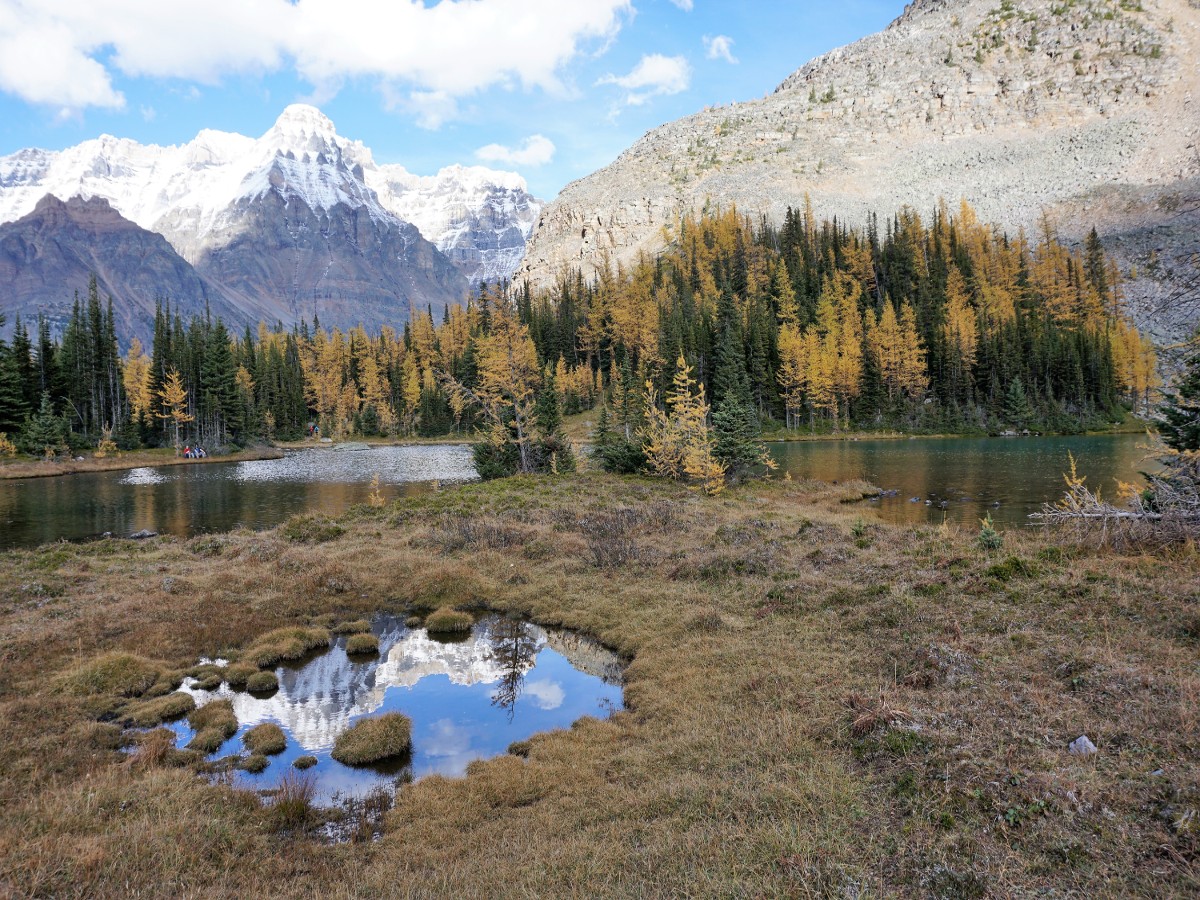
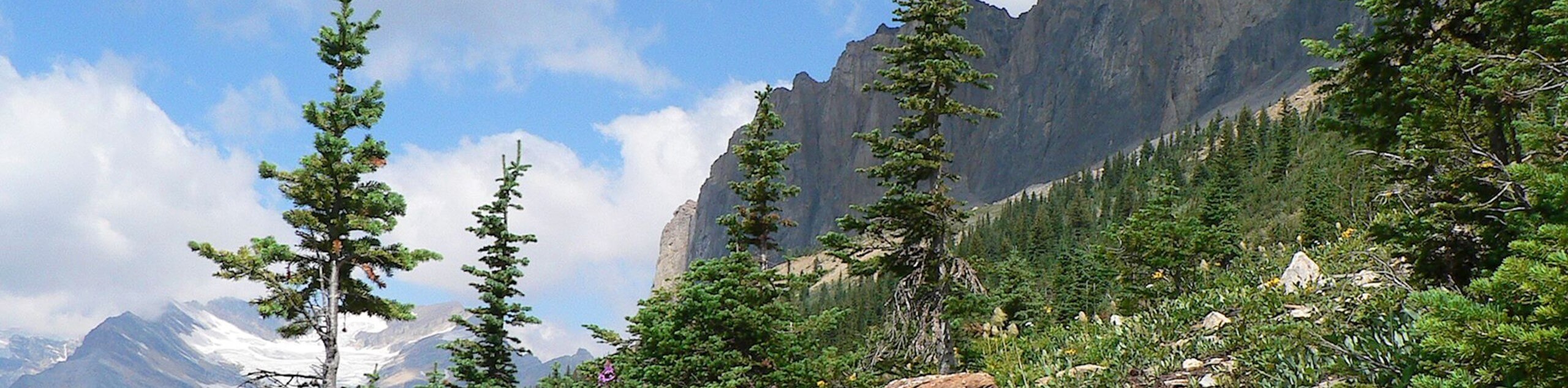
From here take the well-maintained trail, eventually reaching Schaffer Lake. Walk around the lake and make sure you don’t take the All Souls Route (off to the left). Continue on the right side of the fork and travel through a wonderful boulder field and into alpine meadows. There will also be a path veering off for Odaray Highline trail to the right.
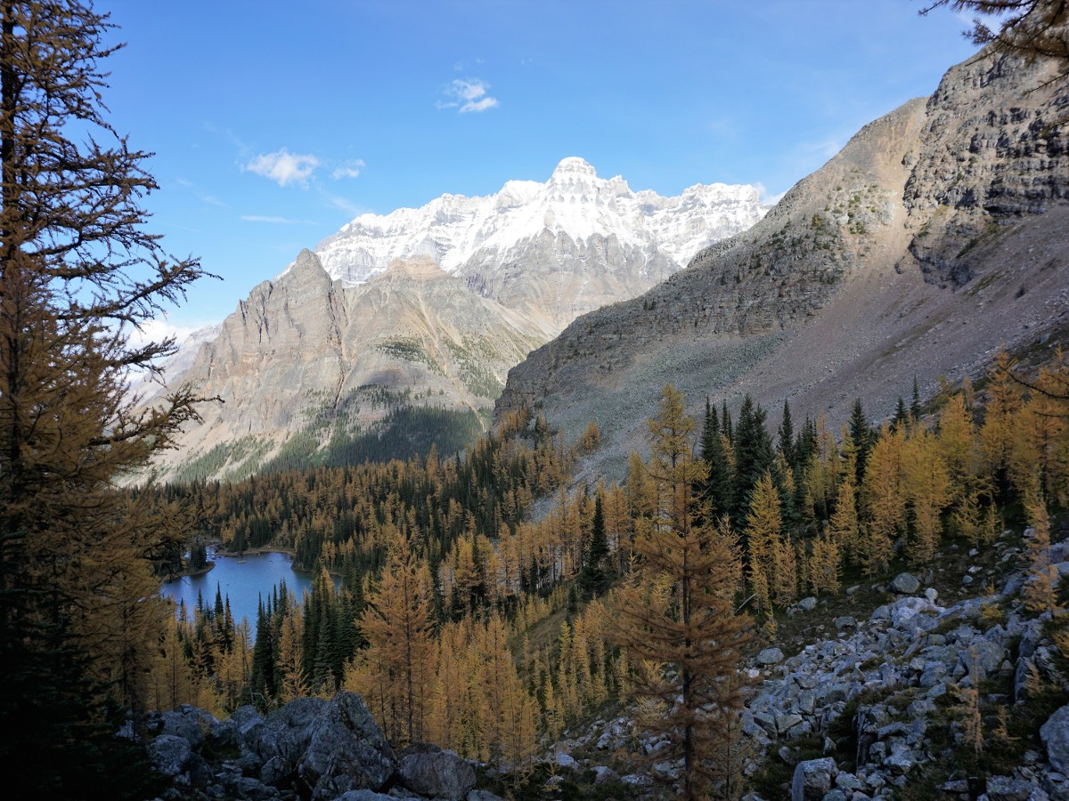
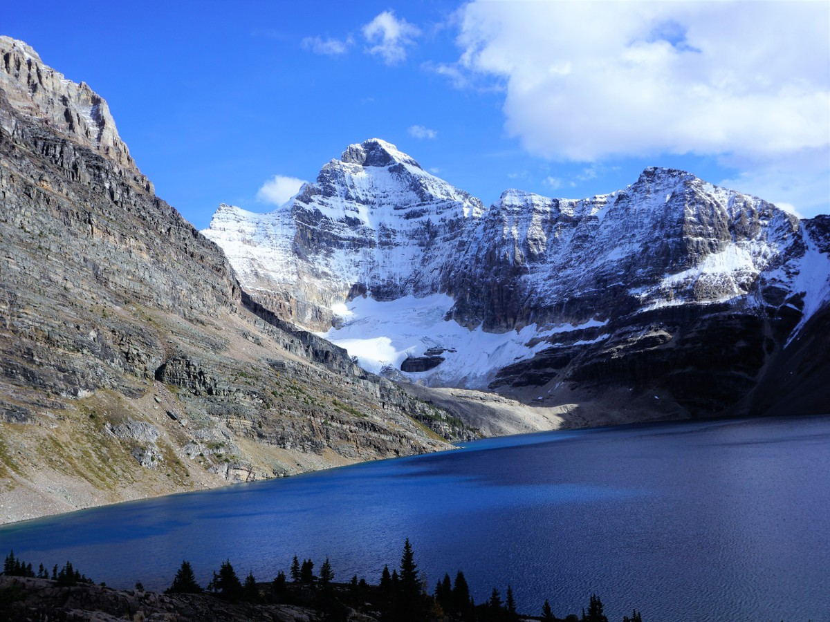
Continue uphill to McArthur Pass, where the trail forks. Both trails go to Lake McArthur, and we typically go up on the Low Level Trail and back down via the McArthur Highline Trail to create a circuit. As you come down to the water, savor the incredible blue of Lake McArthur below you. Continue down to the lake and explore the region for yourself. On a nice day, this is a wonderful break spot.
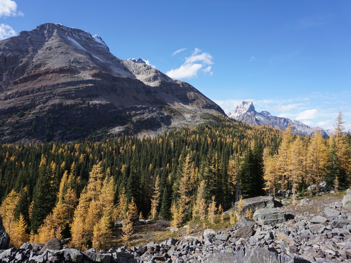
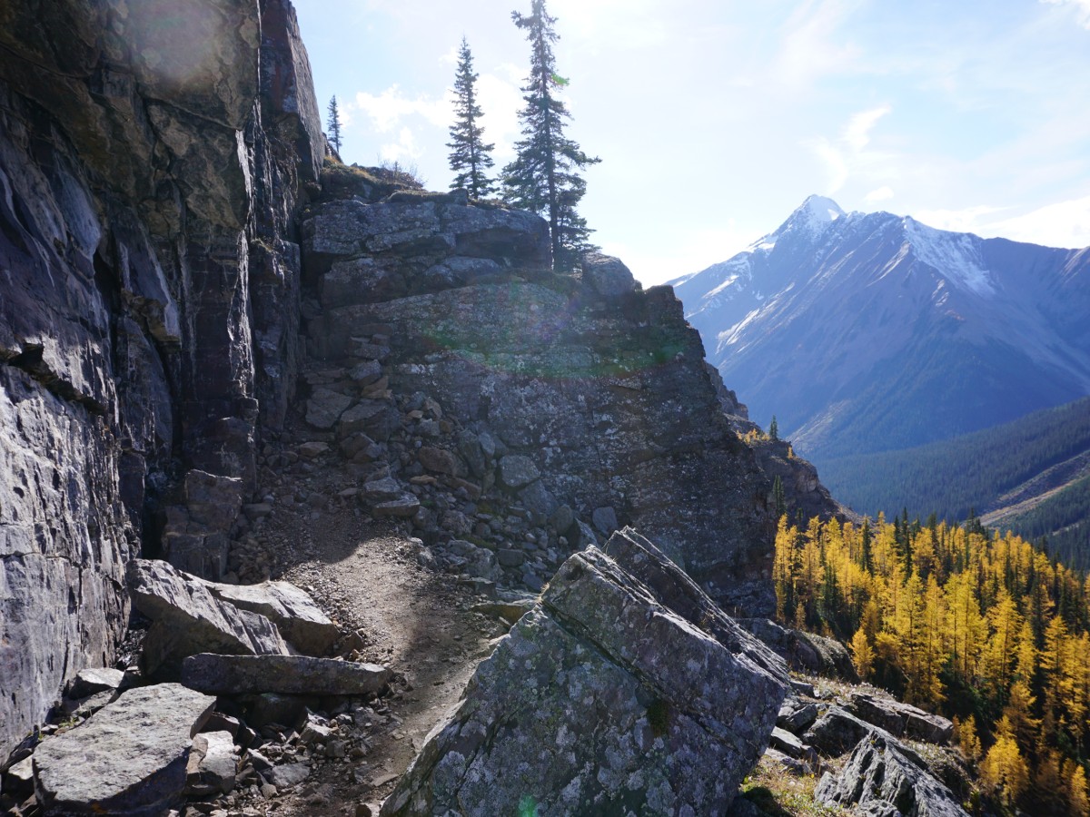
Continue on your path forming a circuit back to the trail junction. From here, travel back to Schaffer Lake, where you can retrace your route up or else go down via the Big Larch Trail. The Big Larch Trail isn’t as scenic as the route you ascended, but is wonderful in autumn as the colors change. You reconnect with the main trail just above Le Relais.
Insider Hints
For a full day, start with McArthur Lake and then take the All Souls Route over the shoulder of Mount Schaffer and continue all the way along to Wiwaxy!
Coffee is available at Le Relais.

Similar hikes to the Lake McArthur hike
A Walk in the Past Trail
The Walk in the Past Trail is a quick and easy hiking route in Yoho National Park that will lead…
Burgess Shale Hike
The Burgess Shale Hike is an amazing experience that will take you uphill along the slopes of Wapta Mountain for…
Lake O’Hara Alpine Circuit
Hiking the Lake O’Hara Alpine Circuit is an amazing experience that will see you traverse the rugged, yet beautiful terrain…
isaacanderson 4 years ago
I had a gorgeous weather for the hike - clear blue sky, frosty morning but the sun came out later in the day.
Aleysha C. 4 years ago
This is a lovely lake. A place you shouldn't miss
WendyMag. 4 years ago
Absolutely fantastic. Beautiful lake and well maintained trail.
cordellitzco 4 years ago
such a good one. not too long or hard but the views are insane. wish i could get to ohara this year
Eric Parats 4 years ago
Very pretty views the whole way, not heavily trafficked as well. No snow but very chilly air. Everything was clear and perfect!
Tara Green 4 years ago
Love this peaceful Lake
Macky O. 4 years ago
Another epic hike in Yoho. The gorgeous view of the meadows and lakes were awe-inspiring. Would absolutely love to visit again.
Kenneth D. 4 years ago
Absolutely gorgeous views. Started at 11am and there were hardly any people on the trail.
Heinrich P. 4 years ago
The wind was so strong when we did this hike. I tried to record the views from the top, but we failed to capture its beauty. Wish my phone camera was of better quality.
Rixy H. 4 years ago
short and moderately easy hike...the views of alpine meadows and lakes were incredible..