Lake O’Hara Alpine Circuit
View Photos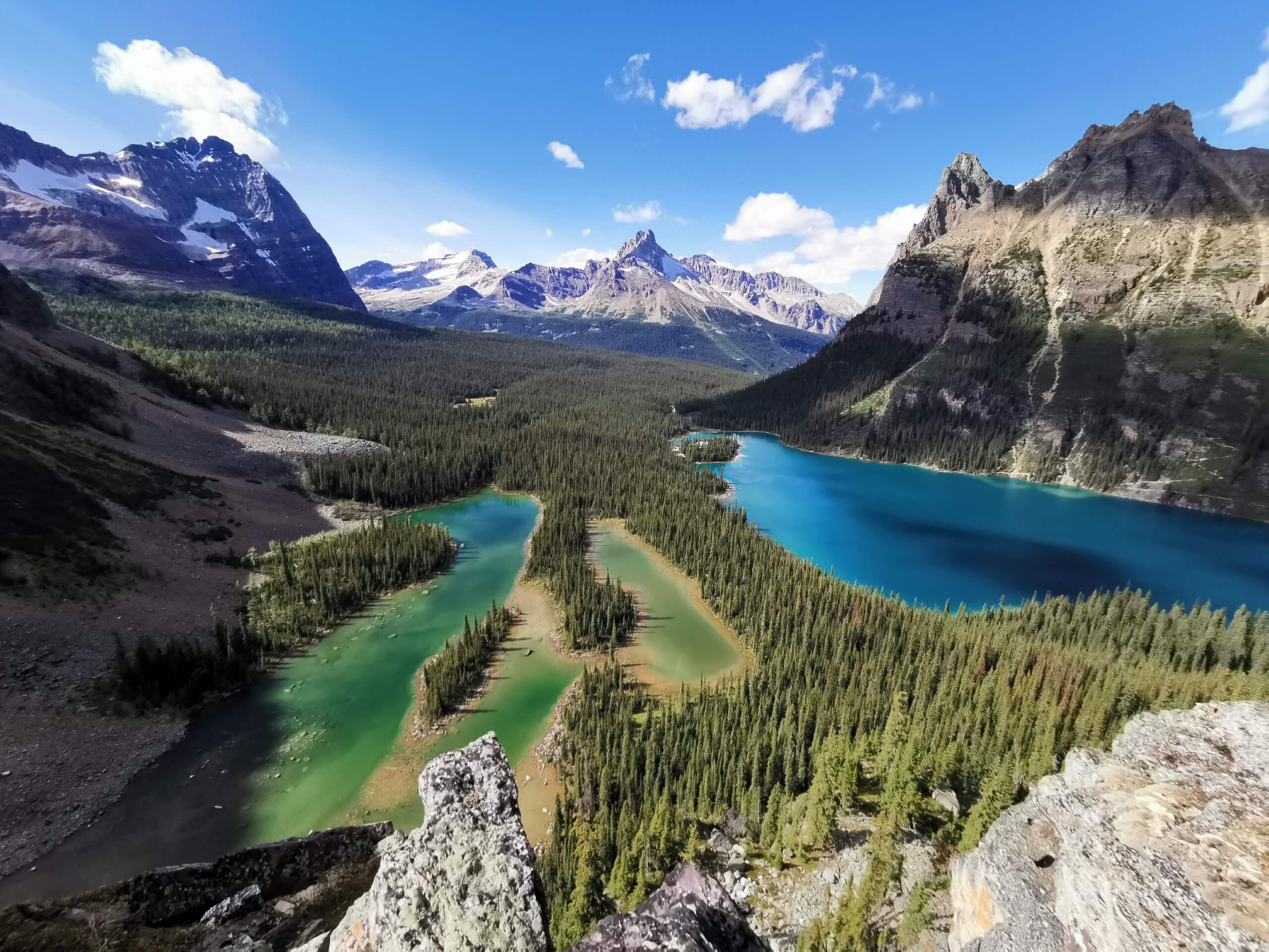
Lake O’Hara Alpine Circuit
Difficulty Rating:
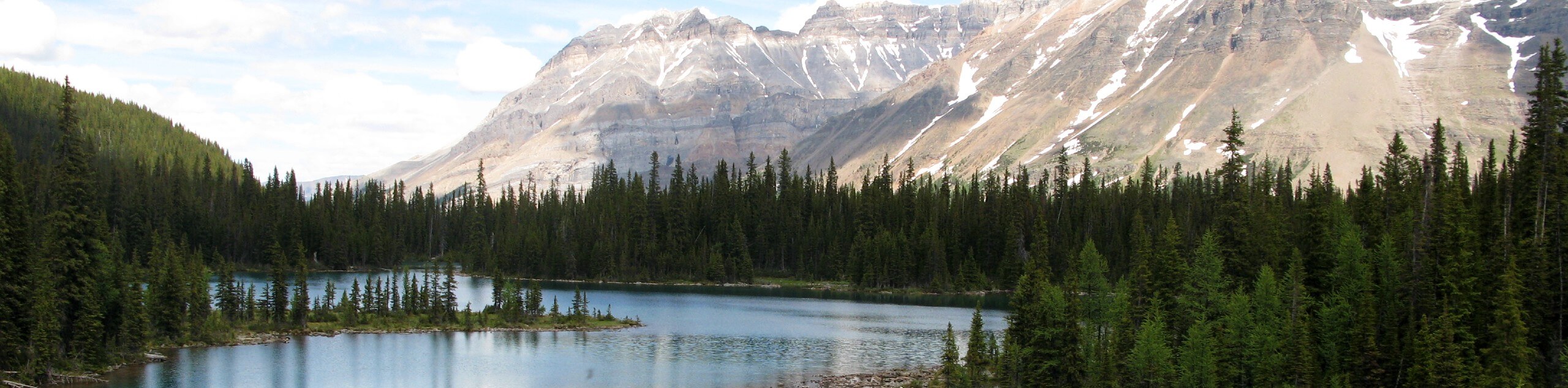
Hiking the Lake O’Hara Alpine Circuit is an amazing experience that will see you traverse the rugged, yet beautiful terrain surrounding Lake O’Hara in Yoho National Park. A fair amount of this hike takes place above the treeline, making for some incredible views overlooking the lake and dramatic peaks of the surrounding area. Remember to book your shuttle into the trailhead in advance, or else you will have to hike an extra 6.8mi each way along the service road.
Getting there
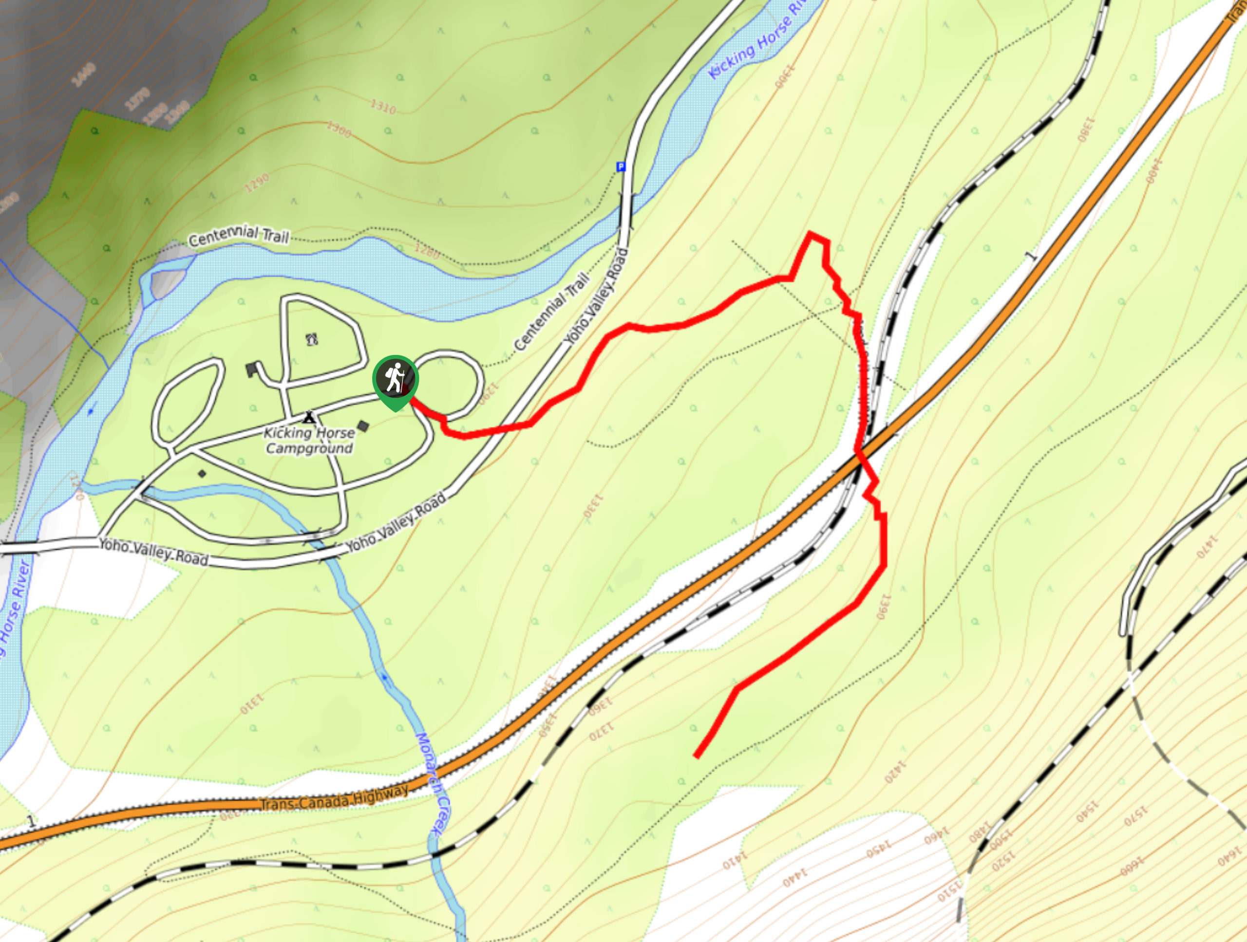
To reach the Lake O’Hara Alpine Circuit car park from Field, drive to the northeast for 8.3mi along BC-1 and turn right at O’Hara Park. Follow this for 1804ft and you will arrive at the parking lot. From here, you will need to either hike 6.8mi to the trailhead or catch your pre-reserved shuttle to the Lake O’Hara Campground.

About
| When to do | April-September |
| Backcountry Campsites | Lake O’Hara Campground |
| Pets allowed | Yes - On Leash |
| Family friendly | Older Children only |
| Route Signage | Average |
| Crowd Levels | Moderate |
| Route Type | Circuit |
Lake O’Hara Alpine Circuit
Elevation Graph
Weather
Lake O’Hara Alpine Circuit Description
The Lake O’Hara Alpine Circuit is a very popular hiking route in Yoho National Park that is fairly remote, making it accessible only through limited circumstances. If you think that you will be able to simply set your GPS and drive into the trailhead, think again. There are four different ways in which you can access the natural beauty of this amazing route: booking a campsite for up to three nights (includes a reservation on the shuttle), day-use shuttle into the trailhead (only available through a random lottery draw), and booking a stay at either the Elizabeth Parker Hut or the Lake O’Hara Lodge. If the shuttle is fully booked during the period of your camping trip, you can also hike the 6.8mi from the parking lot to reach the trailhead. More information on accessing the route can be found on the Lake O’Hara trip planning page.
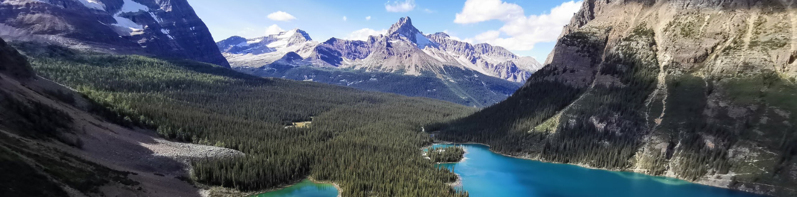
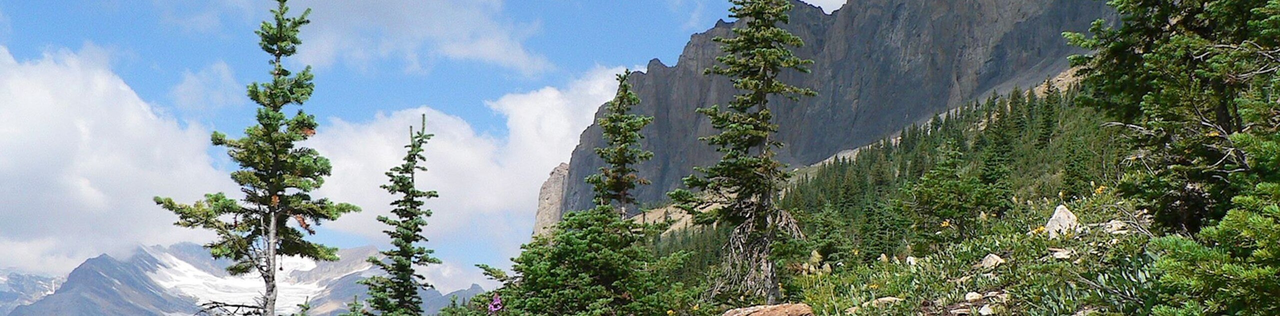
Even with the difficulty in accessing this hiking route, it is an incredible trail that will see you traverse the rugged mountains that surround the lake on three different sides, providing breathtaking views across the scenic landscape of Yoho National Park. Setting out from the trailhead at the edge of Lake O’Hara, you will make your way to the northeast and climb up the steep slopes of Wiwaxy Peaks to reach a lookout at the Wiwaxy Gap. Take a few moments to appreciate the rugged and beautiful landscape that surrounds you, before continuing east along the ridge for a short distance. From here, you will descend the mountainside to the southeast and pass by the lovely waters of Lake Oesa to skirt around the base of Mount Yukness.
At this point, you will continue on to the southwest to pass by several small lakes, where you will be exposed to amazing views of the Opabin Pass and the dramatic mountain peaks nearby. Turning your direction towards the west, you will begin to climb up the lower slopes of Mount Schaffer, before trekking across the stunning lookout at All Soul’s Prospect with its amazing views overlooking Lake O’Hara. Reaching Schaffer Lake on the opposite side of the mountain, you will turn to the northeast and follow the trail through lovely stretches of forest and picturesque meadows on the return back to the trailhead next to the lake.
Trail Highlights
Lake O’Hara
At an elevation of 6627ft above sea level, Lake O’Hara is a stunning body of water set within a picturesque swathe of alpine terrain in the heart of Yoho National Park. The lake and surrounding area are named after Colonel Robert O’Hara, an Irishman from Galway who visited the area in 1889 after being informed of the beauty of the landscape by J.J. McArthur, a surveyor working for the government. In an effort to preserve the pristine alpine ecosystem and relatively untouched nature of the area, access to the lake is limited to those with pre-reserved accommodations and transportation.
Similar hikes to the Lake O’Hara Alpine Circuit hike
A Walk in the Past Trail
The Walk in the Past Trail is a quick and easy hiking route in Yoho National Park that will lead…
Burgess Shale Hike
The Burgess Shale Hike is an amazing experience that will take you uphill along the slopes of Wapta Mountain for…
Linda Lake Hike
The Linda Lake Hike is a fantastic excursion that will lead you through some beautiful terrain in Yoho National Park…
Comments