Emerald Basin hike
View Photos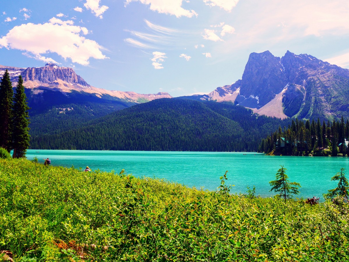
Emerald Basin hike
Difficulty Rating:
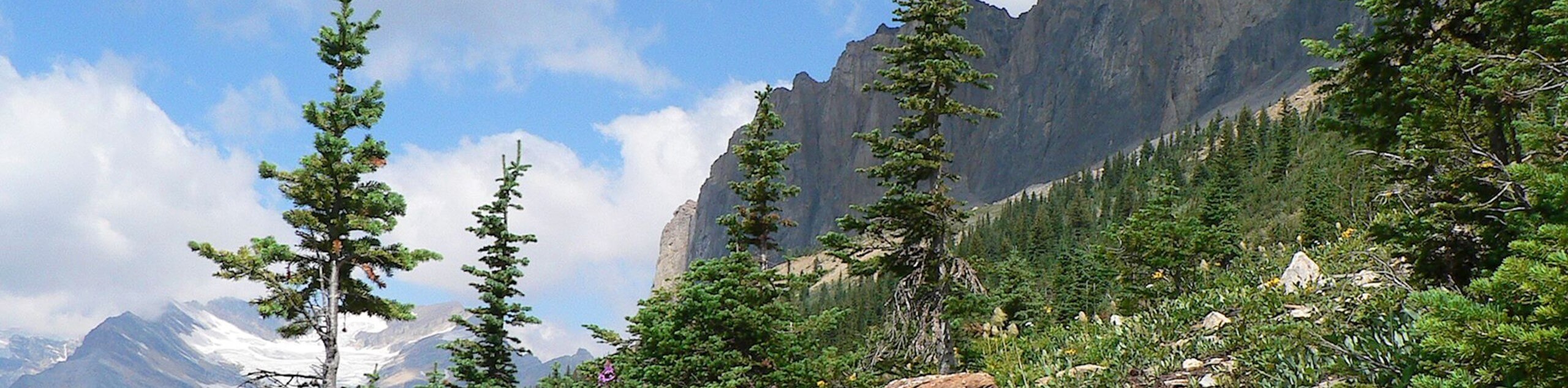
Emerald Basin is a moderate hike, taking you on a tour of Yoho’s fantastically varied terrain. You’ll hike along Emerald Lake and then up an avalanche-scoured glacial bowl ringed by waterfalls, towering peaks, and glaciers.
Getting there
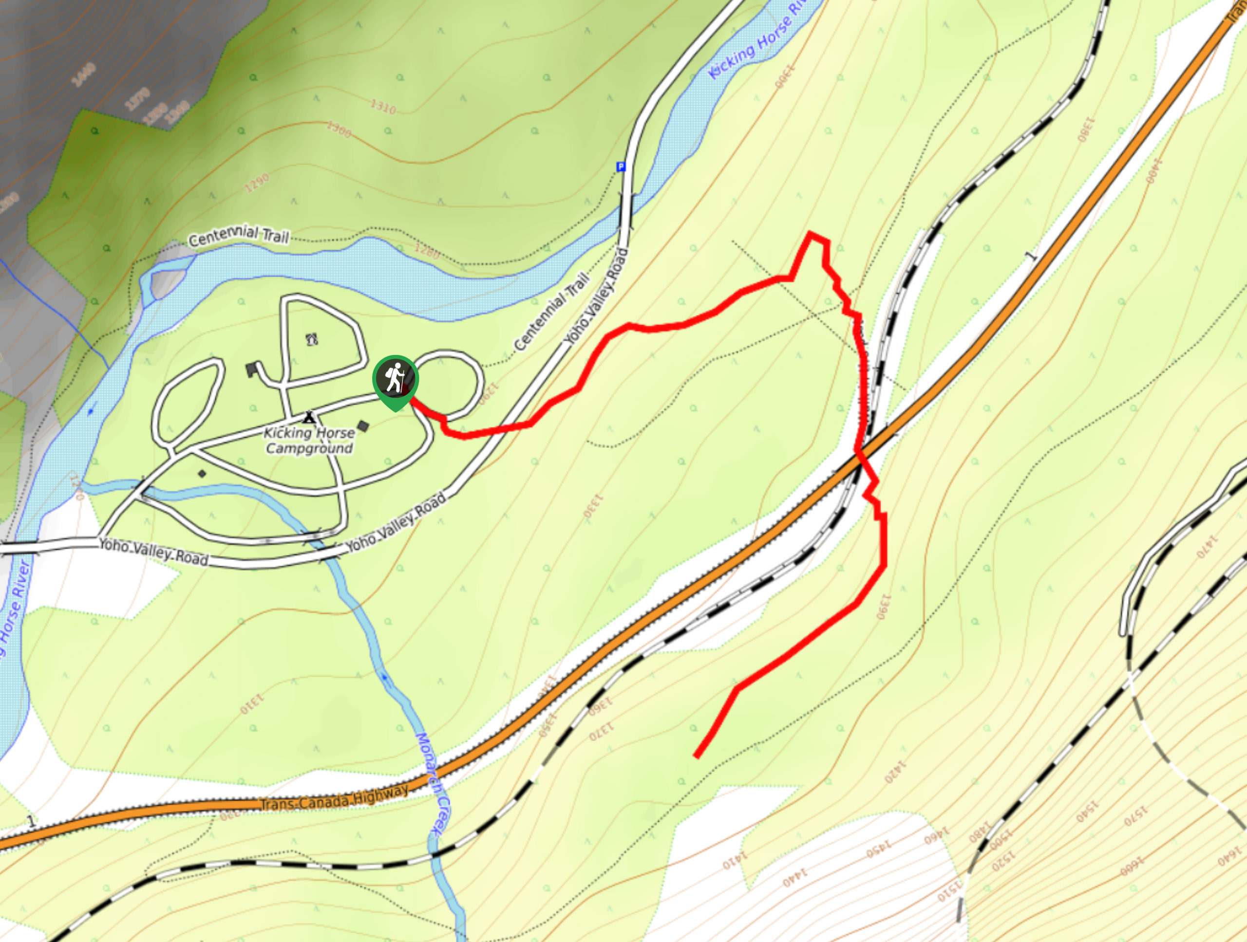
Drive west on the Trans Canada Hwy from Banff. Turn right onto the Emerald Lake Road 1.1mi past Field, BC. Continue 5.6mi and park in the Emerald Lake parking lot. The trailhead is at the north end of the parking lot.

About
| When to do | July through October |
| Backcountry Campsites | No |
| Toilets | Yes, at trailhead |
| Family friendly | Yes |
| Route Signage | Average |
| Crowd Levels | Moderate |
| Route Type | Out and back |
Emerald Basin
Elevation Graph
Weather
Route Description for Emerald Basin
The trail starts at the north (lake) end of the parking lot, by the outhouses. Walk towards the lake, you will be going along the west (left-hand) side of the lake.
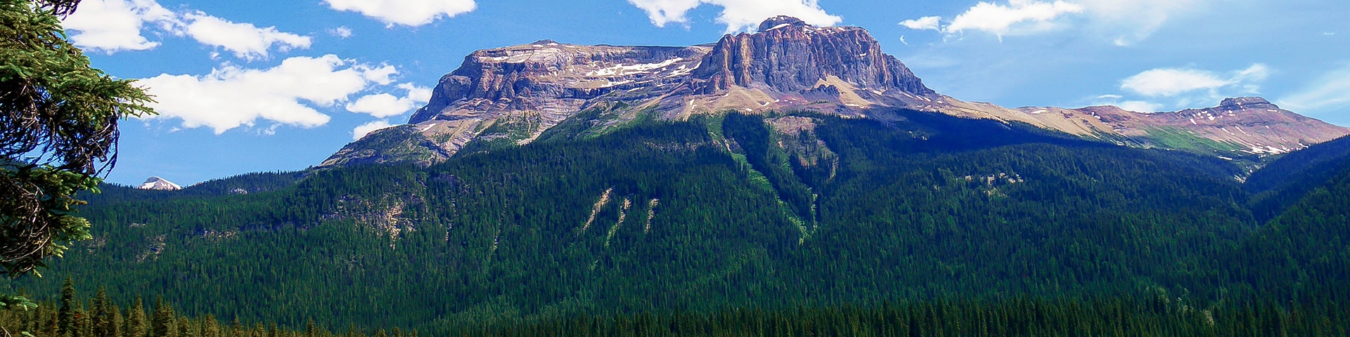
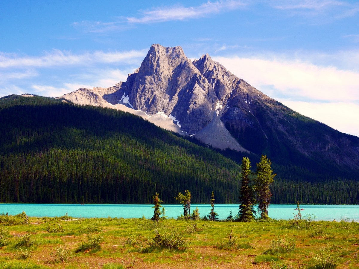
You will first pass a viewpoint and interpretive stop where you can learn about the famous Burgess Shale, a fossil deposit on the flanks of Mt Burgess, the mountain that will be dominating the first half hour of your trip.
The wide, paved trail follows the shore of Emerald Lake through the forest, until around 1312ft along when you step out into a large avalanche slope. Expect to see snow here through spring and early summer. This makes for a lovely location to photograph Emerald Lake Lodge on the opposite shore.
The trail follows the shoreline of Emerald Lake for the first 1.0mi. After that, you’ll reach the glacial outwash plain at the back of the lake. Here, streams, gradually filling the lake up, deposit sediment scoured away from the mountains by glaciers. Vegetation is thinner and smaller due to poor soil and glacial winds, but some of the trees are more than 150 years old. Turn left and follow the trail for 2297ft until you reach another junction. The trail to Emerald Basin branches off to the left.
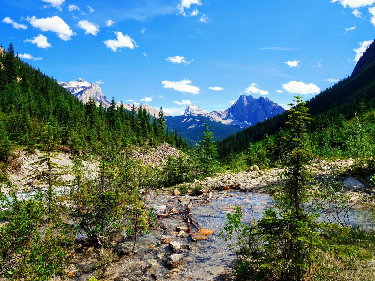
Almost immediately you begin a steep, but short climb. Nearly all the elevation gain for the trip happens here. The rocky trail ascends up the side of the canyon formed by the Emerald River, and in places you can step off the trail for a view across the chasm to Michael Peak. Looking down in the canyon looks like erosion in action. When you reach a small stand of old growth forest, the trail levels out again and is easy going for the rest of the trip. This section of forest is unusual, both for its age and its inhabitants – western red cedar, Douglas fir and western hemlock. Those species are much more typical of coastal rainforests than harsh mountain landscapes.
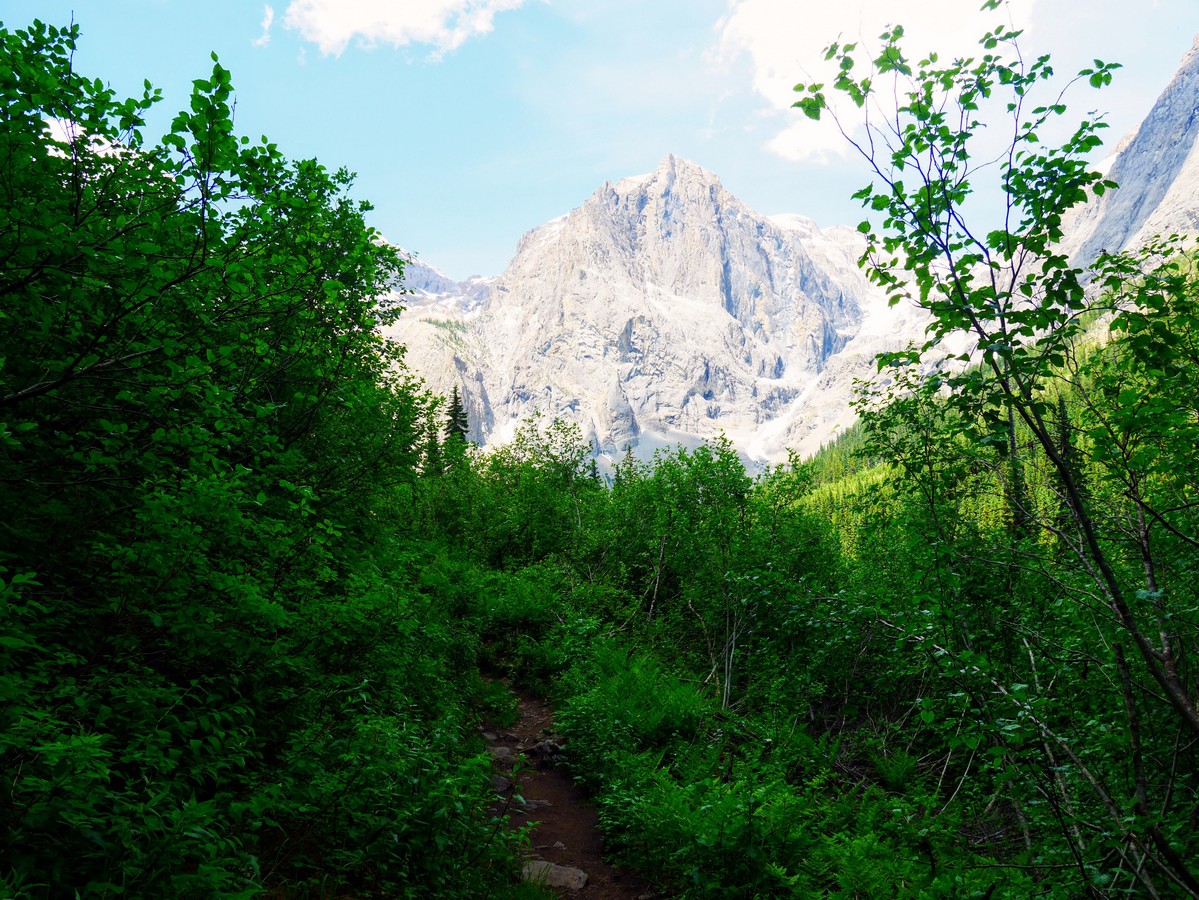
After the silence of the forest you pop out into dense jungle-like shrubbery. From here, you’ll get your first glimpse of the President – one of the peaks forming the walls of the Emerald Basin.
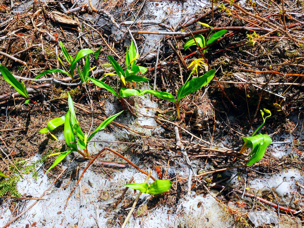
After a few minutes through the vegetation, you emerge into the avalanche battered floor of Emerald Basin. Although you are well below tree line, avalanches regularly clear vegetation from the surrounding slopes. Visiting this area in early July we crossed two patches of avalanche debris and marvelled at their power. Look out in these areas for glacier lilies – popping up where snow has recently melted. Protected meadows hold classic Rockies wildflowers like Indian paintbrush, cow parsnip, and bluebells.
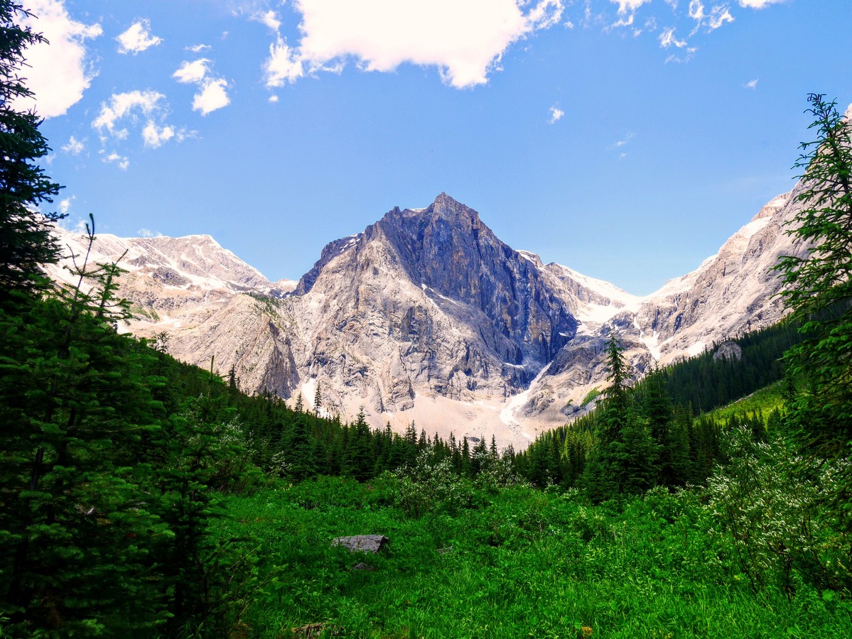
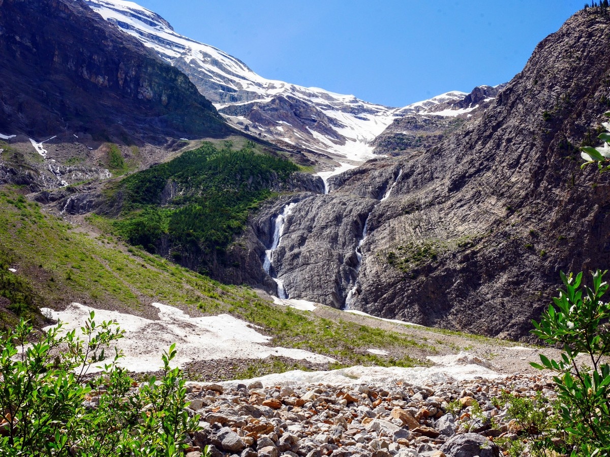
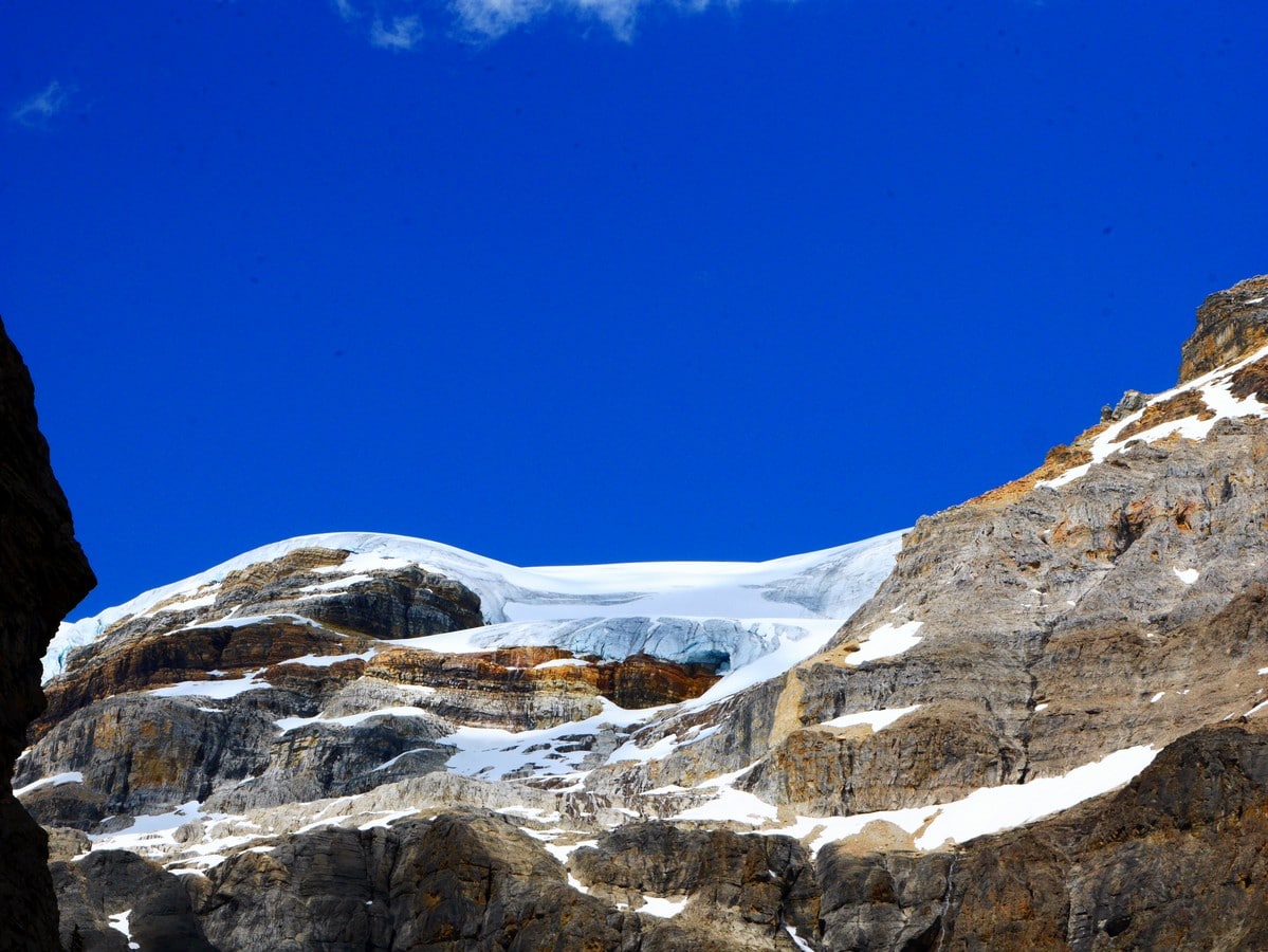
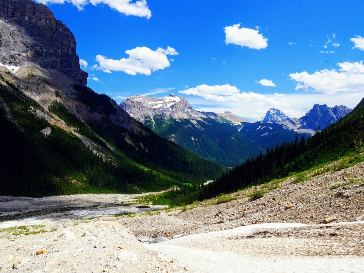
Emerald glacier is visible in the notch between the President (the large triangular peak directly in front, although not the true summit) and the Vice President, but it has retreated much in recent years. The farther you travel into the basin, the less visible it becomes. However, in its place are multiple waterfalls, cascading down the wall like cliffs now surrounding you on three sides. One of them flows into a small creek running between miniature trees that the trail crosses on a mishmash of rocks and logs.
Most vegetation is left behind as the floor of the amphitheatre turns to scree, a favourite hangout of marmots and pikas. The trail peters out here, leaving you to pick out a lunch spot amongst the boulders; although, if the weather is unpleasant you won’t want to linger too long without shelter. While stopping to eat, you may hear the tell-tale whistle of a marmot and, you could even discover one sunning himself on a rock!
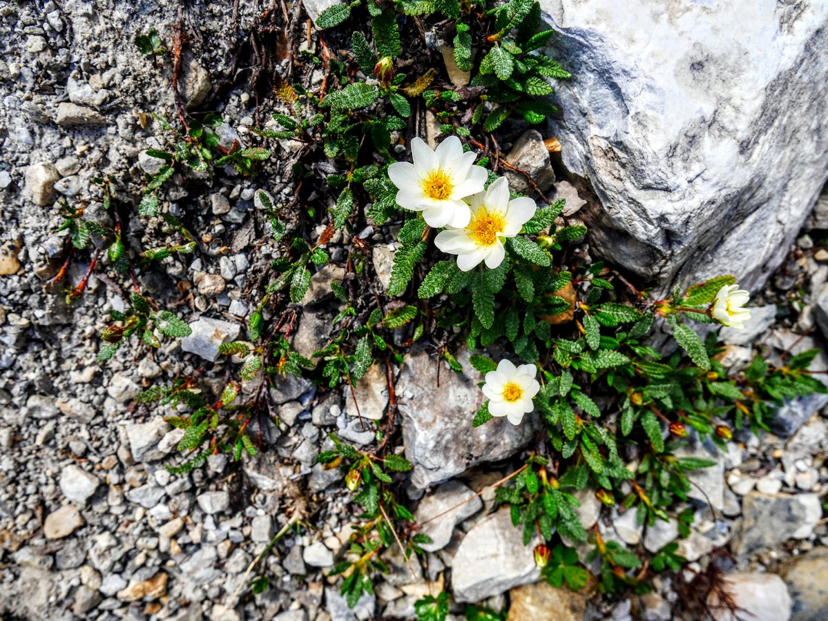
Within the basin you can explore up to the cliffs on either side, or follow bits of trails through the scree up to a pair of waterfalls tumbling from a col between Mt. Marpole and the President. This area is rough going and an easy place to roll an ankle. Hiking poles are recommended or hooves (this is a good area for spying mountain goats)! Watch out for the fragile alpine vegetation clinging to the rocks. Some of these plants can take decades to grow, so stick to the rocks when exploring!
The return trip is back the way you came, and quickly you’ll find yourself back at the shore of Emerald Lake. Here you have the option to extend your hike by completing the lake circuit, adding an extra 1.4km to your day, or admiring the spectacular backdrop of Mt. Burgess on the original route.
Insider Hints
Arrive early (before 10am, earlier on weekends) to ensure a parking space at Emerald Lake.
Check the avalanche forecast before planning your trip. Avalanche season in the Rockies is from November to June, and it’s extra risky when the snow on the mountaintops is rapidly melting in the early summer sun.
Cool off with an ice cream from the Emerald Lake Lodge after your hike, or rent a canoe from Emerald Sports, right on the lake and one of the cheapest canoe rental places in the Rockies.

Similar hikes to the Emerald Basin hike
A Walk in the Past Trail
The Walk in the Past Trail is a quick and easy hiking route in Yoho National Park that will lead…
Burgess Shale Hike
The Burgess Shale Hike is an amazing experience that will take you uphill along the slopes of Wapta Mountain for…
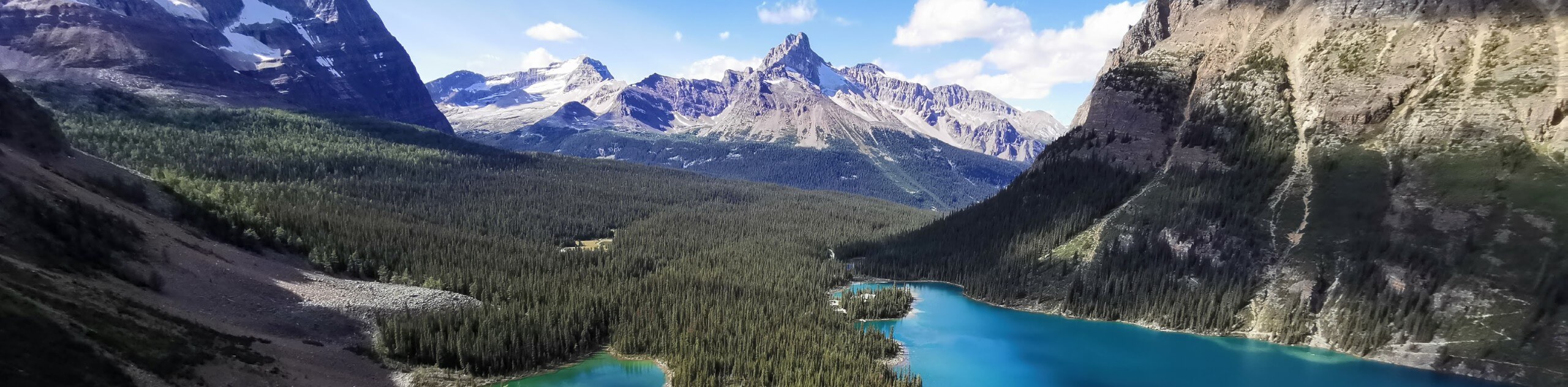
Lake O’Hara Alpine Circuit
Hiking the Lake O’Hara Alpine Circuit is an amazing experience that will see you traverse the rugged, yet beautiful terrain…
AveryJ. 4 years ago
It was an easy hike, but I never run out of interesting subjects to capture!
Aleysha C. 4 years ago
Honestly pics don’t really capture the color. We had an enjoyable morning which included a stroll around the lake, a paddle and a light lunch in the restaurant.
WendyMag. 4 years ago
Each lake we visit is amazingly beautiful, the backdrop of the mountains and the emerald water. It will never stop to amaze you.
Shad J. 4 years ago
This is a nice hike brimming with natural beauty. It reminds me of Jurassic Park somehow. Minus the dinosaurs.
Meighan 4 years ago
Beautiful short hike and fairly straight forward. The start of the trail up to the basin is a little challenging but beyond that very enjoyable.
Jango l. 4 years ago
I'm searching for the right words to describe its beauty, but I can't. Glad to be able to share the lovely views with my loved ones.
Olivia P. 4 years ago
It was a full day of lovely scenery, twisting and winding roads with my sweetheart.
Tara Green 4 years ago
Hiking up the basin trail is roughly a 3 hour out and back and The Emerald Lake is beautiful and the basin is well-worth the visit
kristinoutdoors 4 years ago
I just did this hike as a season starter on June 14, 2020. The trail is clear except for a small patch of snow (easy to walk around) and a few fallen trees to climb under. We had to hop over a couple of streams. Even in the rain, it was a very enjoyable hike with unexpected beauty (snow-capped mountains?? Yes, please!).
Albert W. 4 years ago
Unbelievable wonders of nature! Everything was fantastic! The glaciers, towering peaks, waterfalls, woodlands and vistas....