
Wheeler Ranch Trail
View Photos
Wheeler Ranch Trail
Difficulty Rating:
The Wheeler Ranch Trail is a relatively undiscovered hiking route in the foothills of the Wind River Range. Explore a swathe of wilderness occupied by mixed-pine woodlands, lush meadows, seasonal creeks, and of course, wildlife.
Getting there
The Wheeler Ranch Trail is accessed via East Fork Cottonwood Road.

About
| Backcountry Campground | Backcountry Camping |
| When to do | May-October |
| Pets allowed | Yes - On Leash |
| Family friendly | Older Children only |
| Route Signage | Average |
| Crowd Levels | Low |
| Route Type | Out and back |
Wheeler Ranch Trail
Elevation Graph
Weather
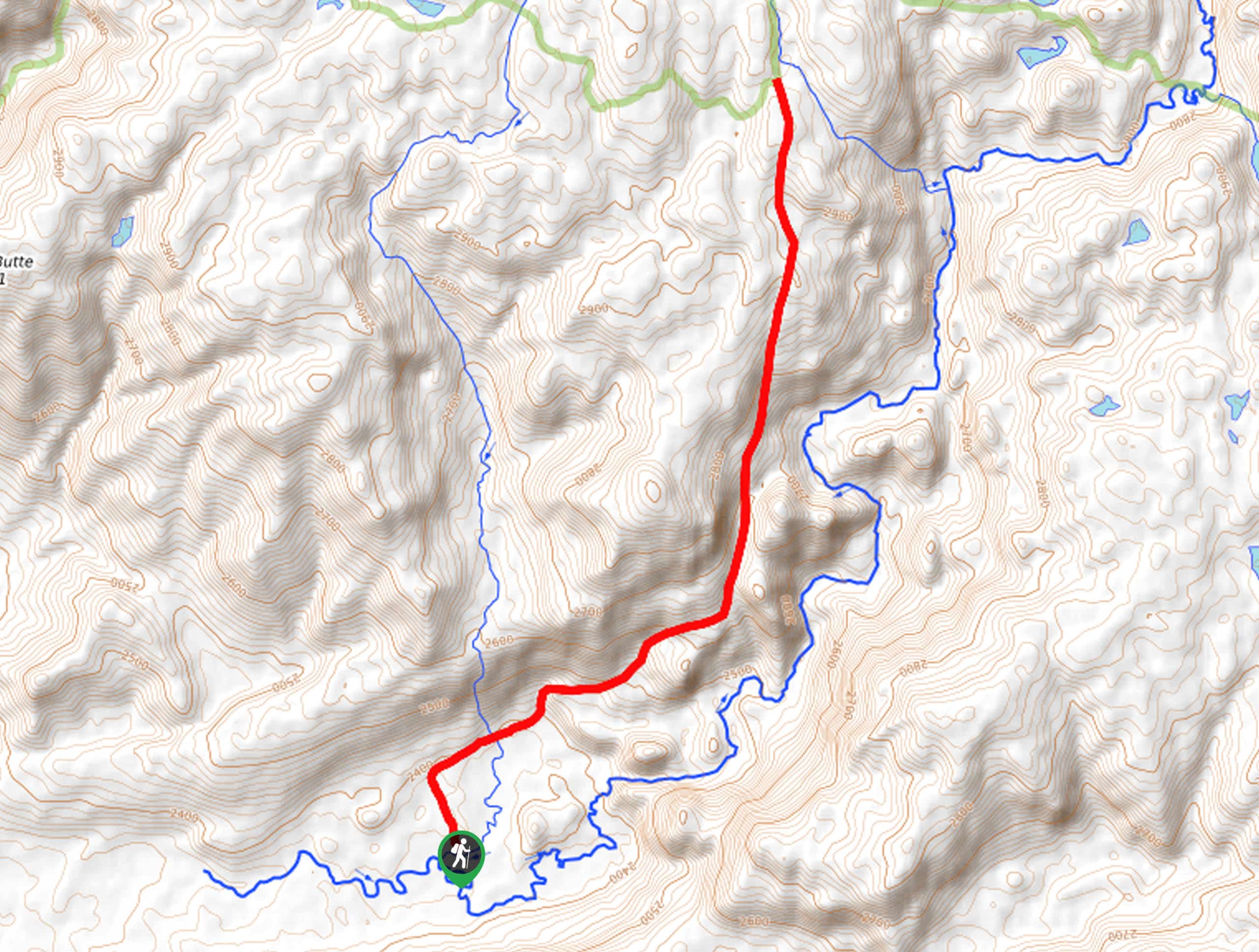
Wheeler Ranch Trail Description
Treat yourself to a tranquil adventure on the Wheeler Ranch Hike. This incredible trail offers motivating views of the Wind River Mountains commanding the skyline as you explore the foothills. While the exposed terrain along the route offers great views, it also warrants extremely hot conditions in the summer months, so wear SPF and pack plenty of water! Like all types of exploration in the area, it is important to be mindful of bears, so we encourage at least one person in your party to carry bear spray!
Your journey along the Wheeler Ranch Trail begins from the trailhead off East Fork Cottonwood Road. While signposted, the trail is overgrown in sections, so consider using the trail GPS to easily navigate the route. Heading northeastward, the path will gently climb through meadows and into a stand of mixed pines. For the entirety of the hike, you will be woven through exposed terrain, and shaded forests adorned with granite outcrops– mind your footing on the uneven terrain.
After some hiking, Aspen Butte and Chimney Butte will become visible in the west and the Twin Butte in the north. You will ultimately reach the trail’s end at the intersection with the Lowline Trail. Take the time to revel in the view of the snow-dusted granite crests in the east. When you are through appreciating the scenery, head back the way you came to the trailhead.
Similar hikes to the Wheeler Ranch Trail hike
Glacier Trail
The Glacier Trail is a demanding day hike in the Winds that boasts a scenic and secluded experience. Wander through…
Upper Brewers Trail
The charm of a one-way trek is unrivaled. Enjoy new scenery every step of the way as you hike the…
Sheep Bridge Trail
The Sheep Bridge Trail checks all the boxes—short, scenic, and secluded. What more could you ask for? Mountain views? It…
Comments