
Jim Lake Trail
View Photos
Jim Lake Trail
Difficulty Rating:
The Jim Lake Trail is a beautiful adventure that boasts scenery and solitude. Exhibiting the diversity of the area’s flora and fauna, in addition to stunning views of the soaring granite crests, this route packs a punch!
Getting there
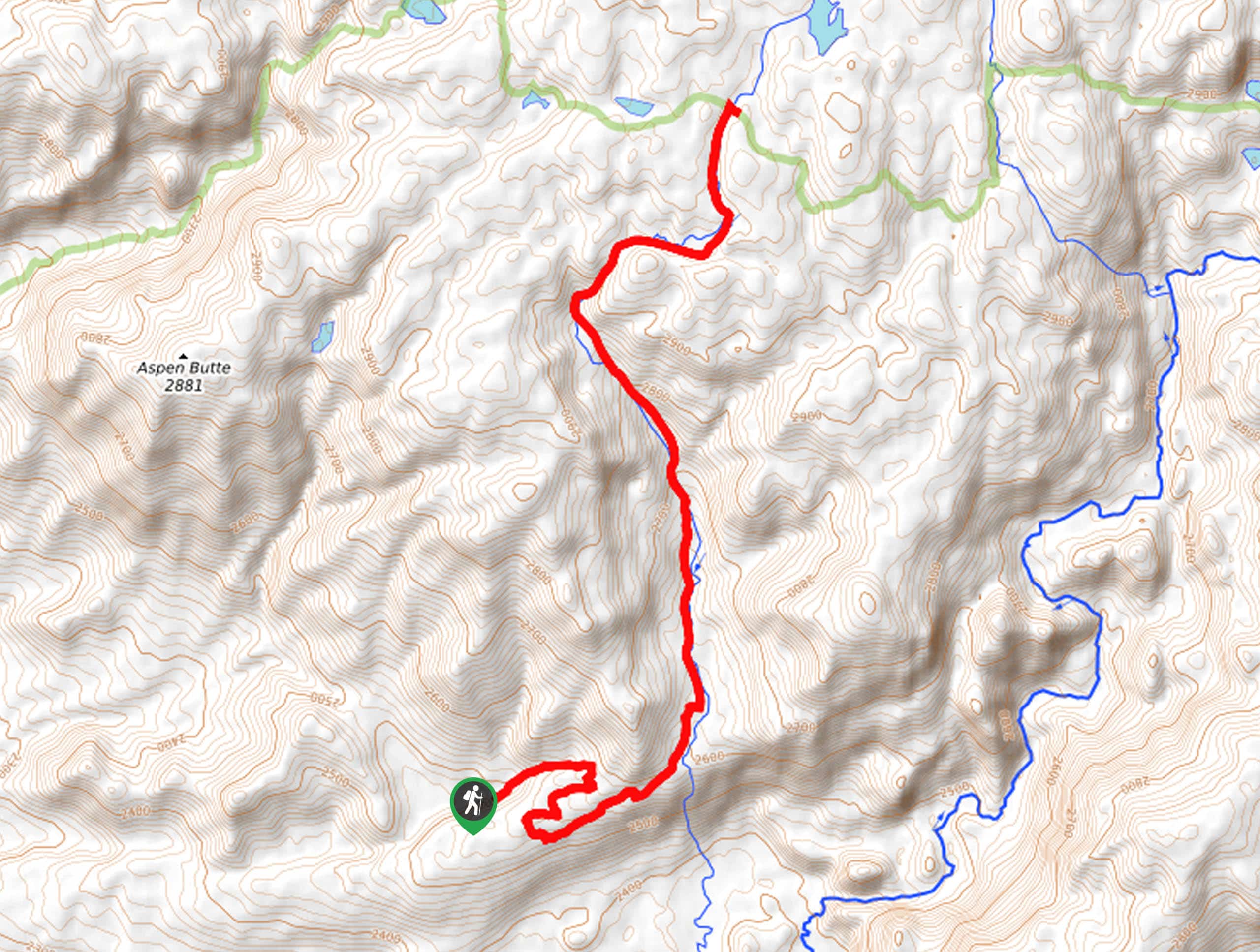
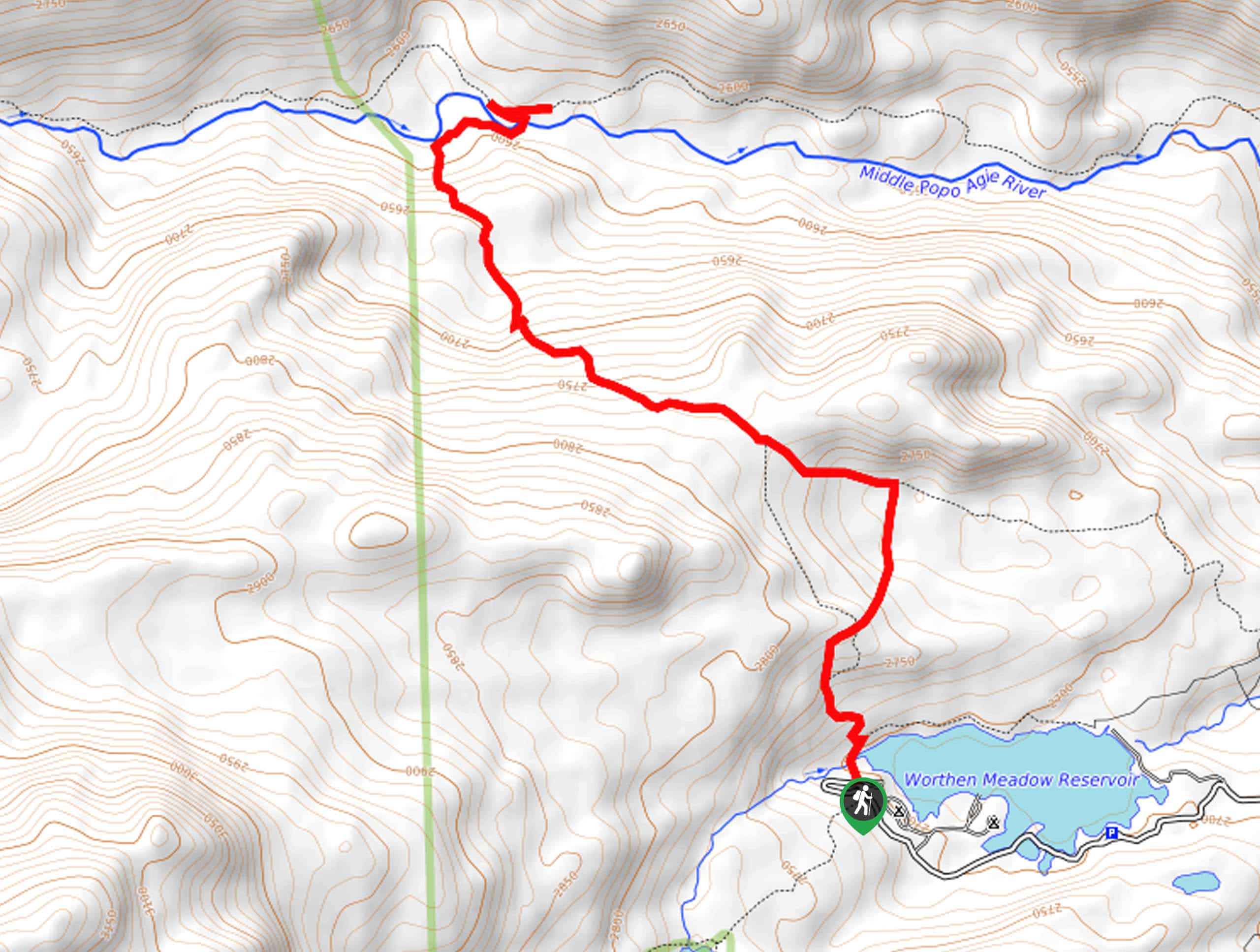
Find the trailhead off Pocket Creek Road.

About
| Backcountry Campground | Backcountry Camping |
| When to do | May-October |
| Pets allowed | Yes - On Leash |
| Family friendly | Older Children only |
| Route Signage | Average |
| Crowd Levels | Low |
| Route Type | Out and back |
Jim Lake Trail
Elevation Graph
Weather
Jim Lake Trail Description
Get outside and reconnect with nature along the Jima Lake Trail. Explore lush meadows blossoming with wildflowers, dense woodlands, snowmelt streams, and glittering lakes. Traveling through various terrains, we encourage hikers to dress in layers as insurance against changing conditions. Additionally, as the route is lightly trafficked and primitive in areas, we suggest downloading the trail GPS before departure to easily navigate the terrain. As with all sorts of exploration of the area, make sure you are mindful of wildlife and consider carrying a can of bear spray.
Setting out from the trailhead off Pocket Creek Road, your adventure follows the Jim Lake Trail. This lovely path follows the meandering Jim Creek through the ever-changing terrain. While the climb is gradual, it is tiring, so take breaks as needed. In the spring, you will be rewarded with the sights of blossoming wildflowers adorning the meadowlands. After some hiking, Aspen Butte and Chimney Butte will rise from the western landscape. Continue hiking along the gurgling creek, and you will eventually reach an intersection with the Lowline Trail.
From here, track north to Jim Lake. Admire the view of the snow-dusted Winds commanding the eastern skyline, then head back to the trailhead the way you came.
Similar hikes to the Jim Lake Trail hike
Glacier Trail
The Glacier Trail is a demanding day hike in the Winds that boasts a scenic and secluded experience. Wander through…
Upper Brewers Trail
The charm of a one-way trek is unrivaled. Enjoy new scenery every step of the way as you hike the…
Sheep Bridge Trail
The Sheep Bridge Trail checks all the boxes—short, scenic, and secluded. What more could you ask for? Mountain views? It…
Comments