
Glacier Trail
View Photos
Glacier Trail
Difficulty Rating:
The Glacier Trail is a demanding day hike in the Winds that boasts a scenic and secluded experience. Wander through lush montane meadows, explore alpine forests and enjoy the scenes of cascading snow-melt creeks.
Getting there
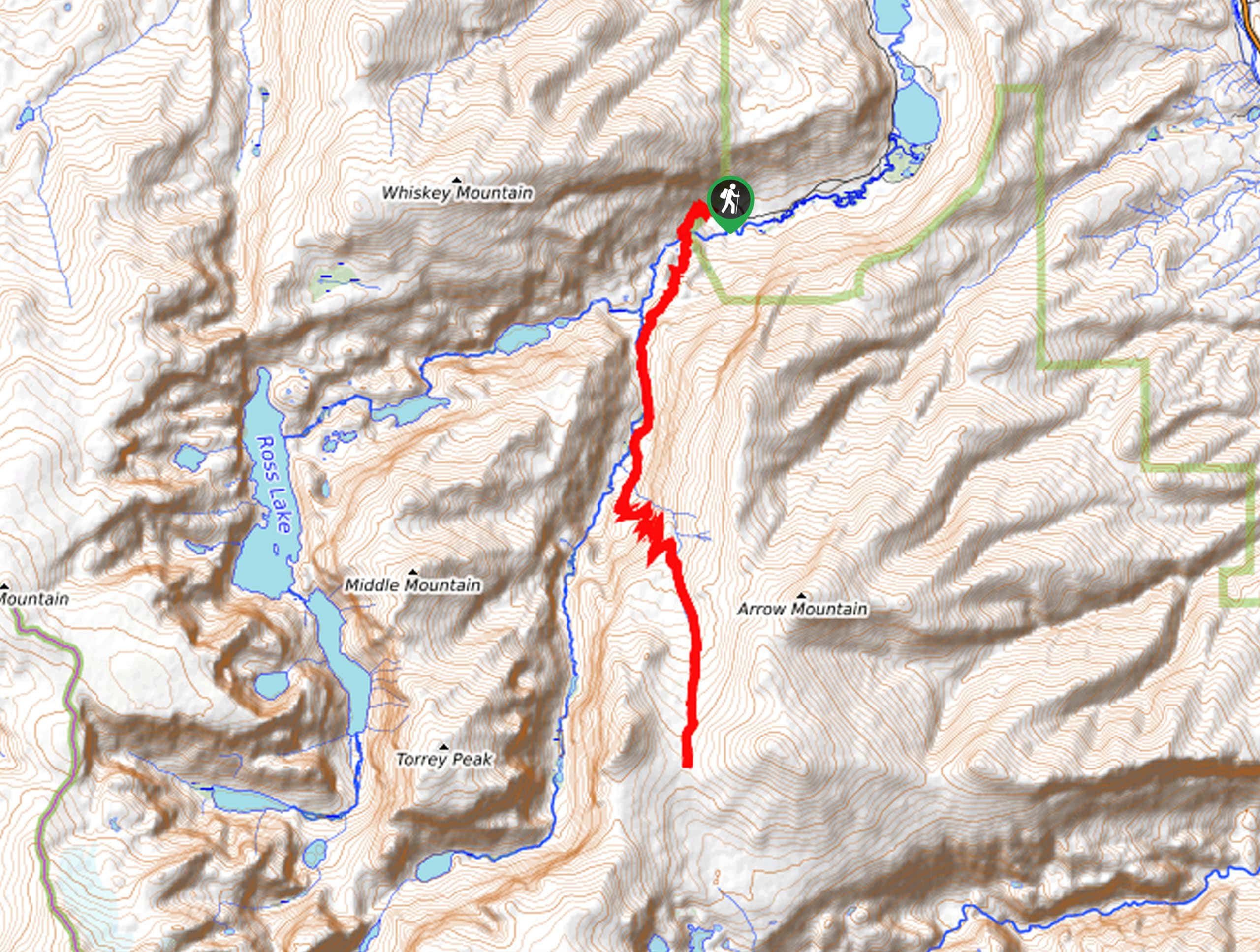
The Glacier Trail is accessed via the Glacier Trailhead off Trail Lake Road.

About
| Backcountry Campground | Backcountry Camping |
| When to do | April-October |
| Pets allowed | Yes - On Leash |
| Family friendly | No |
| Route Signage | Average |
| Crowd Levels | Moderate |
| Route Type | Out and back |
Glacier Trail
Elevation Graph
Weather
Glacier Trail Description
Hiking the Glacier Trail affords anyone a good time. While demanding, this fantastic adventure boasts incredible scenery that is well worth the sweat. As this route explores a diversity of terrain, we encouraged hikers to dress in layers as insurance against changing conditions. Additionally, much of the path is rocky and uneven, so make sure you wear a sturdy pair of footwear. As with all sorts of exploration in the area, make sure you are bear aware and carry a can of bear spray.
Setting out from the trailhead off Trail Lake Road, the Glacier Trail will guide you up a set of switchbacks and over a footbridge over Torrey Creek. Marvel in the scene of the water cascading through the craggy canyon, then begin your climb. Heading southwardly, you will be granted impressive views of the rugged slopes of Whiskey Mountain and Torrey Peak. Dipping beneath the tree canopy, the path will near East Torrey Creek into Upper Bomber Basin.
Eventually, the route will guide you up a set of switchbacks through the montane meadows and ultimately up to the pass below Arrow Mountain. Revel in the panoramic scenery, then head back down the mountain the way you came.
Similar hikes to the Glacier Trail hike
Sheep Bridge Trail
The Sheep Bridge Trail checks all the boxes—short, scenic, and secluded. What more could you ask for? Mountain views? It…
Francis Lake Trail
The Francis Lake Trail is a great hike worth the detour into the Winds. While this area is extremely popular,…
Jim Lake Trail
The Jim Lake Trail is a beautiful adventure that boasts scenery and solitude. Exhibiting the diversity of the area’s flora…
Comments