
Upper Brewers Trail
View Photos
Upper Brewers Trail
Difficulty Rating:
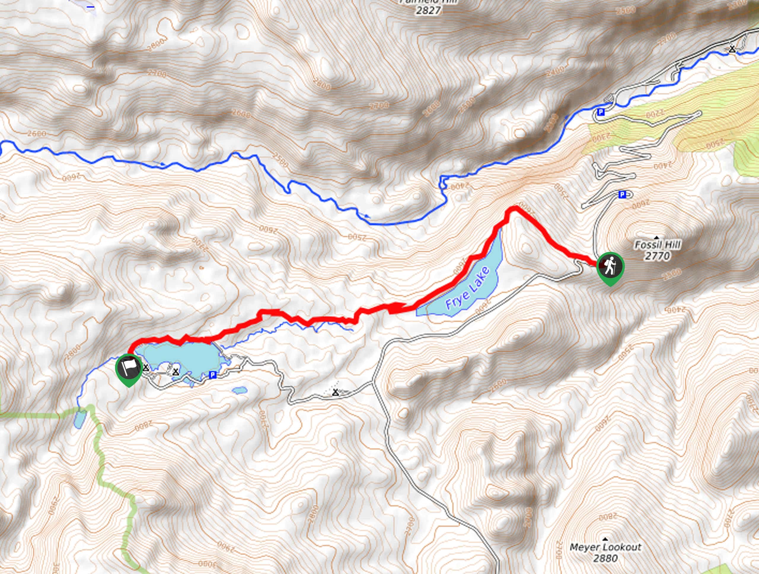
The charm of a one-way trek is unrivaled. Enjoy new scenery every step of the way as you hike the Upper Brewers Trail. This lovely adventure out of Sinks Canyon explores aspen groves, scrub pines, and lush grasslands as it passes two shimmering lakes.
Getting there
The Upper Brewers Trail departs from the trailhead off Louis Lake Road.

About
| Backcountry Campground | |
| When to do | April-October |
| Pets allowed | Yes - On Leash |
| Family friendly | Yes |
| Route Signage | Average |
| Crowd Levels | Moderate |
| Route Type | One Way |
Upper Brewers Trail
Elevation Graph
Weather
Upper Brewers Trail Description
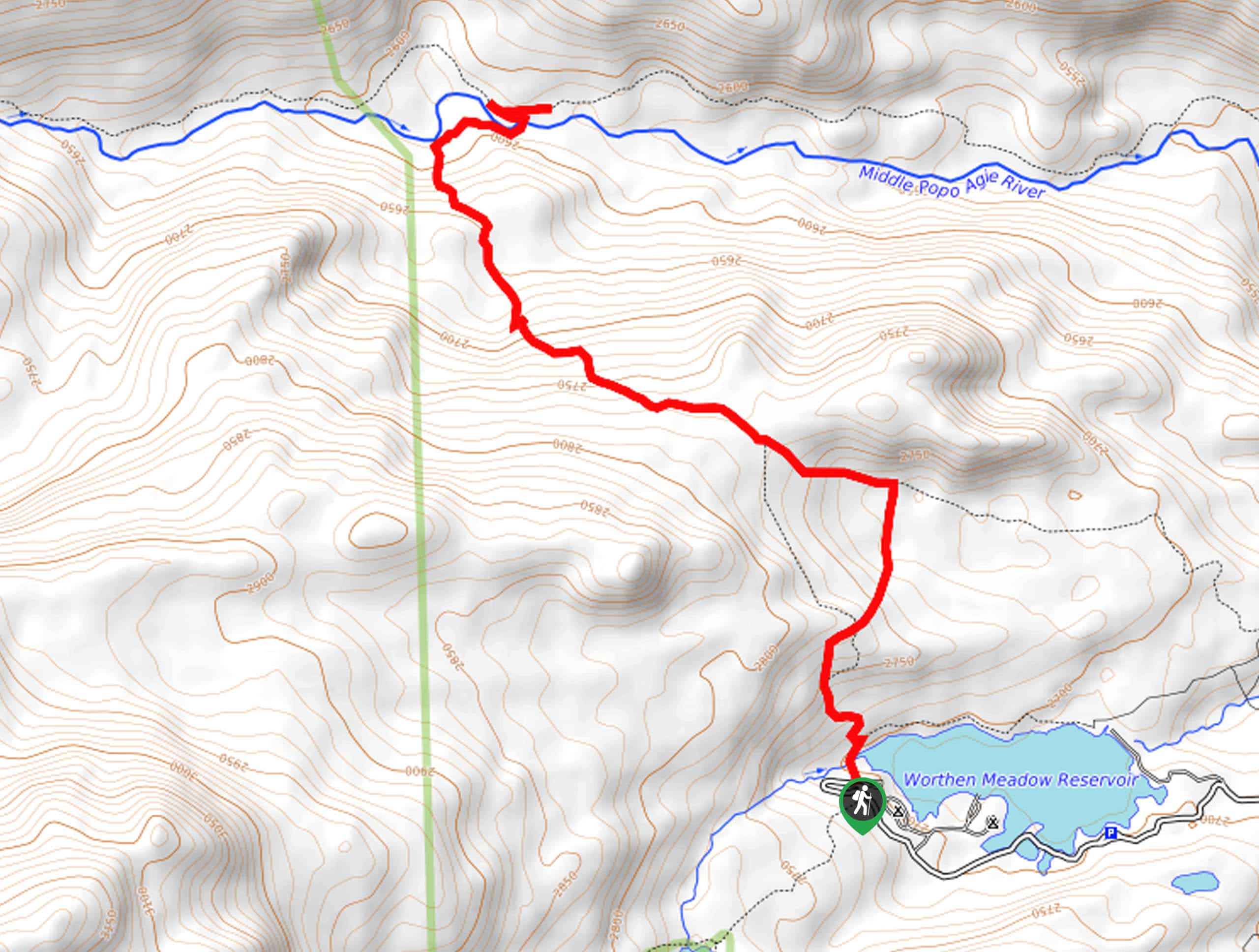
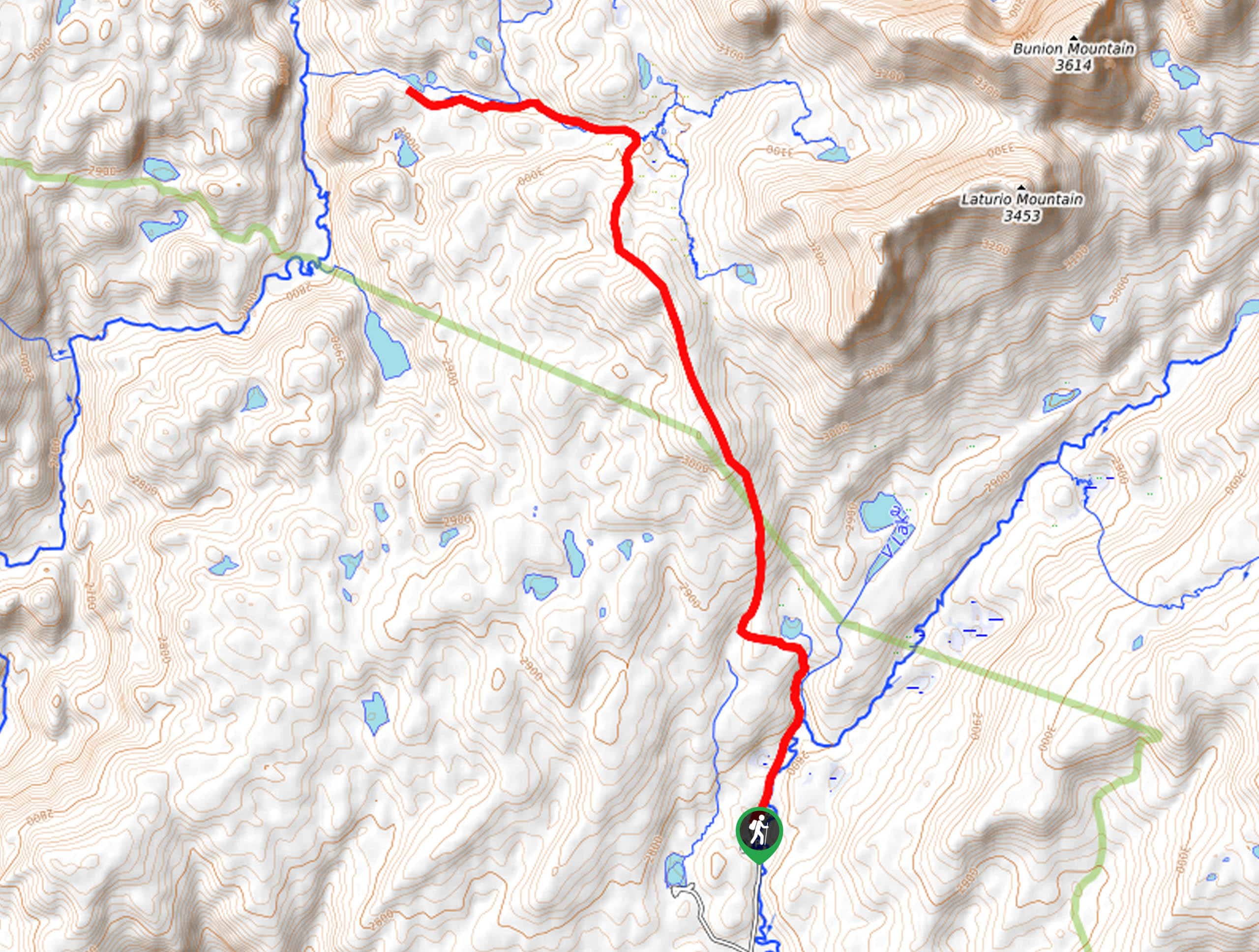
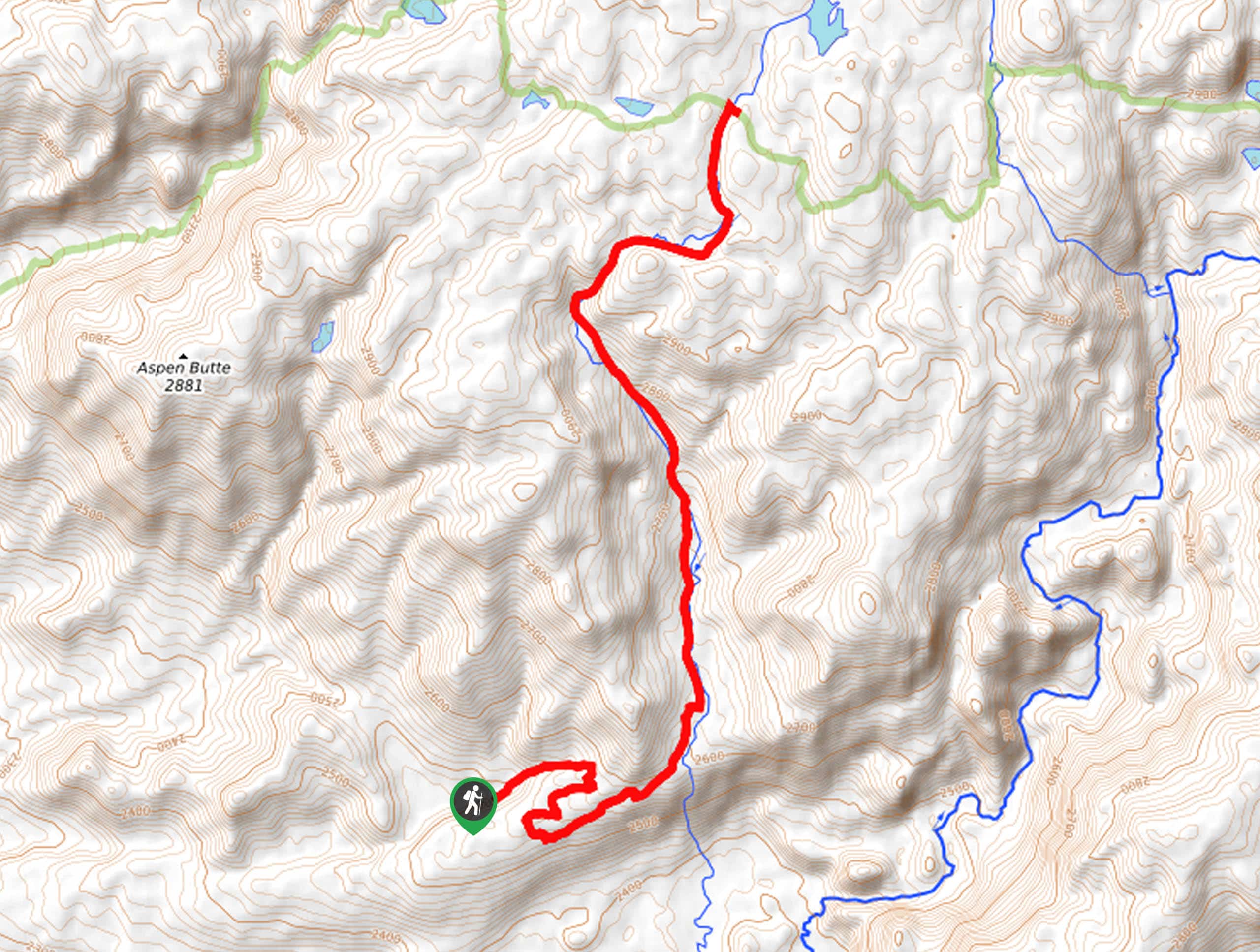
Explore the great outdoors and reconnect with nature as you hike the Upper Brewers Trail. Located in a relatively isolated area in the Wind River Range, this trail sees little traffic, so you will likely enjoy the tranquility. While the hike is manageable, there are a few sections of steep, rocky terrain, so take your time and mind your footing. Additionally, this path is shared with bikers and horseback riders, so it is important to be wary of passers-by. Note this is a point-to-point hike, so make sure you arrange for pick up or leave a vehicle at the trail’s end.
Setting out from the trailhead off Louis Lake Road, you will be guided westwardly along the Upper Brewers Trail. Gradually climbing uphill, the path will soon approach the shoreline of Frye Lake. Meandering along the lakeshore, you will be granted lovely views of the shimmering lake and the bounding forests and hills. After some hiking, you will be diverted back into the woodlands of mixed pines, aspens, and grasslands. Traveling west, the route will be near a creek before opening to Worthen Meadow Reservoir.
Trekking above the lake, you will once again be rewarded with the mesmerizing scenery of a crystalline lake. You will ultimately reach the trail’s end at the Worthen Meadow Campground. If you wish, you can easily retrace your footing back to the trailhead where you began your adventure.
Similar hikes to the Upper Brewers Trail hike
Sheep Bridge Trail
The Sheep Bridge Trail checks all the boxes—short, scenic, and secluded. What more could you ask for? Mountain views? It…
Francis Lake Trail
The Francis Lake Trail is a great hike worth the detour into the Winds. While this area is extremely popular,…
Jim Lake Trail
The Jim Lake Trail is a beautiful adventure that boasts scenery and solitude. Exhibiting the diversity of the area’s flora…
Comments