
Blueberry Lake Trail
View Photos
Blueberry Lake Trail
Difficulty Rating:
Ready to break a sweat? The Blueberry Trail is an epic adventure up to a beautiful alpine lake overlooking the Wind River Range. While shorter than most hikes in the area, this route demands a steep climb, so be sure to pack plenty of water!
Getting there
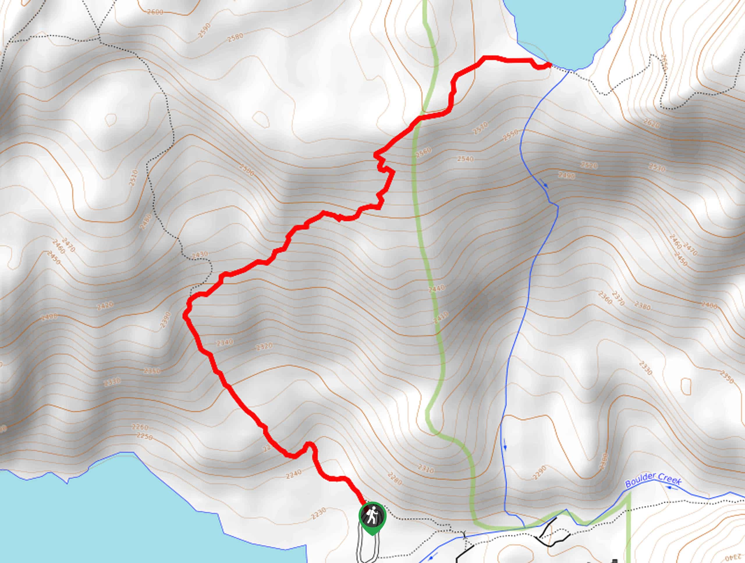
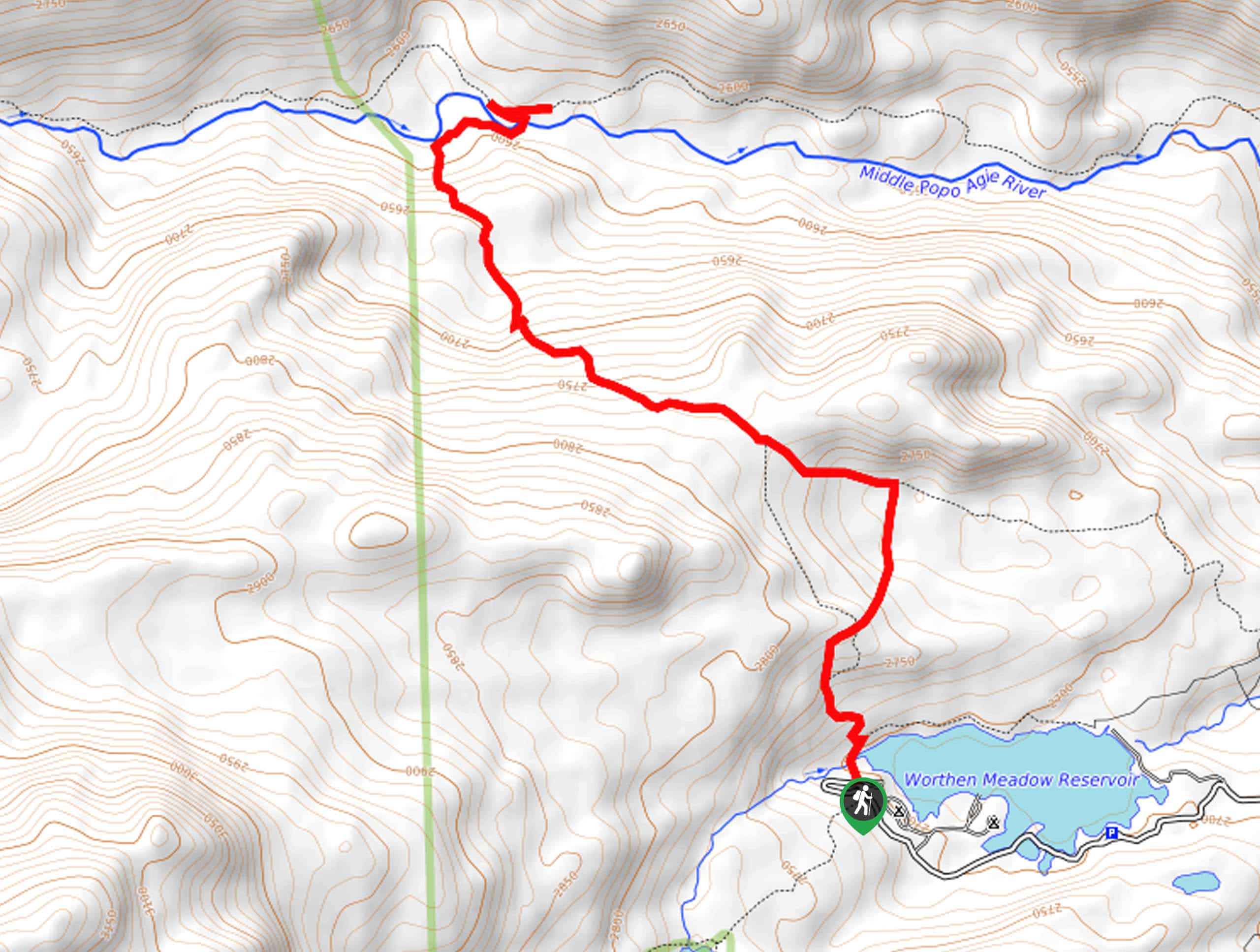
The Blueberry Lake Hike departs from the Burnt Connection Trailhead off Bridger Drive.

About
| Backcountry Campground | Backcountry Camping |
| When to do | May-October |
| Pets allowed | Yes - On Leash |
| Family friendly | Older Children only |
| Route Signage | Average |
| Crowd Levels | Moderate |
| Route Type | Out and back |
Blueberry Lake Trail
Elevation Graph
Weather
Blueberry Lake Trail Description
Indulge yourself with spellbinding views of the Wind River Range, nearby lakes, and the distant plains. Boasting perfect postcard scenery, this route is not without its challenges. The climb up to Blueberry Lake is gradual but intense. Come prepared to navigate some blowdown and experience some extreme conditions from the exposed terrain. Pack plenty of water to stay hydrated, and wear a sturdy pair of footwear! Note that while bear encounters are unlikely, encouraged hikers to bring bear spray, just in case.
Embark on your adventure from the Burnt Connection Trailhead. From here, you will be guided southwest along the ridges above Boulder Lake. Enjoy the views of the glittering lake and, in the spring, revel in the sight of the blossoming wildflowers. After some hiking, you will reach a junction. Here, veer right, and you will be diverted onto the Blueberry Lake Trail. Beyond this point, you will begin a more intense climb up to the charming alpine lake.
From the lakeshore, you will be granted impressive views of the foothills, the nearby alpine lakes, and distant views of the plains. Notice Burnt Lake in the northwest and Boulder Lake in the southwest. When you are through admiring the scenery, retrace your footing back to the trailhead.
Similar hikes to the Blueberry Lake Trail hike
Glacier Trail
The Glacier Trail is a demanding day hike in the Winds that boasts a scenic and secluded experience. Wander through…
Upper Brewers Trail
The charm of a one-way trek is unrivaled. Enjoy new scenery every step of the way as you hike the…
Sheep Bridge Trail
The Sheep Bridge Trail checks all the boxes—short, scenic, and secluded. What more could you ask for? Mountain views? It…
Comments