Johnny Behind the Rocks Trail
View Photos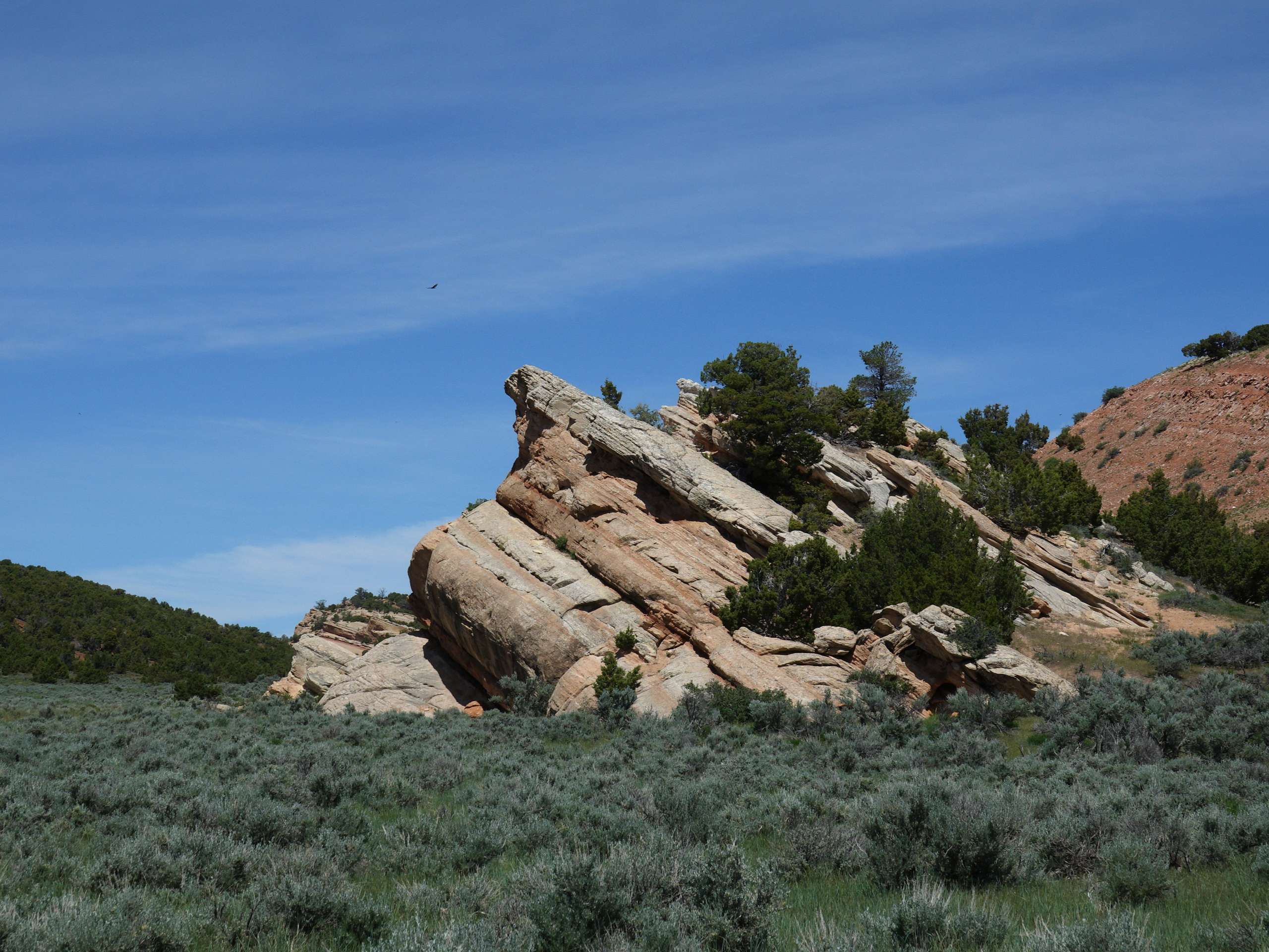
Johnny Behind the Rocks Trail
Difficulty Rating:
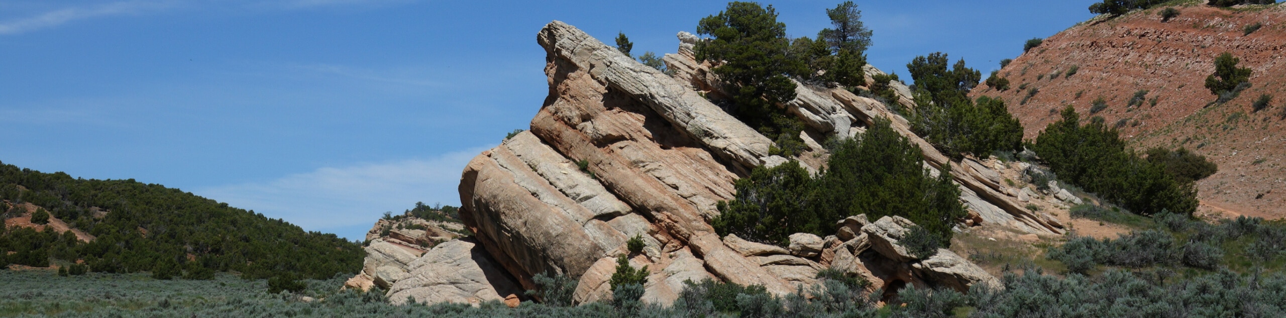
The Johnny Behind the Rocks Trail is a popular weekend destination for mountain bikers and hikers alike. Explore the desert-like terrain occupied with dense communities of sagebrush, pinyon-juniper woodland, and unique geological features.
Getting there
Johnny Behind the Rocks is located off Hwy 287.

About
| Backcountry Campground | No |
| When to do | June-October |
| Pets allowed | Yes - On Leash |
| Family friendly | Older Children only |
| Route Signage | Average |
| Crowd Levels | High |
| Route Type | Lollipop |
Johnny Behind the Rocks Trail
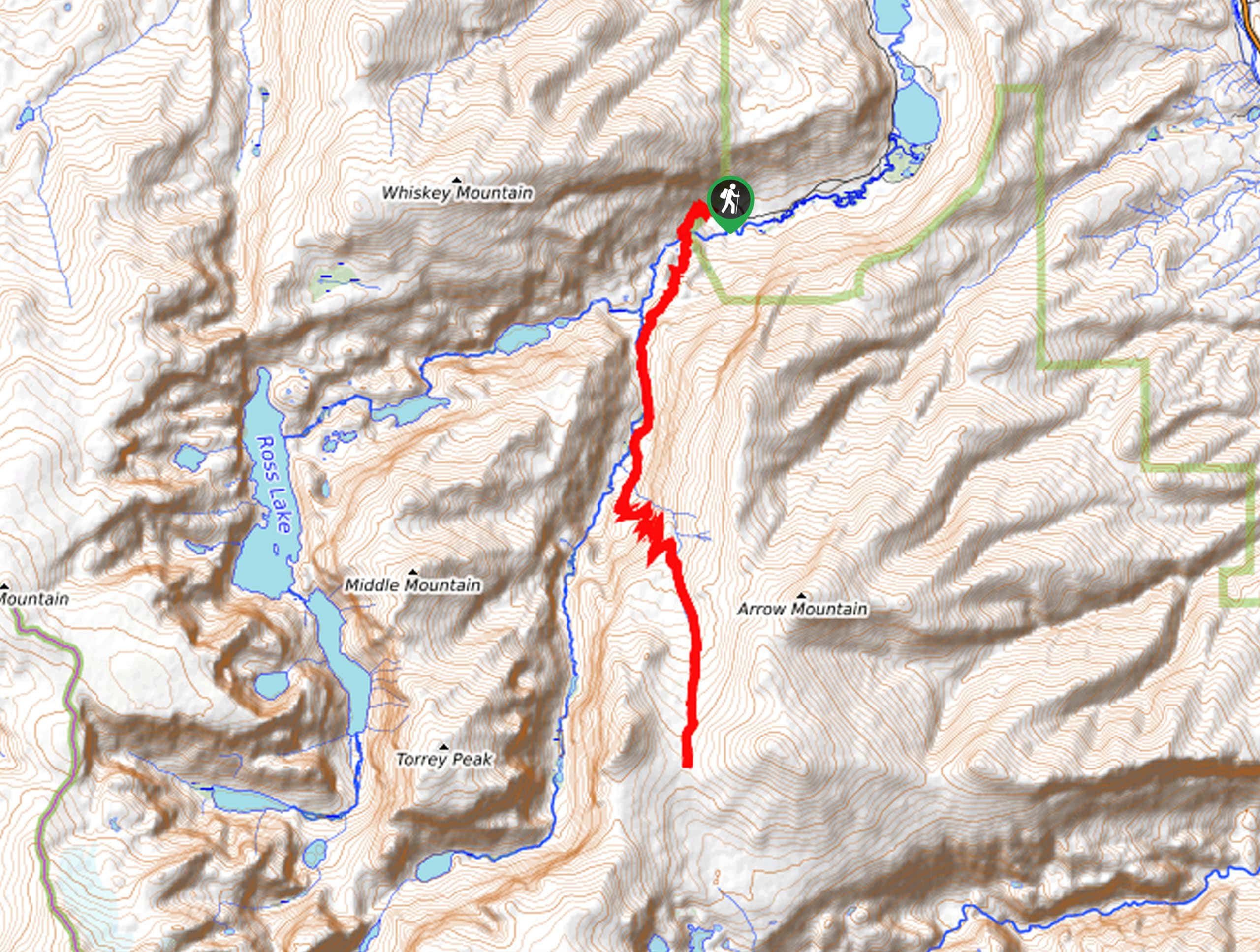
Elevation Graph
Weather
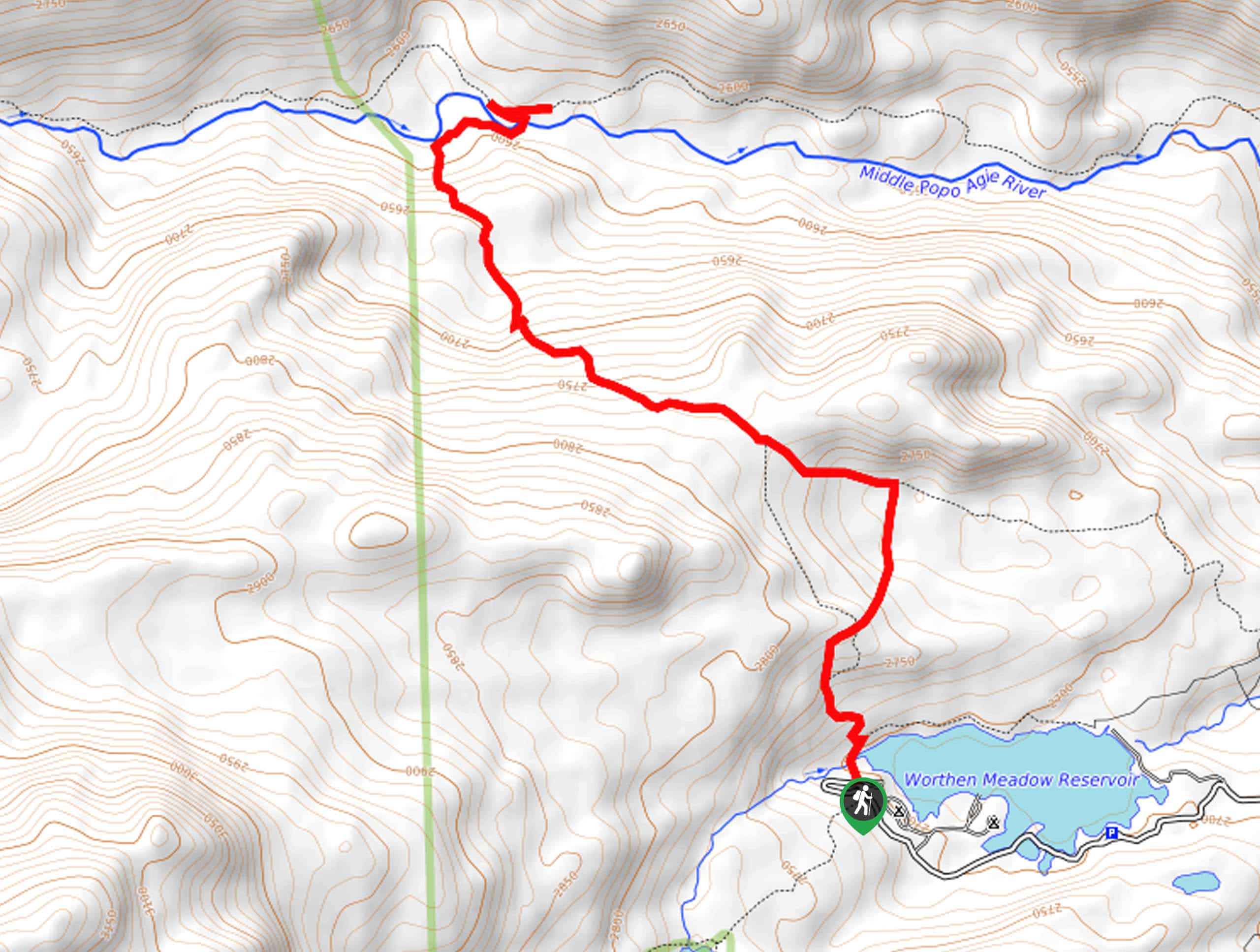
Johnny Behind the Rocks Trail Description
Those seeking an exciting adventure near Lander have come to the correct place. The Johnny Behind the Rocks Trail is a shared route with mountain bikers through sagebrush meadows and impressive ridges. As you hike, be mindful of passers-by and watch your step on the rocky terrain. Note that it is subject to sporadic closures, notably in the spring when the path is extremely muddy. While not necessary, we encourage the use of the trail GPS as the small signposts are easy to miss. Note that rattlesnakes have been spotted in the area.
Embark on your adventure along the Johnny Behind the Rocks from the trailhead off the parking lot. Setting out from here, you will shortly meet an intersection; turn left here. Using the trail GPS, this route will lead you atop the red-hued ridge, passing the Derby Anticline Mine. Enjoy the expansive views across the plains and the distant sights of the Wind River Mountains. The path will ultimately descend the ridge, delivering you to an intersection; veer left here and take an out-and-back detour into a creek canyon. When you eventually return to the junction, the GPS will take you on another detour to an overlook of the beautiful landscape.
Enjoy the wonderful scenery, then return again to the intersection. From here, take a left, and the southbound trail will wander in the shade of the ridges back to the trailhead, completing the circuit.
Similar hikes to the Johnny Behind the Rocks Trail hike
Glacier Trail
The Glacier Trail is a demanding day hike in the Winds that boasts a scenic and secluded experience. Wander through…
Upper Brewers Trail
The charm of a one-way trek is unrivaled. Enjoy new scenery every step of the way as you hike the…
Sheep Bridge Trail
The Sheep Bridge Trail checks all the boxes—short, scenic, and secluded. What more could you ask for? Mountain views? It…
Comments