Whistler Trainwreck Trail
View Photos
Whistler Trainwreck Trail
Difficulty Rating:
Time-travel back to the 1950s along the Whistler Trainwreck Trail as you explore the remnants of a de-railed boxcar from that era. Hike through the forest to reach the Cheakamus River, where you’ll experience the cascading water of the Cheakamus River Waterfalls, before making your way to the graffitied rail cars hidden in the forest. This short route has several unique highlights, so pack your camera and head out on this well-trafficked trail near Whistler.
Getting there
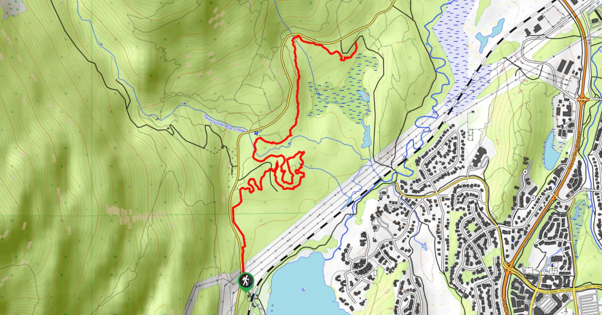
To reach the Whistler Trainwreck Trail from Whistler, head south on BC-99 S and make a right turn onto Alpha Lake Road. After 886ft, you will find the trailhead and parking at the edge of the trees on your left.

About
| When to do | Year-Round |
| Backcountry Campsites | No |
| Pets allowed | Yes - On Leash |
| Family friendly | Yes |
| Route Signage | Average |
| Crowd Levels | High |
| Route Type | Out and back |
Whistler Trainwreck Trail
Elevation Graph
Weather
Whistler Trainwreck Trail Description
The Whistler Trainwreck Trail is a popular route in the area due to its short length, easy terrain, and interesting highlights. As a result, the trail can become extremely busy with foot traffic during peak hours and on weekends. Hikers looking to utilize the trail should arrive early in order to secure parking at the trailhead and get ahead of any potential crowds on the trail.
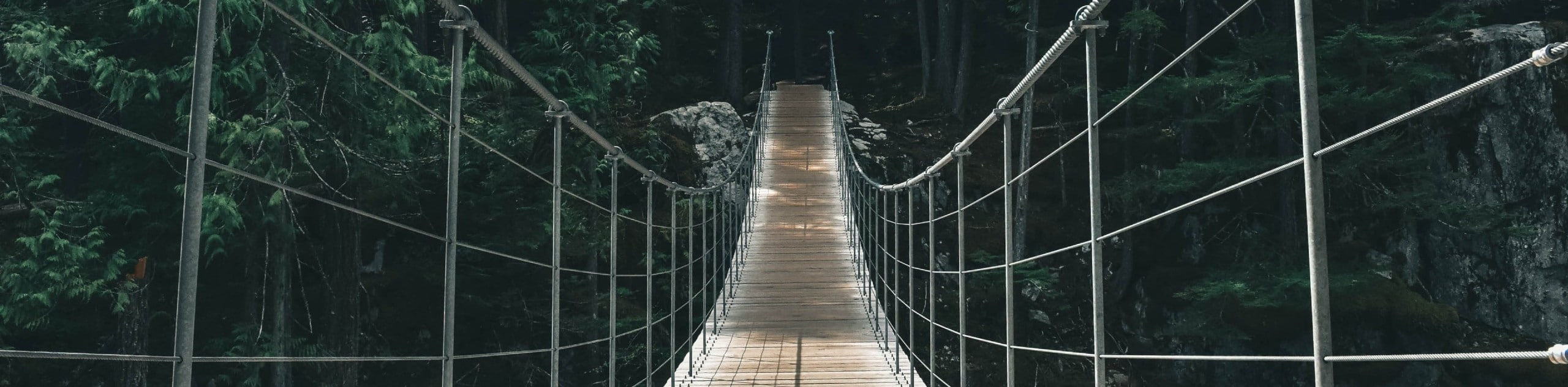
This route is the perfect half-day hike around the Whistler area, especially if you are travelling with family members or simply looking for a short trail packed with highlights. This 2.8mi route sets out along Millar Creek before meeting up with the rushing waters of the Cheakamus River. From here, hikers will pass by the Cheakamus River Waterfalls as they make their way along the forested trail to the Whistler Trainwreck. At this point in the hike, you will be able to explore the remnants of a derailed train from the 1950s and cross over a suspension bridge spanning the river before concluding your hike. The easy terrain and numerous highlights along this route have made the Whistler Trainwreck Trail one of the more popular short hikes around Whistler.
Setting out from the parking lot, pick up the trail at the edge of the trees and follow it southwest until it meets up with the Sea to Sky Highway. Making your way to the other side, continue on the forested trail as it hooks south and crosses over the rail tracks. Continue following the trail west, as it passes by the cascading waters of the Cheakamus River Waterfalls.
Roughly 1476ft after the falls, the trail will turn south and head into a more densely forested area, signalling the final approach to the trainwreck. Here, hikers will be able to explore the area and check out the old, derailed train cars that sit immobilized in the forest and serve as memories of a bygone time. Approaching the river to the left, you will also find a suspension bridge that stretches out over the Cheakamus River below. After reaching the end of the Whistler Trainwreck Trail and experiencing the sights, head back along the same route that you came in on to return to the trailhead and your parked car.
Insider Hints
Arrive early for parking and to beat the crowds.
Bring microspikes or snowshoes if using the trail in wet or snowy conditions.
Bring a camera for some cool photos of the graffiti-covered rail cars.
Similar hikes to the Whistler Trainwreck Trail hike
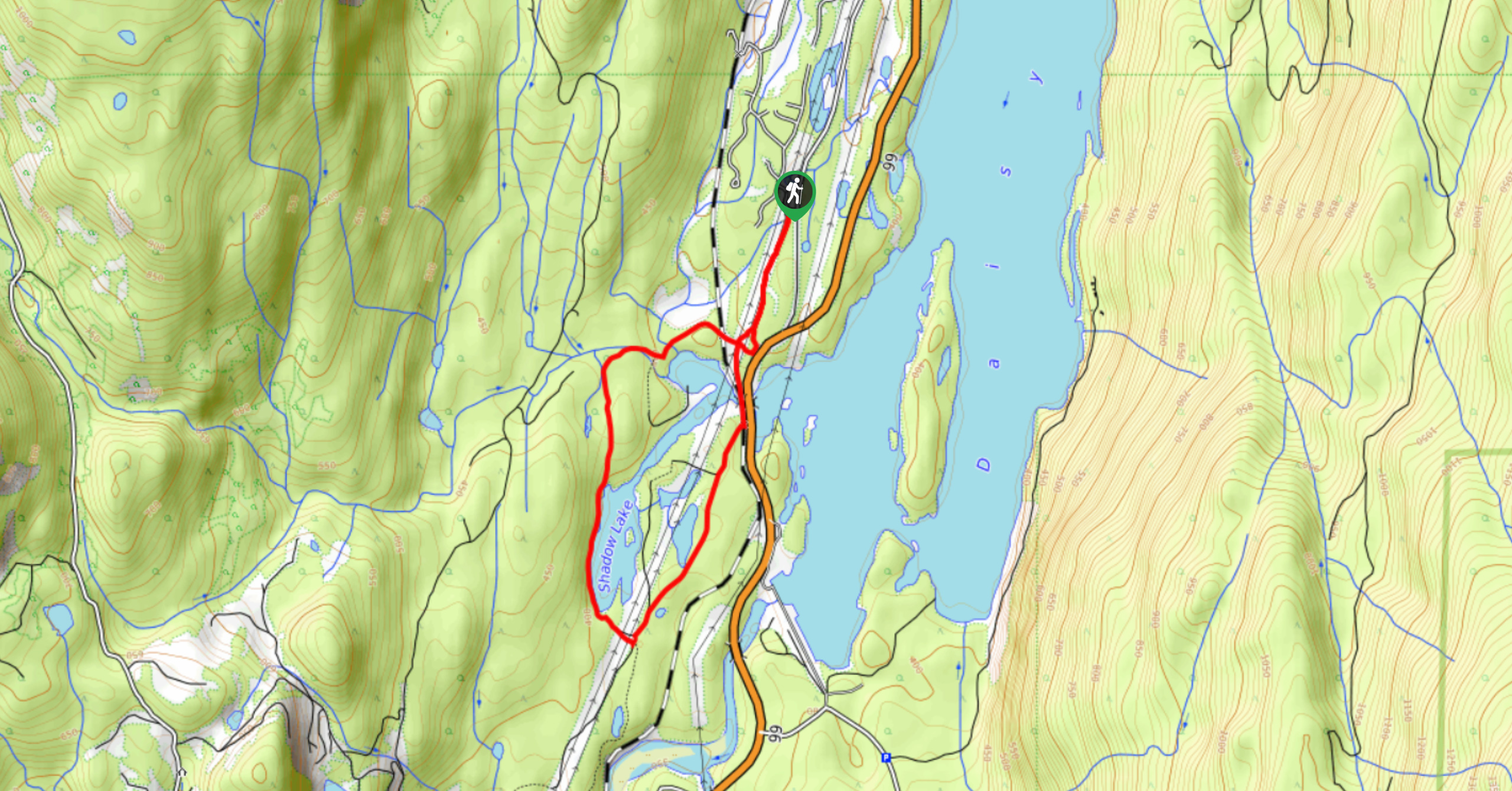
Shadow Lake Loop
Travel along the Shadow Lake Loop for a quick and easy hiking route just off the Sea to Sky Highway,…
Jane Lakes Trail
The Jane Lakes Trail is a lightly trafficked 6.2mi out-and-back hiking route through the Whistler Interpretive forest that…
A River Runs Through It Trail
The A River Runs Through It Trail is a 5.6mi out-and-back hiking route in Whistler that features scenic…
Comments