Brandywine Meadows Hike
View Photos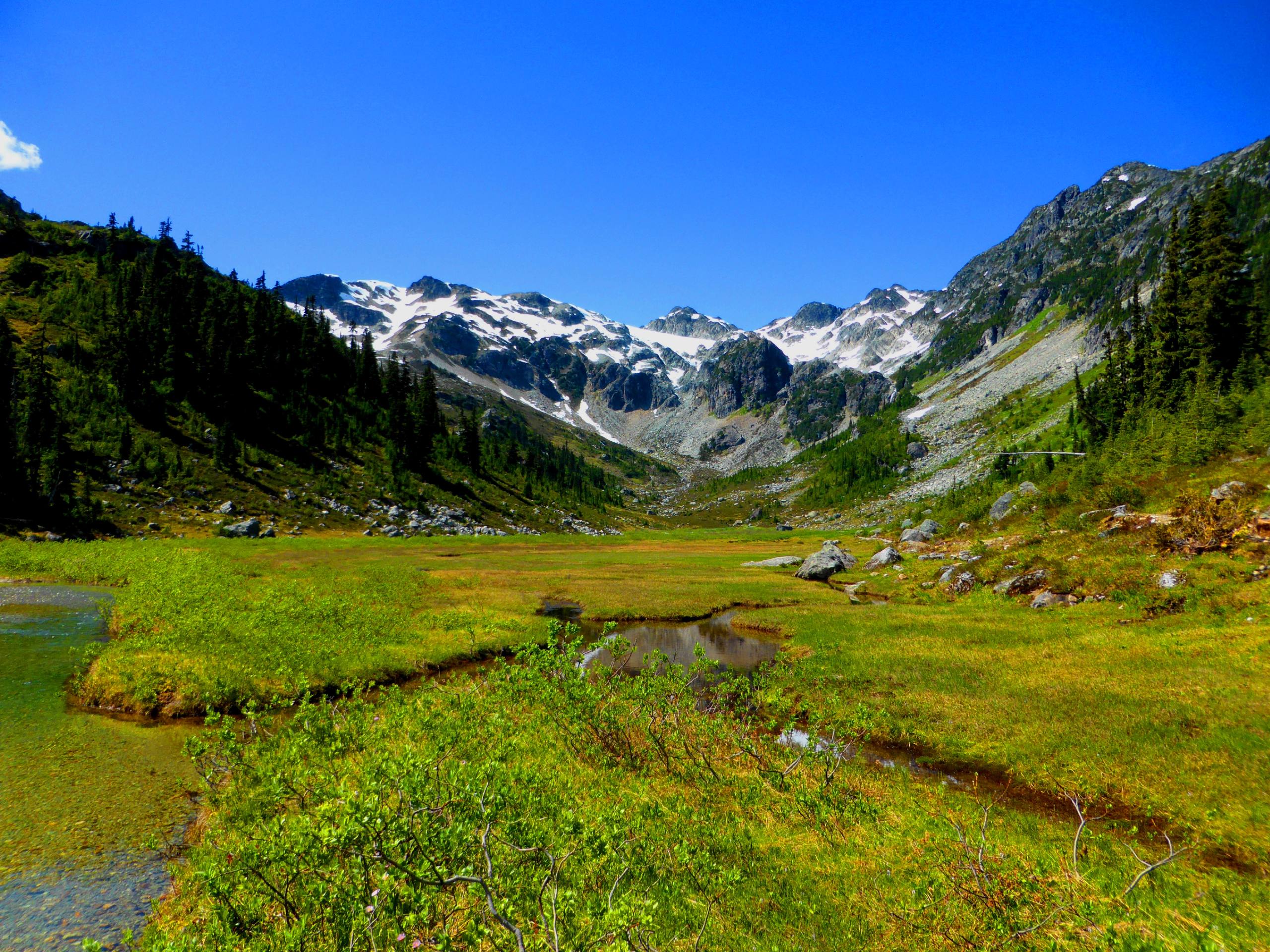
Brandywine Meadows Hike
Difficulty Rating:
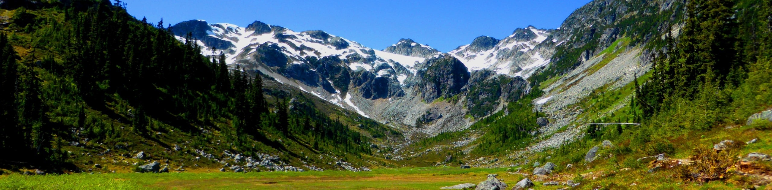
The trail to Brandywine Meadows is an 6.9mi out-and-back trail that will challenge your fitness from the start, but will reward you with some truly stunning views. Climb up the steep forested incline along the creek to reach the picturesque Brandywine Meadows, where you will experience the pristine alpine environment and gorgeous mountain backdrop. If you are in the Whistler area during the late summer, then this hike is definitely worth clearing some time in your schedule.
Getting there
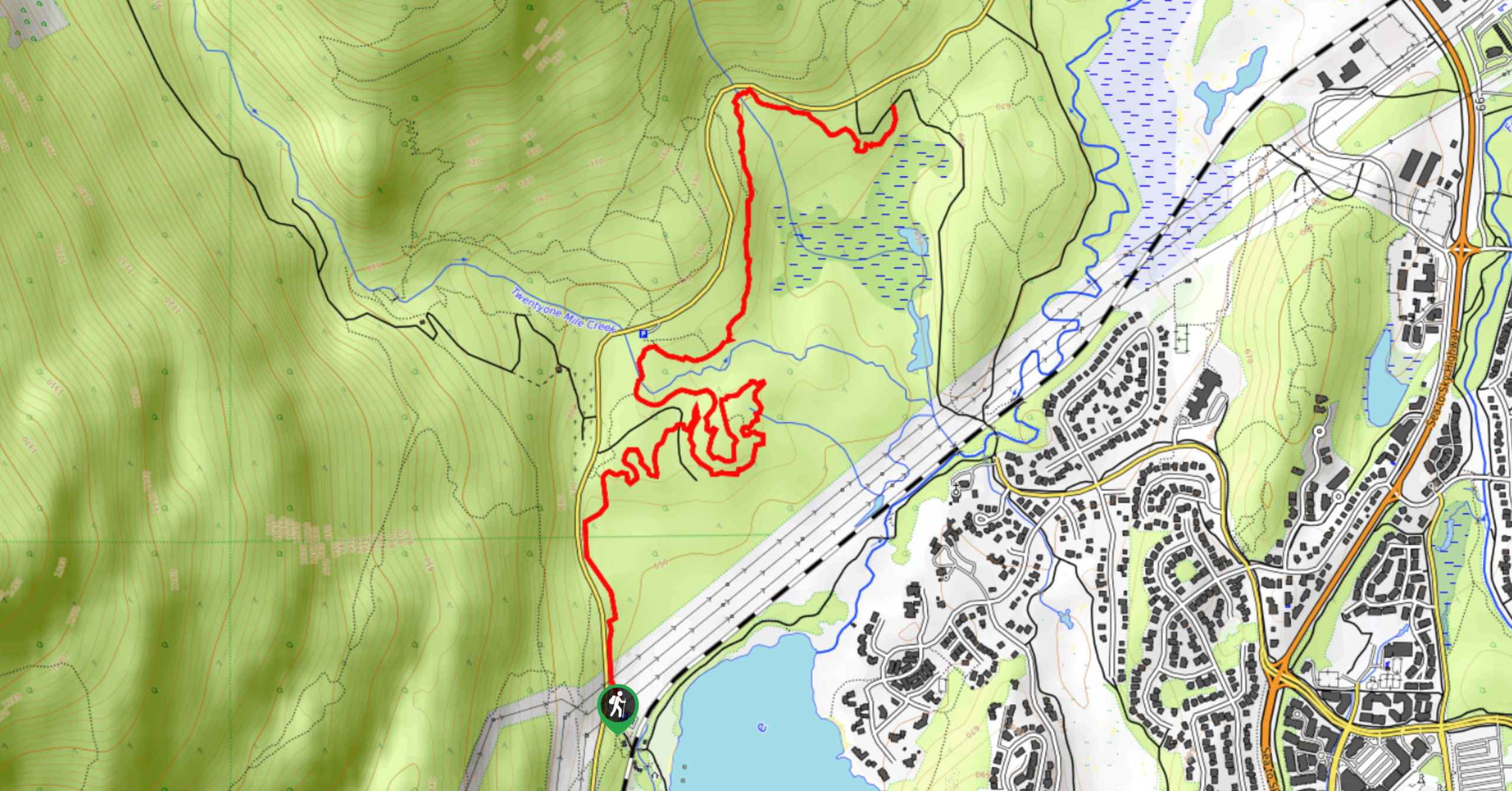
To get to the lower parking lot for the Brandywine Meadows trailhead from Whistler, drive southwest on BC-99 S and make a right turn onto Callaghan Valley Road. Turn left after 0.6mi onto Brandywine FSR, keeping it until you reach a fork in the road. Signs will direct you 1.2mi from this point to the lower parking lot.

About
| When to do | July-October |
| Backcountry Campsites | No |
| Pets allowed | Yes - On Leash |
| Family friendly | No |
| Route Signage | Average |
| Crowd Levels | Low |
| Route Type | Out and back |
Brandywine Meadows Hike
Elevation Graph
Weather
Brandywine Meadows Trail Description:
Hiking to Brandywine Meadows will take you on a steep climb through some densely forested areas that open up into a stunning alpine meadow. The first kilometre of the trail has the steepest incline, making this route a difficult climb from the jump. Hikers utilizing this trail should wear proper hiking footwear and bring any extra gear, such as microspikes or snowshoes, should the weather and trail conditions deem it necessary. Additionally, this trail has two parking areas, one lower parking lot and another further up the road. The upper lot is not accessible unless you have a 4×4 vehicle, so this trail guide will start from the lower lot for ease of accessibility.
Although the initial part of this route is physically demanding, the trail does let up for a more steady climb as you make your way through the woodlands. Reaching Brandywine Meadows, hikers will be greeted with amazingly scenic views of the alpine meadow with its gorgeous mountain backdrop. For those undertaking the hike in late summer, the valley will be filled with the scent of countless wildflowers that blanket the picturesque terrain. This hike may require some effort to complete, but the peaceful experience of strolling through Brandywine Meadows is absolutely worth the grind.
Setting out from the lower parking lot, head northwest along Brandywine FSR until you reach the upper parking lot. Here, hikers will find the trailhead off to the right beyond the BC parks sign. Follow the orange trail markers that can be found along the route as you begin the steep uphill climb through the densely forested area. Keep the creek on your left as you work your way uphill along the treeline that borders a more recently cut section of the forest. Here, you will pass through a stretch of trail that can be fairly muddy, depending on the time of year, so watch your step as you cross over the wooden boards and continue along the trail.
Eventually, the dense tree cover will begin to break as you inch closer towards the beautiful meadows. Reaching a junction in the trail, keep left and take note of its location, as you will need to go right at the junction on the way down to return along the same path. On the final approach to Brandywine Meadows, you will be greeted with beautiful mountain views, as well as the lush grass and wildflowers of the meadow stretching out before you. Continue walking along the trail as it skirts alongside the edge of the creek, stopping short of the left turn in the path. This route leads up to Brandywine Mountain and is a far more technical hike that requires experience to complete.
After taking in the sights of the beautiful alpine meadow and pausing for a quick lunch, head back down the same trail, catching a glimpse of Black Tusk off in the distance before entering back into the tree cover and making your descent to the carpark, having completed the hike to Brandywine Meadows.
Insider Hints
As with most BC trails, bring bear spray.
Time your hike for late summer to see the beautiful wildflowers in the meadow.
Only park at the upper lot if you have a 4x4 vehicle.
Bring hiking poles to save your knees on the return journey.
Similar hikes to the Brandywine Meadows Hike hike
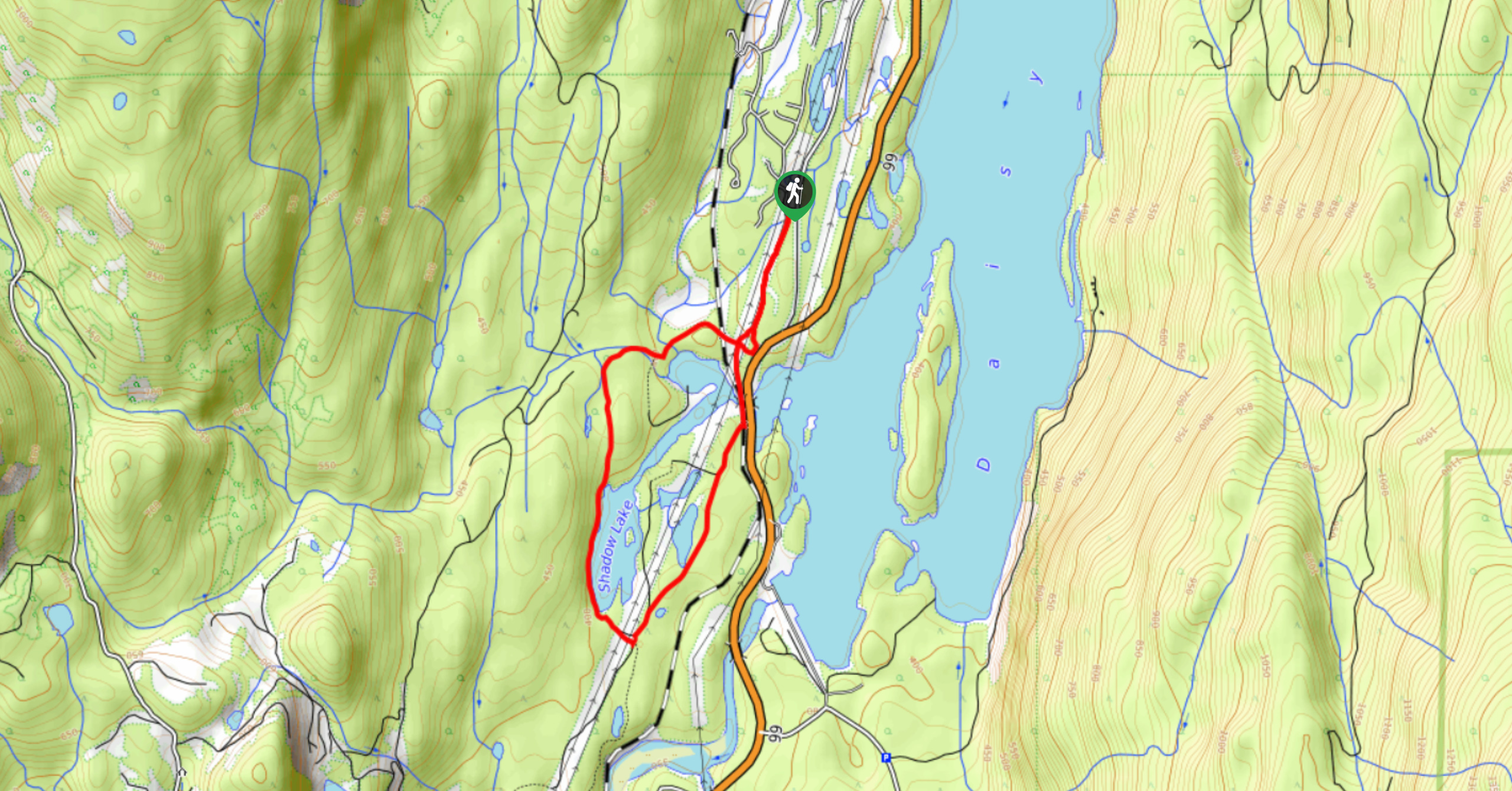
Shadow Lake Loop
Travel along the Shadow Lake Loop for a quick and easy hiking route just off the Sea to Sky Highway,…
Jane Lakes Trail
The Jane Lakes Trail is a lightly trafficked 6.2mi out-and-back hiking route through the Whistler Interpretive forest that…
A River Runs Through It Trail
The A River Runs Through It Trail is a 5.6mi out-and-back hiking route in Whistler that features scenic…
Comments