
Brandywine Trail
View Photos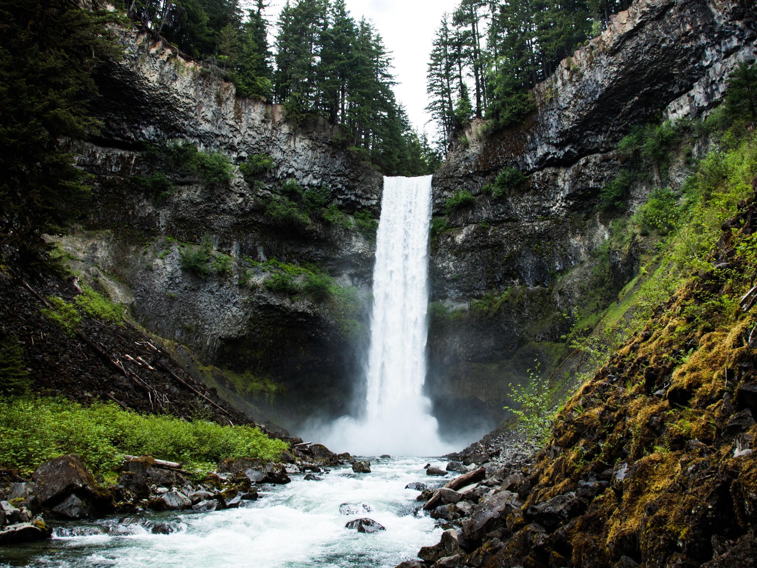
Brandywine Trail
Difficulty Rating:
The Brandywine Trail is a 3.6mi out-and-back route through Brandywine Falls Provincial Park that takes hikers to several scenic viewpoints, including lookouts over Brandywine Falls and Daisy Lake. Hikers will continue along the trail to visit the Whistler Bungee Bridge, where they can watch fearless enthusiasts dive toward the rushing water far below. This short hike is a great half-day option the whole family will enjoy.
Getting there
To reach the parking area for the Brandywine Trail from Whistler, drive southwest on BC-99 S for 10.6mi and make a left turn into Brandywine Falls Provincial Park, where you will find parking to your right.

About
| When to do | April-October |
| Backcountry Campsites | No |
| Pets allowed | Yes - On Leash |
| Family friendly | Yes |
| Route Signage | Average |
| Crowd Levels | High-Extreme |
| Route Type | Out and back |
Brandywine Trail
Elevation Graph
Weather
Brandywine Trail Description
The Brandywine Trail is a short hike through Brandywine Falls Provincial Park that visits a number of interesting highlights along the route. Due to the scenic views, easy to navigate terrain, and viewing platforms located close to the carpark, this trail is often heavily populated, especially in the area around the falls. Hikers wishing to use the trail should arrive early in order to secure a parking space and gain access to the trail before the crowds arrive.
Along this trail, you will be able to experience the breathtaking sight of the cascading Brandywine Falls before heading a bit further south to check out the viewpoint overlooking the turquoise waters of Daisy Lake. Further along the trail to the east, you will find the Whistler Bungee Bridge, from which enthusiastic jumpers can be seen diving toward the rushing waters of the Cheakamus River below. This may be a short route, but it is certainly full of fun highlights to keep you entertained along the trail.
Setting out from the carpark, follow the gravel trail east and cross over Brandywine Creek before turning south to make your way over the rail tracks. Immediately after crossing the tracks, there will be a junction branching off to the right. Take this to access the amazing lookout over the torrent of water that passes over Brandywine Falls. Continue south along the trail to reach a lower viewpoint of the falls, as well as a lookout over the turquoise expanse of Daisy Lake to the south.
After taking in these amazing sights, make your way back up to the junction with the main trail and follow the gravel path to the right to continue along the route. Keep on the trail as it meanders through Brandywine Falls Provincial Park before turning north to reach a trail junction near several small lakes. Take the trail to the right to continue on to the Whistler Bungee Bridge. Take a few moments at the bridge to watch the spectacle of fearless bungee jumpers diving off the platform and plummeting toward the rushing waters of the Cheakamus River below. After you’ve had enough of the spectacle, make your way back along the Brandywine Trail to return to the carpark.
Insider Hints
Arrive early to get a parking space and beat the crowds.
The section near the falls is usually the busiest. Utilize other areas of the trail to escape the crowds.
Washroom facilities can be found next to the parking area.
Similar hikes to the Brandywine Trail hike
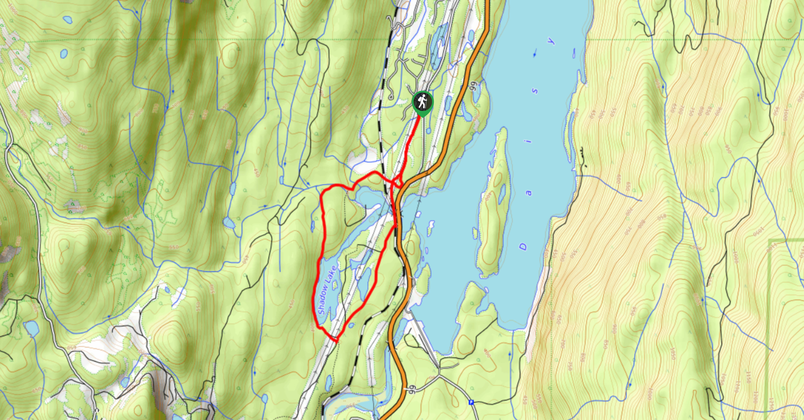
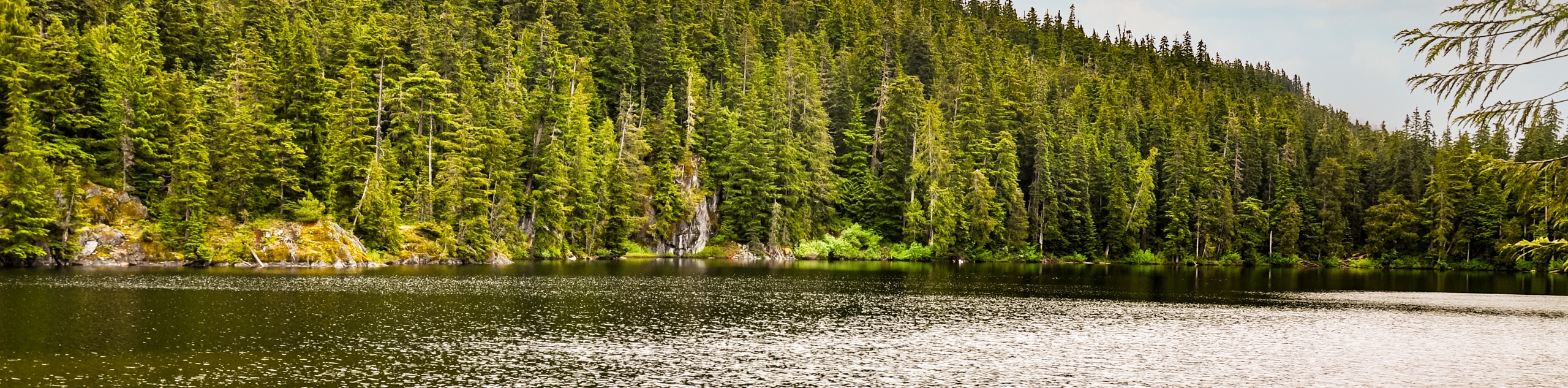
Shadow Lake Loop
Travel along the Shadow Lake Loop for a quick and easy hiking route just off the Sea to Sky Highway,…
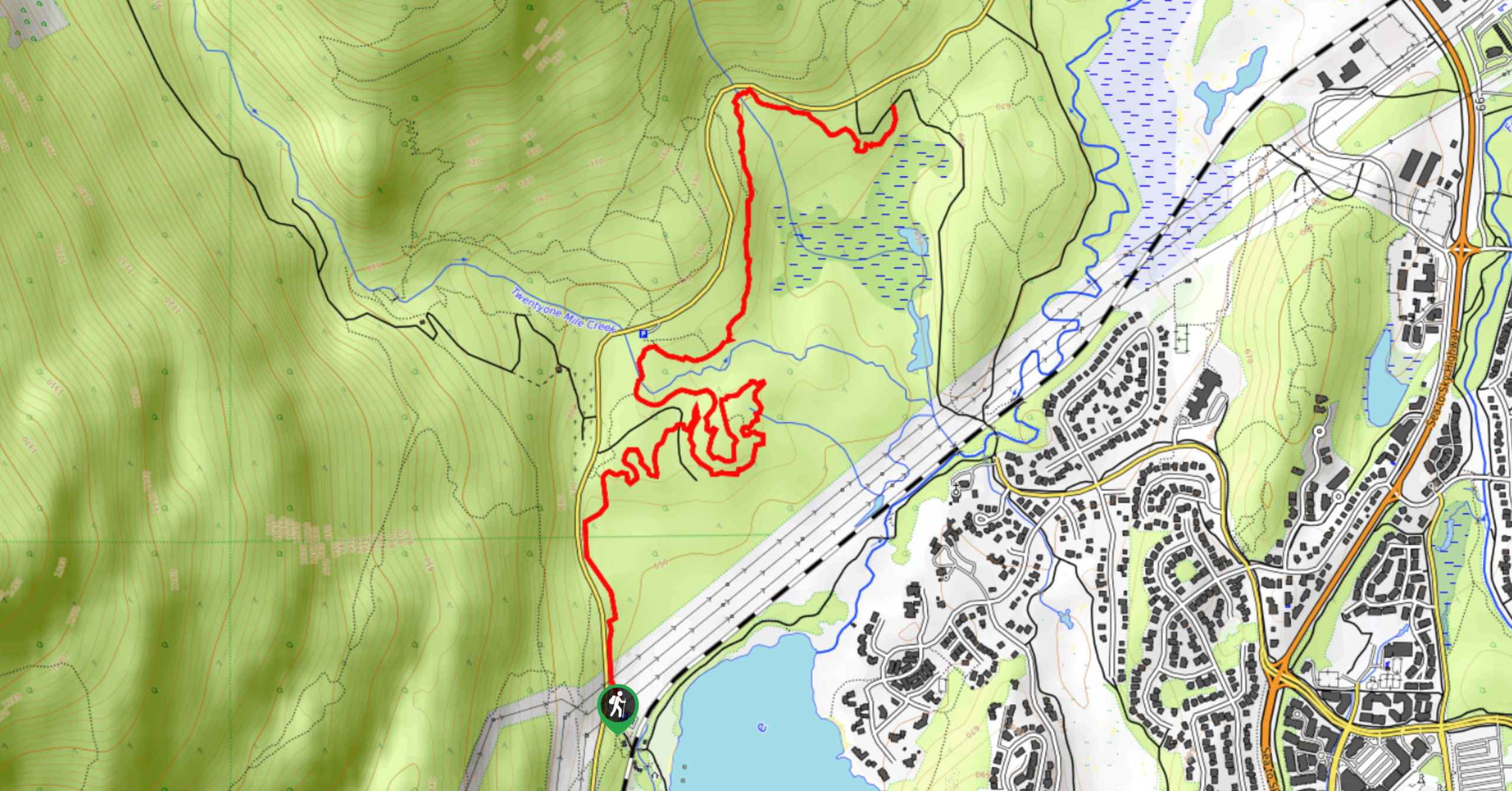
Jane Lakes Trail
The Jane Lakes Trail is a lightly trafficked 6.2mi out-and-back hiking route through the Whistler Interpretive forest that…
A River Runs Through It Trail
The A River Runs Through It Trail is a 5.6mi out-and-back hiking route in Whistler that features scenic…
Comments