
Tonic Peak Hike
View Photos
Tonic Peak Hike
Difficulty Rating:
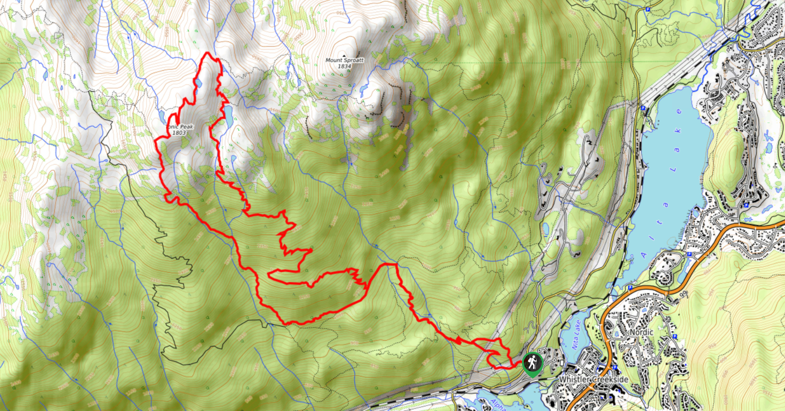
Tonic Peak is an 11.2mi hiking route just west of Whistler, BC, that loops through the forest on the way to a spectacular viewpoint on the summit. Along the trail, hikers will make their way through a picturesque woodland setting before passing by several mountain top lakes on the final approach to Tonic Peak. From there, you will have amazing views overlooking the Fitzsimmons Range.
Getting there
To reach the trailhead for Tonic Peak from Whistler, drive south on BC-99 for 3.2mi and turn right onto Alta Lake Road. Continue on for 1.1mi, where you will find the trailhead on the left just after you pass Nita Lake Drive.

About
| When to do | June-October |
| Backcountry Campsites | No |
| Pets allowed | No |
| Family friendly | Older Children only |
| Route Signage | Average |
| Crowd Levels | Moderate |
| Route Type | Circuit |
Tonic Peak Hike
Elevation Graph
Weather
Tonic Peak Trail Description
The hike to Tonic Peak is a scenic hiking route just west of Whistler that climbs uphill through the dense forest to reach the summit of Tonic Peak. While there is a fair bit of elevation gain along the trail (3832ft), it is spread across the length of the route, making for a gradual climb up to the summit. Along the trail, you can expect to cross over several creeks, as you work your way uphill through the picturesque forest.
Reaching the summit of Tonic Peak, hikers will have a sweeping view across the valley, with numerous peaks in clear sight, such as Whistler Mountain and Blackcomb Peak. There are also several charming mountaintop lakes that you can explore in the immediate vicinity. When you have had your fill of the views, follow the trail to the southwest of the summit to complete the return journey along a different route. The length and terrain on this hike make it a perfect day trip to build up experience for more difficult routes in the area.
Similar hikes to the Tonic Peak Hike hike
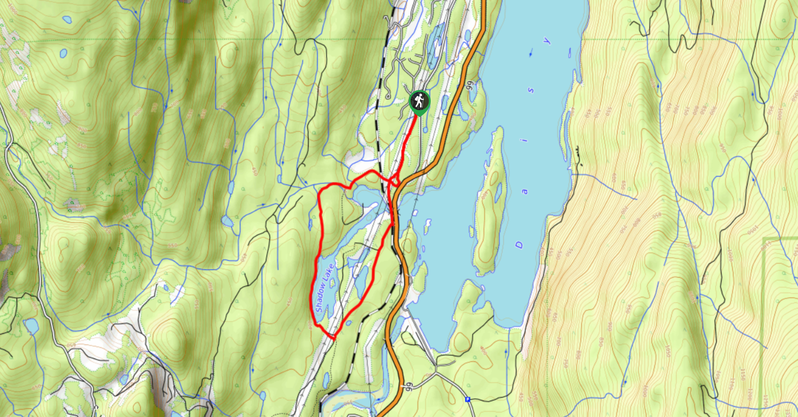
Shadow Lake Loop
Travel along the Shadow Lake Loop for a quick and easy hiking route just off the Sea to Sky Highway,…
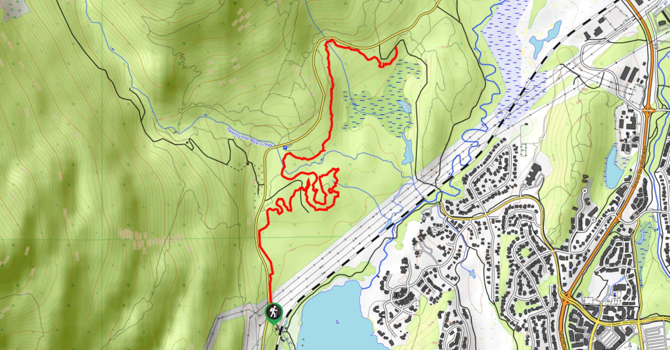
Jane Lakes Trail
The Jane Lakes Trail is a lightly trafficked 6.2mi out-and-back hiking route through the Whistler Interpretive forest that…
A River Runs Through It Trail
The A River Runs Through It Trail is a 5.6mi out-and-back hiking route in Whistler that features scenic…
Comments