Logger’s Lake
View Photos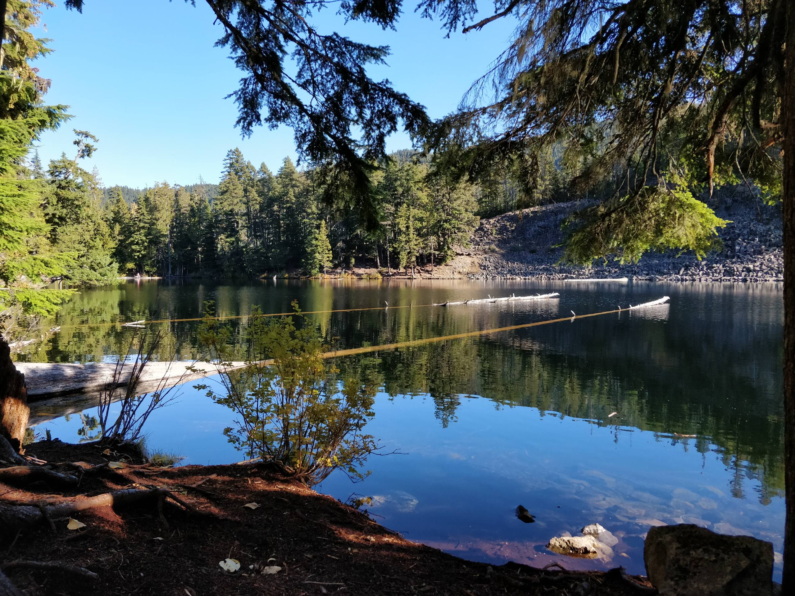
Logger’s Lake
Difficulty Rating:
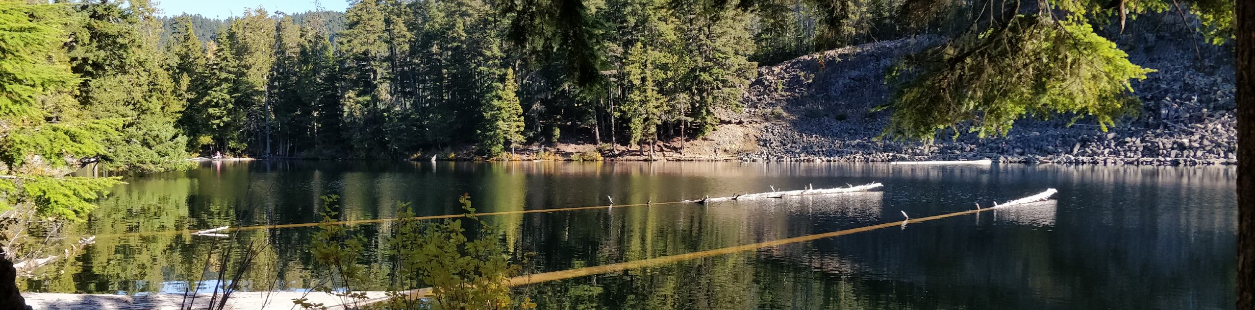
Hiking to Logger’s Lake is a fun experience that will take you through the beautiful woodlands of the Whistler Interpretive Forest to the serene shores of a small lake nestled inside of a 10,000 year-old volcanic crater. This trail features easy to navigate terrain and interpretive signs along the trail, making it ideal from hikers of all skill levels. If you are looking to extend your hike, why not explore the trails east of the lake to arrive at the Cheakamus River Suspension Bridge.
Getting there
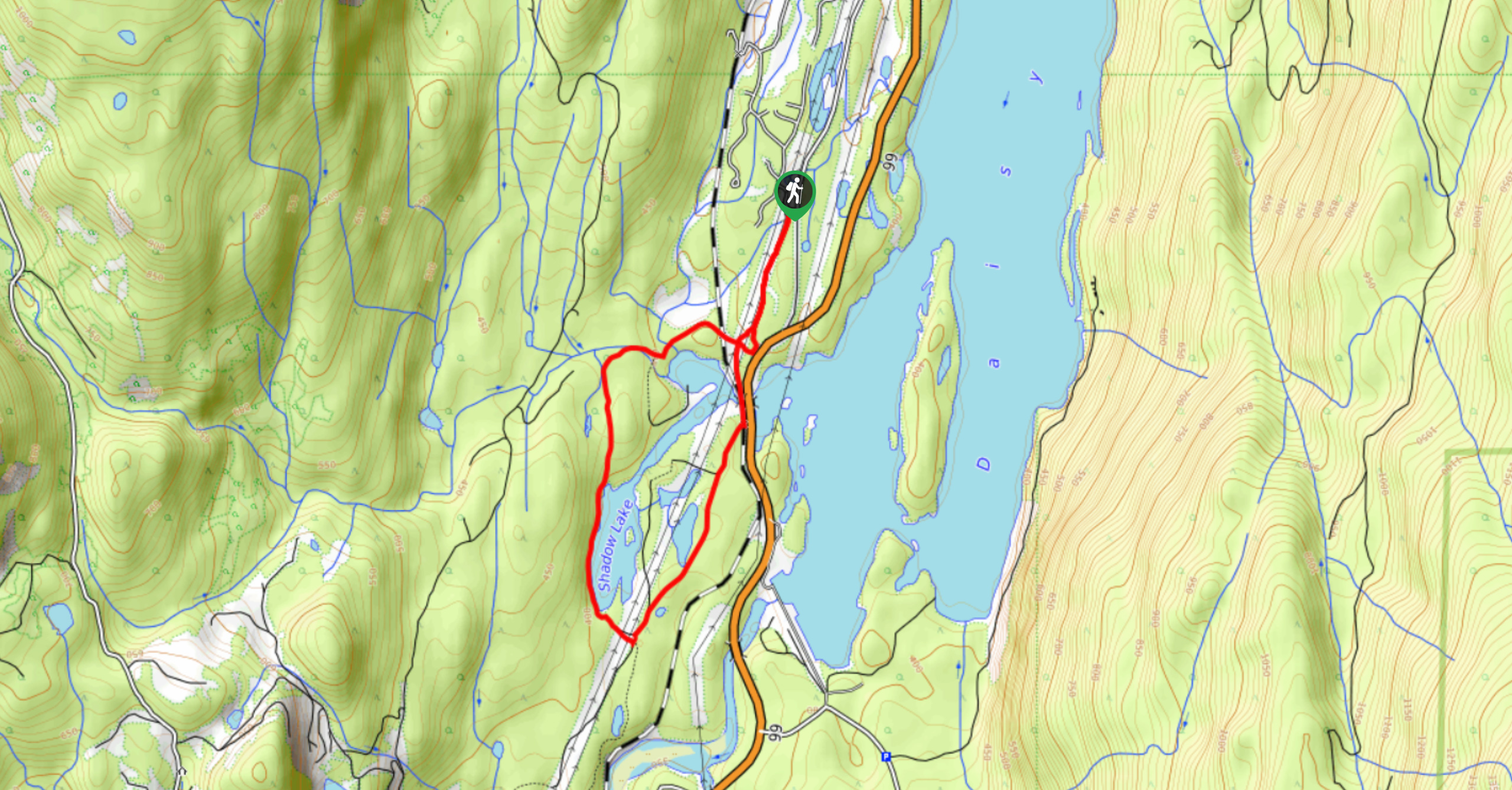
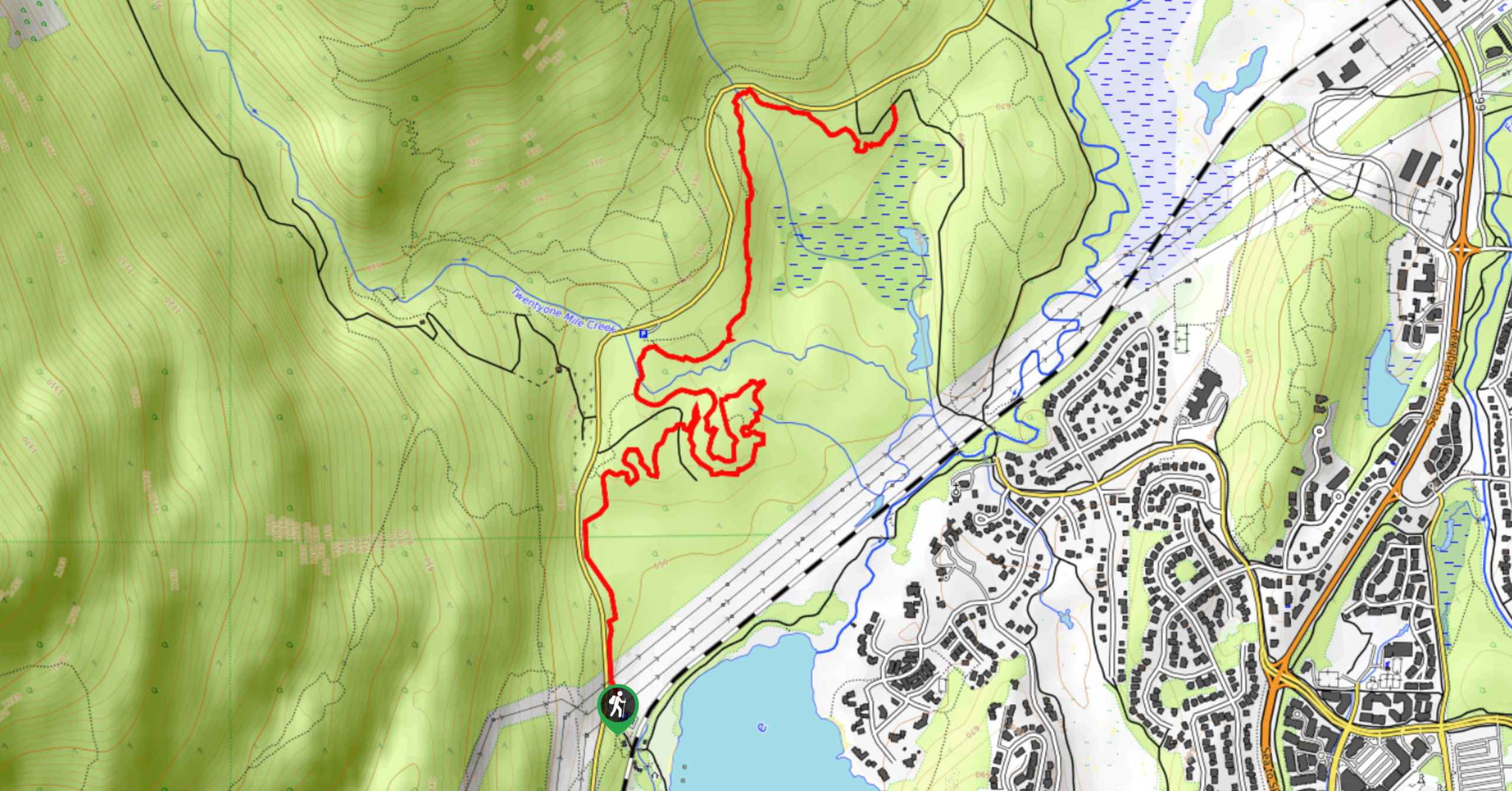
To reach the Logger’s Lake trailhead from Whistler, drive southwest on BC-99 and turn left onto Cheakamus Lake Road. Continue straight for 2297ft and turn left to stay on the road. In another 1148ft, you will find the parking area on the right.

About
| When to do | June-October |
| Backcountry Campsites | No |
| Pets allowed | Yes - On Leash |
| Family friendly | Yes |
| Route Signage | Average |
| Crowd Levels | Moderate |
| Route Type | Lollipop |
Logger’s Lake
Elevation Graph
Weather
Logger’s Lake Trail Description
The hike to Logger’s Lake is a 3.2mi lollipop trail through the Whistler Interpretive Forest that takes hikers from the Whistler Olympic Village to a lake that is nestled within a 10,000-year-old volcanic crater. This is a fairly easy trail through a scenic stretch of forest that features easy-to-navigate terrain and some mild changes in elevation, making it ideal for beginner hikers. The hike follows a course that runs parallel to the Cheakamus River before arriving at the wooded shores of the lake. Take in the tranquil atmosphere as you stroll around the water’s edge and read the informative signs about the area’s unique geology before heading back along the same route to return to the trailhead.
Similar hikes to the Logger’s Lake hike
Shadow Lake Loop
Travel along the Shadow Lake Loop for a quick and easy hiking route just off the Sea to Sky Highway,…
Jane Lakes Trail
The Jane Lakes Trail is a lightly trafficked 6.2mi out-and-back hiking route through the Whistler Interpretive forest that…
A River Runs Through It Trail
The A River Runs Through It Trail is a 5.6mi out-and-back hiking route in Whistler that features scenic…
Comments