Moul Falls Trail
View Photos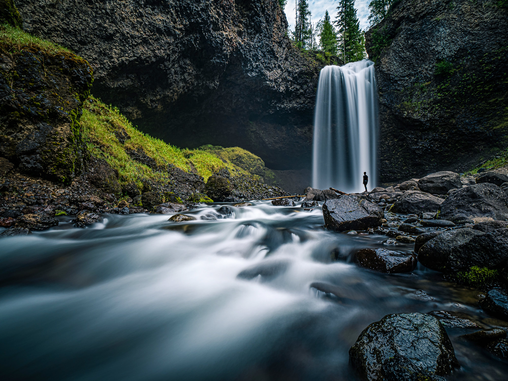
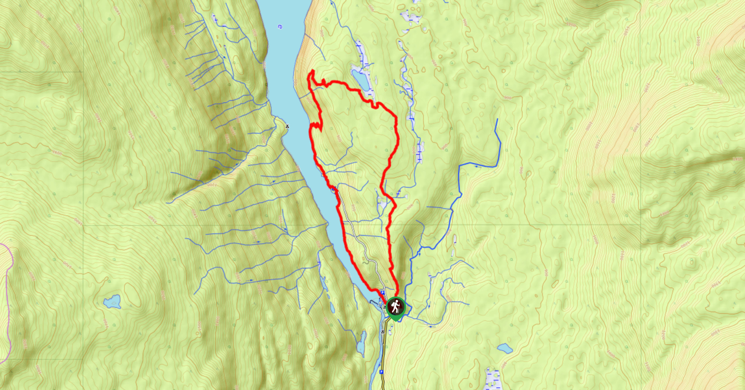
Moul Falls Trail
Difficulty Rating:
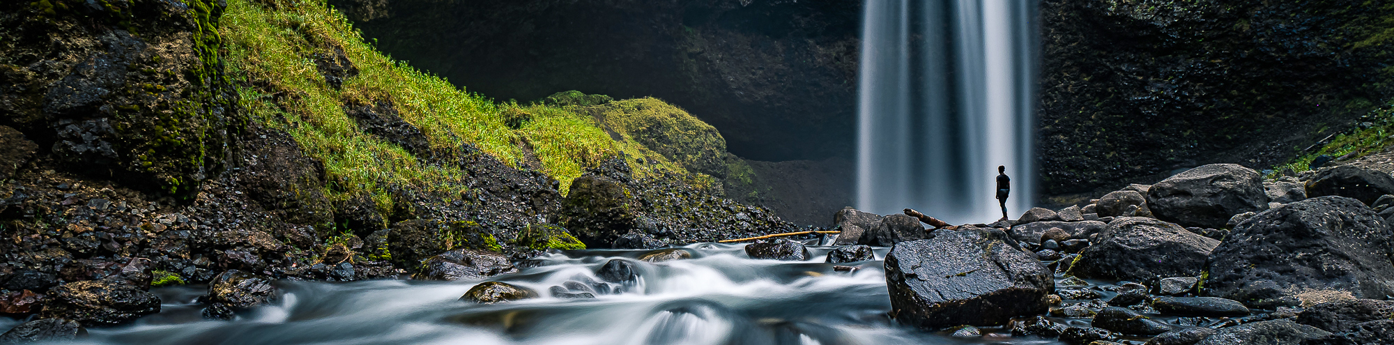
Hiking the Moul Falls Trail is a great family-friendly adventure in Wells Gray Provincial Park that takes you to a viewpoint overlooking a beautiful waterfall. This 3.4mi out-and-back trail is made up of fairly easy terrain and can be completed by hikers of most skill levels; however, the descent to the falls is a bit steep and slippery so make sure to wear proper hiking footwear and watch your footing. For an added bit of adventure on this hike, make sure to head into the cave behind the falls to get the full misty experience of the water crashing down onto the rocks.
Getting there
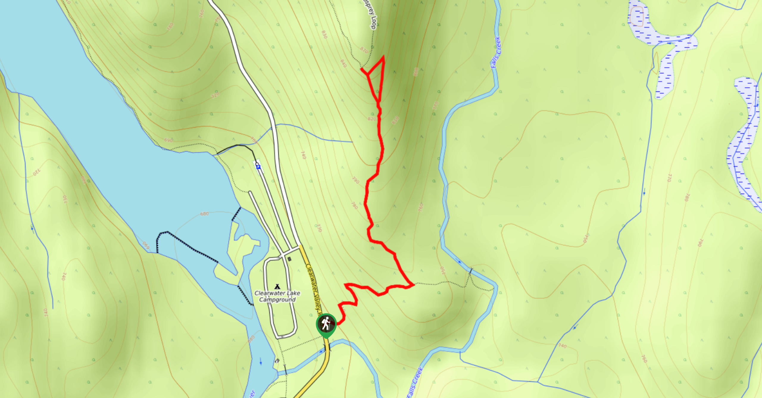
To reach the parking area for the Moul Falls Trail from Clearwater, drive north along Clearwater Valley Road for 12.8mi to find the parking lot and trailhead on the left.

About
| When to do | May-October |
| Backcountry Campsites | No |
| Pets allowed | Yes |
| Family friendly | Yes |
| Route Signage | Average |
| Crowd Levels | Moderate |
| Route Type | Out and back |
Moul Falls Trail
Elevation Graph
Weather
Moul Falls Trail Description
While the Moul Falls Trail can certainly be enjoyed by hikers of all ages and skill levels, there are a few things to keep in mind when setting out on this hike. The trail leads to an amazing viewpoint that looks out onto the falls but if you want to get the full experience, you will need to make your way down a steep and slippery section of trail to reach the water’s edge. Take caution if you want to head behind the falls to relax in the misty atmosphere of the cave, and watch your footing on the wet rocky terrain. Additionally, black bears are sometimes seen in the area, so remember to bring bear spray and make plenty of noise along the trail.
The route sets out from the parking area off Clearwater Valley Road and immediately heads into the forest in a westward direction. The trail itself is well-maintained and meanders through the pleasant forest atmosphere until you reach the viewpoint looking out onto the falls. From here you can watch the torrents of water rush over the edge of the falls and crash onto the rocks below or make the steep descent to get to the edge of the water. From here, you will be able to fully experience the power of the Moul Falls, as you hike in behind the cascading water to explore the small cave in behind. After spending some time exploring the area, carefully make your way back up to the main trail and work your way through the forest to return to the parking area.
Similar hikes to the Moul Falls Trail hike
Osprey Viewpoint
The trek to the Osprey Viewpoint follows a 1.5mi out-and-back hiking route that climbs uphill along a forest…
Pyramid Mountain
The trek up Pyramid Mountain follows a 5.8mi out-and-back hiking route in Wells Gray Provincial Park that provides…
Chain Meadows Loop
The Chain Meadows Loop is a 8.8mi hiking circuit in Wells Gray Provincial Park that traverses some pleasant…
Comments