Spahat Falls
View Photos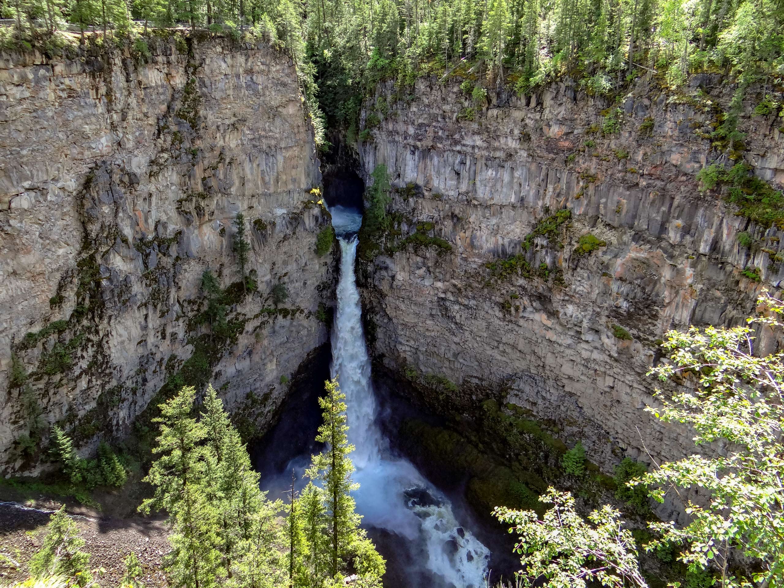
Spahat Falls
Difficulty Rating:
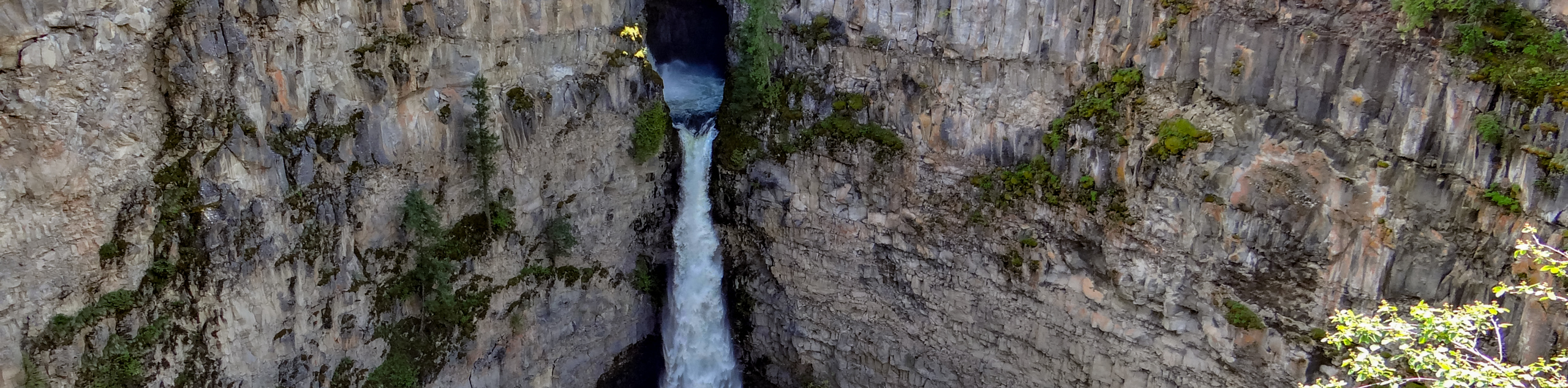
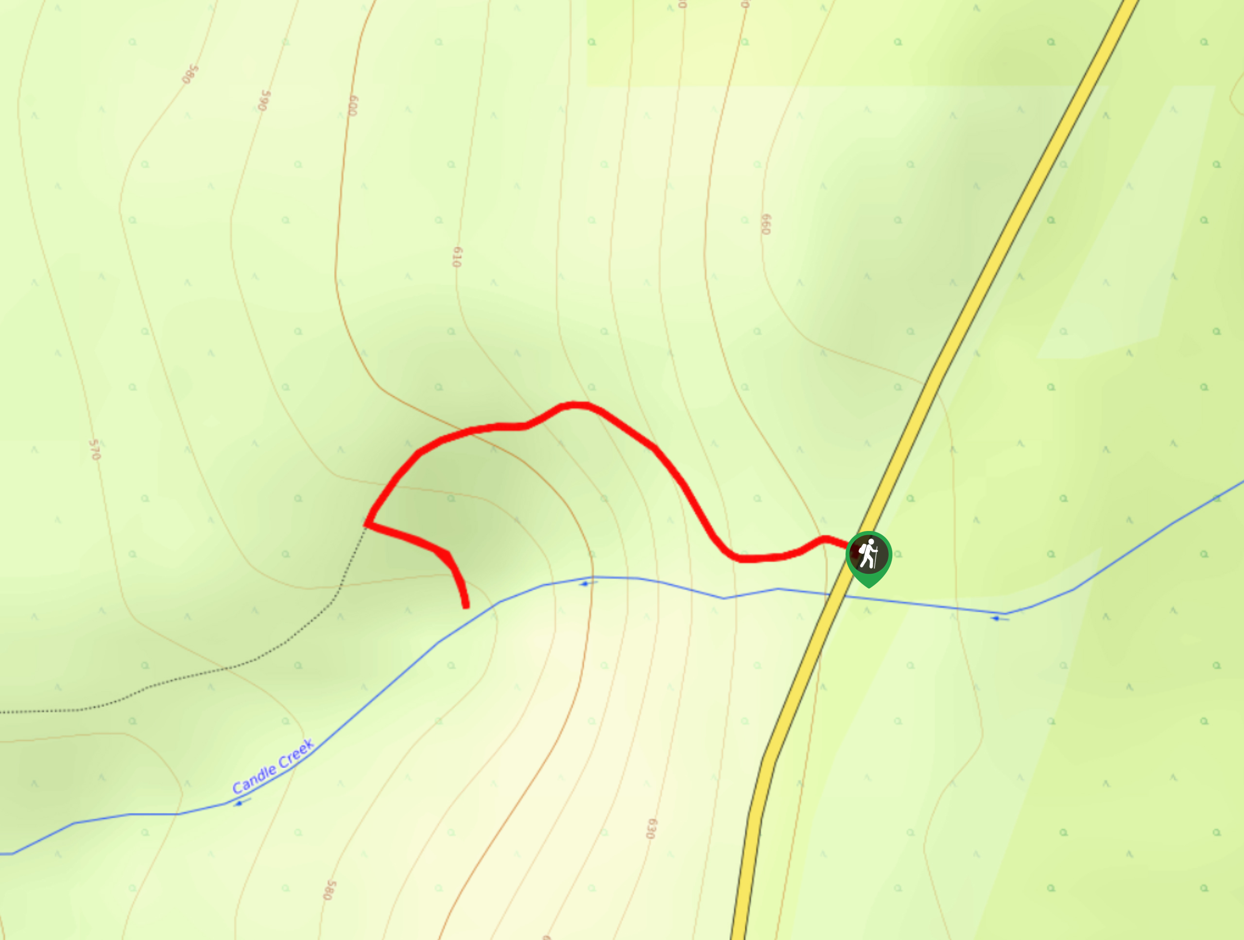
The trek to Spahats Falls follows a 1.9mi out-and-back trail that will take you along the edge of a canyon to reach several viewpoints overlooking the waterfall. Along the trail, you will experience a serene forest setting, views across the Clearwater Valley, and of course the two-tiered waterfall that stands at roughly 246ft tall. If you aren’t looking to complete the entire hike, you can utilize the main parking lot for a shorter trip to the viewpoint overlooking the falls.
Getting there
To reach the parking area for the Spahats Falls from Clearwater, head north on Clearwater Valley Road for 7.0mi and turn left. Continue on for 820ft to find the trailhead and parking area on the right.

About
| When to do | Year-Round |
| Backcountry Campsites | No |
| Pets allowed | Yes - On Leash |
| Family friendly | Yes |
| Route Signage | Average |
| Crowd Levels | Moderate |
| Route Type | Out and back |
Spahat Falls
Elevation Graph
Weather
Spahat Falls Trail Description
While the Spahat Falls Trail sets out from the parking area next to the Shaden Viewing Platform, hikers that do not wish to complete the entire trail can simply park at the main lot next to the falls for an easier access point to the main attraction. Whichever route you decide to take, make sure to arrive early to beat out the crowds and secure parking at either of the two lots. Additionally, hikers should bring bear spray along for this hike and make lots of noise along the trail, as black bears are frequently seen in the area, and the noise of the falls can sometimes cover up any sound you make, increasing the likelihood of an encounter.
This hiking route is an amazing family-friendly adventure that will allow you to take in some breathtaking views along the Clearwater Valley and of the Spahats Falls themselves. The trail begins next to the Shaden Viewing Platform that provides a sightline across the valley before heading through the forest along the edge of the canyon to arrive at the vantage points overlooking the falls. For a minimal amount of required effort, this is a fantastic outdoor excursion that is sure to be a memorable experience for every hiker in your party, regardless of age or skill level.
Setting out from the parking area, quickly head over to the Shaden Viewing Platform for some easy views across the Clearwater Valley and the coursing river far below. Follow the trail to the southwest as it enters into a tranquil stretch of forest terrain along the edge of a cliff. Take in the views across the valley as you make your way south towards the falls.
After roughly 0.6mi of hiking through the forest, you will arrive at the edge of the canyon and be greeted by some amazing views of the dramatic cliffs that characterize the landscape. Head left along the trail to follow the edge of the canyon to several viewpoints overlooking Spahats Falls. Here, you will be able to take in the breathtaking sight of the narrow falls as they pour over the edge of the rocky escarpment and crash into the pool far below.
Follow the trail around the edge of the canyon to gain a different perspective from behind the falls and complete the small trail loop before heading back along the same route to the trailhead, having just completed the hike to Spahats Falls.
Insider Hints
Arrive early to secure parking.
Park at the alternate parking lot for a shorter hike to the falls.
Make plenty of noise and bring bear spray, as black bears are often spotted in the area
Similar hikes to the Spahat Falls hike
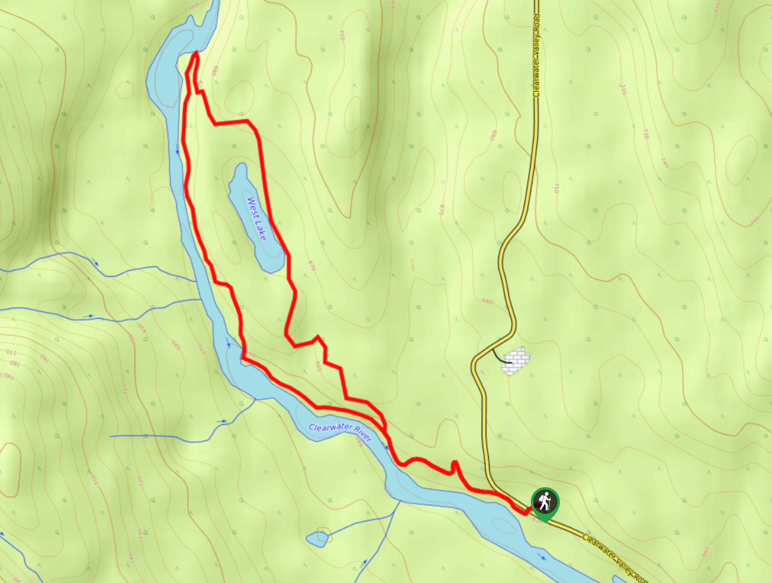
West Lake Loop
The West Lake Loop is a 3.3mi lollipop hiking route within Wells Gray Provincial Park that meanders through…
Ray’s Farm & Mineral Springs Loop Trail
The Ray’s Farm & Mineral Springs Loop is a 2.4mi hiking circuit north of Clearwater, BC, that will…
Triple Decker Falls Trail
The trek to Triple Decker Falls utilizes a 0.5mi out-and-back hiking route near Clearwater, BC that passes through…
Comments