Mount Tzouhalem
View Photos
Mount Tzouhalem
Difficulty Rating:
The trek up Mount Tzouhalem follows a fun hiking circuit through the forest that leads up to several viewpoints overlooking the beautiful waters of Cowichan Bay. Along the trail, you will experience an amazing forest setting and several steep inclines leading up the viewpoints atop the rocky bluffs. Due to a high number of intersecting trails in the area, navigation along this route can be difficult. Make sure to bring a GPS in order to remain on the correct path.
Getting there
To reach the Mount Tzouhalem trailhead from Duncan, head east on Trunk Road for 13.0mi and take the 2nd exit at the roundabout onto Maple Bay Road. Continue on for 1.9mi and turn right onto Kingsview Road. After 623ft, take the 1st exit at the roundabout to stay on the same road for another 0.7mi. Turn right on Sansum Drive and after 787ft, turn right on Salish Road. In 2297ft, turn left onto Kaspa Road and follow it for 1148ft to arrive at the parking area.

About
| When to do | Year-Round |
| Backcountry Campsites | No |
| Pets allowed | Yes |
| Family friendly | Older Children only |
| Route Signage | Poor |
| Crowd Levels | Moderate |
| Route Type | Lollipop |
Mount Tzouhalem
Elevation Graph
Weather
Mount Tzouhalem Trail Description
With an intermediate length, good variation in terrain, and breathtaking scenery, the Mount Tzouhalem Hike is an ideal day trip for both casual and experienced hikers alike. While the trail does feature some small gains in elevation, these are largely spread throughout the hike, with only a few steeper sections that make it a pleasant hike through the forest. As mentioned, this route is part of a dense network of multi-use trails in the area, so make sure to bring a GPS or else you might get pulled off the main route.
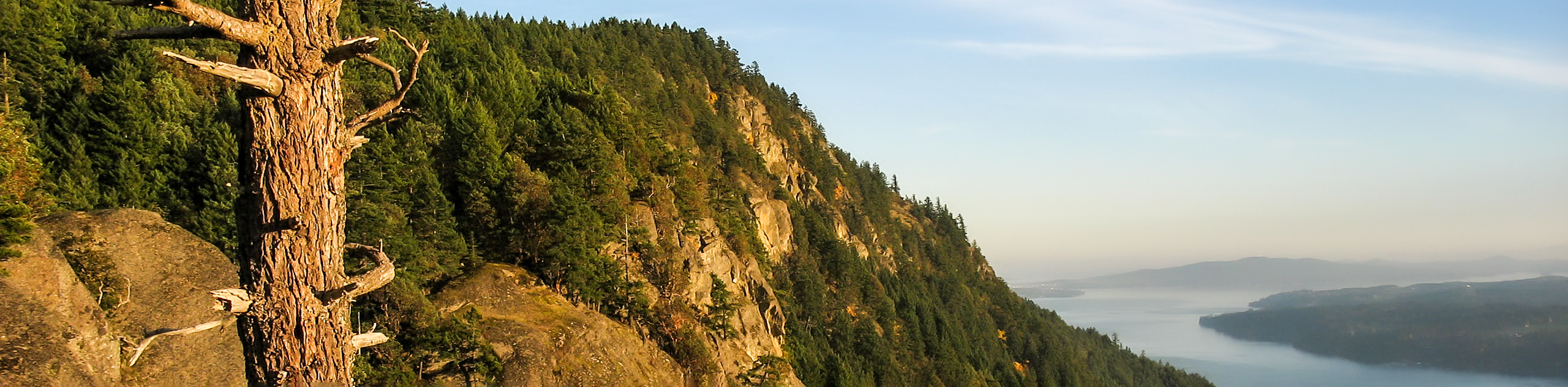
Setting out from the parking area, follow the trail to the southeast and into the thick, shady cover of the forest. The real views will come a little later on in the hike, so take some time to enjoy the amazingly atmospheric forest setting as you begin to traverse the loop portion of the journey. After hiking through the trees, you will eventually come to a scenic lookout over Cowichan Bay in the southeast corner of the trail.
After appreciating the views, follow the route to the west to arrive at the rocky lookout at the Mount Tzouhalem Cross that was installed on the hillside in 1976 as part of Easter celebrations. From this hilltop perch, you will have a commanding view across the Cowichan Valley, stretching from the bay in the east to the city of Duncan. After taking in the views, head back to the main trail and follow it to the north through the web of intersecting routes to arrive back at the parking area where you began.
Similar hikes to the Mount Tzouhalem hike
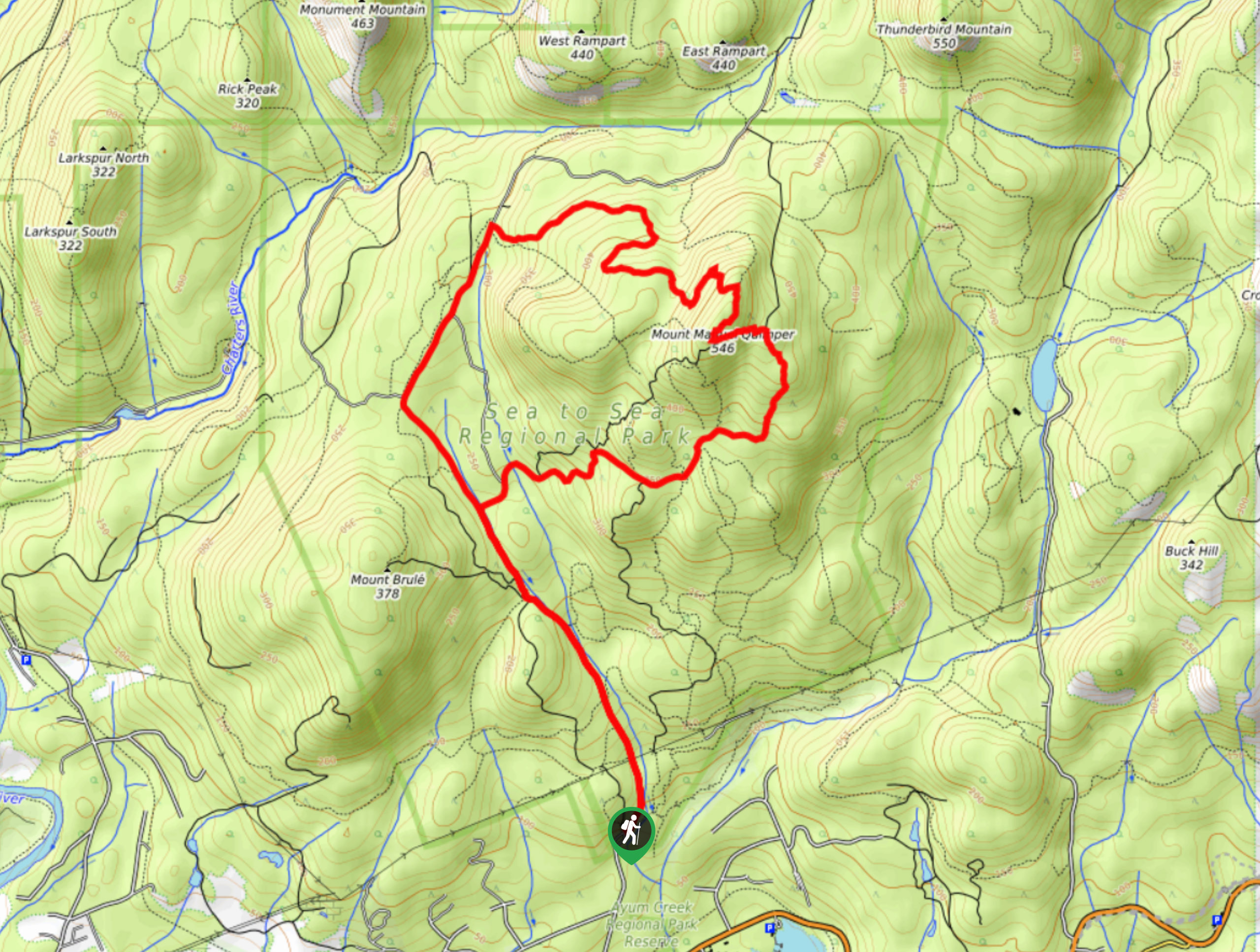
Mount Manuel Quimper Trail
The trek to Mount Manuel Quimper is a 6.2mi lollipop hiking route that climbs uphill through the forest…
Prior and Thetis Lakes Loop Hike
The Prior and Thetis Lake Loop will take you along an 5.0mi lollipop hiking route through a beautifully…
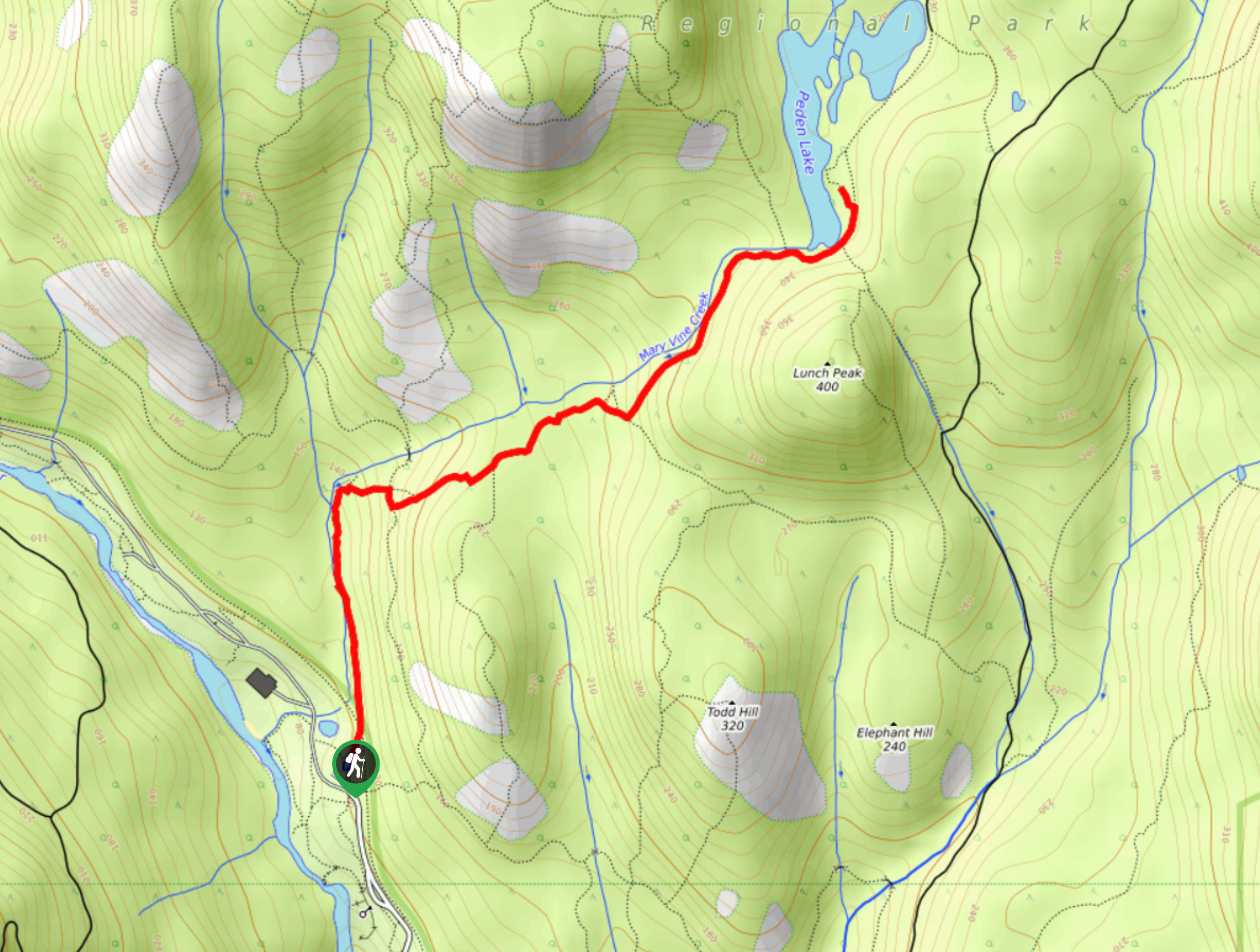
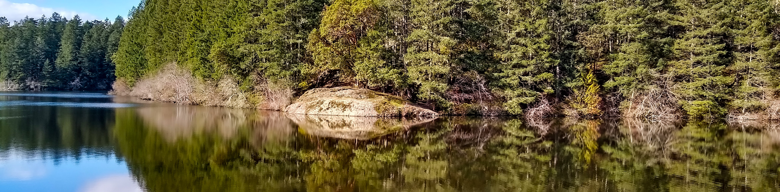
Peden Lake via Mary Vine Trail
Peden Lake via the Mary Vine Trail is a 3.2mi out-and-back hiking route in the Seas to Sea…
Comments