Gowlland Tod Trail
View Photos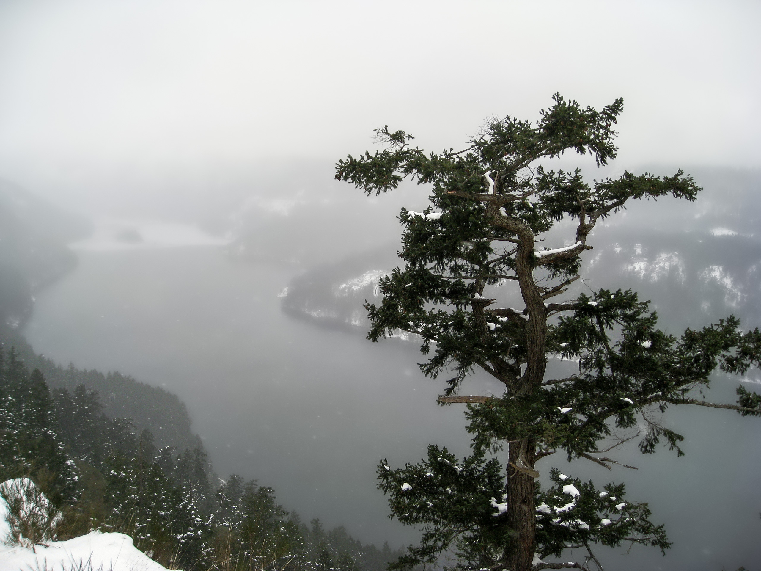
Gowlland Tod Trail
Difficulty Rating:
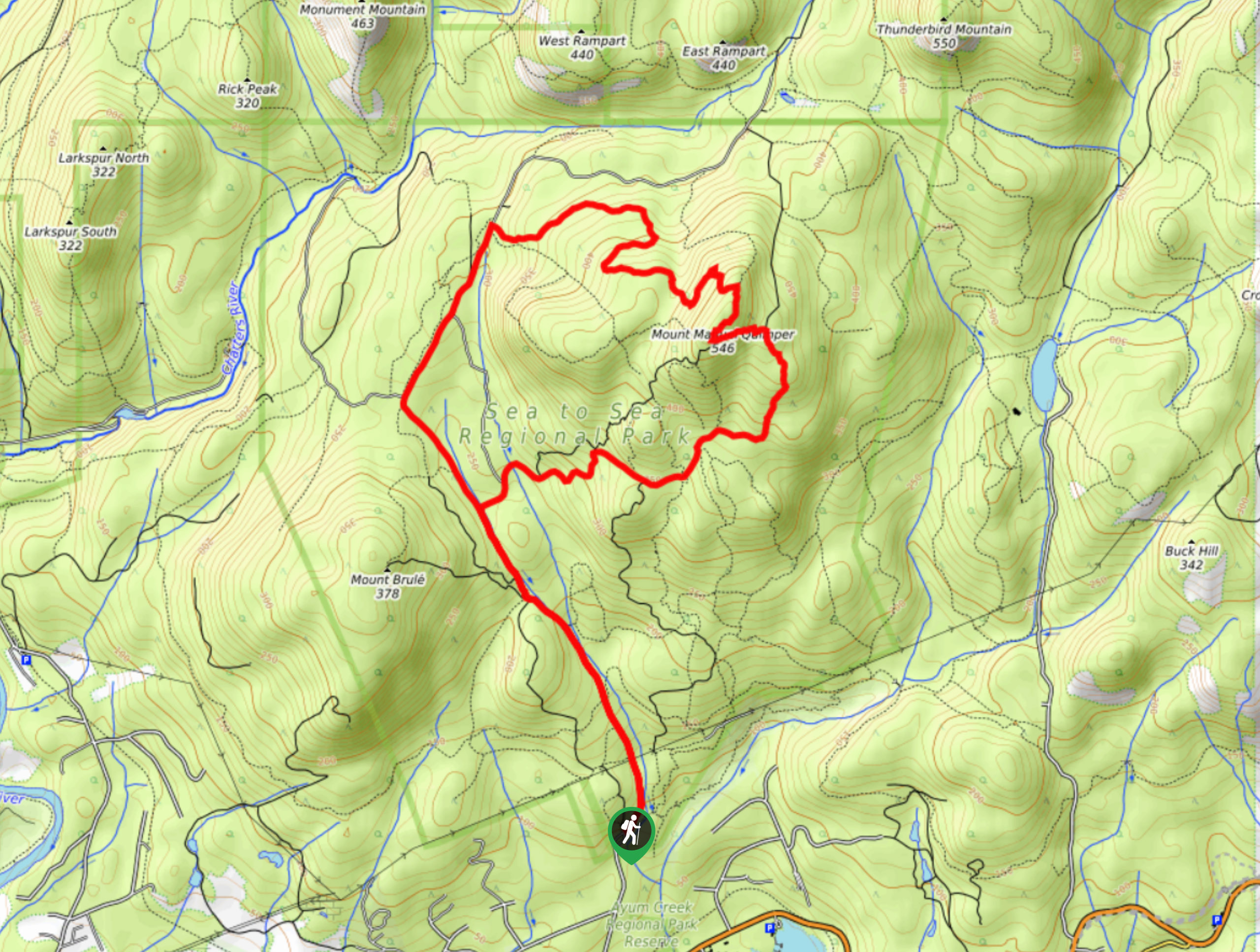
The Gowlland Tod Trail is a 12.1mi lollipop hiking route northwest of Victoria that will lead you through Gowlland Tod Provincial Park for some scenic views overlooking the Saanich Inlet. Along the trail, you will hike through a picturesque forest setting and uphill over some more rugged and exposed terrain to reach several scenic viewpoints. The real challenge of this hike is the overall distance, as opposed to any real difficult terrain; however, there are several steep inclines along the trail that could slow travel for some hikers.
Getting there
To get to the parking area for the Gowlland Tod Trail from Brentwood Bay, head southeast for 3.0mi along BC-17A and make a right turn onto Wallace Drive. Follow it for 1804ft and turn left on Willis Point Road, continuing along it for 2.5mi. Make a left turn onto Ross Durrance Road and in 1148ft you will find the trailhead on the right.

About
| When to do | April-November |
| Backcountry Campsites | No |
| Pets allowed | Yes - On Leash |
| Family friendly | Older Children only |
| Route Signage | Average |
| Crowd Levels | Moderate |
| Route Type | Lollipop |
Gowlland Tod Trail
Elevation Graph
Weather
Gowlland Tod Trail Description
Although lengthy, the Gowlland Tod Trail is an amazing hiking route for both casual and experienced hikers that will produce some breathtaking views and a few short physical challenges along the way. As previously mentioned, the main challenge of this route is the overall length and brief sections of steep hiking that provide a nice bit of variation along the route. As there are a few intersecting trails along this hike, you might want to bring a GPS or trail map in order to stay on the correct route.
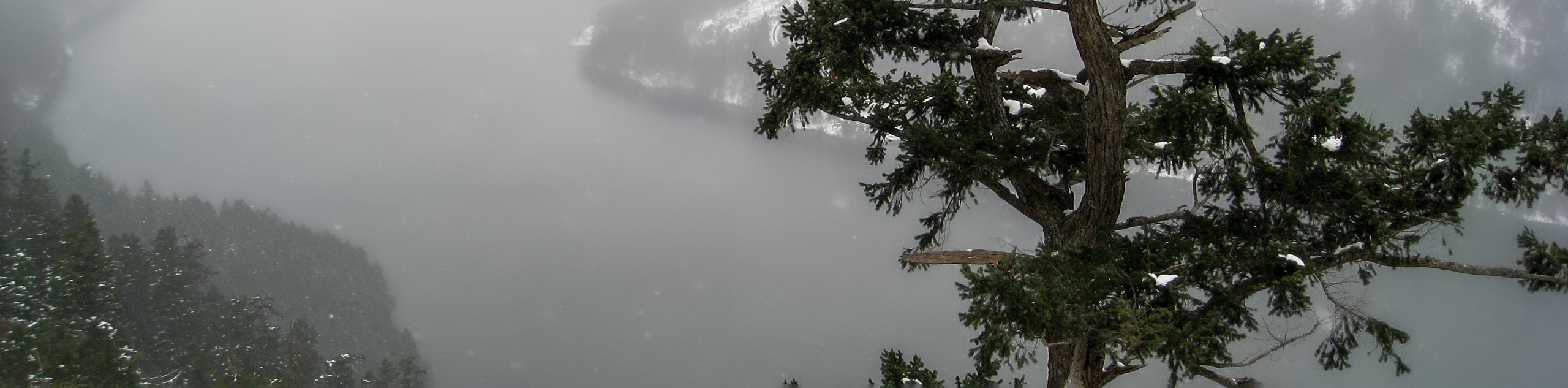
The hike sets out from the trailhead and immediately enters into the thick, shady cover of the forest. On your left, you will pass by several small marshy ponds before arriving at the Saanich Inlet Viewpoint. Take a few moments to admire the views across the deep blue water before continuing southwest to the Squally Reach viewpoint for another amazing sightline across the water. Continue making your way further into the park, as the trail winds through the forest and into some more rugged and exposed terrain.
A quick but steep climb uphill will take you to the top of Jocelyn Hill for some scenic views across the Finlayson Arm to the west before continuing south to reach the summit of Holmes Peak. Roughly 1.3km of hiking through a mixture of light forest and open clearings will bring you to the end of the Gowlland Tod Trail. From here, turn back and retrace your steps along the same route to gain a different perspective on the day’s hike while you make the return journey to the parking area where you began.
Similar hikes to the Gowlland Tod Trail hike
Mount Manuel Quimper Trail
The trek to Mount Manuel Quimper is a 6.2mi lollipop hiking route that climbs uphill through the forest…
Prior and Thetis Lakes Loop Hike
The Prior and Thetis Lake Loop will take you along an 5.0mi lollipop hiking route through a beautifully…
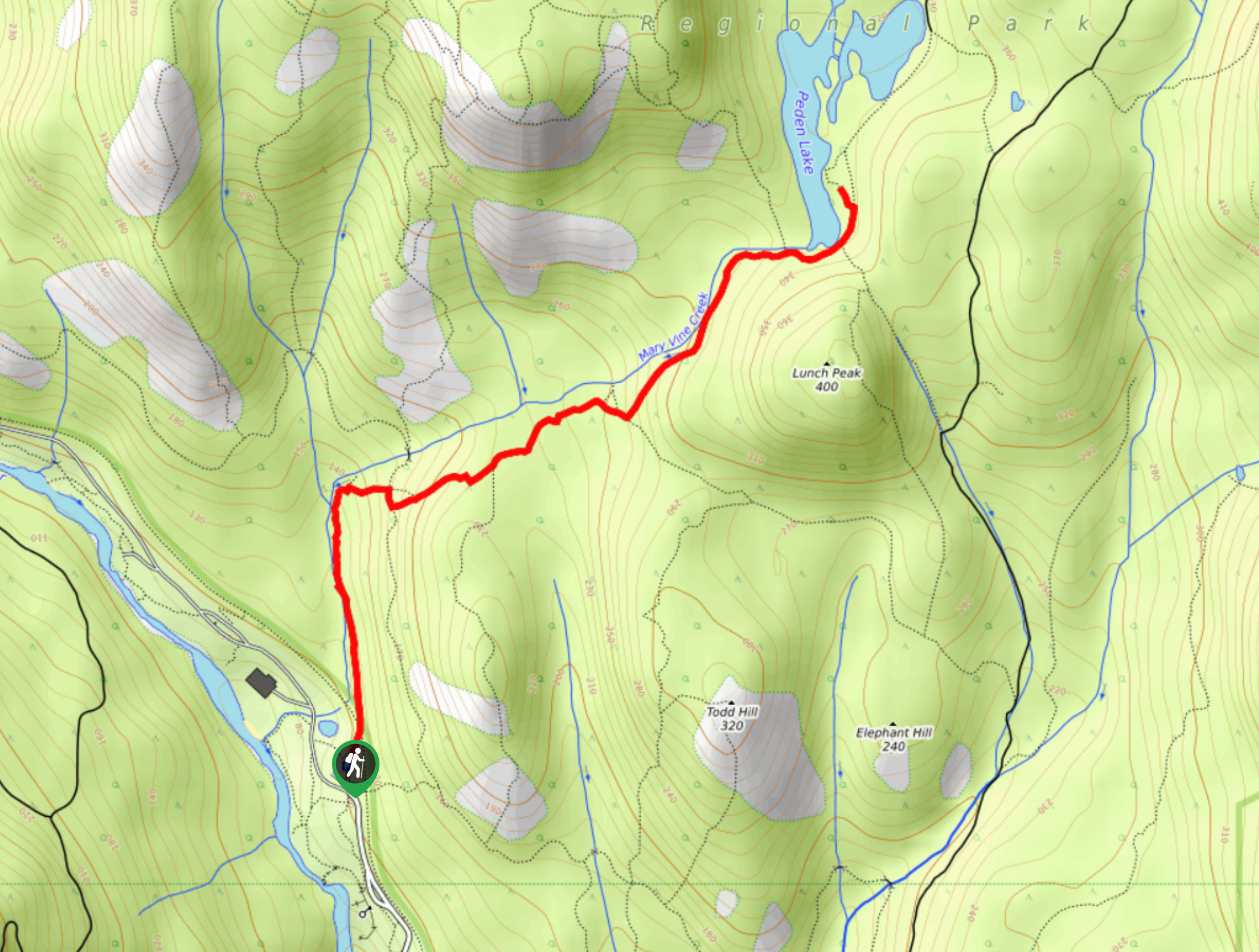
Peden Lake via Mary Vine Trail
Peden Lake via the Mary Vine Trail is a 3.2mi out-and-back hiking route in the Seas to Sea…
Comments