
Old Baldy Mountain Trail
View Photos
Old Baldy Mountain Trail
Difficulty Rating:
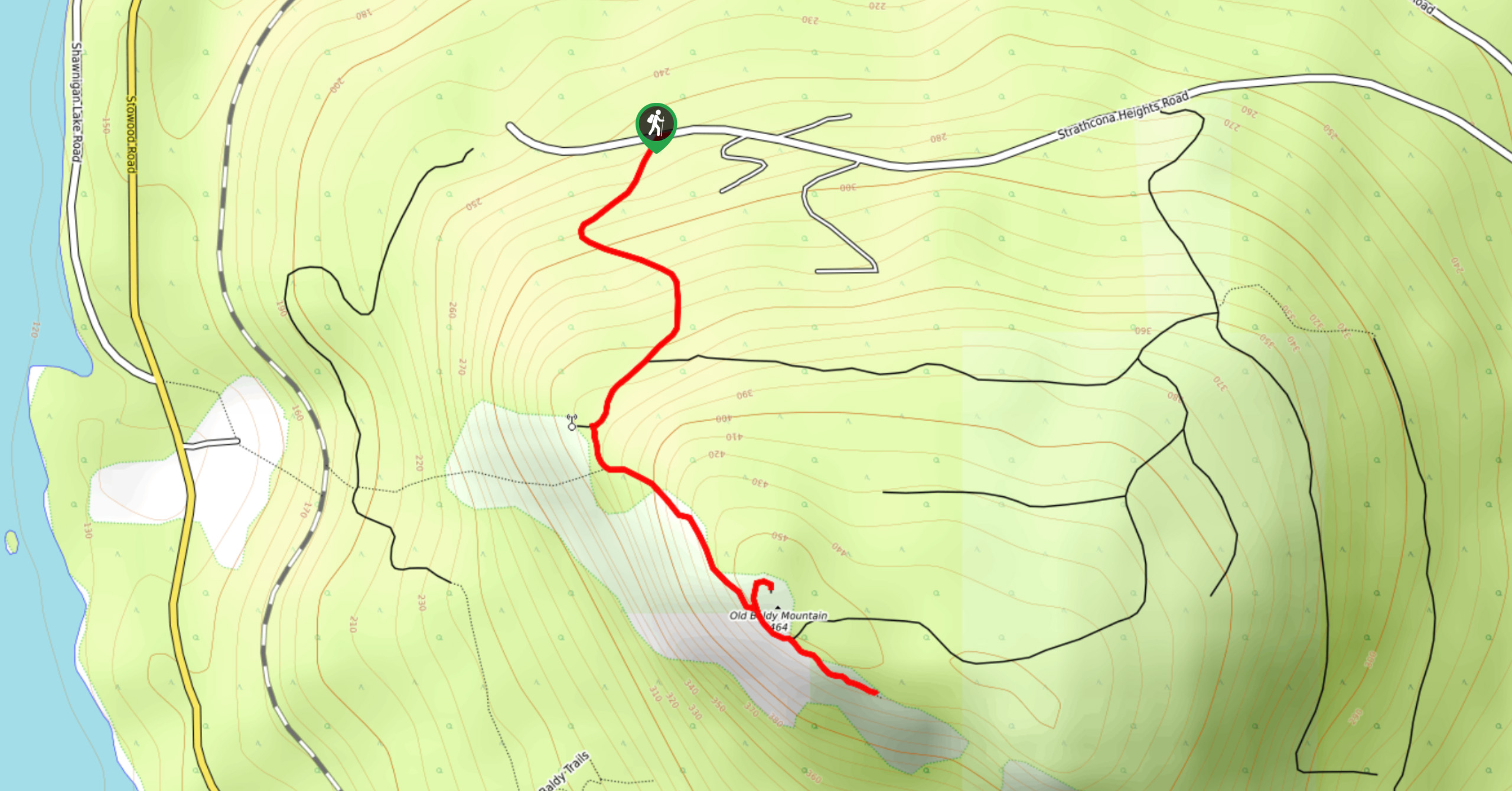
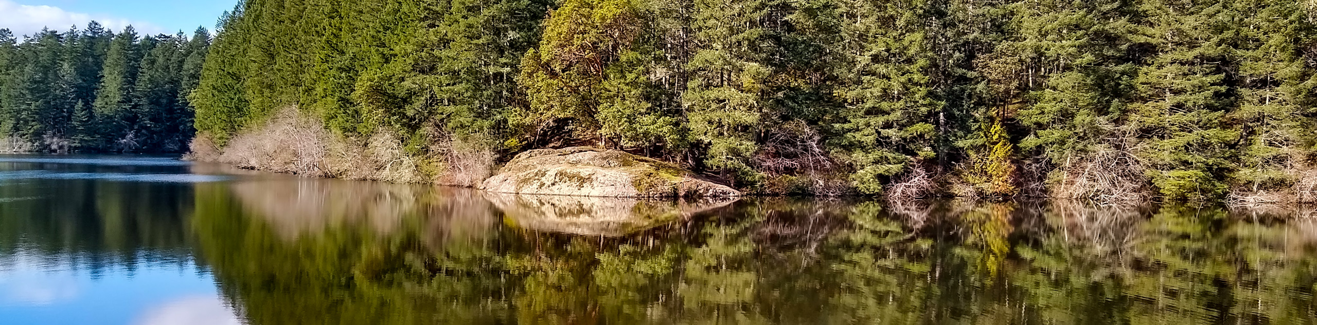
The trek up Old Baldy Mountain Trail follows a 1.5mi out-and-back route west of Victoria, BC, that traverses a mixture of terrain on the way up to the summit. While on the trail, you will hike along a wide gravel road through the forest, before making your way up a steep rocky stretch of trail on the way to the lookout at the top of the mountain. Once there, you will be greeted with some spectacular views looking out across the scenic landscape with the blue waters of Shawnigan Lake breaking up the vast green expanse below.
Getting there
To reach the Old Baldy Mountain trailhead from Mill Bay, head west on Shawnigan Lake-Mill Bay Road for 2.2mi and turn left onto Sylvester Road. After 0.8mi, turn right onto Baldy Mountain Road and follow it for 2789ft. Make a left on Hawking Road and after 2789ft it will turn right and transition into Strathcona Heights Road. Follow this for 0.9mi to find the trailhead on the left.

About
| When to do | April-October |
| Backcountry Campsites | No |
| Pets allowed | Yes - On Leash |
| Family friendly | Older Children only |
| Route Signage | Average |
| Crowd Levels | High |
| Route Type | Out and back |
Old Baldy Mountain Trail
Elevation Graph
Weather
Old Baldy Mountain Trail Description
There are a few different ways that hikers can choose to make their way up Old Baldy Mountain and this one offers a nice variation in terrain that will keep you engaged without adding too much difficulty. While the route isn’t overly challenging, there are a few steep rocky stretches on the approach to the summit that are a bit technical. It is best to wear proper hiking footwear, so as to get the best footing while out on the trail. The top of the mountain is a bit exposed, so you might want to think about bringing a light jacket if you plan on spending more than a few minutes up there, as it can be extremely windy.
These minor details aside, this is a fantastic hiking route that will lead you uphill for some breathtaking views looking out across Shawnigan Lake. Although the route can be steep in places, it is balanced out with plenty of areas to stop for a rest and take in the scenic views. If you want to extend your adventure atop Old Baldy Mountain, try exploring some of the other trails that can be found in the immediate vicinity for a bit of added excitement to your day.
Setting out from the trailhead, make your way south through the forest and follow the wide gravel road as it climbs steeply uphill. After meandering through the forest for 2165ft, you will arrive at a junction with a trail branching off toward the summit of the mountain.
Follow the trail to the left to begin your ascent of the summit along the rocky terrain that makes up the southwestern face of the mountain. After some light scrambling, you will arrive at the mountain top lookout and be greeted with an amazing sightline that stretches west across Shawnigan Lake toward the interior of Vancouver Island. Hike a bit further along the trail and you will find a small wooden tree swing where you can sit and enjoy the breathtaking views while teetering near the edge of the rocky bluff. After taking in the views, carefully make your way back down the same route to return to your vehicle having completed the hike up Old Baldy Mountain.
Insider Hints
Bring a jacket, as the top of the mountain is a bit exposed and fairly windy.
Try extending your hike by exploring the adjoining trails around the summit area.
The trail is quite steep in places with some rocky terrain. Make sure to wear proper hiking footwear.
Similar hikes to the Old Baldy Mountain Trail hike
Mount Manuel Quimper Trail
The trek to Mount Manuel Quimper is a 6.2mi lollipop hiking route that climbs uphill through the forest…
Prior and Thetis Lakes Loop Hike
The Prior and Thetis Lake Loop will take you along an 5.0mi lollipop hiking route through a beautifully…
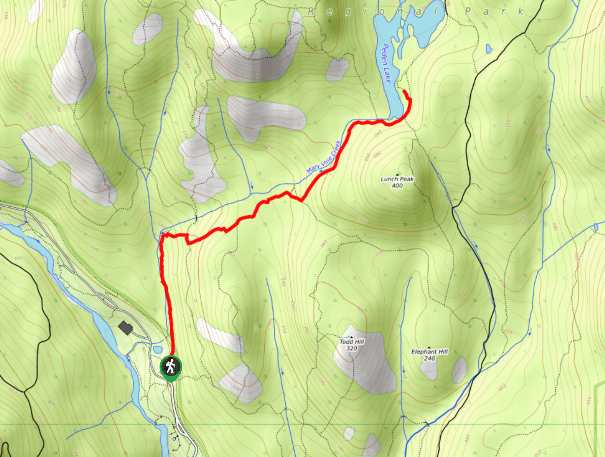
Peden Lake via Mary Vine Trail
Peden Lake via the Mary Vine Trail is a 3.2mi out-and-back hiking route in the Seas to Sea…
Comments