Inchnadamph to Kylestrome Walk
View Photos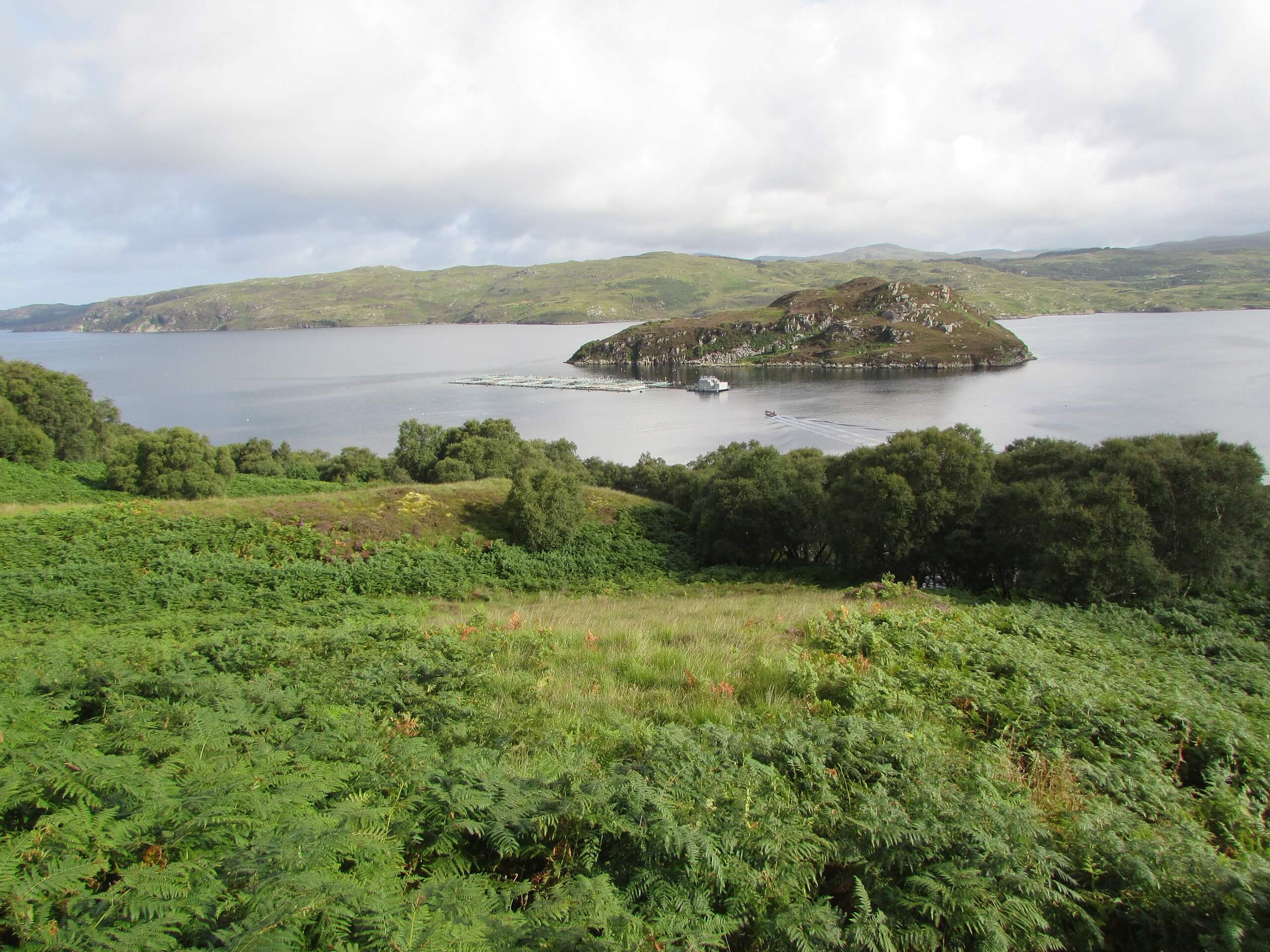
Inchnadamph to Kylestrome Walk
Difficulty Rating:
Some may find the one-way part of the Inchnadamph to Kylestrome Walk intimidating, but trust us, planning a ride back to your car or staying at the hotel in Kylesku (during summer) before turning around is so worth it. Plus, you can wild camp along the way, so there are options to ease the intimidation factor of this walk. You don't want to miss out on revelling in the lochs, scenic viewpoints, and Britain's tallest waterfall en route, do you?
Getting there
To get to the start of the Inchnadamph to Kylestrome Walk, plug these coordinates into your GPS: 58°09'00.7"N 4°58'15.2"W. The walk starts in Inchnadamph.

About
| Backcountry Campground | Wild camping |
| When to do | May - October |
| Pets allowed | Yes - On Leash |
| Family friendly | No |
| Route Signage | Good |
| Crowd Levels | Moderate |
| Route Type | One Way |
Inchnadamph to Kylestrome Walk
Elevation Graph
Weather
Inchnadamph to Kylestrome Walk Description
The Inchnadamph to Kylestrome Walk makes for a great adventure if you’re looking to try a section of the Scottish National Trail! Expect a reel of highlights en route. However, just know that this is a one-way route, so you’ll need to plan your transportation accordingly or plan to wild camp en route and return the same way you came the following day. We wouldn’t complain about waking past the same views twice—they are that good. You can expect to traverse some boggy areas and a burn crossing!
It’s hard not to fall in love with the rugged scenery sweeping the Highlands, where Loch Glendhu, Loch Beag, Eas a’ Chual Aluinn waterfall (the highest in Britain), and more top-notch views await. You’ll also pass bothies with wild camping options nearby! We recommend loading up your overnight bag and spending a night or two along this trail—or a night en route and another night on the way back!
Starting from Inchnadamph, you’ll follow the track stretching past the hostel’s entrance to walk along River Trallgil. You’ll see a track to your left and another right after —ignore them! Just before the track darts across Allt Poll an Droighinn, take a left to follow a path marked by a little cairn before heading northeast. From here, the path gently ascends, going past a gate to climb above the river winding north. At the small shelter, the path forks. Be sure to stay left to travel by the west end of Loch Fleodach Corrie. You will need to wade across here due to a broken bridge! Hopefully, the water isn’t too high.
After, the path heads for Bealach na h-Uidhe. You’ll know when you reach when you see a cairn. From here, you’ll start to descend; expect some zigzags after a brief rough section. When you arrive along the west side of a lochan, notice that the path divides. Take a right here to walk along the lochan. Shortly after, the path veers off again. Stay left to begin another descent to reach the floor of the glen. Look at the views unravelling beside you as you descend more zigzags. Get ready for a boggy path!
After crossing the burn, the bogginess will ease. Continue downhill as you walk alongside the burn, eventually reaching Abhainn an Loch’ Bhig. Watch out: you may have to wade here. Go northwest to descend the glen. If you think, “Wow, I’m not moving fast.” Don’t worry! You aren’t alone! This part along the river lacks a distinct path. Although, the view unveiling of the sea and views of Britain’s tallest waterfall in front of you will hopefully force you to forget all about the limited path.
Not long after, you’ll reach Loch Beag! Here, stay above the fence posts to keep along the east of the sea loch. Then, you’ll finally find a path after a crumbling stone wall. Soon, you’ll reach a bothy, where you can choose to stay overnight or opt to wild camp nearby!
If you aren’t setting up camp for the night, continue in front of the building towards Glencoul River to find a bridge. On the other side, take a right to follow a path leading up the glen before taking a left to reach a small path heading above Loch Glencoul. This is a steep climb! After gaining in elevation, look for a view of the mass of Quinag. And don’t forget to glance back over your shoulder to check out Glencoul from above. Stunning!
The path becomes more straightforward as it reveals glimpses of Unapool and Kylesku in the near distance, just beyond the water. Soon, the path veers to kickstart your descent to Loch Glendhu. Expect to meander through some woodland with the next bothy within eyesight. When you reach the shoreline, you’ll follow the path that can be washed away during high tide. However, if the tide is high, you can go behind the rocks just to your right. You’ll then reach a footbridge. You’re almost there! Walk through the gate to head towards the next bothy at Glen Dubh. A beautiful area worth spending the night in.
Keep walking to Kylestrome via an undulating path along Loch Glendhu’s north if you aren’t staying. The trail veers uphill before you reach the forest section, but avoid this and take the lower track to the left. Who wants to climb more after walking almost all day? This next part unveils some of the best views of the adventure! Revel in the picturesque Kylesku Bridge stretching across Loch a’ Chàirn Bhàin. After, follow the minor road and take a right to go uphill to pass buildings dotting Kylestrome to reach the A894.
Take a left to go along the road and cross the bridge leading into Kylesku! This is where your journey ends as it’s a one-way walk. Some of you may be completing the Cape Wrath Trail or Scottish National Trail; if that’s the case, enjoy a lovely evening before setting off on the next section of these iconic long-distance routes.
Trail Highlights
Kylesku Bridge
The Kylesku Bridge isn’t your typical straight-across-the-water bridge; no, this bridge curves across Loch a’ Chàirn Bhàin, giving it a unique, picturesque look! The mastermind behind this creative-looking bridge is someone named Ove Arup. Kylesku Bridge was built between 1981-84.
Eas a’ Chual Aluinn
Boasting a roaring drop of 656ft, the Eas a’ Chual Aluinn waterfall is the highest in all of Britain. Some say that when it’s flowing at its highest capacity, it’s even three times greater than Niagara Falls. Talk about an epic waterfall worth viewing! You can find this waterfall tumbling near Sutherland in the Scottish Highlands.
Insider Hints
If you plan on staying at a bothy, do yourself and everyone else a favour and check out the bothy code before going—remember to clean up after yourself!
Enjoy some wild camping spots en route.
Don’t forget to organize transportation if you plan on doing this as a one-way route.
Consider booking at the charming Kylesku Hotel if you want to stay a night before heading back the way you came.
Similar hikes to the Inchnadamph to Kylestrome Walk hike
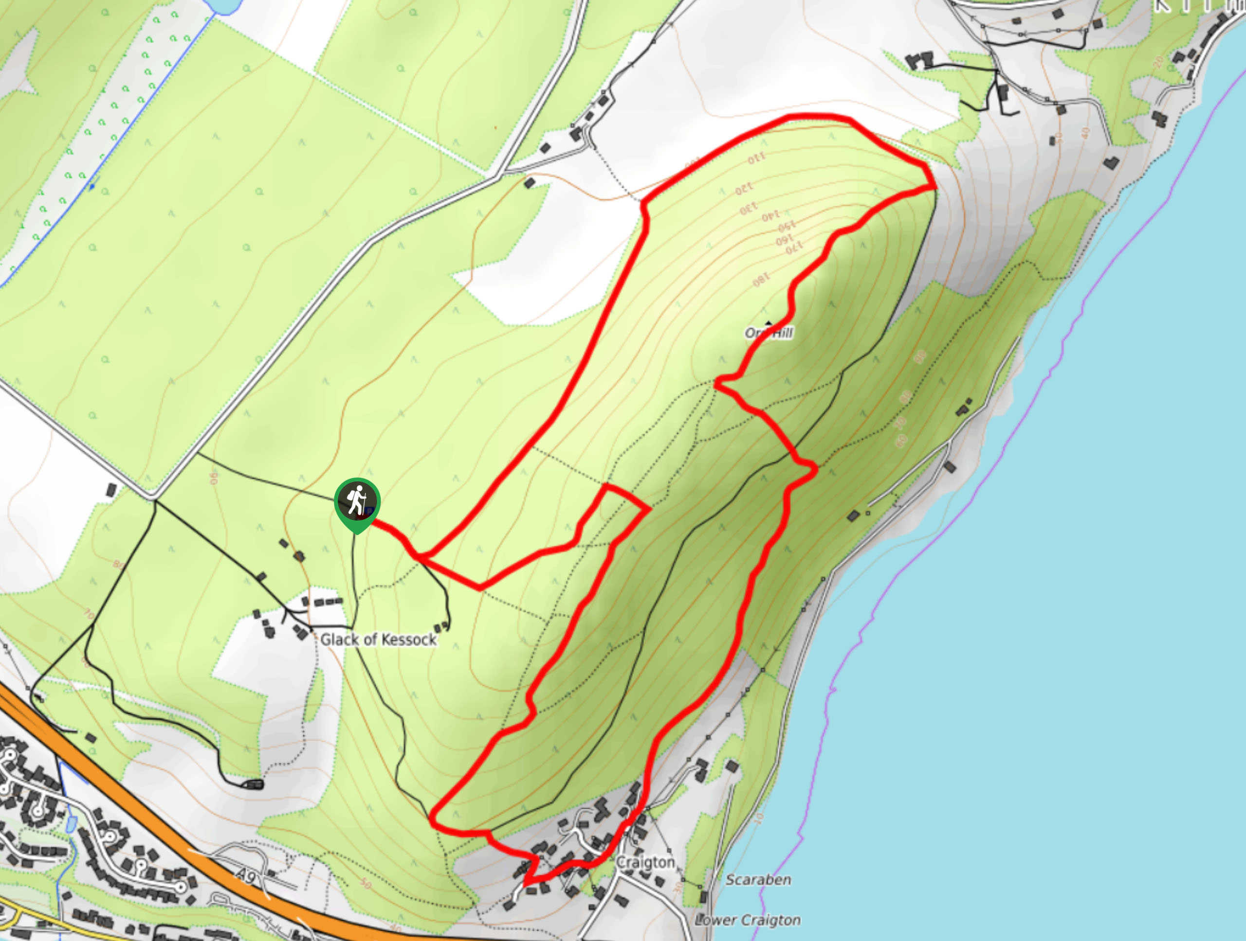
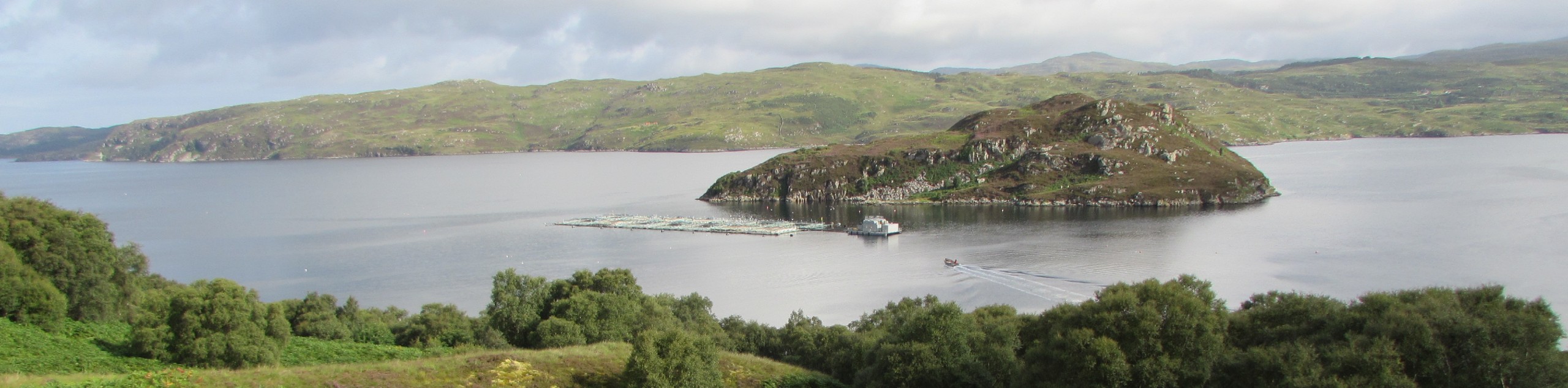
Ord Hill Walk
If you still have some gas left in the tank or have a day between activities in the Highlands and…
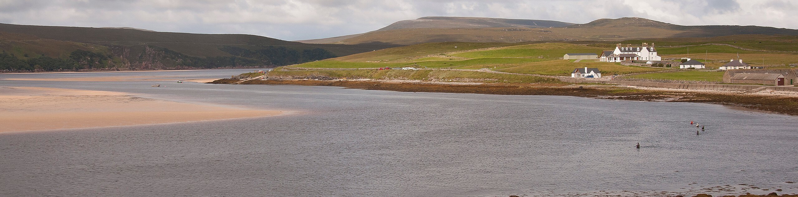
Kyle of Durness Circular Walk
The Kyle of Durness Circular Walk packs a punch when it comes to the scenery! Gaze out into the coastline,…
The Saddle, Forcan Ridge and Sgùrr na Sgìne Walk
The Saddle, Forcan Ridge and Sgùrr na Sgìne Walk is a rugged adventure that boasts a thrilling challenge while unveiling…
Comments