Fyrish Monument Walk
View Photos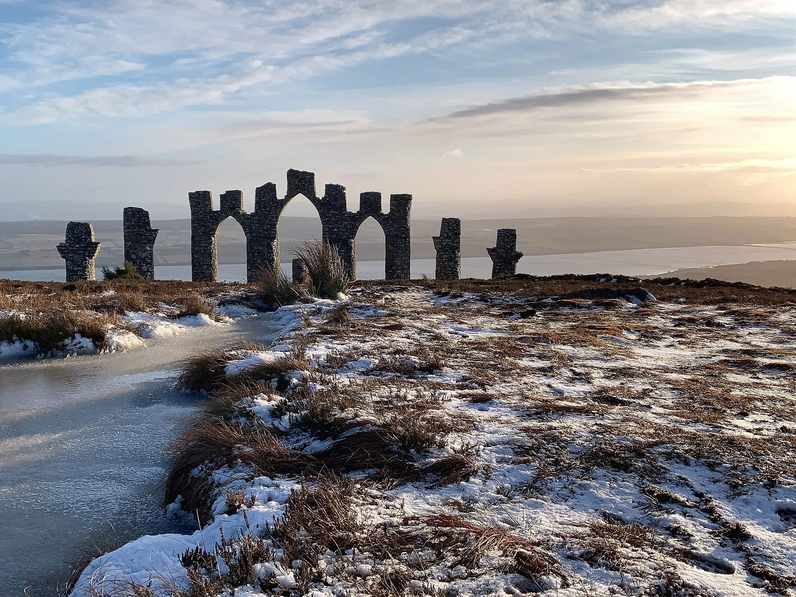
Fyrish Monument Walk
Difficulty Rating:
The Fyrish Monument Walk fuses a fun combination of views to form an unforgettable adventure—despite its shorter length. This walk may not take you deep in the quintessential wild sweeping the Highlands, but it’s definitely a cool adventure that doesn’t compromise on scenery (or uniqueness!). While the main object along this walk is the Fyrish Monument, you’ll also get to revel in views of the Cromarty Firth below, with the North Sea and Ben Wyvis painting colour into the image.
Getting there
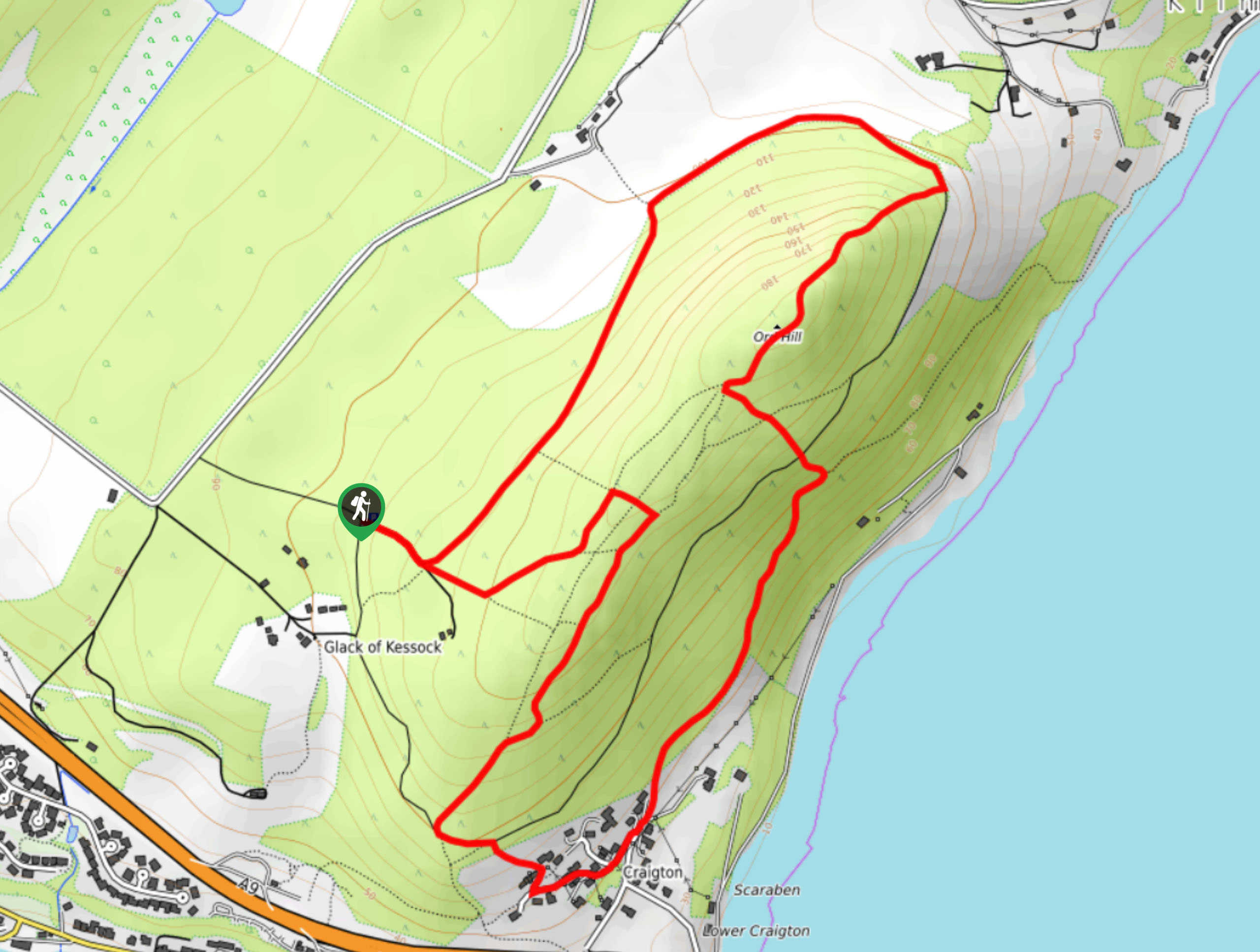
To get to the start of the Fyrish Monument Walk, head to the small Fyrish car park near Boath.

About
| Backcountry Campground | No |
| When to do | Year-round |
| Pets allowed | Yes - On Leash |
| Family friendly | Yes |
| Route Signage | Good |
| Crowd Levels | Moderate |
| Route Type | Lollipop |
Fyrish Monument Walk
Elevation Graph
Weather
Fyrish Monument Walk Description
The Fyrish Monument Walk winds through woodland scenery to a remarkable monument that stands above Cromarty Firth. Thankfully, families can tackle this one together. Just be mindful of the undulations—your heart will likely go through some ups and downs along this walk! Other than that, the path isn’t complicated, and most should be able to reach the Fyrish Monument without a problem. Aim to go on a clear day so that you can see the scenery sweeping below the monument.
This fantastic family-friendly walk offers a collection of outstanding views—from the monument itself to Cromarty Firth below, replete with the North Sea and backed by Ben Wyvis.
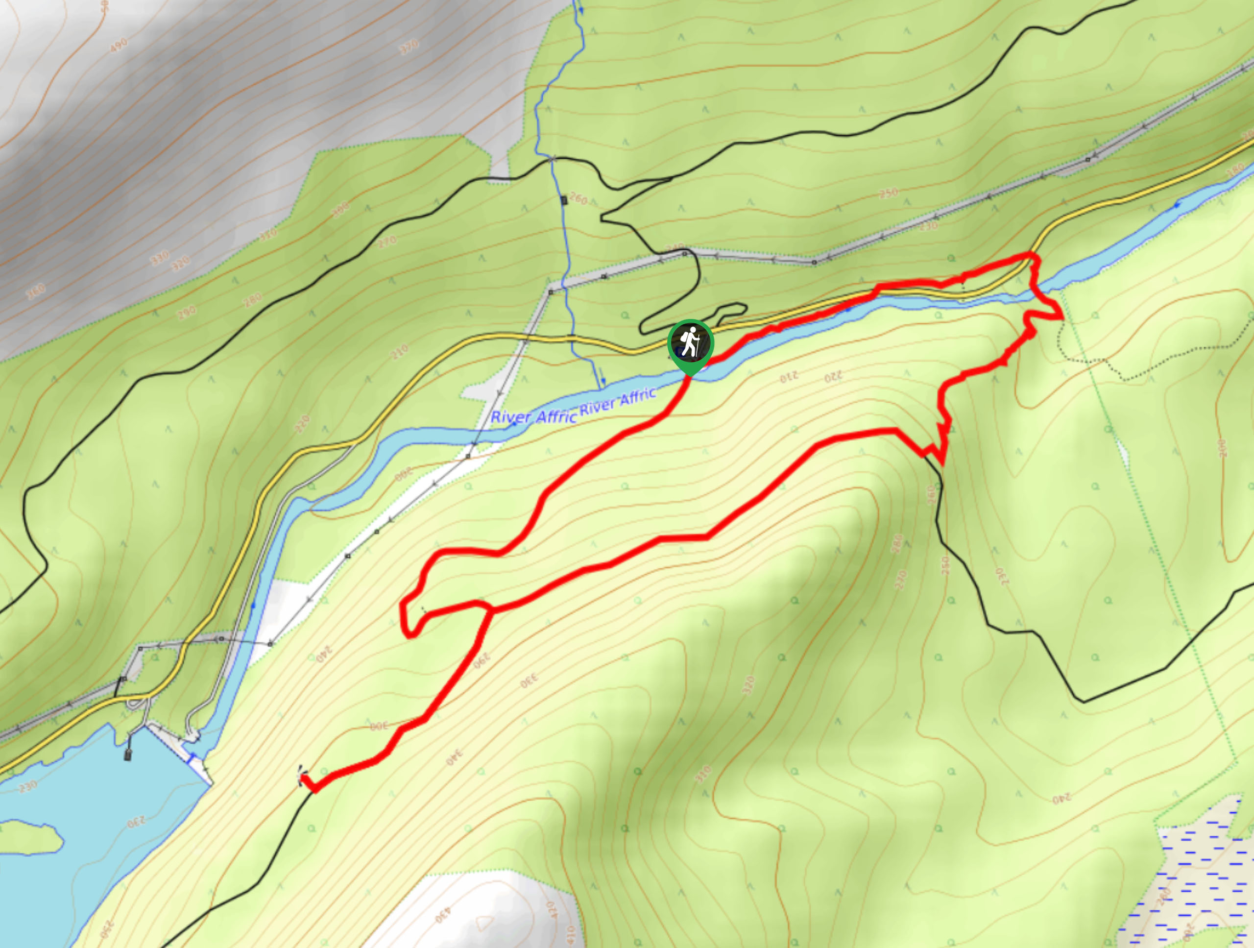
From the small parking lot, follow the signpost indicating ‘Jubilee Path.’ Follow the ups and downs in the forest, ensuring you continue straight across when you encounter the forestry track. Later on, you’ll descend stone steps, cross a footbridge, and then climb up more steps as you continue to meander through woodland.
Keep straight and get ready to ascend above the trees at the next junction, where stunning views await. When you get to the next intersection, go straight. If you head left, you’ll reach a small lochan. Heading straight will take you across open moorland and closer to the Fyrish Monument!
Around 0.3mi later, you’ll arrive at the monument. Take a moment to revel in its unique structure from afar before getting closer and checking out the views below. After soaking in the scenery, head back the way you came. When you reach the intersection with the option to go to the lochan, go left here for an alternate route back to create a lollipop, as you’ll eventually meet up with the same path that you started on. Follow this same path back to the car park!
Trail Highlights
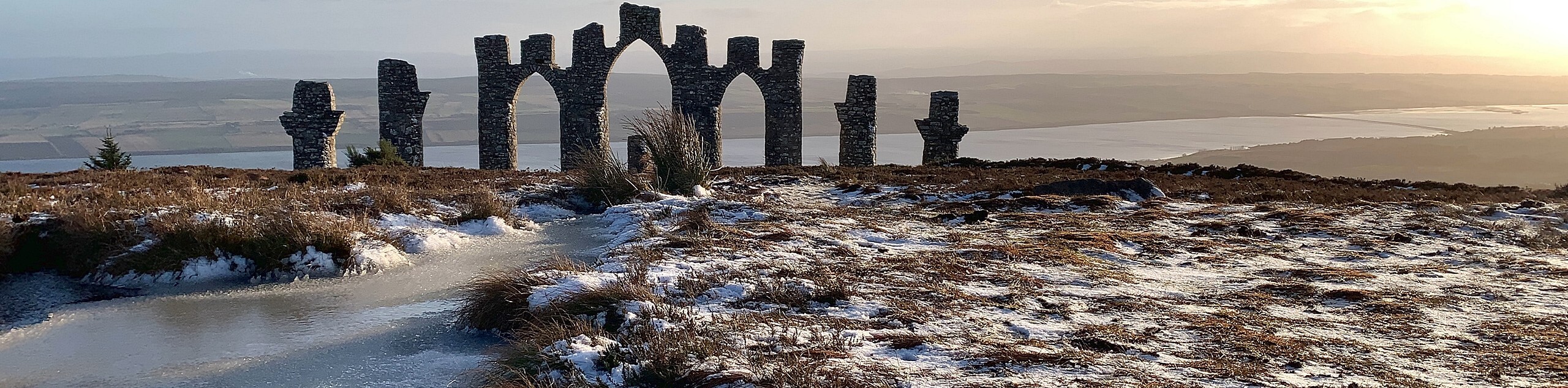
Fyrish Monument
The Fyrish Monument is an impressive, unique structure that harks back to 1783 when Sir Hector Munro crafted it. When he returned to the Highlands after serving as a commander for the British Forces of India, Munro noticed that several people were starving. But, during this time, it was unacceptable to hand out food to starving people. Those suffering could only earn relief by working! Therefore, building this monument became one of the jobs people could do to keep from starving. The monument replicates the Gates of Negapatam; a battle won by Munro in 1781.
Insider Hints
Go early to secure a spot as this car park is small
You can take public transport to Alness, but it adds 2.5mi to your adventure
Aim to go on a clear day
Similar hikes to the Fyrish Monument Walk hike
Ord Hill Walk
If you still have some gas left in the tank or have a day between activities in the Highlands and…
Kyle of Durness Circular Walk
The Kyle of Durness Circular Walk packs a punch when it comes to the scenery! Gaze out into the coastline,…
Dog Falls Walk
The Dog Falls Walk boasts a lovely, serene setting, punctuated by a waterfall, River Affric, and a stunning view of…
Comments