
Ord Hill Walk
View Photos
Ord Hill Walk
Difficulty Rating:
If you still have some gas left in the tank or have a day between activities in the Highlands and need something to do, we can’t help but suggest the Ord Hill Walk! This adventure will get your blood pumping while immersing you in a forest setting as it leads towards a lovely view of Inverness below.
Getting there
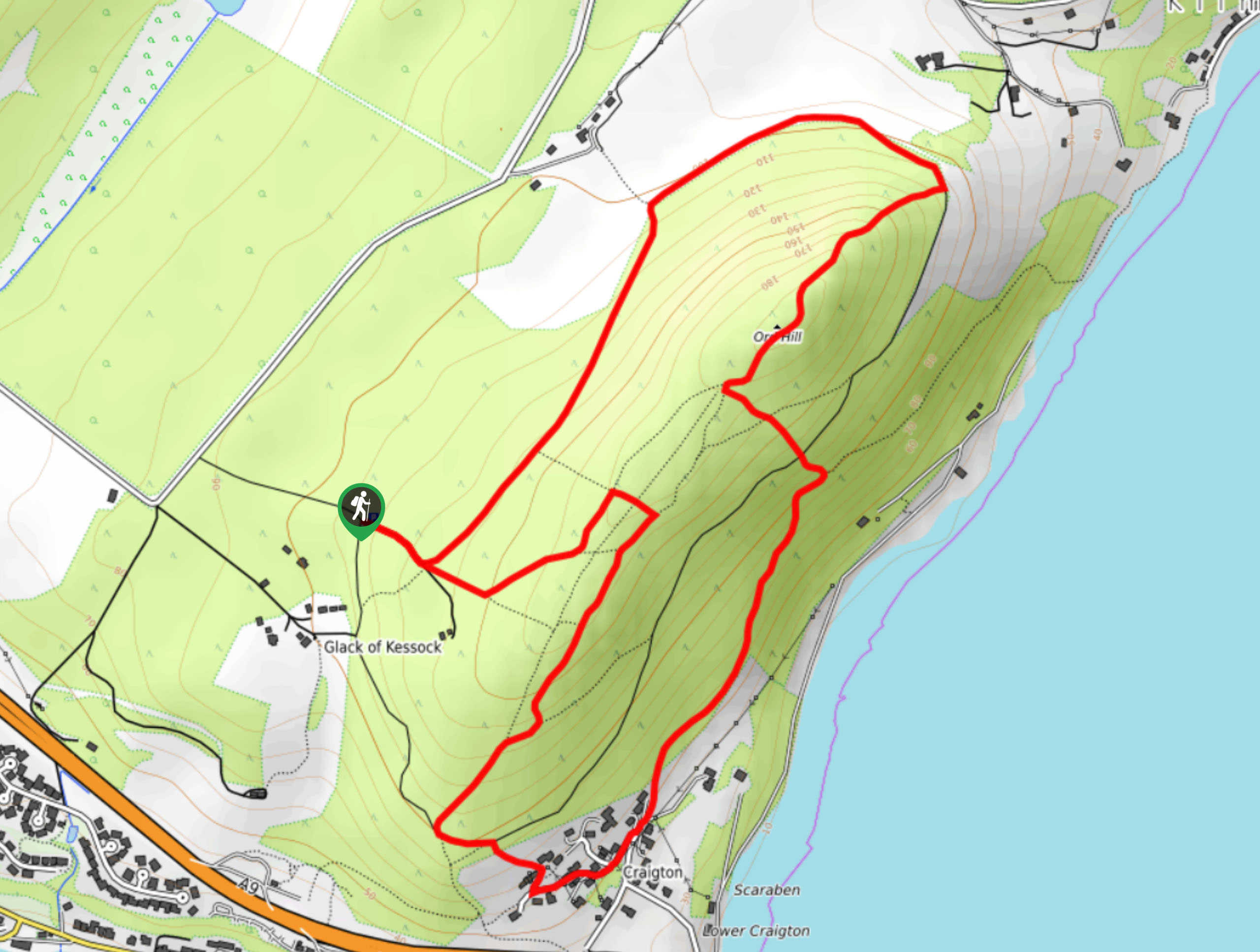
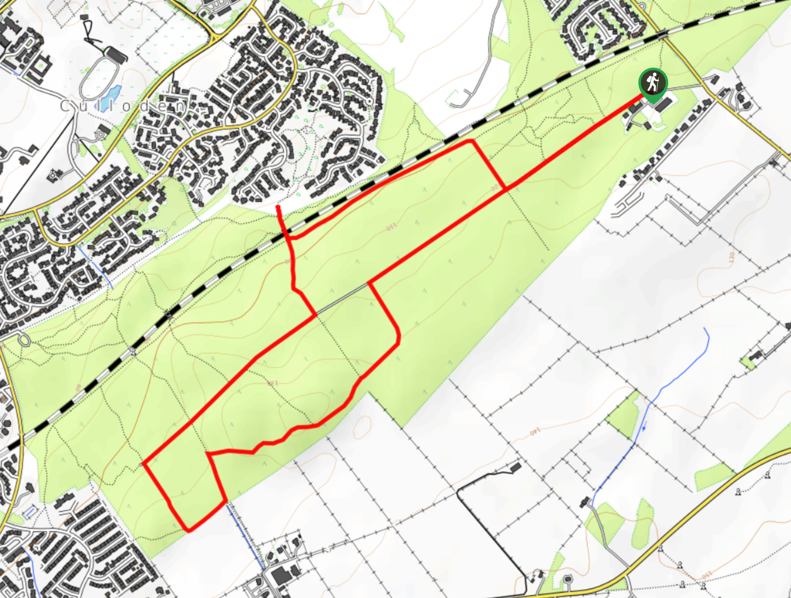
The Ord Hill Walk starts from the Ord Hill Carpark.

About
| Backcountry Campground | No |
| When to do | May-October |
| Pets allowed | Yes - On Leash |
| Family friendly | Yes |
| Route Signage | Average |
| Crowd Levels | Moderate |
| Route Type | Lollipop |
Ord Hill Walk
Elevation Graph
Weather
Ord Hill Walk Description
The Ord Hill Walk travels through a shaded forest setting before opening up to view Inverness hustling and bustling below. While we don’t suggest adding this walk to your Highland bucket list, it still makes for a great add-on adventure if you have some energy after completing another walk. Be sure to bring your GPS to ensure you stay on track!
Setting out from the car park, follow the path straight towards a junction, where you’ll go left and stay on the same track. Keep right to remain on this path at the next junction, where you’ll start to loop around toward another intersection. Here, take the inner path to your right. At the next junction, curve left to go towards the Inner Murray of Firth. At the fork, go right to walk in the direction of the A9. But don’t go all the way to the road. Instead, follow the path as it hooks around to head back to your car.
Similar hikes to the Ord Hill Walk hike
Kyle of Durness Circular Walk
The Kyle of Durness Circular Walk packs a punch when it comes to the scenery! Gaze out into the coastline,…
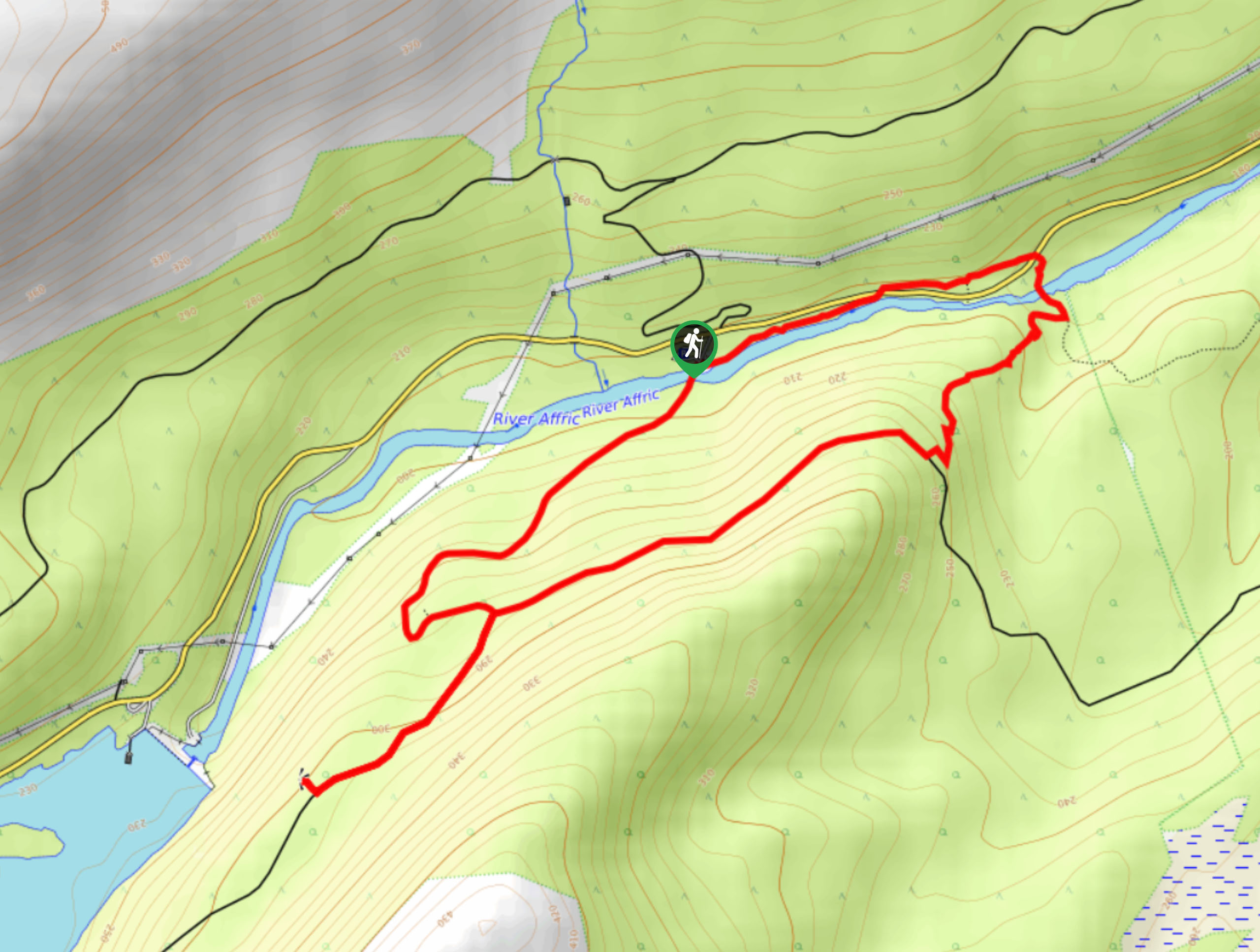
Dog Falls Walk
The Dog Falls Walk boasts a lovely, serene setting, punctuated by a waterfall, River Affric, and a stunning view of…
Culloden Woods Walk
The Culloden Woods Walk circumnavigates the battlefield where the Battle of Culloden occurred. Discover remnants of the battle as you…
Comments