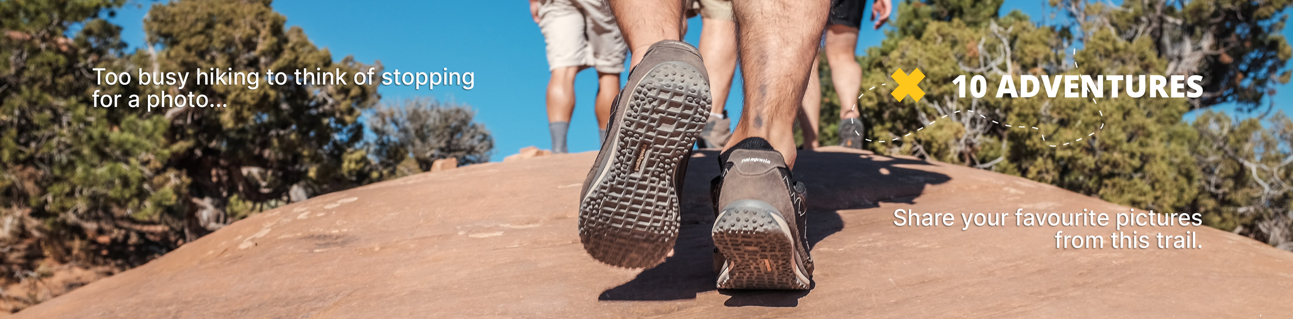
Eas a' Chual Aluinn Walk
View Photos
Eas a' Chual Aluinn Walk
Difficulty Rating:
The Eas a' Chual Aluinn Walk takes you on an out-and-back adventure to the tallest waterfall in Britain! Venture deep into Assynt, where rugged terrain and unreal scenery will keep you well-entertained (and alert). The views unravelling along this route only work to elevate the Eas a' Chual Aluinn Walk from incredible to epic.
Getting there
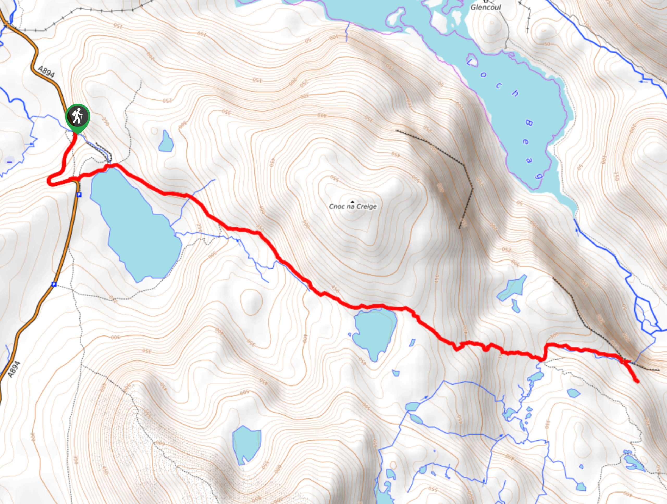
To get to the start of the Eas a' Chual Aluinn Walk, follow the A894 and you’ll find parking between Kylesku and Lochinver along the north side of Loch na Gainmhich. You’ll see a sign for a car park.

About
| Backcountry Campground | No |
| When to do | May-October |
| Pets allowed | Yes - On Leash |
| Family friendly | No |
| Route Signage | Average |
| Crowd Levels | Moderate |
| Route Type | Out and back |
Eas a' Chual Aluinn Walk
Elevation Graph
Weather
Eas a' Chual Aluinn Walk Description
The Eas a’ Chual Aluinn Walk is a must-do adventure in the Scottish Highlands! Replete with phenomenal scenery, including Britain’s highest waterfall, the Eas a’ Chual Aluinn Walk will not disappoint. However, this trail also has rugged terrain, such as bogginess and rocky terrain. Take care around the falls as it can be dangerous.
From the car park, follow the track heading along an old road before the path gets more rough and technical and boggy. Cross an outfall via stones and ascend a somewhat destroyed path instead of following the path by the loch. Then, go right to follow a rough path above the loch before ascending southeast. The path then becomes even stonier as it makes its way to a bealach. Continue straight, ignoring a track on your right and continue your ascent.
Eventually, you’ll reach Loch Bealach a’ Bhuirich—a great spot to chill for a moment. Then, continue heading uphill. But, don’t worry—you’ll reach the high point of the walk soon!
After, you’ll go downhill. It can get steep, so take care here. At the main burn, where there are stepping stones, cross where the path meets the burn. You’ll see a faint scribble on a rock indicating where the falls are; take a left to descend the minimal path adjacent to the burn.
When you reach the section above the lip of the falls, go along the path to the right instead of descending the lip until you reach an area that allows you to descend via a somewhat scrambly trail. From here, pause to revel in the views of the waterfalls dropping 656ft while Loch Glencoul paints a pretty backdrop.
After revelling in the scenery, it is safest to turn around and head back to the car park the same way you came.
Side note: During the section where we mention the main burn with stepping stones, you must ignore the path leading down the near side, heading towards the waterfall’s lip. The view isn’t as good here, and some fatalities have been reported.
Similar hikes to the Eas a' Chual Aluinn Walk hike
Ord Hill Walk
If you still have some gas left in the tank or have a day between activities in the Highlands and…
Kyle of Durness Circular Walk
The Kyle of Durness Circular Walk packs a punch when it comes to the scenery! Gaze out into the coastline,…
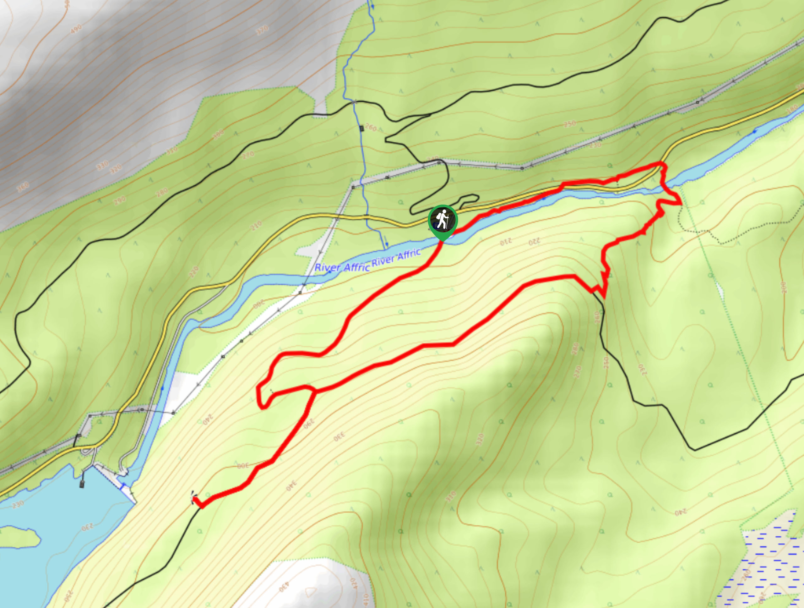
Dog Falls Walk
The Dog Falls Walk boasts a lovely, serene setting, punctuated by a waterfall, River Affric, and a stunning view of…
Comments