Sgurr na Stri Walk
View Photos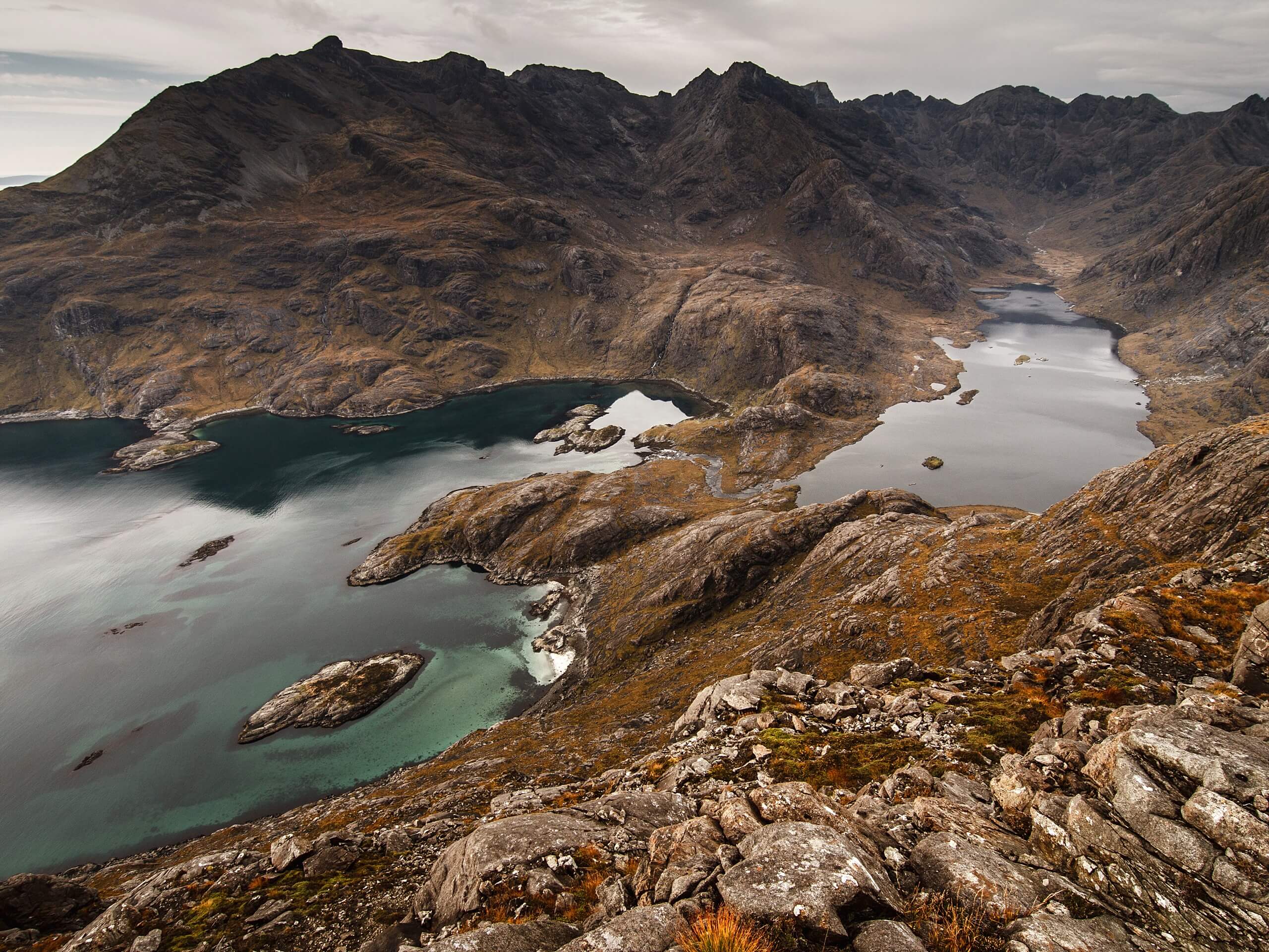
Sgurr na Stri Walk
Difficulty Rating:
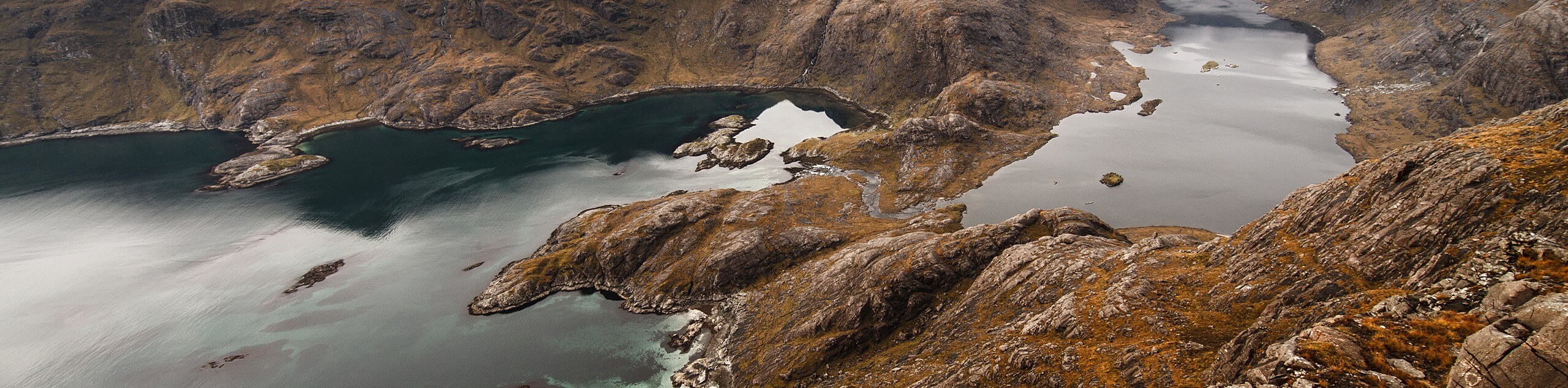
The Sgurr na Stri Walk climbs to incredible views overlooking the sea, Loch Coruisk, and the Cuillin. It’s safe to say that this walk does not disappoint, but, let’s be honest, disappointing adventures are hard to come by when exploring the Isle of Skye.
Getting there
To get to the start of the Sgurr na Stri Walk, head to the Sligachan Old Bridge Car Park.

About
| Backcountry Campground | No |
| When to do | May-October |
| Pets allowed | Yes - On Leash |
| Family friendly | No |
| Route Signage | Average |
| Crowd Levels | Moderate |
| Route Type | Out and back |
Sgurr na Stri Walk
Elevation Graph
Weather
Sgurr na Stri Walk Description
The Sgurr na Stri Walk summit unveils unforgettable views, where supernatural landscapes cradle moody, blue bodies of water. Know that the path, at first, is easy to follow before fading into a rugged final climb that requires some wayfinding. Be sure to download a GPS before you go!
Setting out from the car park, the Sgurr na Stri Walk begins by heading towards the statues of Prof. Norman Collie and John McKenzie. After this, you’ll make your way towards the footpath leading up Glen Sligachan—revel in the inspiring scenery here! This next section will have you crossing some streams before reaching Allt na Measarroch. You can cross this via the large stones. Take care! Eventually, dryer conditions take over the bogginess.
Soon, you’ll reach a cairn, go right here to cross another stream while basking in views of Blà Bheinn (Blaven). The path then starts to climb the ridge via the right. Look for the tiny lochan as you ascend! At the Druim Hain ridge (as indicated by the cairn), pause and let your eyes explore your surroundings, most notable being Loch Coruisk and Sgùrr nan Gillean. Where the path forks at the cairn, go left to follow a rugged trail, which takes you to the foot of Sgurr na Stri. The lack of path here means you have two options to ascend: 1) Go shortly up the burn before veering right 2) Follow the broad ridge to the burn’s right. When you get to the summit, pat yourself on the back and soak in the incredible scenery!
After refuelling, hydrating and feeling happy with the amount of time you’ve spent marvelling at the views, turnaround and retrace your steps back to the car park.
Similar hikes to the Sgurr na Stri Walk hike
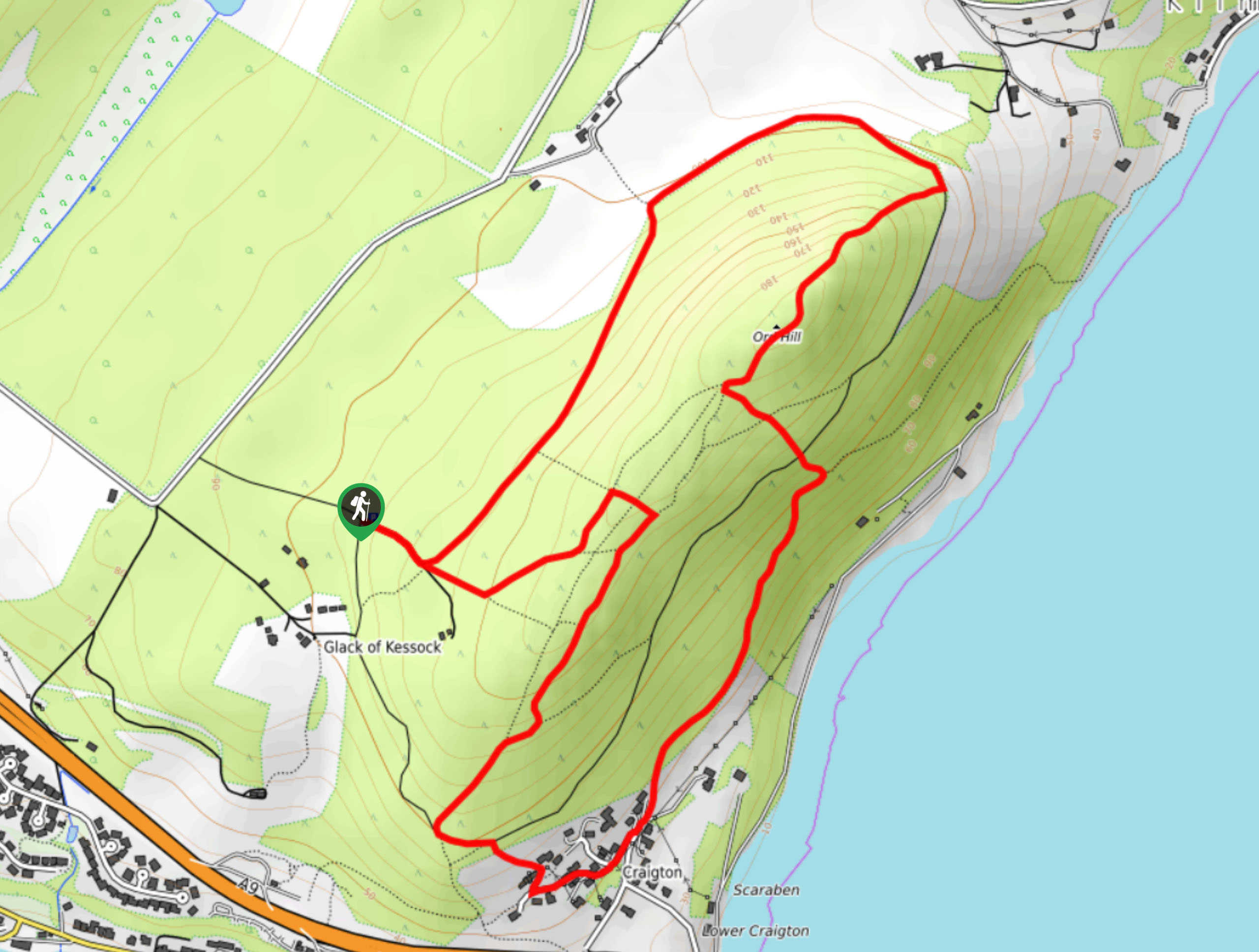
Ord Hill Walk
If you still have some gas left in the tank or have a day between activities in the Highlands and…
Kyle of Durness Circular Walk
The Kyle of Durness Circular Walk packs a punch when it comes to the scenery! Gaze out into the coastline,…
Dog Falls Walk
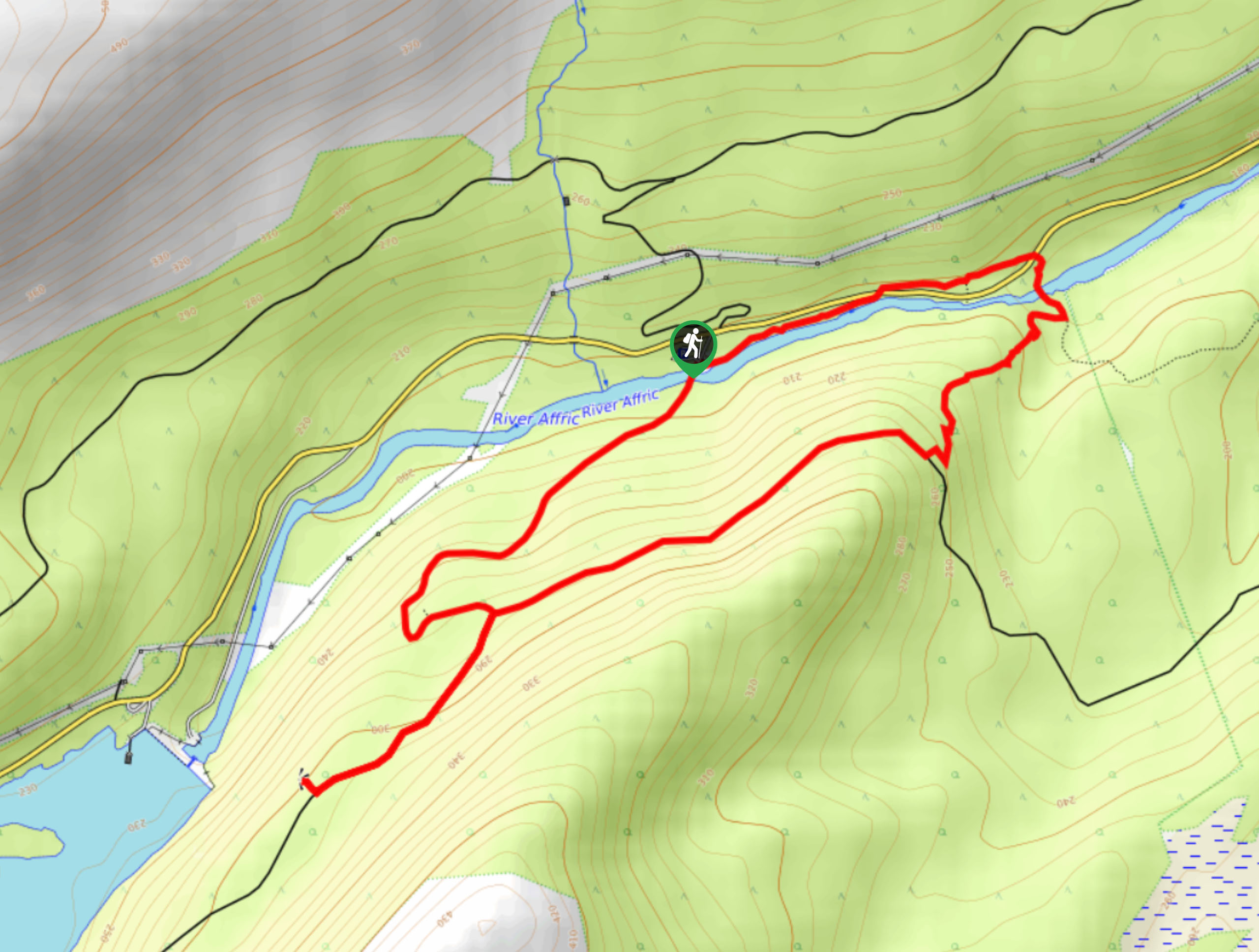
The Dog Falls Walk boasts a lovely, serene setting, punctuated by a waterfall, River Affric, and a stunning view of…
Comments