
Cul Mor Walk
View Photos
Cul Mor Walk
Difficulty Rating:
The Cul Mor Walk has you climbing a mostly easy-to-follow path leading up a Corbett, a mountain just not big enough to be a Munro, but it still makes for a challenging adventure. Revel in views of Assynt, Coigach, and the sea from the top!
Getting there
To get to the start of the Cul Mor Walk, head to the layby along the A835 just past the Knockan Crag National Nature Reserve & Visitor Centre.

About
| Backcountry Campground | No |
| When to do | May-October |
| Pets allowed | Yes - On Leash |
| Family friendly | No |
| Route Signage | Average |
| Crowd Levels | Moderate |
| Route Type | Lollipop |
Cul Mor Walk
Elevation Graph
Weather
Cul Mor Walk Description
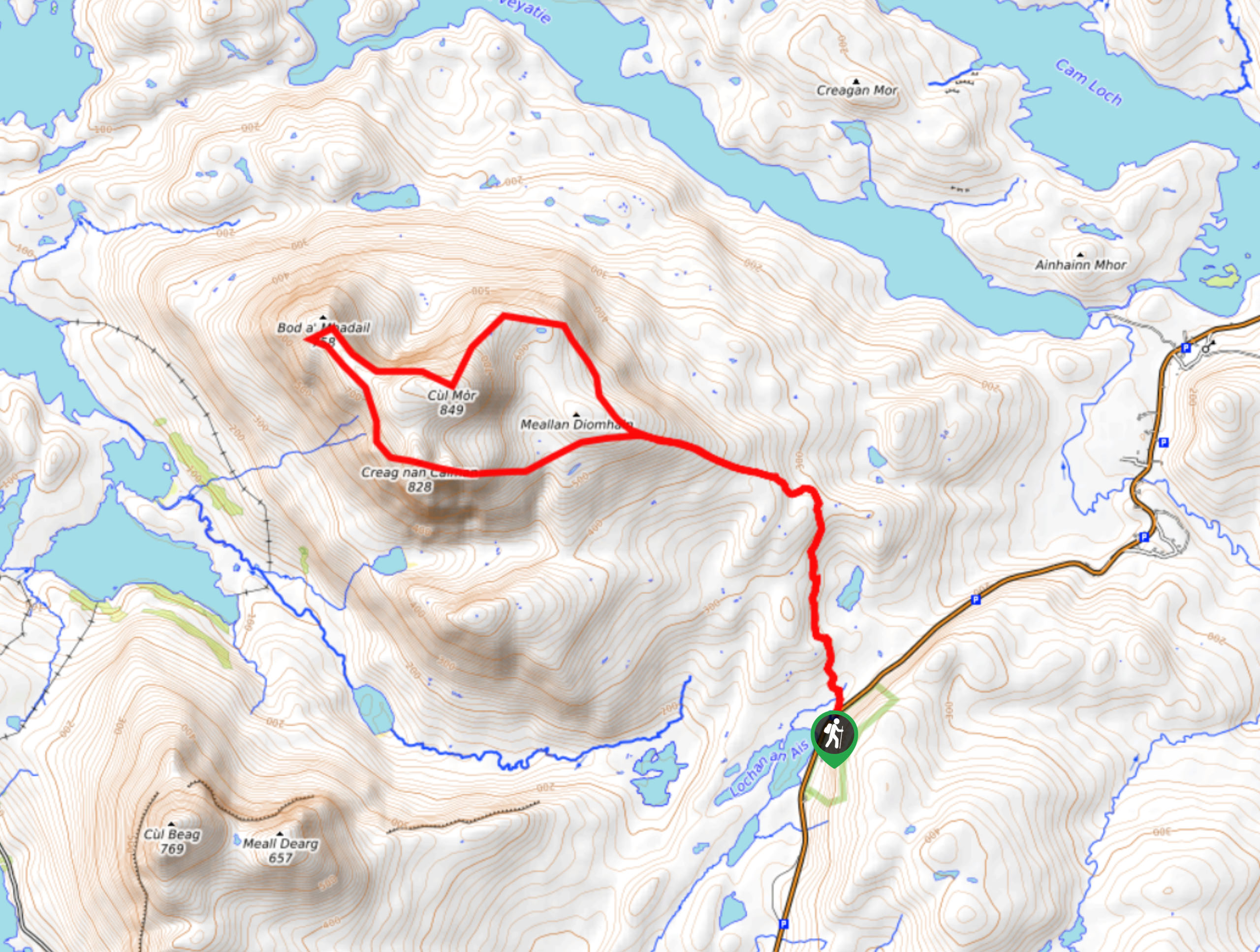
The Cul Mor Walk makes for an exciting adventure that has you summiting a Corbett, classified as a mountain ranging between 2500ft – 30000ft. So while this walk doesn’t have you ascending a Munro, it will still get you huffing, puffing, and boy does it deliver when it comes to peak-top views. And then, further on, you can expect a collection of lochs adding an enchanting glimmer to the rugged landscape below! Note that most of the path is easy to follow, but there is a pathless and wetter section, making appropriate footwear essential.
From the layby, head through the gate to follow the stalkers’ path. When you reach a big cairn, follow the track as it travels to the southeast side of Cul Mor. The path may fade due to wetness and bogginess, so keep an eye on that faint path. After walking uphill, the terrain evens out before the steep section leading to Cul Mor’s summit. To best get to the summit, veer around to the right to travel up the northeast ridge. Go across a boulder field before eventually reaching the top! Check out the views of Assynt, Coigach, and the sea from the peak before continuing.
From here, go west to descend the ridge. If you have time—and we highly recommend this—keep along the spur of Sròn Gharbh to land on the northwest end for remarkable views of the collection of lochs shimmering below! After, return along the ridge to get to the bealach under Creag nan Calman. You have the option of walking the east ridge down or going to the bealach and following the path from there toward the grassy coire to return.
Similar hikes to the Cul Mor Walk hike
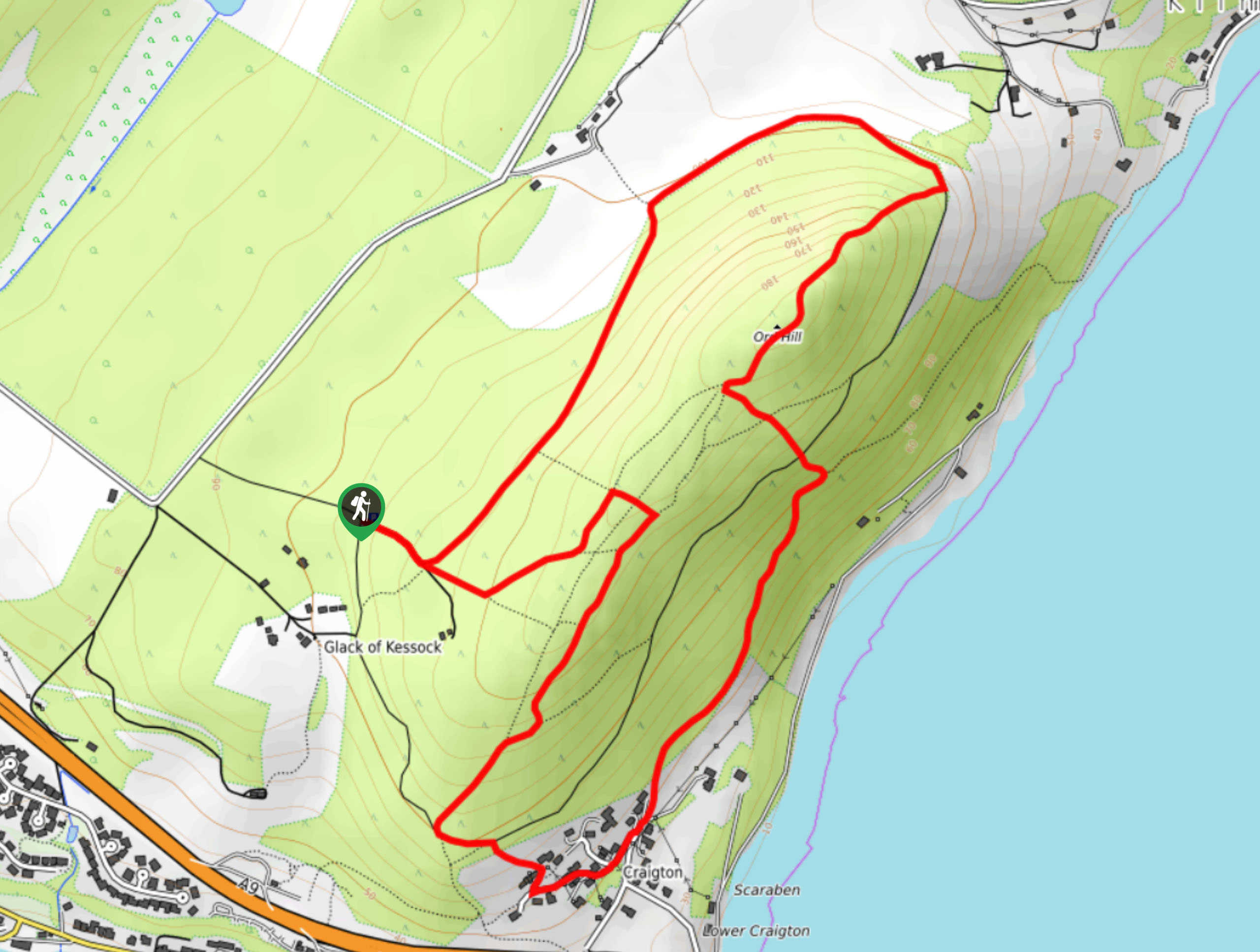
Ord Hill Walk
If you still have some gas left in the tank or have a day between activities in the Highlands and…
Kyle of Durness Circular Walk
The Kyle of Durness Circular Walk packs a punch when it comes to the scenery! Gaze out into the coastline,…
The Saddle, Forcan Ridge and Sgùrr na Sgìne Walk
The Saddle, Forcan Ridge and Sgùrr na Sgìne Walk is a rugged adventure that boasts a thrilling challenge while unveiling…
Comments