Binnein Mòr and Na Gruagaichean Walk
View Photos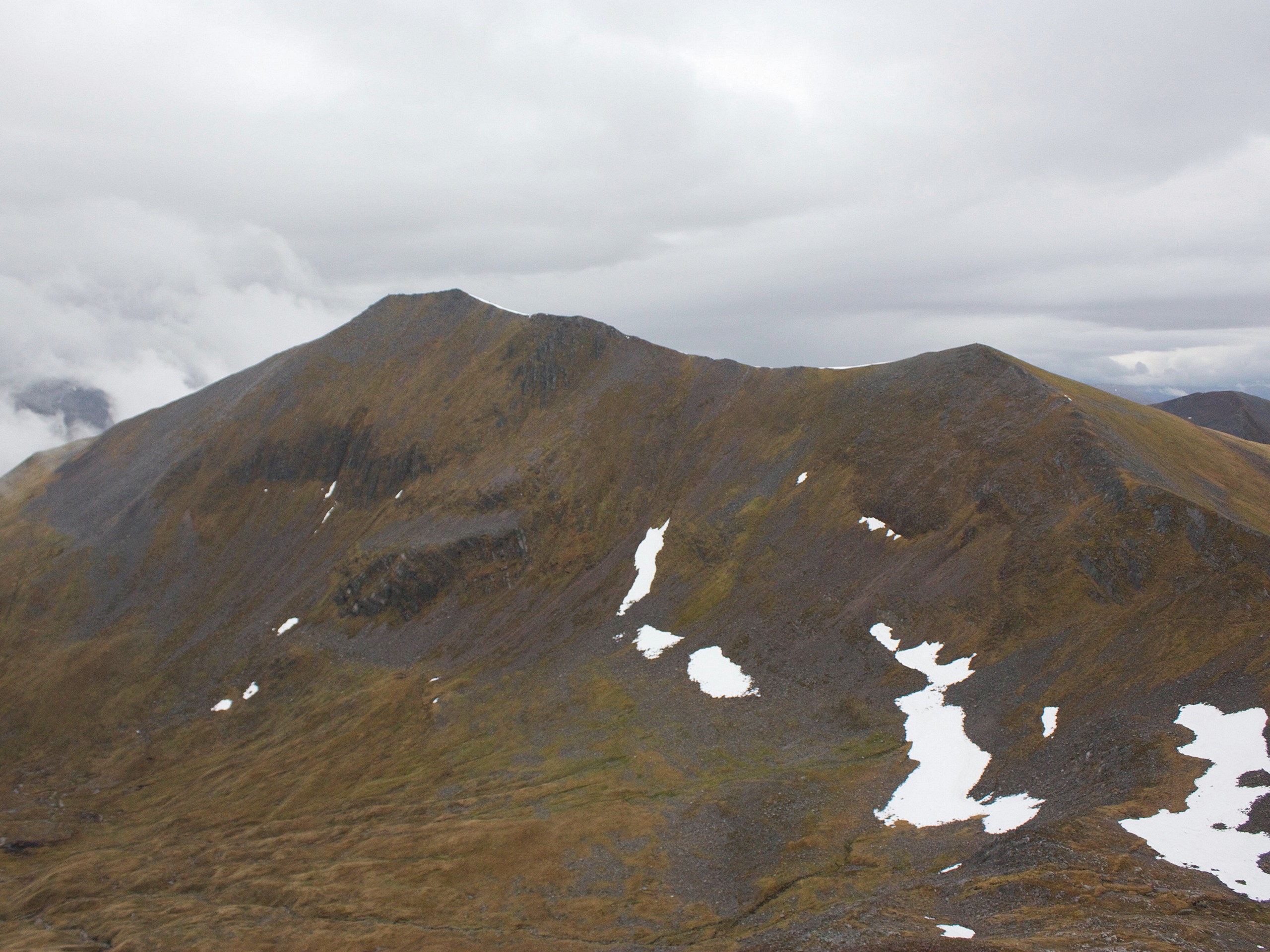
Binnein Mòr and Na Gruagaichean Walk
Difficulty Rating:
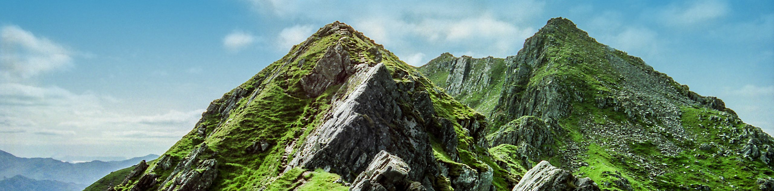
Looking for the ultimate walking adventure in the Highlands? Experienced hillwalkers will definitely want to look into the incredibly challenging Binnein Mòr and Na Gruagaichean Walk, where dumbfounding views flank narrow ridges and feel all the more rewarding after climbing two Munros.
Getting there
The Binnein Mòr and Na Gruagaichean Walk starts from the Grey Mare’s Waterfall Car Park in Kinlochleven.

About
| Backcountry Campground | No |
| When to do | May-October |
| Pets allowed | Yes - On Leash |
| Family friendly | No |
| Route Signage | Average |
| Crowd Levels | Moderate |
| Route Type | Lollipop |
Binnein Mòr and Na Gruagaichean Walk
Elevation Graph
Weather
Binnein Mòr and Na Gruagaichean Walk Description
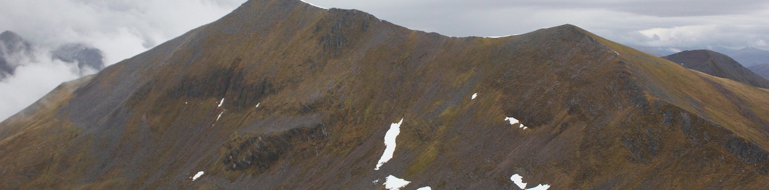
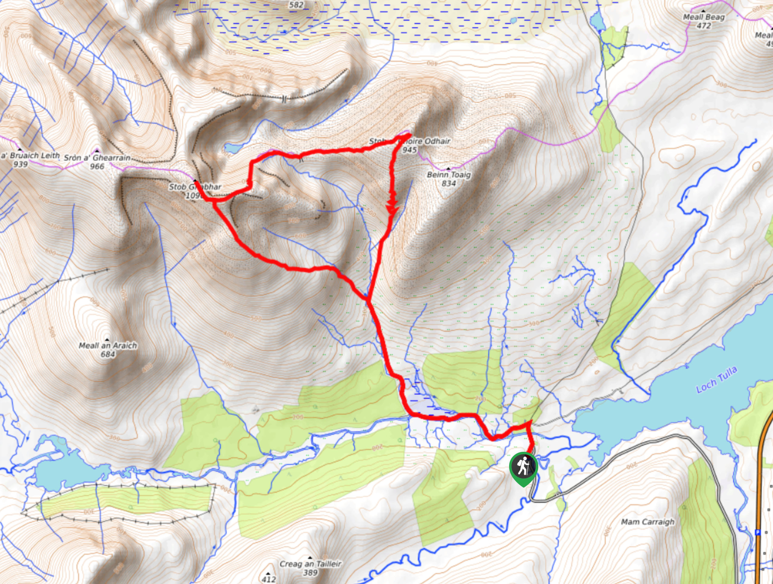
The Binnein Mòr and Na Gruagaichean Walk climbs two Munros, with one, Binnein Mòr, soaring the highest of the Mamores. Expect some technical, rocky terrain along with narrow ridges and a lot of grassy sections along this walk! Do note that descent from has proven to be relentless. You may think, “Ah, the descent is the easiest part!” But, sometimes, the descent can be the most technical and painful for your knees, requiring care when the trail drops in elevation. Before you lace up your boots, we also advise downloading the GPS as this walk has a lot of turns—we don’t want you to get lost!
To start the Binnein Mòr and Na Gruagaichean Walk, head into the woods from the car park, which wastes almost zero time taking you to the first ascent of the day—be sure to check out the views of Loch Leven and Kinlochleven painting the scenery behind you. From here, stay on the old route to help prevent erosion! Soon, this path leaves the trees for moorland. There are quite a few turns in the next section, which is why emphasize downloading a GPS before heading out!
After spending some time in the moorland, you’ll join a stalker’s path from the right before climbing left and switchbacking to Sgùrr Èilde Beag, the first ridge of the walk! Follow the grassy slope to the first minor peak. The views here are phenomenal. From here, the terrain along the ridge fuses rocky with grassy. Follow this wide ridge until you arrive at another peak 3484ft .
Continue north along the ridge north to head towards Binnein Mòr. After checking out the views, you’ll retrace your steps back to the minor peak from before (1062m). From here, take the narrow ridge southwest towards a bealach. From here, summit to the next Munro, Na Gruagaichean, which isn’t too difficult to reach! After, follow the south ridge to Leachd na h-Aire, revealing more great views en route. At the Leachd cairn, go WSW to dip in elevation along grassy terrain.
After the boulders, the path gets really steep and technical, requiring care. Be sure to check your GPS here. However, the views of Loch Leven more than makeup for any potential confusion or frustration! With the help of your GPS, as there are many turns, continue the descent back to the car park.
Similar hikes to the Binnein Mòr and Na Gruagaichean Walk hike
The Saddle, Forcan Ridge and Sgùrr na Sgìne Walk
The Saddle, Forcan Ridge and Sgùrr na Sgìne Walk is a rugged adventure that boasts a thrilling challenge while unveiling…
Stob Ghabhar and Stob a'Choire Odhair Walk
Confident and experienced hillwalkers should only attempt the Stob Ghabhar and Stob a'Choire Odhair Walk due to the elevation gain,…
Cul Mor Walk
The Cul Mor Walk has you climbing a mostly easy-to-follow path leading up a Corbett, a mountain just not big…
Comments