Chokramudi (Shiva's Head) Hike
View Photos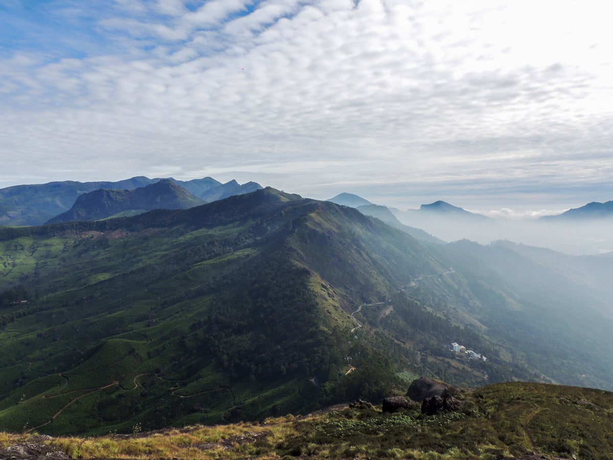
Chokramudi (Shiva's Head) Hike
Difficulty Rating:
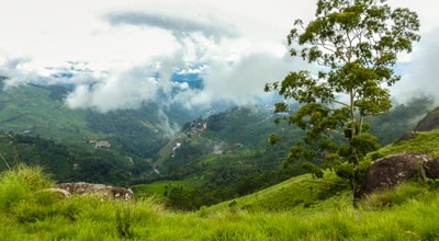
Chokramudi is the third-highest peak in Munnar and makes for insane views for those willing to take on the challenge. The Dome, also known as Shiva’s Head, is accessible by a tiny, narrow path through grassland and is not for the faint of heart. This moorland is bursting with the fragrance of wildflowers throughout the year. Be sure to have your camera—and your nose—at the ready.
Getting there
The reporting point is at the forest office at the Great Escape Gap. It is accessible from Munnar after a 9.9mi drive along the Munnar–Periyar road. This point is accessible by car, Jeep, or bus.

About
| When to do | November to June |
| Backcountry Campsites | No |
| Family friendly | Older Children only |
| Route Signage | Average |
| Crowd Levels | Moderate |
| Route Type | One Way |
Chokramudi (Shiva's Head) Hike
Elevation Graph
Weather
Route Description for Chokramudi (Shiva's Head) Hike
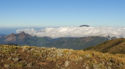
The Chokramudi hike begins from the Gap westwards. The trail is narrow and snakes through the slope, passing moorland and forest to reach the dome. The first lap of the hike is steep, but not overly hard.
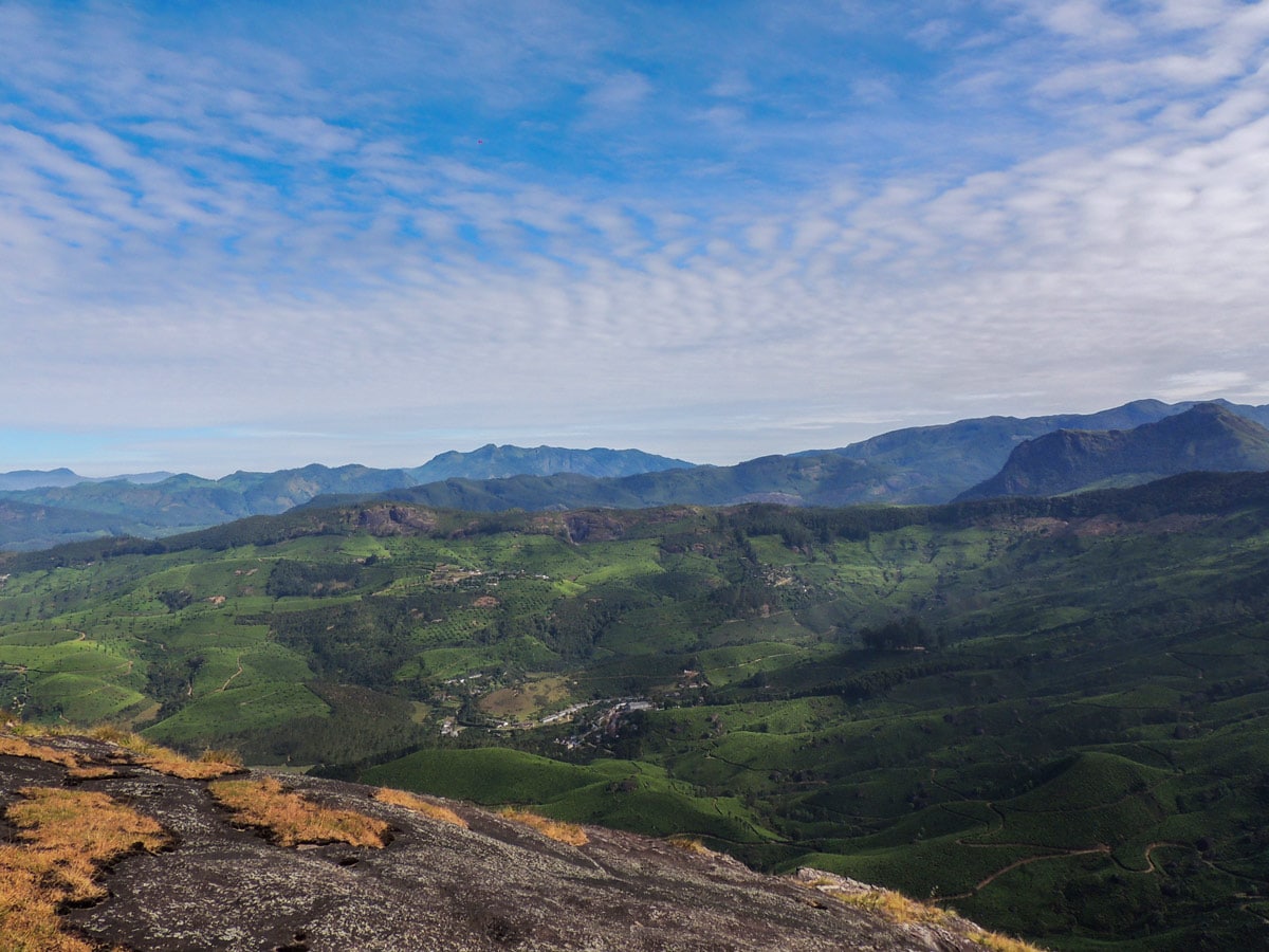
After the first lap, the trail reaches a small rocky tableland with mesmerizing views of Munnar Valley, Meesapulimala, and Bison Valley. This viewpoint is worth a photo and is also the perfect stop to cool down with refreshments.
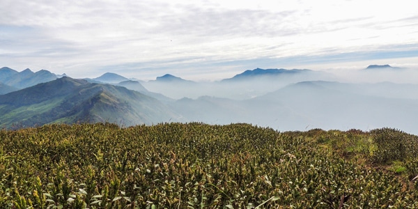
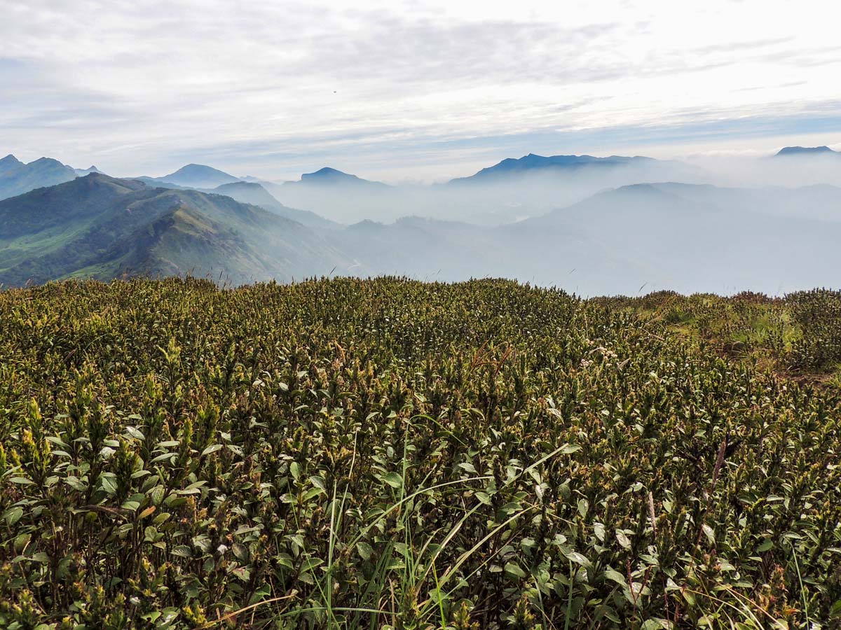
After a short break, take the second lap through the moorland, where a good number of bog orchids, wildflowers and beautiful hypericum plants greet you. This area is thick with strobilanthes bush, which is a high-altitude endemic flowering plant that blooms over 12 years.
The second lap leads the trail to a cliff edge overlooking ranges of the west ridge out towards Anamudi range. It boasts breathtaking views and cool winds from the west carrying wispy clouds across the ranges.
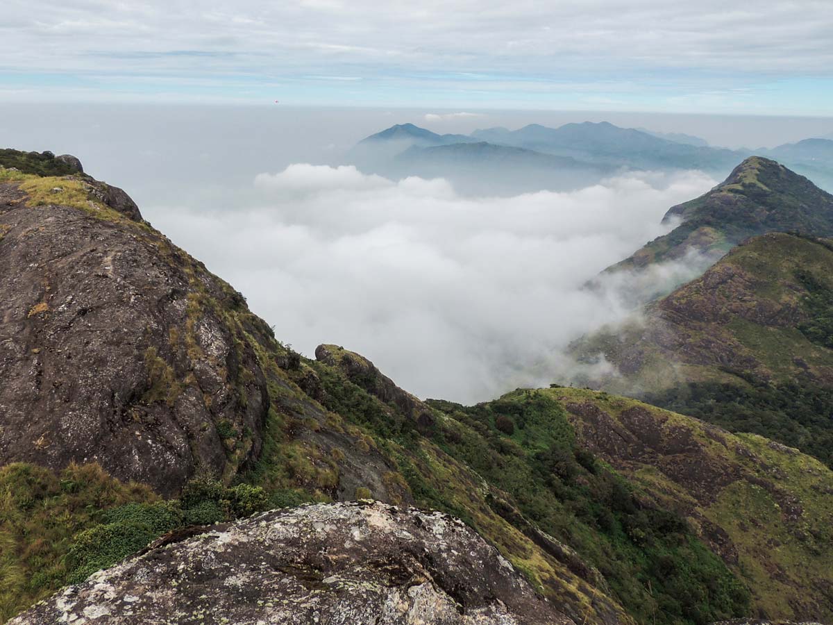
Spotting these clouds as they wrap around the neck of the highest peaks is an unforgettable sight. The dome of the peak looks very close after you pass the neck.
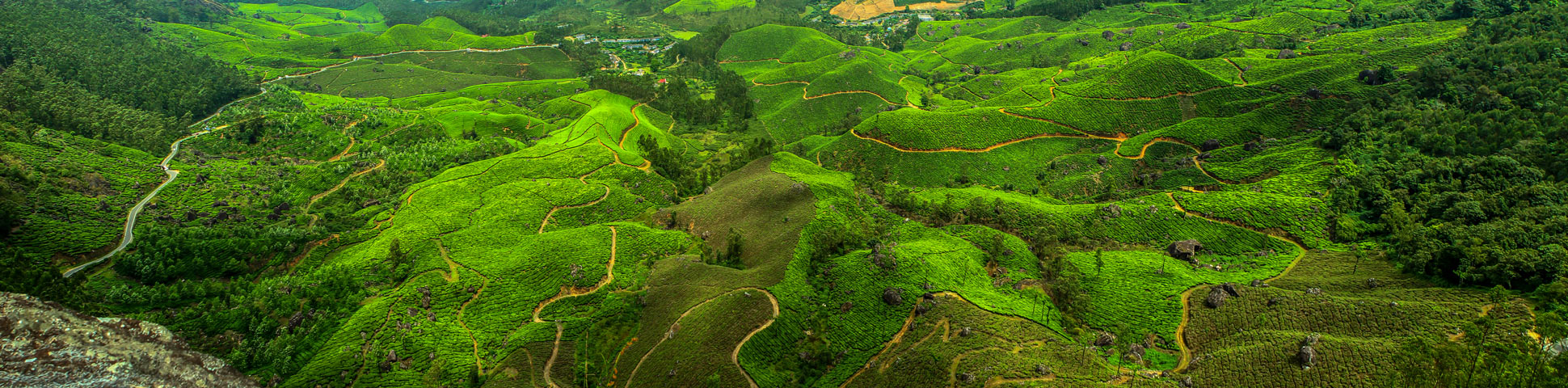
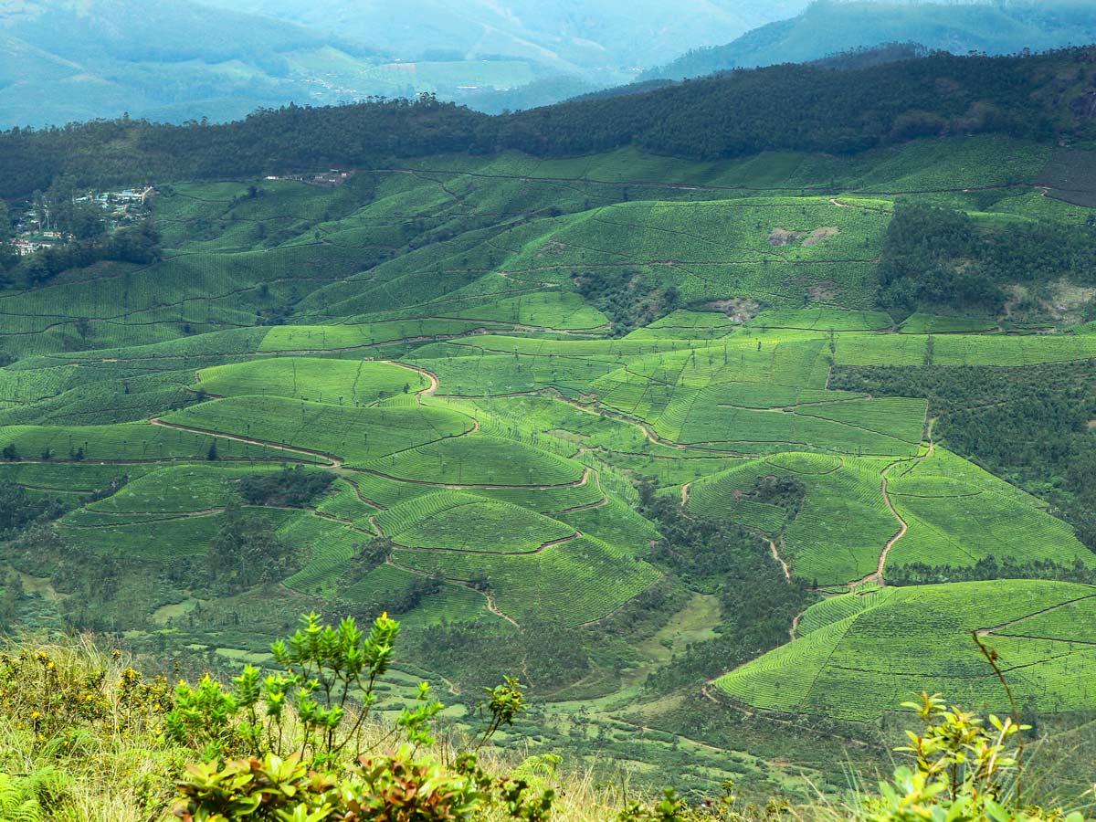
You’re almost there! The peak offers a 360-degree view of the Ghats and the vast expanse of tea gardens spreading over a hundred thousand acres of rolling hills in the Munnar plateau. You can also spot stunning gorges and silver lines of white clouds, mountains, and low-flying black eagles.
The hike can backtrack in a yoyo style, but the views of the landscape feel different. It is time to enjoy more low flying clouds, birds and flowers with your guide.
Insider Hints
You can’t self-guide yourself on the Chokramudi hike in the Western Ghats, you must have a guide for this walk.
Those who want to see the sunrise should start at 6 AM.
Pack leech socks during monsoon season.
Similar hikes to the Chokramudi (Shiva's Head) Hike hike
Cloud Forest Walk
This Cloud Forest walk takes place in a national park, home to a dedicated nature reserve, protecting high-altitude flora and…
Meesapulimala Hike
Meesapulimala is the second-highest peak in Southwestern Ghats at a height of 8661ft, overlooking the east escarpment of…
Lakshmi Hills Hike
Named after a tea factory division, this cliffy ridge trail on the west side of Munnar is popularly called Lakshmi…
Comments