
Ya-Gub-Weh-Tuh Trail
View Photos
Ya-Gub-Weh-Tuh Trail
Difficulty Rating:
Reconnect with nature and escape the stressors of the real world along the Ya-Gub-Weh-Tuh Trail. Offering impressive views of the boulder bounded river, the mossy forestlands, and surrounding mountains—the stunning scenery along this route is limitless. Open and airy, this scenic day-hike is a must-add to your adventure itinerary.
Getting there
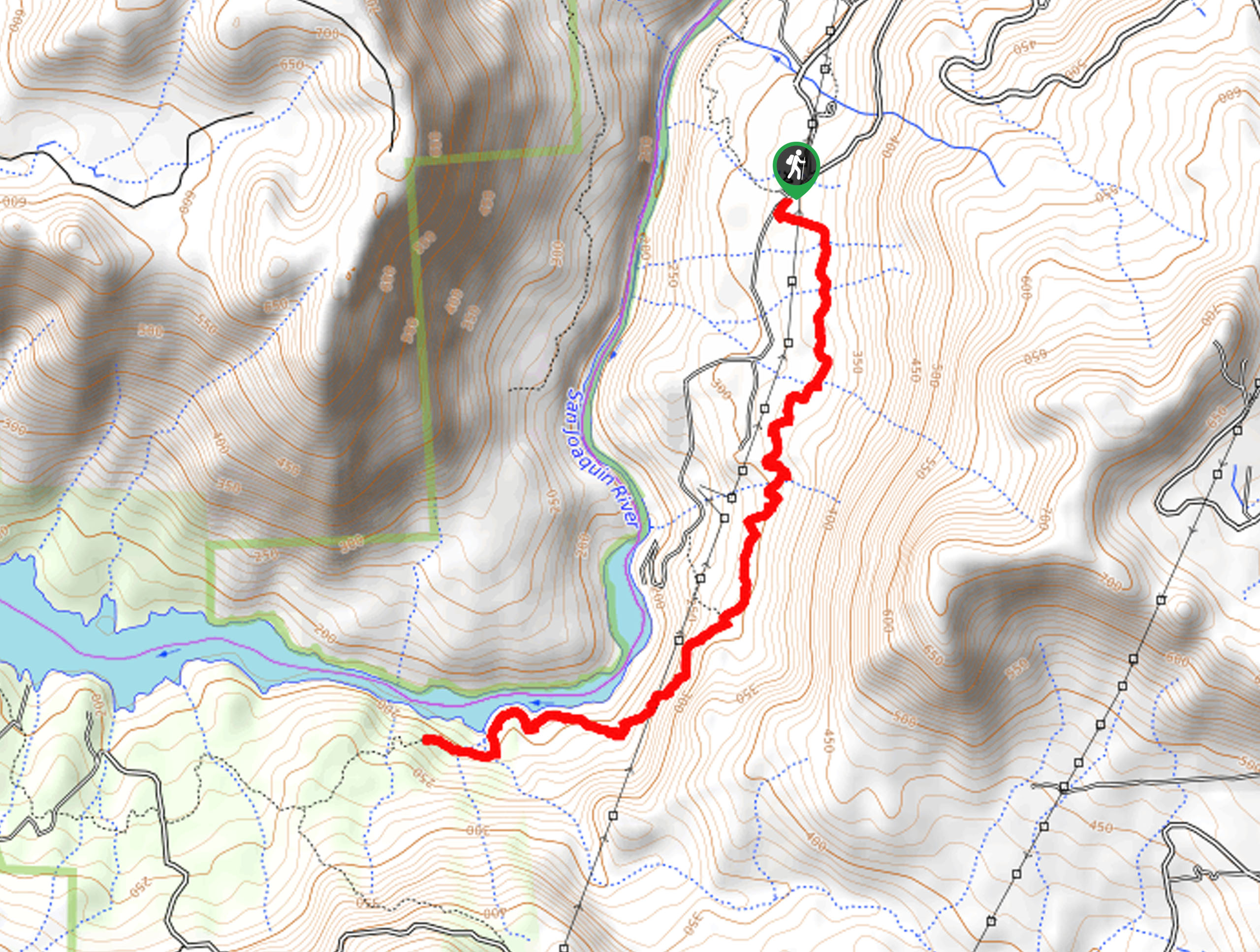
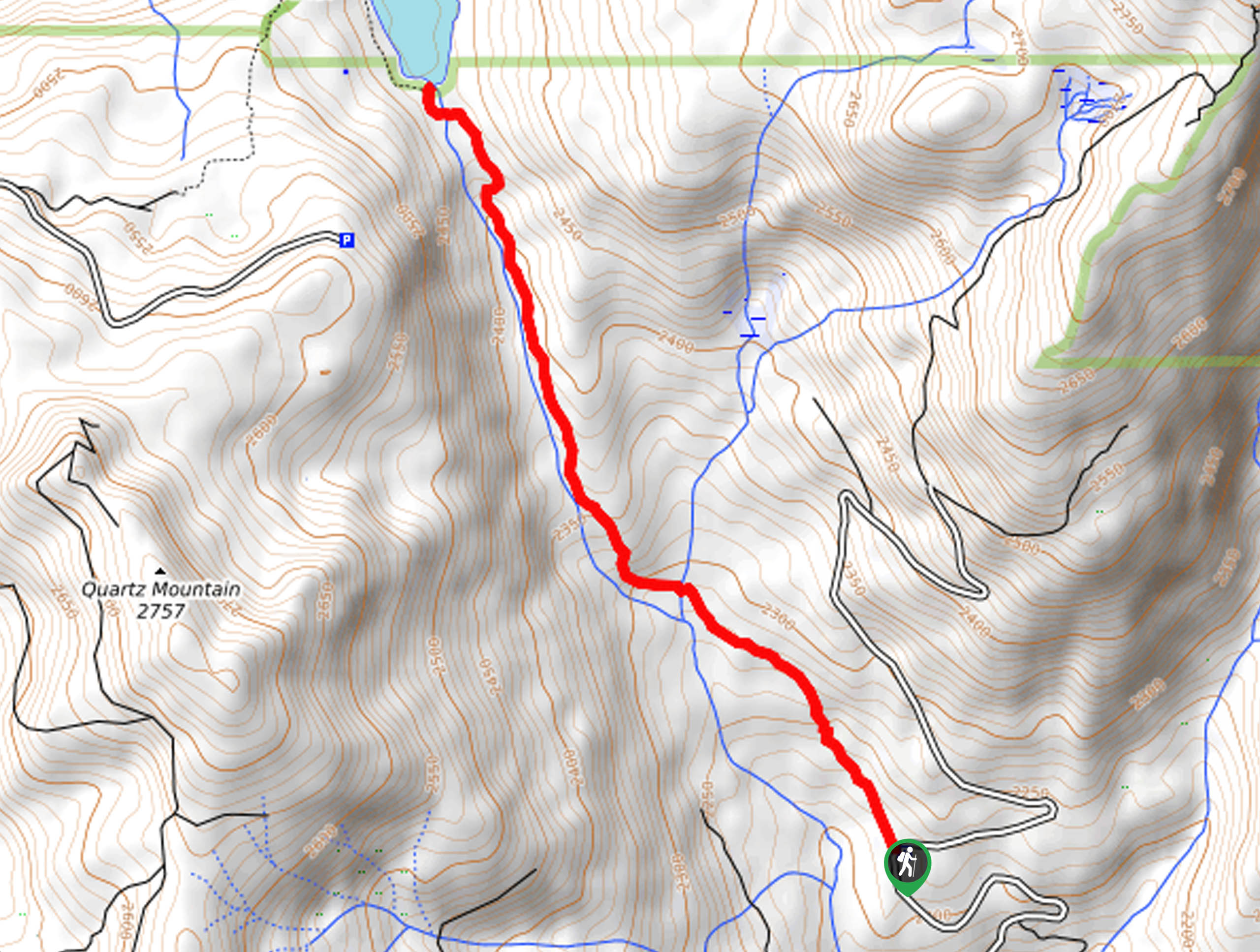
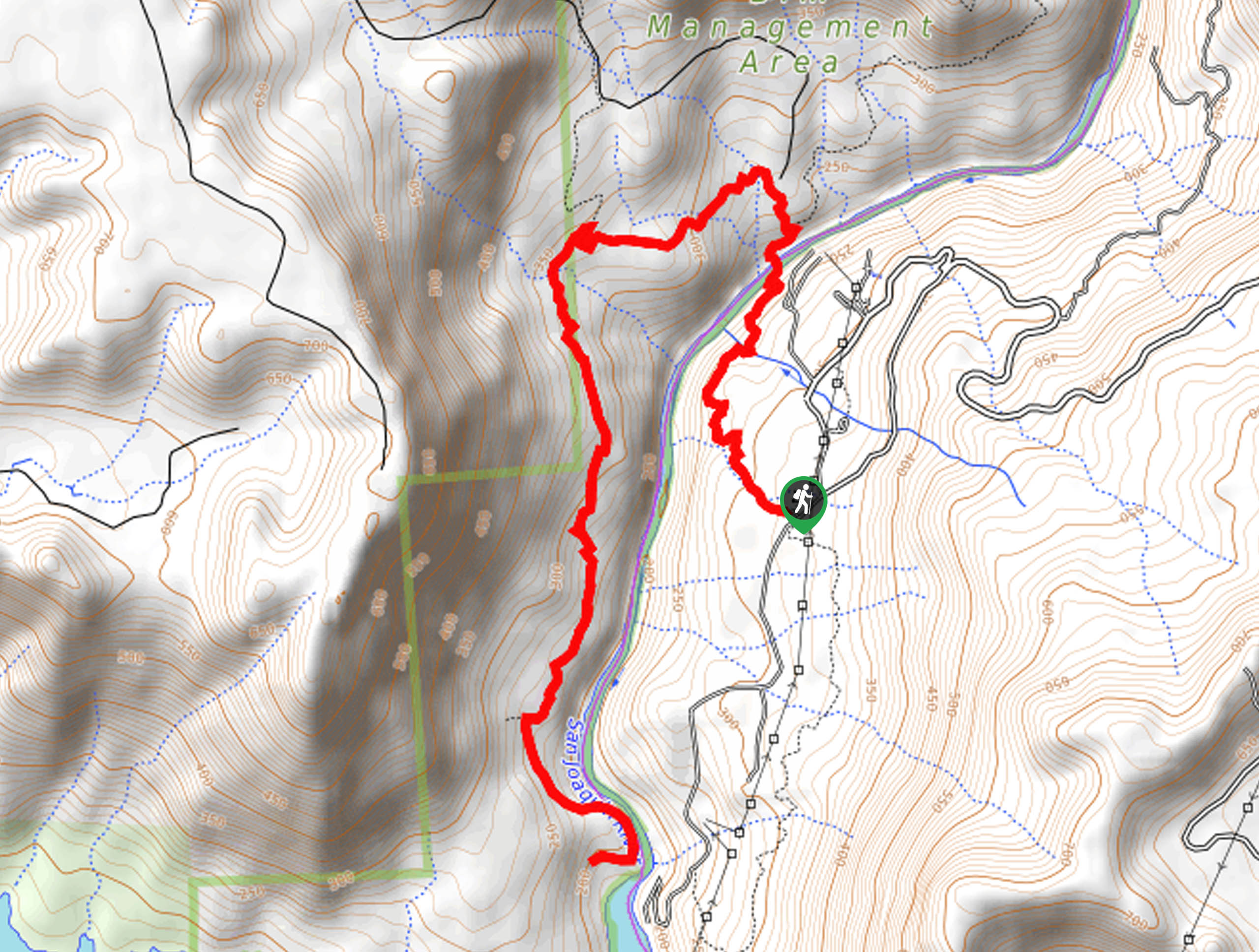
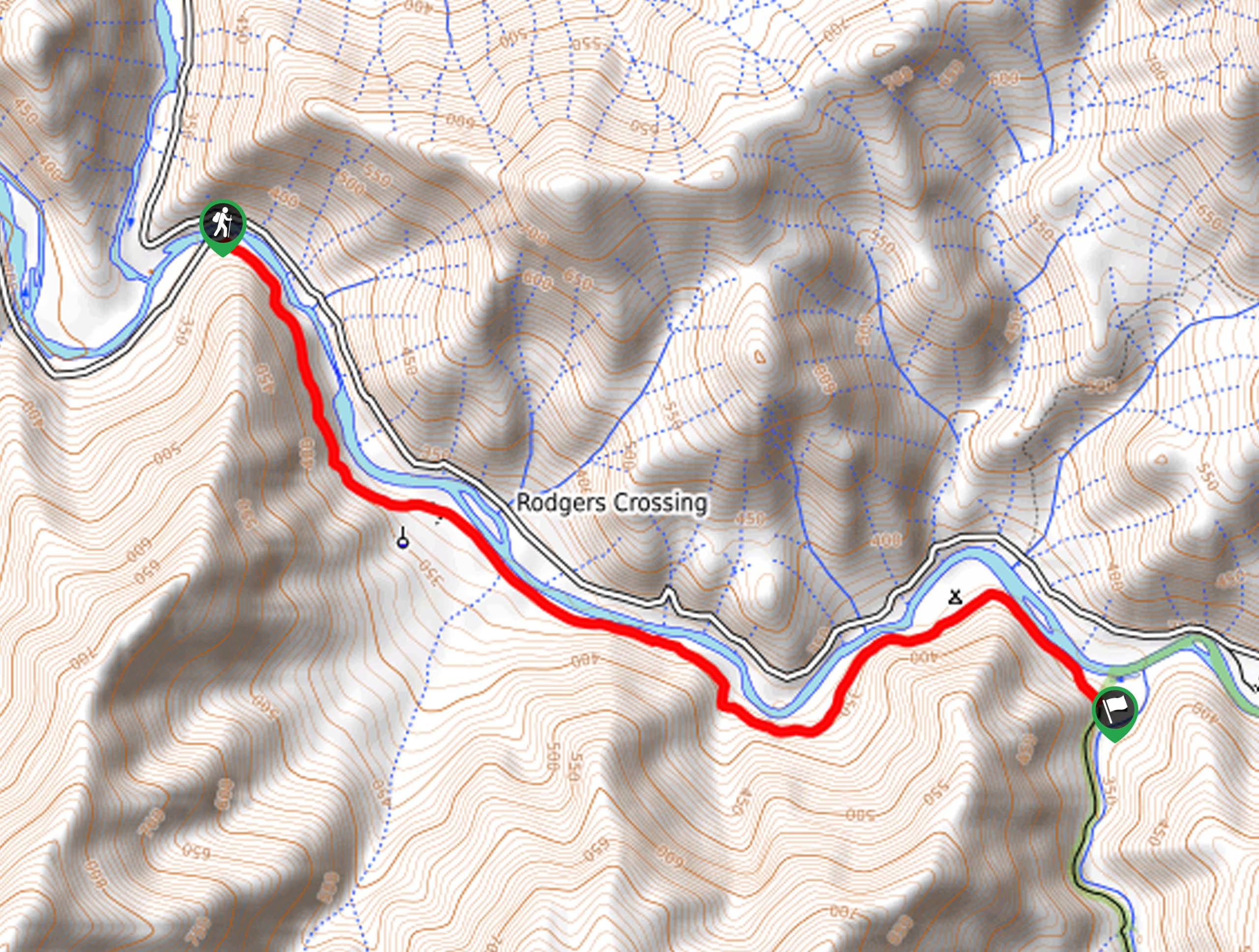
The Ya-Gub-Weh-Tuh Trail departs from the San Joaquin River Trailhead off Smalley Road.

About
| Backcountry Campground | |
| When to do | Year-round |
| Pets allowed | Yes - On Leash |
| Family friendly | Yes |
| Route Signage | Average |
| Crowd Levels | Low |
| Route Type | Out and back |
Ya-Gub-Weh-Tuh Trail
Elevation Graph
Weather
Ya-Gub-Weh-Tuh Trail Description
Hike along the banks of the San Joaquin River as you venture the Ya-Gub-Weh-Tuh Trail. Boasting beautiful views of the river valley and encompassing peaks, this hidden gem of a trail is a must-do when in the Sierra National Forest. Offering amazing panoramas, the exposed terrain can become unbearably hot in the summer months, so we suggest heading out in the early morning to beat the heat. Additionally, when trekking in the summer, be sure to wear sun protection to avoid overexposure! Pack plenty of water to stay hydrated and take refuge under the tree shade when you need to cool off. Note there have been reports of car break-ins—don’t leave any valuables in your car as you hike.
Immerse yourself in the picture-perfect landscape as you meander along the Ya-Gub-Weh-Tuh Trail. Ideal for those seeking a half-day hike, this route will get your heart rate up without over-exhausting you. Enjoy the sights and sounds of the San Joaquin River running as you hike along the moss-cloaked banks. Indulge yourself in the stunning scenery and revel in the tranquility of this hidden gem—though we fear it won’t stay hidden for much longer! Versatile and accessible year-round, we think this hike is best experienced in the spring when the wildflowers bloom, the water is moving, and the climate is ideal! We love this trek, and we think you will too.
Setting out from the trailhead, the Ya-Gub-Weh-Tuh Hike follows the San Joaquin River Trail south. This path hikes through the meadowlands and forestlands before gradually descending into the river valley. Mind your footing on the terrain as a few granite outcrops decorate the path! Continue hiking over a few snow-melt streams before dipping further into the canyon. Enjoy the sights of the looming pines and moss-coated outcrops along the river. As you near the adventure’s end, the path will open, revealing wonderful views of Crook Mountain and the wide valley. We turned around shortly after crossing the Big Sandy Creek Bridge. If you have some gas left in the tank, continue further. If not, head back the way you came back to the trailhead.
Trail Highlights
San Joaquin River
The San Joaquin River is the longest river in central California—stretching over 366.0mi from high in the Sierra Nevada into the Pacific Ocean. This scenic flow is one of the most heavily dammed rivers in the state—vital irrigation and wildlife corridor. This section of the river that runs near the Ya-Gub-Weh-Tuh Trail is slow-moving and stunning.
Insider Hints
Head out in the early morning to beat the heat
Wear sun protection to avoid overexposure
Pack plenty of water!
Don’t leave any valuables in your car
Customize this hike to your liking by turning around whenever you please—or keep hiking!
Similar hikes to the Ya-Gub-Weh-Tuh Trail hike
Chiquito Pass Trail
The Chiquito Pass Trail is arguably one of the most scenic adventures in the Sierra National Forest. Wander up through…
Wuh-Ki'o Trail
The Wuh-Ki'o Trail is an unassumingly picturesque adventure in the Sierra National Forest. Traveling through meadowlands, brush, over bridges, and…
Davis Flat Trail
Experience the grandeur of the Sierra Nevada Mountains as you hike through the Kings River Valley, bounded by rolling hills.…
Comments