Stevenson Falls Trail
View Photos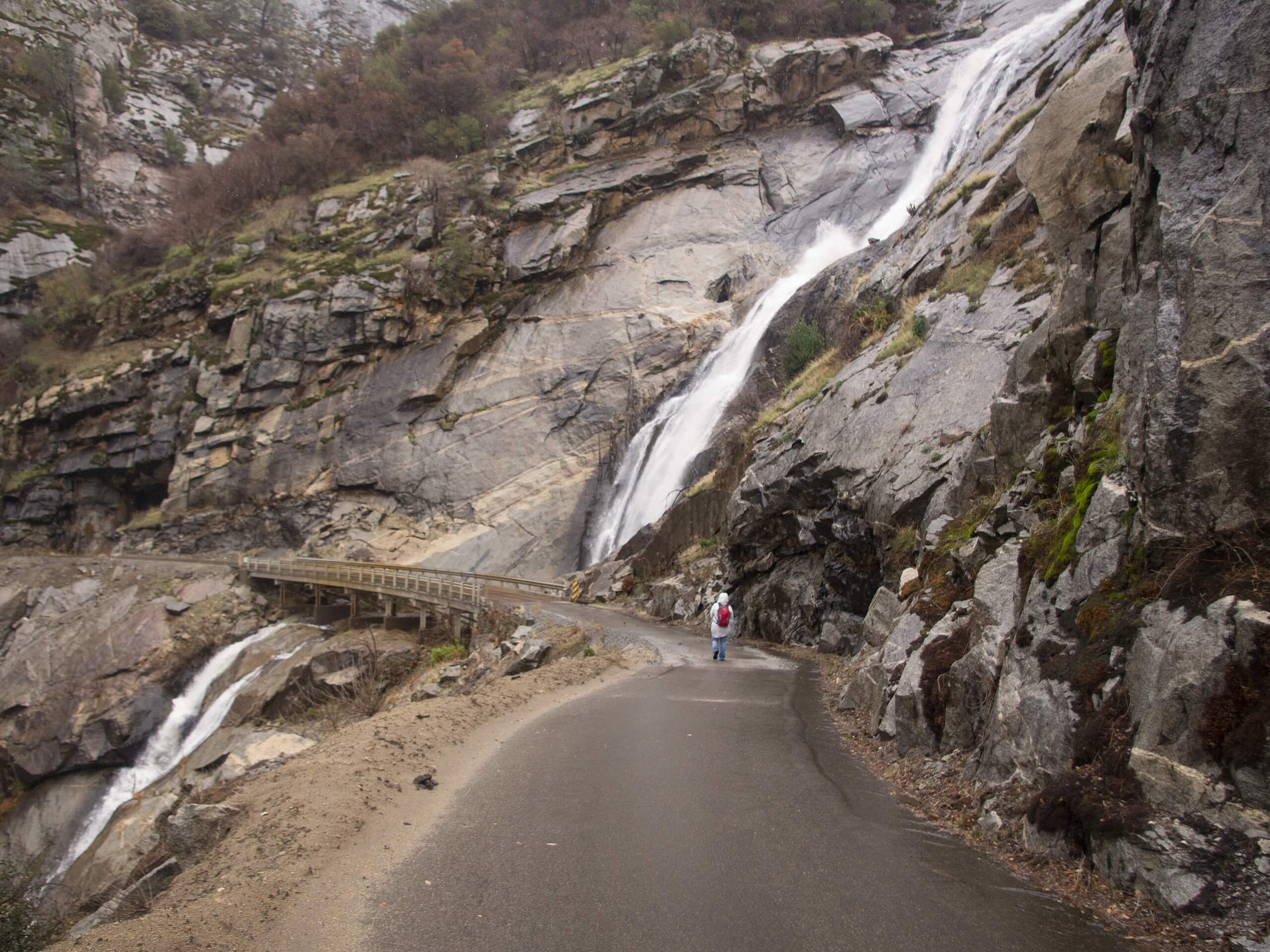
Stevenson Falls Trail
Difficulty Rating:
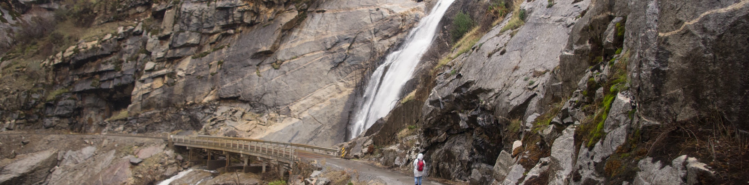
The Stevenson Falls Trail is an intermediate paved route along a cliffside featuring waterfalls, caves, and epic mountain views. The whole family can enjoy this scenic adventure which boasts breathtaking panoramas of the High Sierra and the San Joaquin River.
Getting there
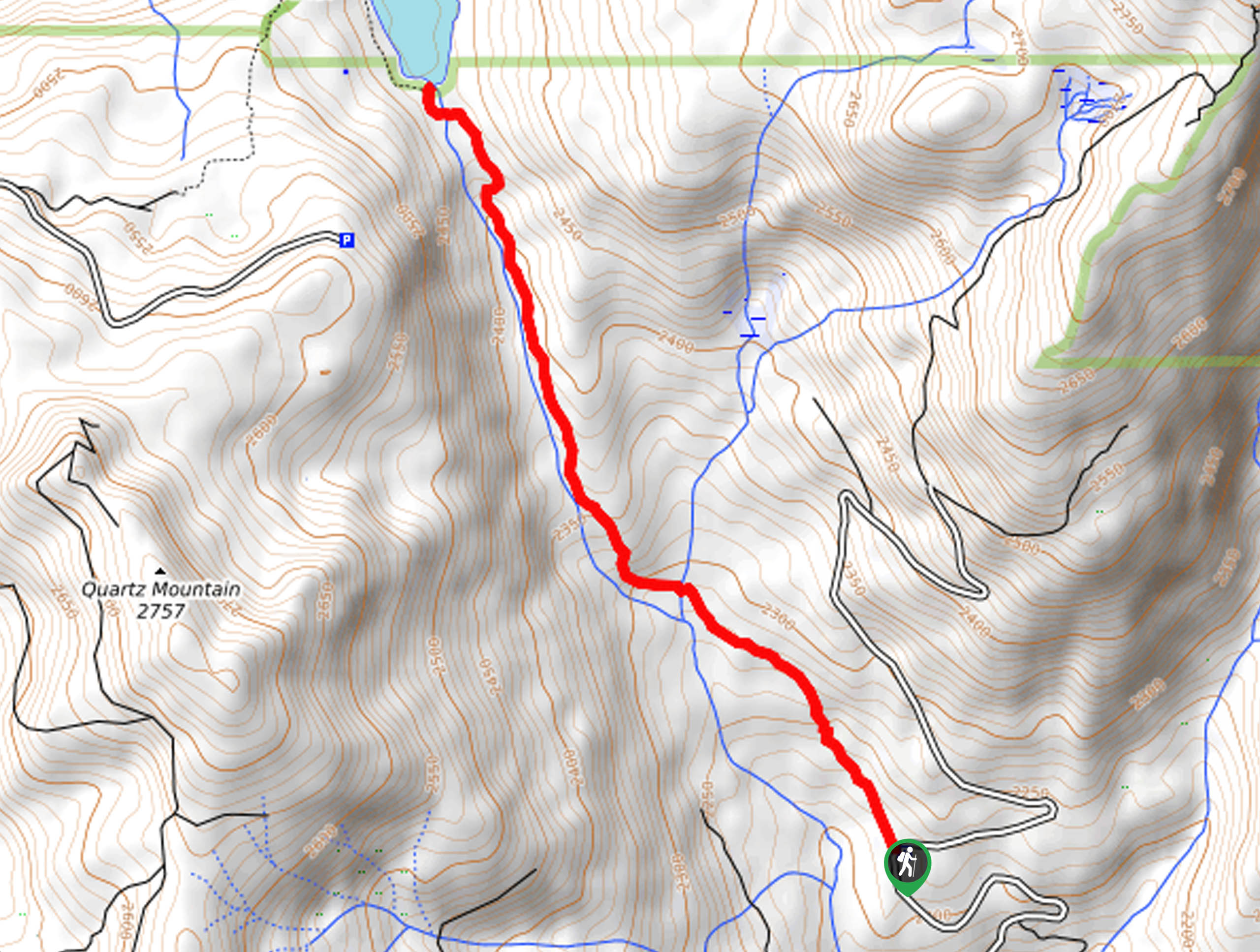
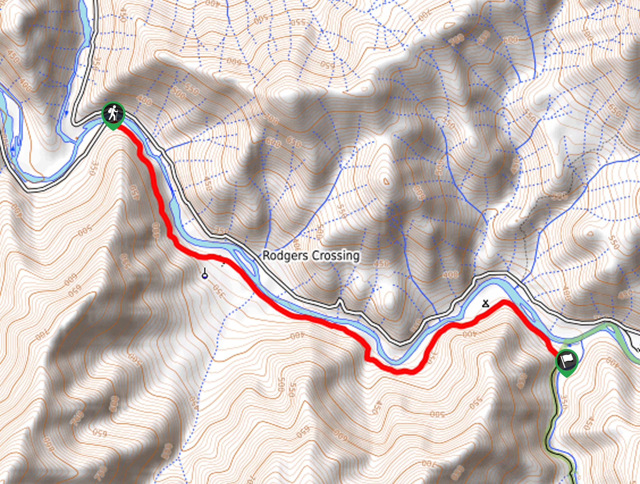
The Stevenson Falls Trail begins from the Million Dollar Road gate.

About
| Backcountry Campground | No |
| When to do | Year-round |
| Pets allowed | Yes - On Leash |
| Family friendly | Yes |
| Route Signage | Average |
| Crowd Levels | Moderate |
| Route Type | Out and back |
Stevenson Falls Trail
Elevation Graph
Weather
Stevenson Falls Trail Description
This adventure is a must add to your hiking bucket list. Indulge yourself in some of the best scenes that the Sierra National Forest has to offer along this route. Paved most of the way, this trail is ideal for novice hikers and children alike! Note that while the exposed terrain offers great views, it also warrants extreme conditions—so check the forecast and prepare accordingly.
From the trailhead, the Stevenson Falls Trail tracks east past the gate, and along the Million Dollar Road. This path will soon divert northwest along a mountainside of Flume Peak. As you climb, the path will reward you with wonderful views of the San Joaquin Valley below. Notice Lion Point looming in the northwest as you hike the paved path past a sealed tunnel. Eventually, you will reach Stevenson Falls.
In the spring, the cascades will surge over the granite cliffside. Revel in the sights, and when you are ready, retrace your footing along the path back to the trailhead.
Similar hikes to the Stevenson Falls Trail hike
Chiquito Pass Trail
The Chiquito Pass Trail is arguably one of the most scenic adventures in the Sierra National Forest. Wander up through…
Wuh-Ki'o Trail
The Wuh-Ki'o Trail is an unassumingly picturesque adventure in the Sierra National Forest. Traveling through meadowlands, brush, over bridges, and…
Davis Flat Trail
Experience the grandeur of the Sierra Nevada Mountains as you hike through the Kings River Valley, bounded by rolling hills.…
Comments