Shuteye Peak Trail
View Photos
Shuteye Peak Trail
Difficulty Rating:
The Shuteye Peak Trail is an epic excursion through the Sierra National Forest’s backcountry. A shared route with off-roaders and mountain bikers, this scenic trek attracts outdoor enthusiasts of all sorts. Wander through mixed conifer forest lands up to the scenic overlook that boasts breathtaking alpine views.
Getting there
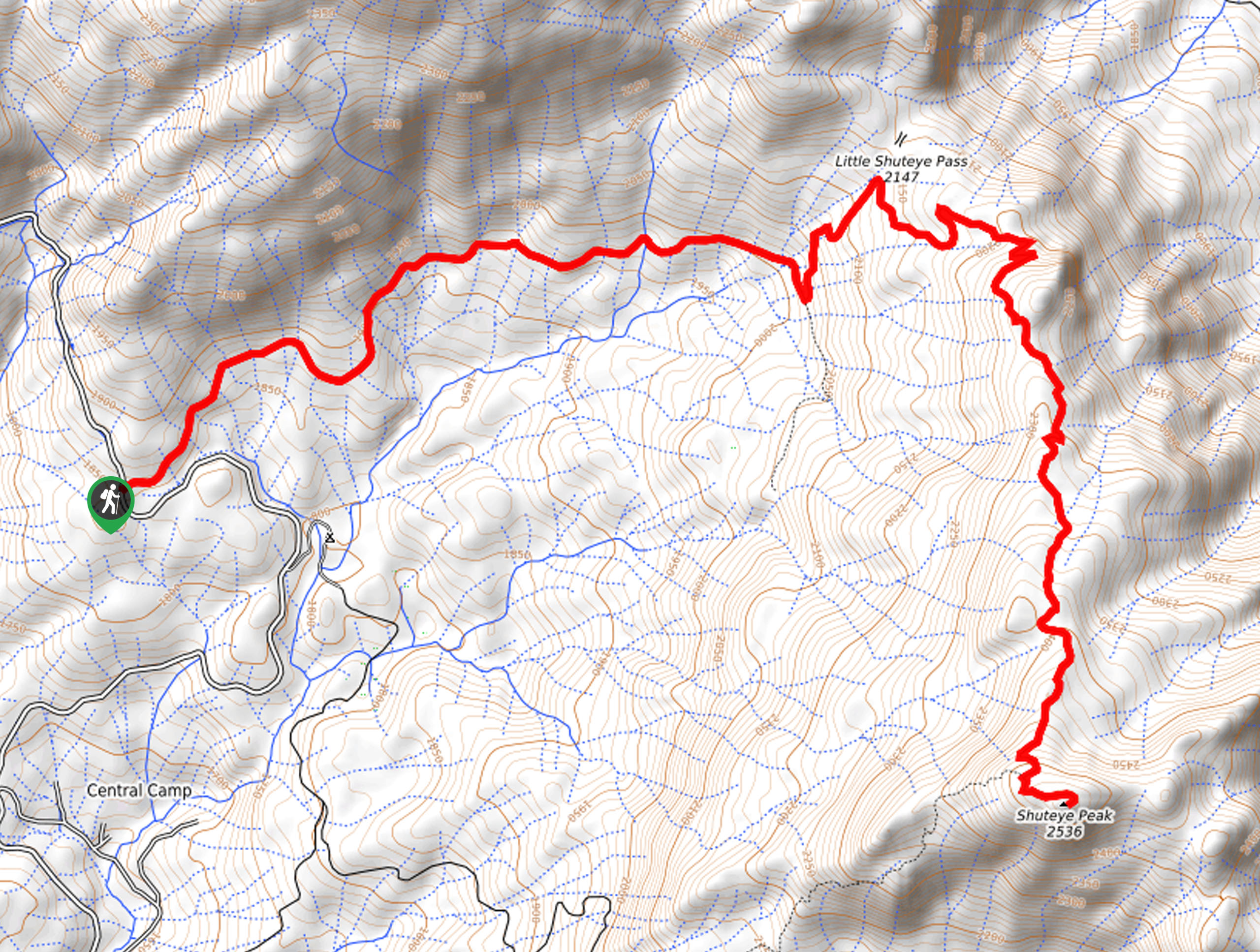
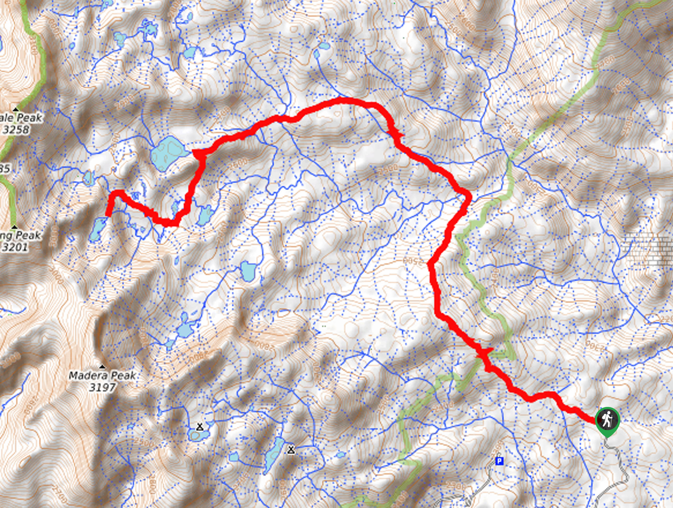
The Shuteye Peak Trail is accessed via the 6S59 Trailhead off Central Camp Road.

About
| Backcountry Campground | Backcountry Camping, wilderness permit required. |
| When to do | May-November |
| Pets allowed | Yes - On Leash |
| Family friendly | No |
| Route Signage | Average |
| Crowd Levels | Moderate |
| Route Type | Out and back |
Shuteye Peak Trail
Elevation Graph
Weather
Shuteye Peak Trail Description
The Shuteye Peak Trail is an excellent adventure for those seeking a sequestered yet simulating adventure In the High Sierra. Mender alongside bikers and off-roaders through the mixed forests adorned with granite outcrops up to the summit of the bald mountain. Note that this long route demands preparation and stamina, so we encourage you to head out early when tackling this trek as a day hike. Additionally, much of the path is exposed, so be sure to dress in layers and wear sun protection if necessary! Lastly, a pair of comfy shoes will make a world of difference!
Embark on your adventure along the Shuteye Peak Hike from the trailhead off Central Camp Road. From here, hikers will be guided northeast along Route 6S59. Departing from the trailhead, the path will gradually climb through the woodlands. When hiking in the spring, the path will intersect with countless snowmelt streams before diverting south, up to the summit of Shuteye Peak.
From atop the summit, you will be granted panoramic views of the High Sierra. Marvel in the beauty of the dramatic landscape and explore the layer granite peak. When you are through ogling the scenery, head back along the path the way you came, all the way back to the trailhead.
Similar hikes to the Shuteye Peak Trail hike
Post Corral Meadows Trail
A popular backpacking route turned epic day hike, the Post Corral Meadows Trail is an epic back-country expedition. Hike amongst…
Wuh-Ki'o Trail
The Wuh-Ki'o Trail is an unassumingly picturesque adventure in the Sierra National Forest. Traveling through meadowlands, brush, over bridges, and…
Chittenden Lake Hike
The Chittenden Lake Hike exhibits the beauty and grandeur of the High Sierra. Explore mixed pine forests, meadowlands, granite gardens,…
Comments