Rancheria Falls Trail
View Photos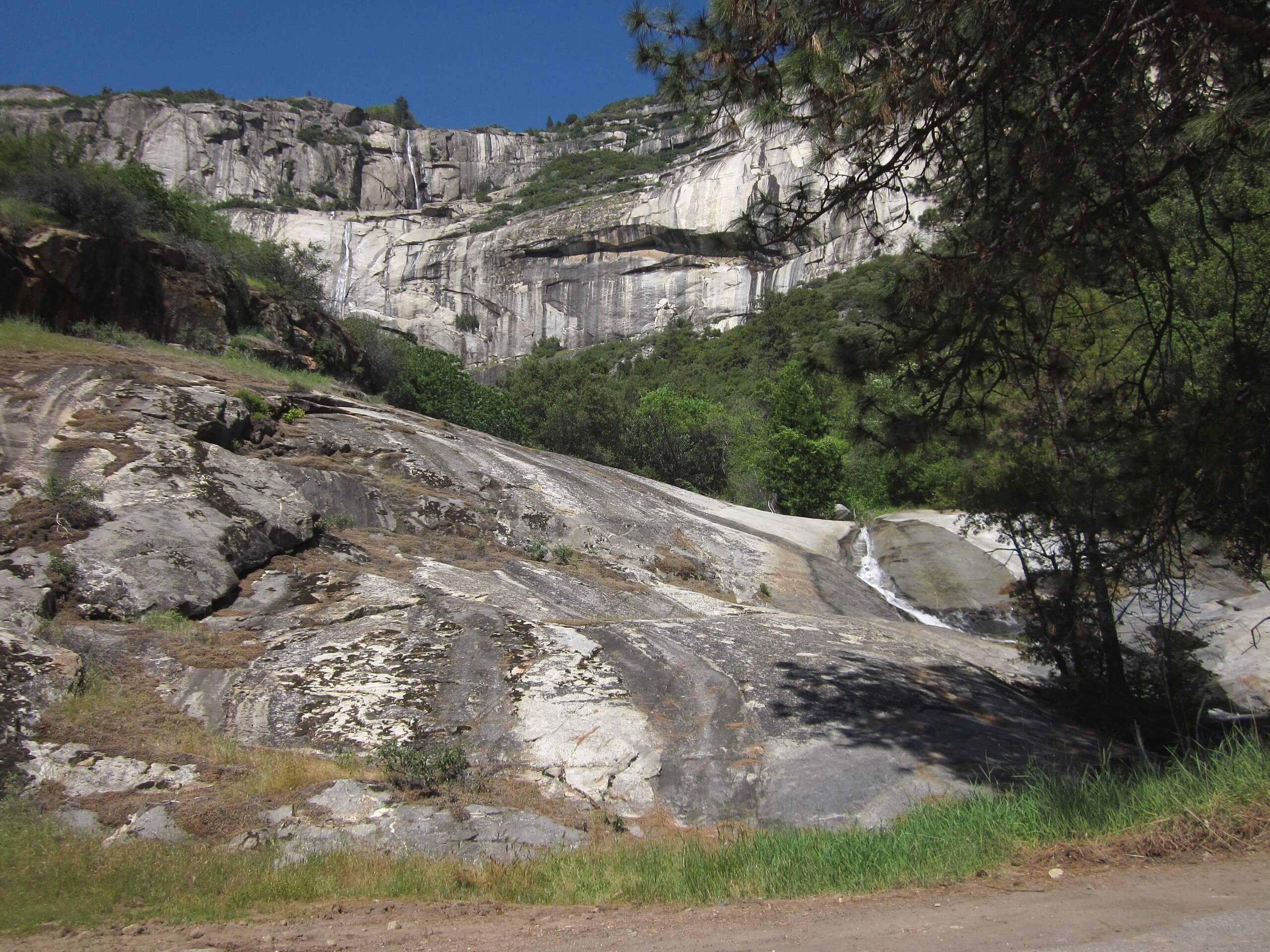
Rancheria Falls Trail
Difficulty Rating:
Hiking the Rancheria Falls Trail makes for an awesome adventure. Wander through the mixed forestlands up to the charming cascades that surge from the granite canyon. Easy-going and family-friendly, this scenic trek is a must add to your hiking list.
Getting there
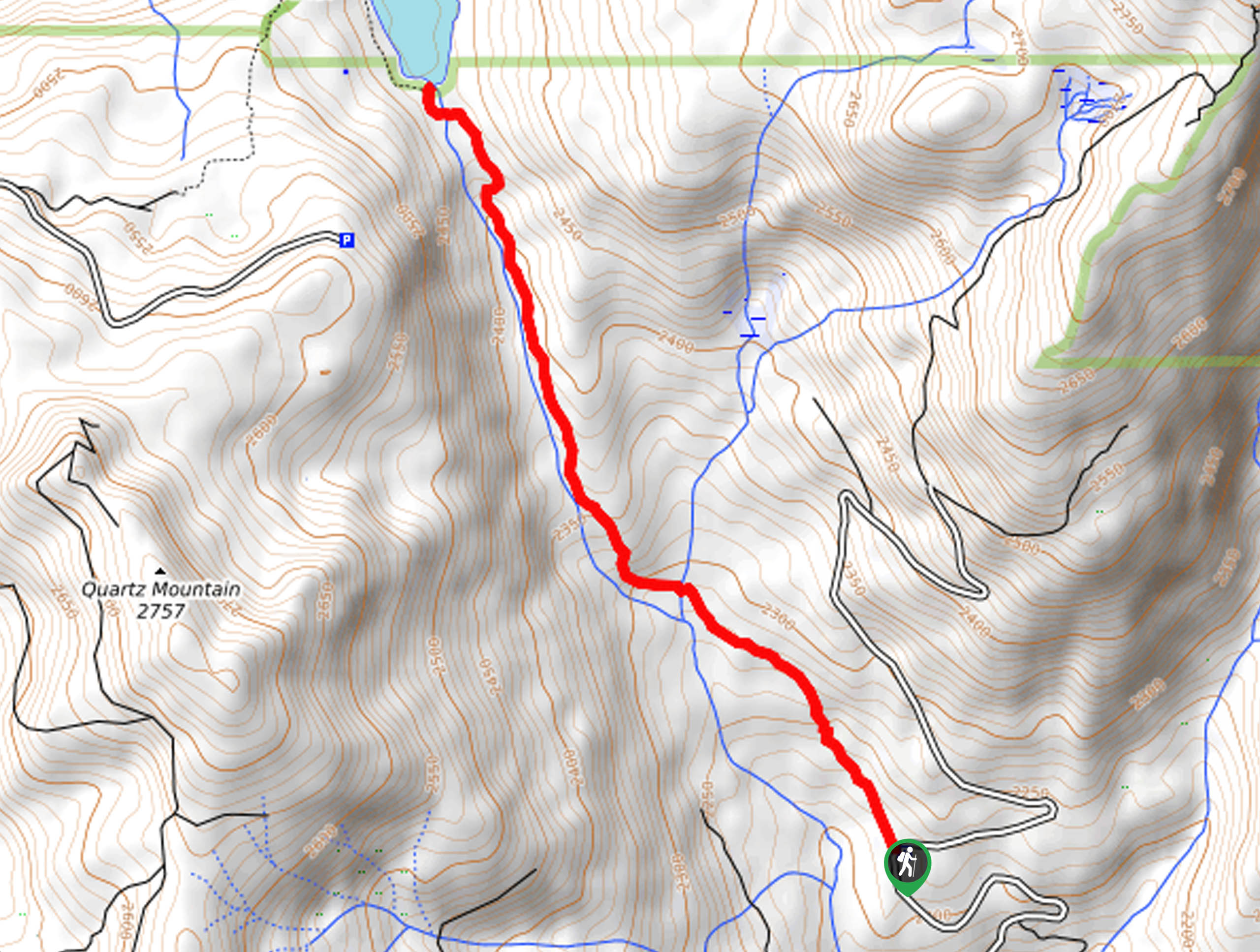
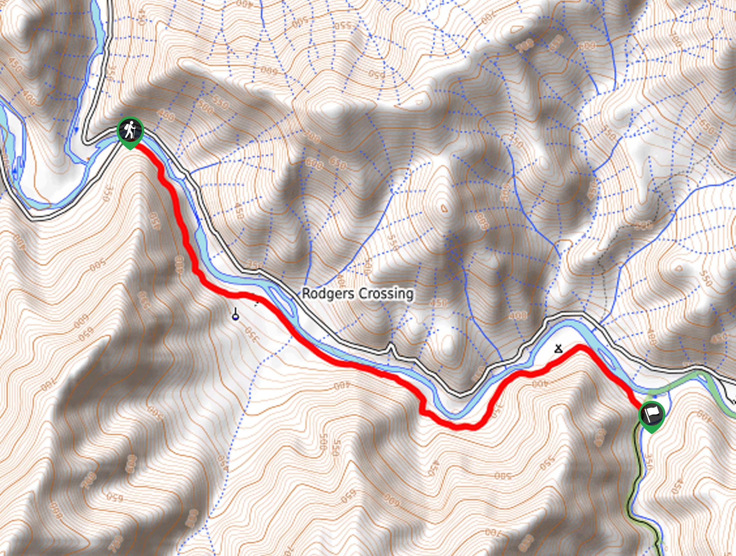
The Rancheria Falls Trail departs from the trailhead off Highway 168.

About
| Backcountry Campground | |
| When to do | Year-round |
| Pets allowed | Yes |
| Family friendly | Yes |
| Route Signage | Average |
| Crowd Levels | High |
| Route Type | Out and back |
Rancheria Falls Trail
Elevation Graph
Weather
Rancheria Falls Trail Description
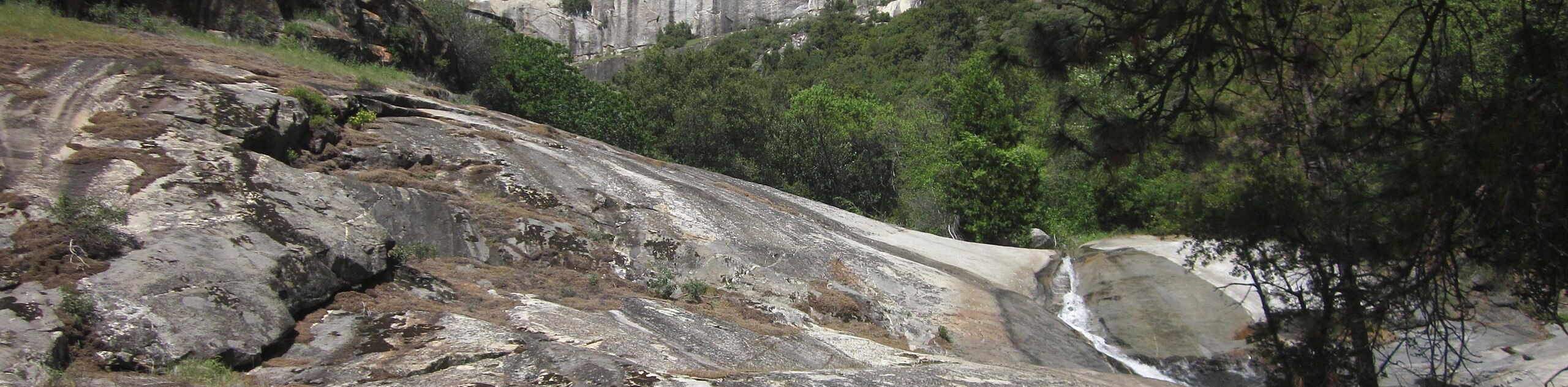
The Rancheria Falls Hike is a stunning excursion in the Sierra National Forest that is sure to please. The crowds that are drawn to this hike are a testament to the area’s beauty. Though this route is accessible year-round, we prefer to venture out in the spring when the cascades are surging with the snowmelt! If you are daring enough to head out in the winter months, then make sure to strap on a pair of microspikes or snowshoes. No matter the time of year, make sure to pack plenty of water and consider packing provisions and having a picnic overlooking the waterfalls.
Setting out from the trailhead, the Rancheria Falls Trail follows the connector route, heading northeast. From here, the path will climb through the woodlands up a switchback and over a stream. Soon you will encounter an intersection, keep right here, and you will be diverted south. This winding path will ultimately deliver you to the Rancheria Falls Trailhead. At this point, you will merge onto the Rancheria Falls National Recreation Trail. Enjoy the towering pines and red firs as you ascend through the forestlands to the waterfalls.
Eventually, you will reach Rancheria Falls. The surging cascades over a granite cliffside will mesmerize you. Revel in the beauty of the hypnotic waterfall and admire the beauty of the valley below and the imposing mountains in the opposite direction. Retrace your footing along the path back to the trailhead when you are ready.
Similar hikes to the Rancheria Falls Trail hike
Chiquito Pass Trail
The Chiquito Pass Trail is arguably one of the most scenic adventures in the Sierra National Forest. Wander up through…
Wuh-Ki'o Trail
The Wuh-Ki'o Trail is an unassumingly picturesque adventure in the Sierra National Forest. Traveling through meadowlands, brush, over bridges, and…
Davis Flat Trail
Experience the grandeur of the Sierra Nevada Mountains as you hike through the Kings River Valley, bounded by rolling hills.…
Comments