Lewis Creek National Recreation Trail
View Photos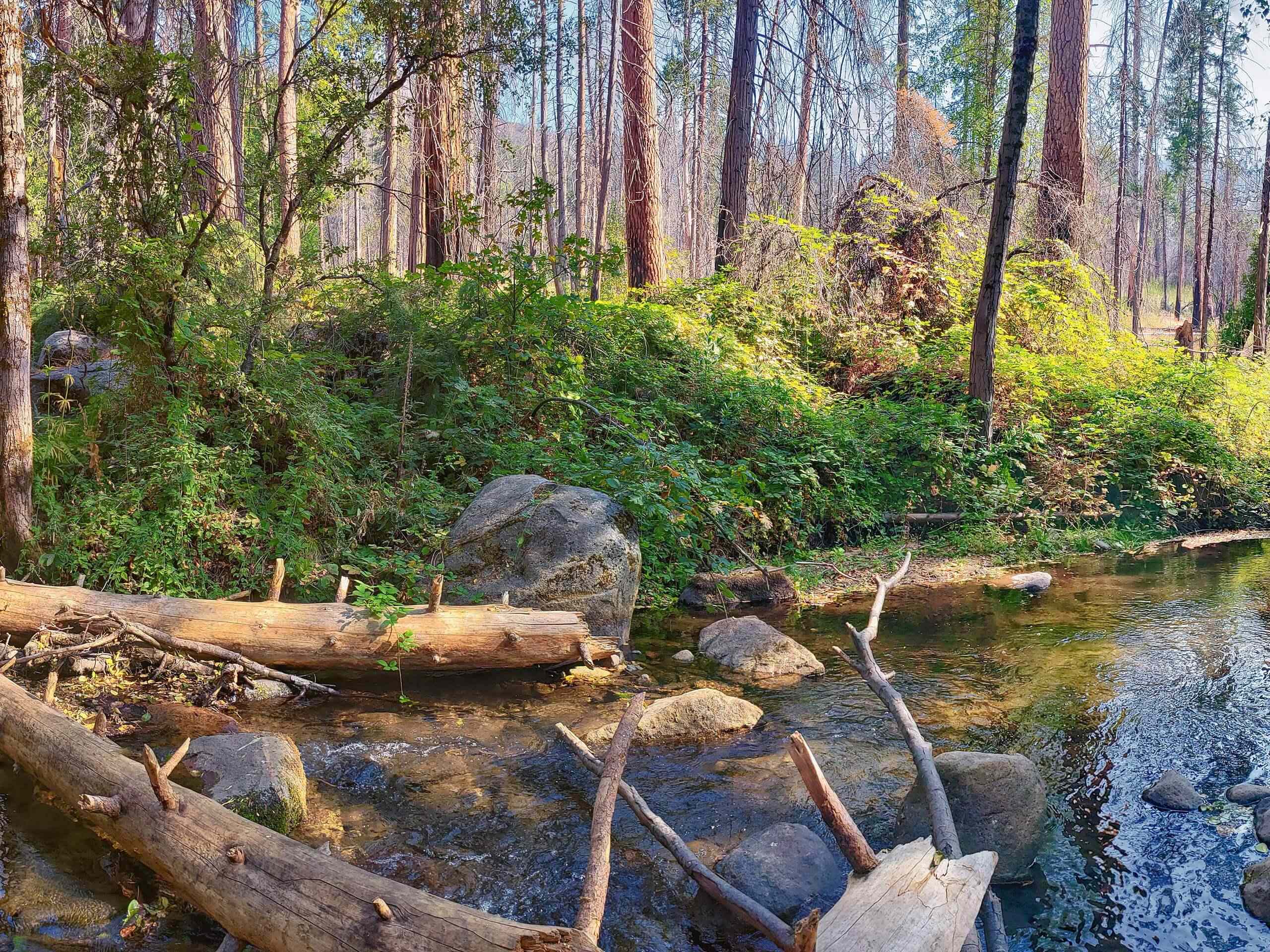
Lewis Creek National Recreation Trail
Difficulty Rating:
The Lewis Creek National Recreation Trail checks all the boxes: waterfalls, woodlands, wildflowers, and wonderful views—what more could you ask for? Wander through the mixed forestland adorned with granite outcrops along the running waters of Lewis Fork to not one but two surging cascades.
Getting there
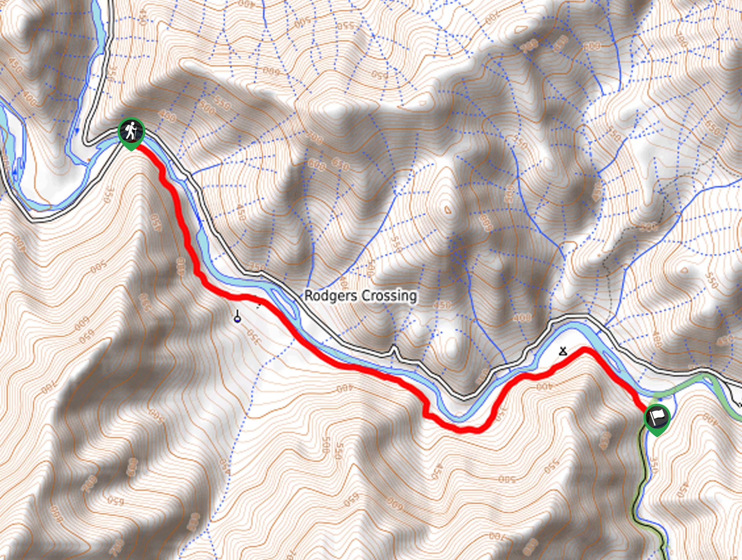
The Lewis Creek National Recreation Trail departs from the Lewis Creek Trailhead off Southern Yosemite Highway.

About
| Backcountry Campground | No |
| When to do | March-November |
| Pets allowed | Yes - On Leash |
| Family friendly | Yes |
| Route Signage | Good |
| Crowd Levels | High |
| Route Type | Out and back |
Lewis Creek National Recreation Trail
Elevation Graph
Weather
Lewis Creek National Recreation Trail Description
The Lewis Creek National Recreation Trail is a revered route in the Sierra National Forest—and we really aren’t surprised. Immerse yourself in the woodlands and enjoy a relaxing nature walk along the curves of Lewis Creek. Though is the route is accessible year-round, winter treks boast inherent risks as the terrain becomes increasingly slippery and harder to navigate. When trekking in the winter, wear microspikes or snowshoes and bring along the trail GPS. In the summer months, when the weather is warm and the wildflowers bloom, this route attracts more visitors, so we suggest heading out in the early morning to beat the crowds and the heat!
The crowds that flock to the area are a testament to the Lewis Creek National Recreation Trail’s beauty. This versatile, scenic, shared route draws outdoor enthusiasts from all over. A shared route with horseback riders, mountain bikers, and pups, this trail caters to adventurers of all sorts! Head out into the High Sierra and let the fresh alpine air fills your lungs. The impressive waterfalls and lush vegetation will motivate you as you travel this enchanting trail through the woodlands. We enjoy this trek most in the spring when the waters surge but don’t wear your new white runners as the terrain is often soft and muddy!
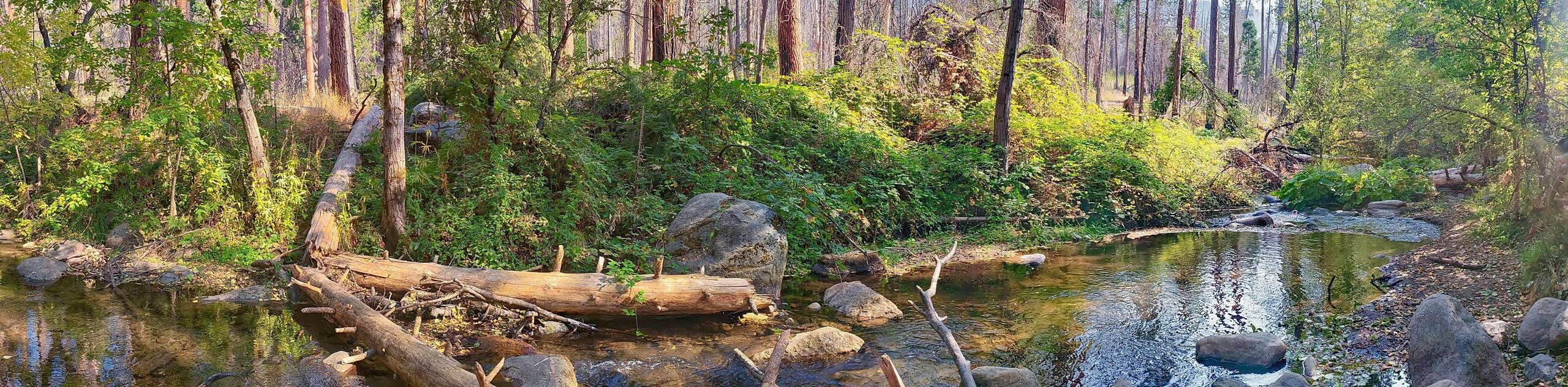
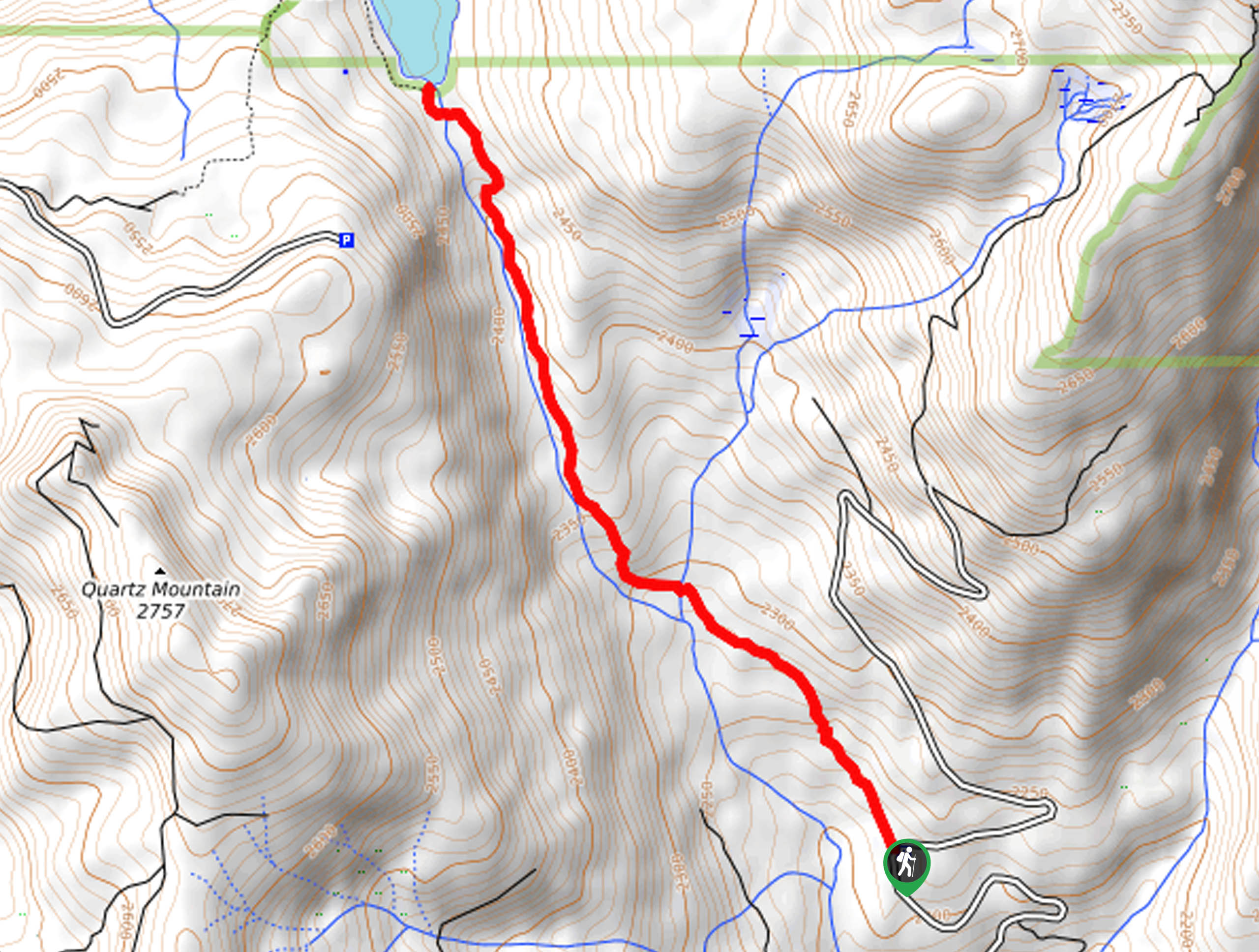
When your shoes are laced, and your camera is charged, begin your hike along the Lewis Creek National Recreation Trail from the trailhead. From here, the Lewis Creek Trail heads northwest to a junction, veer right here and you will be diverted southeast down to Corlieu Falls. From the viewing deck, you will be granted amazing views of the 80ft falls cascading into the valley. Revel in the beauty of the waterfall and enjoy the meditative sounds of the surging waters! When you are through admiring the falls, head back northwest back up to the Lewis Creek Trail. Now trekking north, you will cross a log bridge over the running waters to the eastern side of Lewis Fork.
Gradually climbing through the forestlands adorned with granite outcrops, you will be lulled into a state of relaxation by the sounds of the babbling waters. As you wander, the path will intersect with several snowmelt streams as you near the second waterfall of the trail. You may even spot fishermen trying their hand at rainbow trout in the summer! Soon you will reach the path’s end at the Red Rock Falls—a short but intense cascade. The sights of the pouring waters will hypnotize you, making it hard to look away. When you can pull yourself away from the waterfall, retrace your steps back along the path back to the trailhead, marking the end of your adventure.
Trail Highlights
Corlieu Falls
Corlieu Falls is a scenic cascade near the Lewis Creek National Recreational Trailhead. Surging over 80ft into the Lewis Creek Canyon, this waterfall sits at an elevation of 4,000ft above sea level. This cascade at the trailhead will make sure you start your hike off on the right foot.
Red Rock Falls
The Red Rock Falls is the second waterfall along the Lewis Creek National Recreational Trail. Compared to Corlieu Falls, the Red Rock Falls are about 60ft shorter, cascading over 20ft into the canyon. Though shorter, this impressive fall is wider and surges more intensely over the granite bluffs.
Frequently Asked Questions
How long is the Lewis Creek National Recreational Trail?
The Lewis Creek National Recreational Trail is a 3.9mi out-and-back hike.
Are dogs allowed on the Lewis Creek National Recreational Trail?
Yes, dogs are welcome on the Lewis Creek National Recreational Trail if they remain on-leash.
Insider Hints
Head out early to secure a spot in the small trailhead parking lot
When venturing in the winter months be sure to strap on microspikes or snowshoes
Charge your camera, the cascades are picture-perfect
Head out in the spring when the cascades surge!
Similar hikes to the Lewis Creek National Recreation Trail hike
Chiquito Pass Trail
The Chiquito Pass Trail is arguably one of the most scenic adventures in the Sierra National Forest. Wander up through…
Wuh-Ki'o Trail
The Wuh-Ki'o Trail is an unassumingly picturesque adventure in the Sierra National Forest. Traveling through meadowlands, brush, over bridges, and…
Davis Flat Trail
Experience the grandeur of the Sierra Nevada Mountains as you hike through the Kings River Valley, bounded by rolling hills.…
Comments